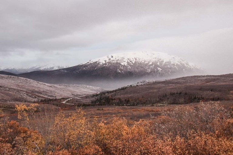
The Ultimate Alaska Highway Guide: Driving the Alcan between Canada & Alaska
Updated January 2024, The Ultimate Alaska Highway Guide: Driving the Alcan between Canada & Alaska was originally published in June 2023
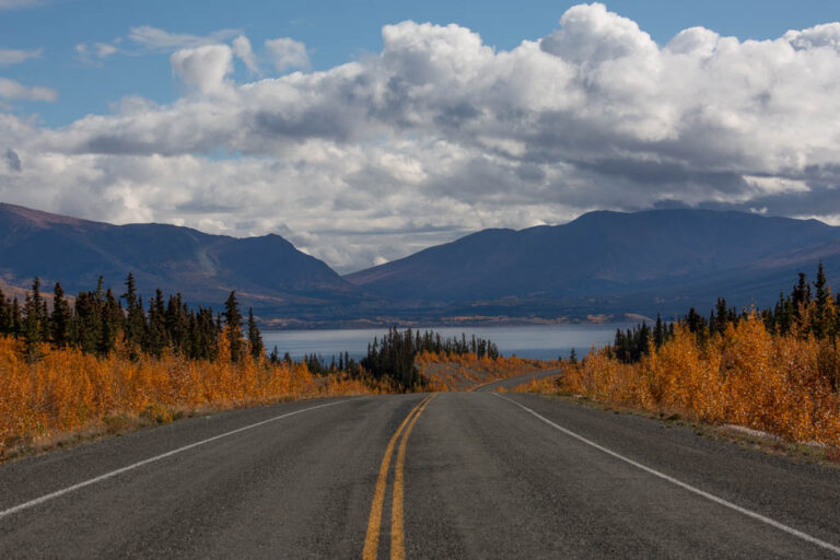
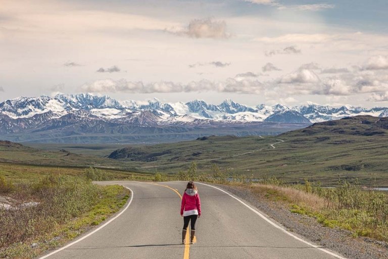
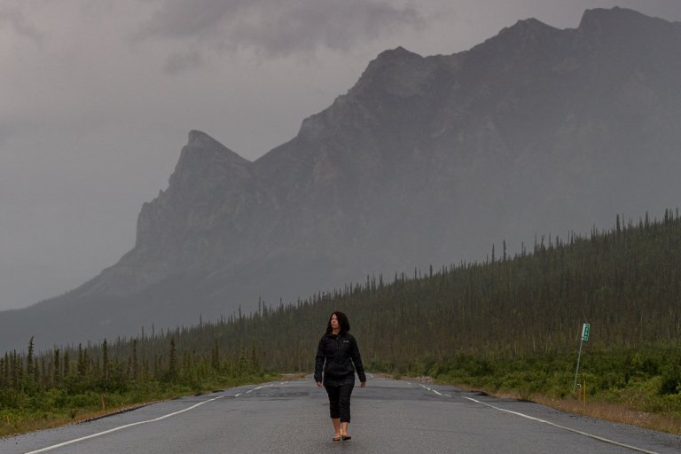
Driving the Alaska Highway, or the Alcan as most of us who have grown up in Alaska or are longtime Alaskans call it, is one of the biggest bucketlist scenic road trips in the world.
But the Alaska Highway is no small undertaking. At 1,387 miles, it’s quite the journey extending between Dawson Creek, British Columbia and Delta Junction, Alaska.
As someone who was born and raised in Alaska and was a lifelong Alaskan until I decided to try new things and the home base finally in the fall of 2022 to go see what Lower America (as I like to call it) has to offer (it still, in my opinion, is paling in comparison to Alaska!), I’ve driven the Alcan more than once. And as many of you have been reading on here for a while already know- I am also no stranger to wildly remote road trips.
Though, for most of you reading this, the Alaska Highway will be a once-in-a-lifetime journey (or more than likely twice as you’ll probably be driving back home to wherever you came from afterward- unless you’re moving to Alaska permanently or shipping your vehicle back to or from Alaska).
So buckle up and get comfy cause you’re gonna be here for a while. This is a MEGA guide to the Alaska Highway. It is extremely long and quite comprehensive based on many years of experience.
Need Travel Insurance and Evacuation Services for Alaska & Canada?
Start shopping for travel insurance plans over at IATI Insurance. Readers of the Adventures of Nicole get a 5% discount off your plan.
The Adventures of Nicole partners with Global Rescue to offer the world’s leading medical evacuation and security advisory services. To travel with peace of mind, shop evacuation coverage at Global Rescue.
- About the Alaska Highway
- When & Why Was The Alcan Built
- How to Get to the Start of the Alcan
- A Detour From the Alaska Highway: The Cassiar Highway
- The Best Time to Drive the Alaska Highway
- Where Does the Alcan Start & End?
- Is the Alaska Highway Open for Travel Year-Round?
- How Many Days Does it Take to Drive the Alaska Highway?
- Alcan Road Conditions
- What Type of Vehicle to Drive Along the Alaska Highway
- Accommodation Options Along the Alcan
- What to Pack for Your Road Trip On the Alaska Highway
- Will I Have Phone Reception on the Alaska Highway
- Info About Crossing the Alaska-Canada Border
- The Alaska Highway Itinerary
About the Alaska Highway
The Alaska Highway, as mentioned above is a 1,387 mile long road that begins in Dawson Creek, British Columbia, and extends through the Yukon Territory before crossing into Alaska where it ends in Delta Junction.
When & Why Was The Alcan Built
The Alcan was built in reaction to the 1941 Attack of Pearl Harbor, Hawaii with the United States quickly realizing that it needed access by road to its Territory of Alaska to defend the nation.
This reaction wasn’t completely unwarranted either as we would go on to see the Japanese occupations of both Attu and Kiska in 1942 and 1943 as well as an attack on Dutch Harbor.
Relatively quickly an agreement when the US and Canada were reached which have the US the green light to begin construction of the Alcan in March of 1942.
The Americans funded it with the promise to maintain the Alaska Highway throughout the duration of WWII and another 6 months after the war’s end. Once the war concluded Canada would then be handed over the portions of the Alaska Highway in their country.
Over 10,000 US soldiers were sent to Canada in the spring of 1942 to begin construction working grueling hours with no break in sight as they trudged on 7 days per week.
Additionally, 16,000 civilians of the US and Canada worked to help complete the Alaska Highway which was finished in November 1942 for use by the military to move supplies.
It wouldn’t be until 1948 that the Alaska Highway was opened to the public.
How to Get to the Start of the Alcan
Since the Alaska Highway starts in Dawson Creek, there is more than one way to get there including via British Columbia or Alberta.
Via British Columbia
If you’ll be coming from Vancouver (or further south beyond) as many of you will be you have a couple of options for getting to the start of the Alcan in Dawson Creek.
This will be via either the Sea to Sky Highway (Highway 99) or the Trans-Canada Highway (Highway 1). Both these routes will tie into Highway 97 which leads to Dawson Creek.
The Sea to Sky Highway: Highway 99
The Sea to Sky Highway is a great option for first-timers on the Alaska Highway as it blends some of British Columbia’s most stunning landscapes from coastal gems to mountain escapes- it does cut through Whistler after all.
The Sea to Sky Highway is also the shortest option as it will get you from Vancouver to Dawson Creek in 718 miles. Total drive time is about 13 hours 30 minutes not including stops.
The Sea to Sky Highway meets Highway 97 just north of Cache Creek where you’ll remain on Highway 97 to Dawson Creek.
Trans-Canada Highway: Highway 1
The quickest (though not shortest) way to get from Vancouver to Dawson Creek is via the Trans-Canada Highway.
This route cuts more inland in BC and isn’t quite as scenic as the Sea to Sky Highway but does offer different scenery.
Like the Sea to Sky Highway, the Trans-Canada Highway goes to Cache Creek and from there you’ll join Highway 97 which will take you the remainder of the way to Dawson Creek.
The total drive time via the Trans-Canada from Vancouver to Dawson Creek is 13 hours and a distance of 736 miles.
From Cache Creek to Dawson Creek: Highway 97
Once you hit Cache Creek, whether you opted for the Sea to Sky Highway or the Trans-Canada Highway, you will end up taking Highway 97 to reach Dawson Creek.
Via Alberta

If you’re coming up from more eastward such as Montana, Utah, Colorado, or so on, you may want to consider cutting through the stunning Canadian Rockies.
The highlight of this option is that you will get to pass through both Banff National Park and Jasper National Park.
I have a thing for wild mountain landscapes, so this was the route I took when I moved out of Alaska and so far it was my favorite route I’ve taken through Canada.
I’m going to start this one from Calgary for simplicities sake (there are numerous ways to get to Calgary of course!).
From Calgary take the Trans-Canada Highway (Highway 1) to Banff National Park.
Once to Banff, you’ll get onto the spectacular Icefields Parkway (Highway 93) which leads up to Jasper National Park.
Once you’ve exited Jasper you can take several different routes to reach Alaska but the main ones are to either take Highway 16 to the west to Prince George where you will meet with Highway 97 to reach Dawson Creek.
Alternatively, once out of Jasper, you can also take Highway 16 east and then onto Highway 43 and then Highway 2 to reach Dawson Creek.
If starting in Alberta, specifically near Calgary, the most scenic route will be to take the Trans-Canada Highway (Highway 1) to Banff National Park, then drive the Icefields Parkway (Highway 93) to Jasper National Park, before taking a mix of highways to cross back into British Columbia and getting to Dawson Creek.
The total drive time between Calgary and Dawson City is 10 hours 30 minutes throughout 587 miles. Though to be honest, you will want to take a few days for this route if possible because there is so much to do and see in both Jasper and Banff!
A Detour From the Alaska Highway: The Cassiar Highway
An alternative to part of the Alaska Highway is to take the Cassiar Highway (Highway 37) which we all grew up calling the “logging road” for obvious reasons.
To reach the Cassiar, you’ll need to veer off Highway 97 at Prince George, taking Highway 16 to the west.
The Cassiar officially begins in Kitwanga and ends near Watson Lake.
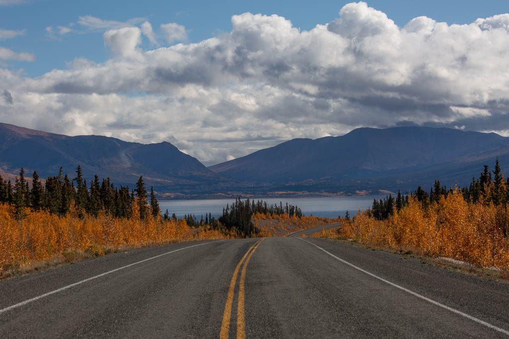
The Best Time to Drive the Alaska Highway
The Alaska Highway can be driven any time of year as it is open year-round, but some times of the year are better than others.
Undoubtedly, the best time of year to drive the Alcan is between May and September due to the harsh and cold climates of both Alaska and Canada.
May through September, particularly starting Memorial Day Weekend and ending Labor Day Weekend, the Alaska Highway is generally snow-free.
Weather along the Alcan can be erratic as this is the Pacific Northwest after all, so you can expect some rain in the May-September summertime season and potential for snow at the periphery of that time.
One huge advantage of the summer months is the long days. Especially between June-August, it’s daylight the majority of the time at these far north latitudes (I mean, you are headed to “the land of the midnight sun”, after all).
Many of the businesses along the Alcan are only open seasonally too, usually adhering to the Memorial Day to Labor Day dates, though some do stay open later/earlier or even year-round.
I’ve only driven the Alaska Highway in the summer and fall myself, though I have friends and family that have driven it in the spring and winter and have said it’s generally fine. Just quite cold with short days (daylight hours are incredibly short further north in the winter) and not much to do and see en route unless you have serious winter gear with you, of course.
Extra caution should be exercised if traveling between October and April due to snow and ice on the roads and extreme cold as temps can easily plummet below -40° (Fahrenheit and Celsius meet at -40° by the way 😂).
This past journey I took down the Alcan I left Alaska on September 17, 2022, and took about a week to reach the US border in Montana (I treated it as a vacation to myself, because- why not?).
I found that even in mid to late September that many businesses were still opening such as shops and fuel stations.
It was a beautiful fall in 2022 as I drove down the Alcan and stayed mostly snow-free until early October so I think some businesses may be opting to stay open later in the season on years when the weather is pleasant.
Where Does the Alcan Start & End?
The Alcan officially begins in Dawson Creek, British Columbia, and ends in Delta Junction, Alaska.
As mentioned above, there are several routes through Canada to reach Dawson Creek.
Beyond Delta Junction in Alaska, you can take the Richardson Highway to continue to Fairbanks, or before reaching Delta, take the turn onto the Tok Cutoff in Tok. The Tok Cutoff goes to Glennallen where you can take the Glenn Highway toward Anchorage or the Richardson to Valdez or Fairbanks.
Is the Alaska Highway Open for Travel Year-Round?
Yes, as mentioned above, the Alaska Highway is open year-round.
How Many Days Does it Take to Drive the Alaska Highway?
How many days it takes to drive the Alcan is highly dependent on your interests and plans are en route.
The total drive from between Dawson Creek and Deta Junction is 25 hours, so while it is possible, in theory, to do the drive in a day or two, you probably won’t want to.
Ideally, a week is a good minimum amount of time to spend on the Alaska Highway to give yourself time to explore without feeling like you spent the entire time in the car.
Those that do have tighter time constraints can still drive the Alaska Highway and make nice scenic stops without feeling too rushed with 4-5 days.
If you have more time, you can squeeze in some hikes in national parks, make some detours from the main Alcan Highway, and make other stops of interest.
Alcan Road Conditions
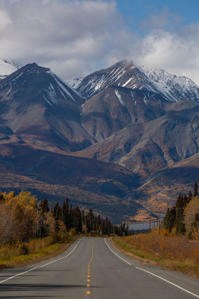
The Alcan is mostly paved (I say mostly because you’ll likely go through a few sections of construction where they are working on the road and it’s down to dirt).
Depending on the year, the Alaska Highway can either be smooth sailing or it can look like a potholed, bombed-out road in a warzone (trust me, I’ve spent a lot of time on those too!). I’ve seen the Alcan in both extremes of conditions.
Largely, the conditions of the Alcan will be determined by if the highway was recently grated and maintained and by how bad of cold snaps happened the winter/s prior- these lead to sometimes giant ice heaves (buckles in the road if you will).
On my most recent drive on the Alaska Highway in September of 2022, the entire route was the best I have ever seen it in my entire life!
Bar a couple of sections of road construction last year (the last 50 miles on the Alaska side of the border and near Ft. Nelson), the Alcan was in excellent condition in 2022.
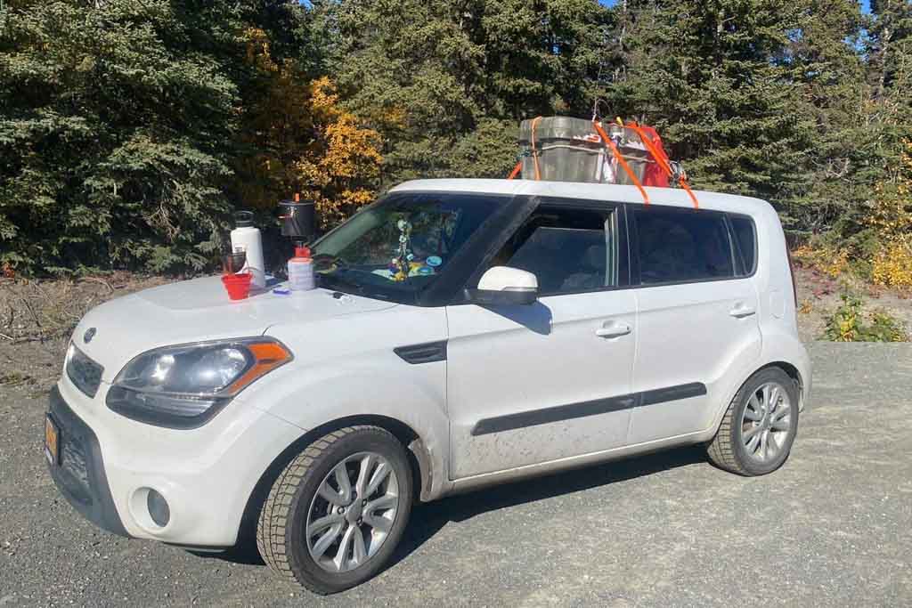
What Type of Vehicle to Drive Along the Alaska Highway
You could drive anything along the Alaska Highway if you’re determined.
I’ve driven in trucks, cars, and SUVs. You will see some motorcyclists out there too.
On my move out of Alaska in 2022 I took my old 2012 Kia Soul down the Alcan without any issues. So for reference, if you’re not sure about this car, it’s a low-clearance 2WD hamster mobile.
Canada Uses Metric Measurements, While Alaska Uses Imperial Measurements
Canada’s road signs will list distances and speed limits in metric (kilometers). Note that gasoline will be sold in liters.
Once you cross into Alaska you will have to switch to the imperial system (I really really wish the US would change to metric as it would make many parts of my life much easier!)
So, this means distances and speed limits in Alaska will be in miles and gasoline sold by the gallon.
Accommodation Options Along the Alcan
Good news! There are a vast array of options for accommodation as you travel the Alaska Highway (I mostly am meaning if you’re traveling in the summer months though).
There are heaps of campgrounds, RV parks, motels, hotels, and lodges en route along the Alcan.
One thing to note is that if you plan to drive the Alaska Highway in winter (October-April) many lodging options will be shut for the season so plan ahead and make your bookings strategically so that you’re not left stranded trying to find a place open each night.
What to Pack for Your Road Trip On the Alaska Highway
Driving the Alaska Highway is no joke so you’ll want to make sure you’re prepped and have all the necessities with you.
These are mostly all car-related (you know because s*** can and will happen along the way!).
Spare Tire, Tire Jack, & Tire Repair Kit
I think I can solidly say that I’ve never driven the Alcan without getting a flat. It just comes with the nature of this journey.
I drove through a long section of construction just before reaching Ft. Nelson and got a flat just on the other side of town. I pulled out my little repair kit, patched the tire, and drove a few kilometers back to Ft. Nelson to a tire shop.
They found a screw in there (no surprise after driving through a construction zone). They laughed when I asked if that construction zone was keeping them in business all year and said yes.
I did have a spare with me too but figured since I was so close to a town I might as well get the current tire taken care of. (Don’t worry the spare came in handy later in my trip down in Montana after a mishap).
Moral of the story: plan for the worst and bring a spare, a jack, and a tire repair kit.
Gas Can
A gas can used to be an absolute must for driving the Alcan in the past, but not so much these days- but I still recommend carrying a full gas can just in case.
On my drive down the Alaska Highway in September 2022, I rarely dropped below half a tank of gas in the Kia before running across another fuel station (I still have memories of driving the Alcan in years past when fuel stations were few and far between).
So the safest bet is to fill up every chance you get and pack a gas can for the worst-case scenario.
Vehicle Fluids
Make sure and top up your windshield wiper fluid, that your oil has been freshly changed, and any other fluids and lubricants to keep your vehicle running smoothly have been topped up before you go.
Along with that, I would recommend carrying extra bottles of wiper fluid, oil, etc. to refill en route just in case.
Jumper Cables
Running your battery dead does happen, so I would recommend bringing some jumper cables in the event it happens to you. That way you can flag down another car and ask them for a jump.
Alternatively, you can look into a portable car jumper.
Passports & Cash
It goes without saying that you will need your passport for your Alaska Highway road trip to cross the border, so don’t leave home without it!
Many campgrounds are paid in cash only, so make sure and hit an ATM in Canada or Alaska to have the proper currency in order to pay.
Alaska Milepost
Not an absolute must but a copy of the Alaska Milepost does come in handy when taking on the Alcan.
Food & Water
As there are shops in the towns and cities you’ll pass through you can easily replenish as you make your way north along the Alaska Highway.
I’d recommend having a cooler to store food, drinks, and snacks in.
This is even more important if you’ll be driving the Alcan October-April as there won’t be as many shops open along the way.
Will I Have Phone Reception on the Alaska Highway
In some places, you will have coverage, in others you will not. Of course, as you near towns and cities you will pick up mobile coverage but when you’re on those remote sections of the Alaska Highway expect to have no service.
That said, I would recommend carrying a satellite messenger like the Garmin Inreach or a sat phone if you’re concerned about having coverage in the event you need to make contact.
Info About Crossing the Alaska-Canada Border
Crossing the border is pretty straightforward.
Once you arrive just follow the signs explaining what to do. Sometimes you’ll receive many questions other times not so much.
When I last drove the Alaska Highway in 2022 registering on the ArriveCan App was still required to enter but this was no longer the case after October 2022 (these were all pandemic travel requirements). There is no longer a requirement for Covid testing either.
You will likely be asked if you have any fresh meat, produce, pets, firearms, or marijuana with you (I was). I simply said no, and I was welcomed into Canada (note that I was going in the opposite direction as most of you will be).
Crossing the Border with Food Items
Note that fresh meat and produce will pose issues at the border, so make sure to cross without them. If you declare them they will likely just make you toss them out. If you risk it and don’t declare them and they search you at the border you risk being fined).
Generally, packaged food should be fine to cross the border with.
If you need more info on what’s allowed into the US (Alaska) here and into Canada here.
Crossing the Border with Pets
You do have to provide documentation if you are bringing pets and/or firearms across the border.
Find everything you need to know about entering the US with pets here and entering Canada with pets here.
Crossing the Border with Firearms
If you will have any firearms with you, you will need to declare them and provide documentation.
Find the rules for entering the US with firearms here and for entering Canada with firearms here.
The Alaska Highway Itinerary
Now, this isn’t a strict Alaska Highway itinerary per se, it’s more of a list of stops en route along the way so that you can mix and match to create your own itinerary to suit your interests and time frame.
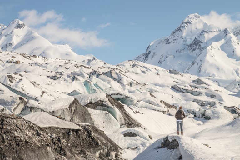
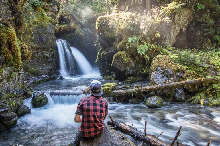
Since this is an insanely long post (it’s over 10,000 words at this point), I’ve not included many photos in order for the page to load a bit more quickly (I know you all have google and can search the destinations listed here anyway).
Note that prices listed in this Alaska Highway Itinerary are in CAD in the sections between Dawson Creek and the Alaska-Canada Border, from the border to Delta Junction prices are listed in USD.
Mile 0: Dawson Creek
Your adventure along the Alaska Highway has begun!
Dawson Creek provides a great opportunity to stock up on all the odds and ends you’ll need for traveling the Alcan.
So fuel up, grab some groceries and snacks, load up on water, and so on before you depart.
Places to Stay in Dawson Creek
Dawson Creek Campgrounds & RV Parks
- Mile 0 Campground: Has RV and tent sites. Tents are $28 per night and RV sites range from $28-46 per night.
- Northern Lights RV Park: Also has RV and tent sites. Tents are $30 per night and RV sites range $52-60 per night. Cabins are also available for $125 per night.
Dawson Creek Hotels
Where to Grab A Bite to Eat in Dawson Creek
Things to do in Dawson Creek
- World Famous Alaska Highway Sign: Snap your photo with the famous sign marking the start of the Alcan (don’t laugh but I still do not have a picture with the sign somehow!).
- Dawson Creek Visitor Center: Gives out useful information on Dawson Creek and the surrounding area, as well as updates on the Alaska Highway. You can also pick up a souvenir or two here at the visitor center.
Services Available in Dawson Creek
- Fuel (several stations to choose from)
- Grocery stores (several to choose from)
- Vehicle repair
- Dump station and water fill up
Mile 1-46: Dawson Creek to Fort St. John
There isn’t a lot to see in this short stretch extending between Dawson Creek and Fort St. John on the Alaska Highway, but there are a couple of places worthy of a quick stop.
Mile 17: Kiskatinaw Provincial Park: Located a few miles off the main Alcan Highway and home to the Kiskatinaw Bridge, a timber bridge that is the only original one built along the Alaska Highway still in use to this day.
To get to the Kiskatinaw Bridge you’ll need to turn off the Alcan at Mile 17 onto 220 Road and follow it a few meters and then turn left onto Kiskatinaw Road which will bring you to the original Kiskatinaw Bridge.
Mile 34: Taylor: A small town home to 1200 residents. There are fuel, groceries, and restaurants here. Noteworthy things to check out include Peace Island Park.
Mile 47: Fort St. John
Fort St. John is only a short distance from Dawson Creek, so most won’t stop here (plus there aren’t any major attractions).
That said, if you do find yourself here in Fort St. John on your trip along the Alaska Highway, here are a few things to help you plan your time there.
Where to Stay in Fort St John
Fort St. John Campgrounds & RV Parks
- The Humestead: Located northwest of Fort St. John, past Charlie Lake (off of RD 287). Reserve in advance. Tent and RV slots are available. $35 per night
Hotels
Where to Eat in Fort St. John
- Olive Tree Mediterranean Grill
- Brown’s Crafthouse Fort St. John
- North Bar & Grill (inside the Northern Grand Hotel)
Things to do in Fort St. John
- Fort St. John Peace Museum: Learn about indigenous and contemporary history in and around Fort St. John.
- Fort St. John Visitor Information Center: Here you can find useful information about the city and surrounding area.
Services Available in Fort St. John
- Fuel (several stations to choose from)
- Grocery stores (several to choose from)
- Vehicle repair
- Dump station and water fill up
Mile 48-282: Fort St. John to Fort Nelson
Again, Mile 48-283 isn’t the most exciting stretch of the Alaska Highway but there are a couple of stops en route between Fort St. John and Fort Nelson.
Mile 53: Charlie Lake Beatton Provincial Park: Beatton is a 320 hectare park offering walking trails, fishing, swimming, and other outdoor recreational activities. It’s located around Mile 53 along the Alcan. This will also give you access to Charlie Lake.
Mile 153: Pink Mountain: Pink Mountain is a small community of about 100 residents. The views of the Rocky Mountain Foothills near here are quite nice and worth a quick top to stretch your legs.
Mile 173: Buckinghorse River Provincial Park: A gorgeous area on the shore of the Buckinghorse River that has a campground.
Places to Sleep Between Fort St. John & Fort Nelson
- Duhu Lake Recreational Site: Located at Mile 154. 7 campsites and the best part is that camping is free. First come, first serve.
- Sikanni River Campground & RV Park: At Mile 159 and has both RV and tent sites and cabins. Tents are $30 per night, RVs are $30-$50 per night, and cabins are $75-90 per night.
- Buckinghorse River Lodge: Features a motel, cabins, and 15 camping spots. Located at Mile 175.
- Andy Bailey Regional Park: Located at Mile 265 (and about 12 kilometers off the Aaska Highway). Features 13 camping slots. $17 per night, cash only.
Mile 283: Fort Nelson
Fort Nelson got its origins as a fur trading post for the North West Fur Trading Company.
It remained little more than an outpost until the 1950s when more development rolled in as a result of being located along the Alaska Highway.
Much like Fort St. John, there aren’t many major attractions in town, however, Fort St. John provides a nice place to bed down for the night and grab something for dinner.
Fort Nelson is the largest town you’ll cross through on the Alcan until you reach Watson Lake, so it’s a great place to stop and stock up on any groceries and other necessities.
Places to Stay in Fort Nelson
For Nelson Campgrounds & RV Parks
- Triple G Hideaway Campground: Features RV and tent sites.
Fort Nelson Hotels
Where to Grab Food in Fort Nelson
- One Restaurant (inside Woodlands Inn & Suites)
- Northern Spice Pizza & Donair
- P & T Restaurant
Things to do in Fort Nelson
- Fort Nelson Heritage Museum: Check out the array of artifacts from the Fort Nelson area on display here at the museum and learn about the history of the town. There’s even a vintage car collection on display.
- Old Fort Nelson: Just a little off the main route on the Alaska Highway find the original town site of Fort Nelson.
Services Available in Fort Nelson
- Fuel (several stations to choose from)
- Grocery stores (several to choose from)
- Vehicle repair
- Dump station and water fill up
Mile 284-437: Fort Nelson to Muncho Lake
This section of the Alcan gets a lot more interesting as you bend toward the west from Fort Nelson and traverse the northern stretches of the Rocky Mountains.
Mile 300: Highway 77 Junction: Those wanting to take a detour from the Alaska Highway can opt to veer north at Mile 300 onto Highway 77 (also known as the Liard Highway between the junction and Fort Liard and then the MacKenzie Highway from Fort Liard to Fort Simpson) which will take you into the uber-remote Northwest Territory.
The highway officially opened in June of 1984 and is a decent condition gravel road most of the time, though do enquire about conditions at the Fort Nelson Visitor Center before departing. This goes into a fairly remote area with limited services so go in prepared.
Mile 319: Muskwa River Park: Located just off the Alaska Highway and makes for a good break point.
Mile 342: Tetsa River Regional Park: Another good breakpoint on the Alcan. There is a campground here for those wanting to spend the night. If not camping you can check out the Testa River Lodge.
Mile 371-380: Stone Mountain Provincial Park: Stone Mountain Provincial Park provides a great opportunity to get out and stretch your legs along the long journey up the Alaska Highway.
With beautiful sceneries, hiking trails, potential for wildlife spotting, kayaking, and more you can easily spend a few hours or even an overnight here.
At Mile 371 you will find Summit Lake which has a campground and is a great place to stay for the night and take some time to explore the outdoors here at Stone Mountain Provincial Park.
Scattered throughout this 9 mile span of the Alaska Highway that cuts through Stone Mountain Provincial Park you’ll find its handful of trails including Baba Canyon Trail, Summit Peak Trail, and Flower Springs Trail.
Mile 409: Folded Mountain: Worthy of a stop to appreciate the strange geology of Folded Mountain with its striated and wavy appearance. There is a pull-off here and interpretive signs.
Places to Stay Between Fort Nelson & Muncho Lake
Tetsa River
- Tetsa River Lodge: Features a campground for tents and RVs and, cabins, RV slots are $30 per night and $20 for tents.
- Tetsa River Regional Park Campground: Features 25 camping sites and costs $20 per night.
In Stone Mountain Provincial Park
- Summit Lake Campground: Inside of the park, only open from May 1-September 15. $20 per night, cash only.
Between Stone Mountain Provincial Park & Muncho Lake
- Toad River Lodge: -Features RV and tent camping in addition to their cabins. Open May 15-October 10. Cabins are $125+ per night.
- Poplars Motel & Campground: Features both cabins and an RV park.
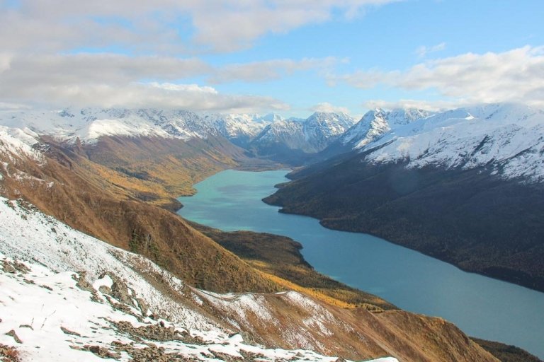
Mile 437: Muncho Lake
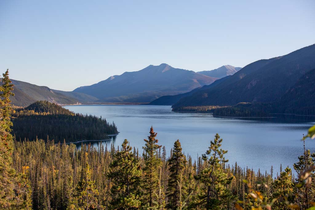
Meaning “big lake” in the Kaska language, it’s easy to see how Muncho gained its name- the lake is over 7 miles long and 750 feet deep.
Muncho Lake is one of the prettiest stops along the Alaska Highway route with its dazzling turquoise waters. Make sure not to miss soaking in the Muncho Lake views at one of the pull-offs overlooking the lake.
It’s also a great place to get out of the car and into the outdoors with potential for kayaking, hiking, fishing, and more.
Places to Stay around Muncho Lake
Muncho Lakes Campgrounds
- Strawberry Flats Campground: On Lake Muncho. Open May 1-September 15. $20 per night.
- MacDonald Campground: Open May 1-September 15. Also located on Muncho Lake. $20 per night.
Where to Get a Bite to Eat by Muncho Lake
- Double G Services Motel
- Northern Rockies Lodge (also features an RV campground in addition to their motel and lake chalets)
Things to do at Muncho Lake
- Kayaking on Muncho Lake: Canoeing is available as well. A good way to break up your Alcan journey and get out on the water.
- Muncho Lake Viewpoints: There are several great places for viewing the beautiful lake tucked into the Canadian Rockies along the Alaska Highway.
- Stone’s Sheep Trail: A gradual uphill hike covering 3.8 miles/6.1 kilometers that will take you to some interesting rock formations and a waterfall.
Services Available in Muncho Lake
- Fuel (2 stations: Double G and at Northern Rockies Lodge)
- Grocery stores (More like convenience stores that are found inside the Double G Fuel Station and inside the Northern Rockies Lodge)
- Dump station and water fill up
Mile 443-474: Muncho Lake to Liard Hot Springs
It’s a short jaunt along the Alaska Highway between Muncho Lake and Liard Hot Springs with some hiking on offer.
Mile 452: Red Rock Canyon Trail: A 3.7 mile/6 kilometer out-and-back trail that follows the course of the Red Rock Canyon here just north of Muncho Lake. A good spot for wildlife viewing.
Mile 453: Mineral Lick Trail: A good and short walk at 0.7 miles/1.1 kilometers. It’s a great chance for viewing wildlife.
Mile 477: Liard Hot Springs

Liard Hot Springs is the perfect place to relax for an afternoon or so, lapping up the warm waters range in temperatures from 42ºC to 52ºC.
Places to Stay in Liard
- Liard River Hot Springs Provincial Park: Costs $27 per night to camp here and this will waive the $5 per person hot spring entrance fee, but there are no hookups or dump stations.
- Liard River Hot Springs Lodge
Things to do at Liard Hot Springs
- Soak in Liard River Hot Springs Provincial Park: An obvious choice if you’re planning to stop through Liard. Read more about visiting here in my post on Liard Hot Springs.
Things to Know Before Going to Liard Hot Springs
- There is a $5 per person fee to visit between April 1 and October 31, outside this time it is free to enter.
- The park opens at 7 am.
- There are pretty nice modern facilities here with changing rooms and toilets right next to the hot springs.
- You’ll need to go on a short walk along a boardwalk for about 10 minutes to reach the hot spring.
- Bears are a common sighting here, especially along the boardwalk, so stay alert and bring some bear spray with you.
Services Available in Liard
- Fuel (at Liard Hot Springs Lodge)
- Grocery store(Also inside Liard Hot Springs Lodge)
- Dump station and water fill up Liard River Hot Springs Provincial Park Campground
Mile 478-611: Liard Hot Springs to Watson Lake
This is your last stretch of the Alcan through British Columbia! There are a couple of stops of interest along this part of the Alaska Highway before your grand entrance to the Yukon Territory at Watson Lake.
Mile 491: Smith River Falls: Here at Mile 491 find a gravel road meandering off of the Alaska Highway. It will lead to a parking lot at Smith River where you can take a 1.6 mile/2.5 kilometer hike to view 115 foot/35 meter high Smith River Falls.
Mile 516: Whirlpool Canyon: Stop off here for a great view of the whirling waters of the Liard River. This area is known for being treacherous as many boats capsized here in the past trying to navigate this crazy canyon.
Mile 603: Welcome to Yukon Sign: You’ve crossed into the Yukon Territory so snap a pic to take home with you.
Places to Stay Between Liard Hot Springs & Watson Lake
- Coal River Services: Offers a Tent and RV campground in addition to their motel. Located at Mile 513 of the Alaska Highway. Campground is open from May 15-late October and the motel is open year-round. Also sells fuel and has a cafe.
- Contact Creek Lodge: Located at Mile 590 of the Alaska Highway, about 40 miles south of Watson Lake. Lodge only. Sells fuel and features a convenience store too.
Mile 612: Watson Lake
Watson Lake is where you’ll get your first warm welcome to the Yukon Territory (although the Alcan does go up in the Yukon before, bends back into BC, and then again turns north to re-enter the Yukon).
With that all said, Watson Lake is the first bigger town you’ll reach in the Yukon Territory and you’re more than likely overdue to get out and stretch your legs anyways.
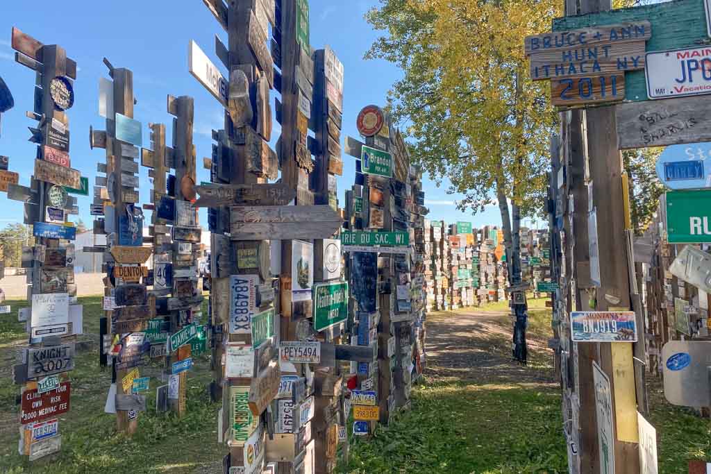
What Watson Lake is most famous is of course the Watson Lake Sign Forest which makes for a fun little wander.
Places to Stay in Watson Lake
Watson Lake Campgrounds & RV Parks
- Downtown RV Park: A simple RV park in the middle of town.
- Watson Lake Campground: Located on the southern shore of Watson Lake. Slots start at $18 per night.
Watson Lake Hotels
Where to eat in Watson Lake
- Nugget Restaurant
- Laurie’s Bistro & Coffeehouse
Things to do at Watson Lake
- Watson Lake Sign Forest: The Watson Lake Sign Post Forest is the most famous site in Watson Lake. It came about during the construction of the Alaska Highway in 1942 when Carl Lindley, a US soldier who was recovering from an injury in Watson Lake was given a job of repairing signposts.
- Watson Lake Visitor Center: Offers some insight into the history of the Watson Lake area and offers brochures and maps of the area. The staff can also help you with information on the Alcan.
- Northern Lights Center: A planetarium featuring a domed theatre that is centered around the northern lights.
Services Available in Watson Lake
- Fuel (several stations)
- Grocery stores (several stores)
- Vehicle repair
- Dump station and water fill up
Mile 613-775: Watson Lake to Teslin
There are a few stops to check out here on the southern end of the Yukon Territory to break up this leg of the journey from waterfalls to lakes, and even the cut-off to take the alternative to the Alaska Highway through the Yukon.
Mile 628: The Junction for the Cassiar Highway: Those wanting to take this alternative route to the Alaska Highway will need to turn off here.
Mile 691: Lower Rancheria River: Features a short walk that will bring you to an overlook of Rancheria Falls.
Mile 699: The Continental Divide: The Alcan crosses this ridge that separates the two largest river drainages in North America and at this point, this narrow ridge separates the Swift River flowing westward and eventually into the Bering Sea, and the Rancheria River flowing eastward and eventually into the Beaufort Sea.
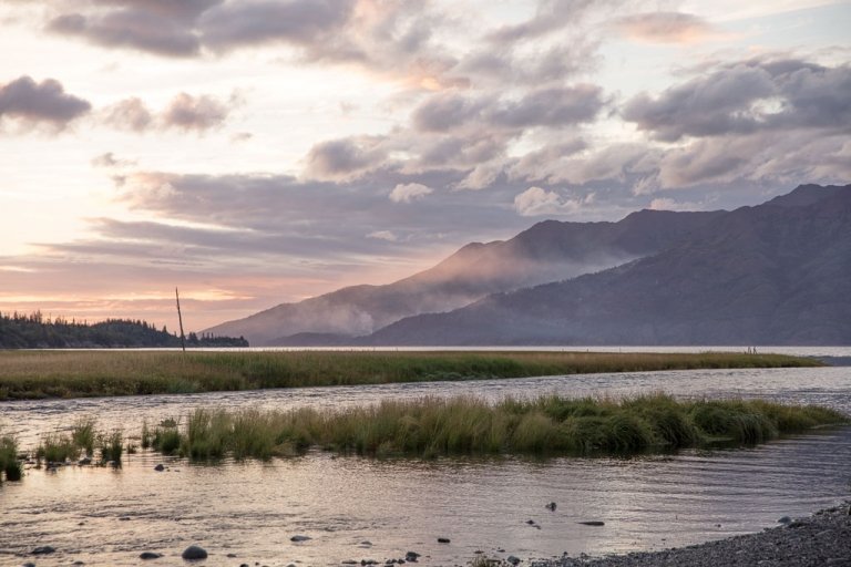
Mile 772: Teslin Lake & Nisutlin Bay Bridge: Stop here for great views off of the Nisutlin Bay Bridge to Teslin Lake, a lake that spans across the border into both Yukon and BC.
Mile 776: Teslin
Sat on the shores of Teslin Lake within Nisutlin Bay this pint-sized town of 125 residents has a few services for passersby.
Places to Stay near Teslin
Campgrounds & RV Parks in and Around Teslin
- Big Creek Government Campground: Sat at the shore of Big Creek. Features RV and tent camping. $18 per night.
- Continental Divide Lodge: Located at Mile 721 and features RB and tent camping.
- Teslin Lake Government Campground: A nice campground off of Teslin Lake featuring both Tent and RV camping. $12 per night.
- Teslin Rest Stop: A rest area close to the Nisutlin Bridge. Free to stay at and has outhouses.
- Yukon Motel & RV Park: As the name suggests, Yukon Motel & RV Park features RV camping in addition to their motel. Also has a cafe inside.
Hotels in Teslin
Where to eat in Teslin
- Inside the Yukon Motel
Things to do in Teslin
Teslin Tlingit Heritage Center: Learn about the local Tglinget People who originate from this area around Teslin as well as the geographical and landscape features of the surrounding area.
Services Available in Teslin
- Fuel
- Grocery stores
Mile 777-832: Teslin to Jake’s Corner
This is just a short section. The only stops really in this section are at Mile 805 for Johnson’s Crossing where you’ll find fuel and food and at Mile 817 for Squanga Lake.
Mile 833: Jake’s Corner & the Detour to the Klondike Highway to Carcross (or onto Skagway!)

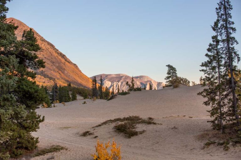
This is a popular detour from the Alaska Highway and in my opinion much worth it for the chance to visit a tiny oddity- The Carcross Desert.
From Jake’s Corner take Tagish Road (Yukon 8) which will take you to Carcross where you’ll have the chance to visit one of the world’s tiniest deserts.
At Carcross, you’ll reach the Klondike Highway (Yukon 2) where a turn to the north will route you back to the Alaska Highway.
Those wanting to cross the border into Alaska here and go to Skagway will take the Klondike Highway to the southeast at Carcross.
In total, the detour from the Alaska Highway to go to Carcross is 66.5 miles/107 kilometers. The Klondike Highway meets back with the Alcan at Mile Marker 872 on the Alaska Highway.
Places to Stay in Carcross
- Carcross Tagish First Nation Campground: Right in the middle of Carcross and features tent and RV sites. $12 per night.
- Conrad Historic Townsite & Campground: A few miles outside of Carcross along the Klondike Highway to the south. Tent and RV camping are available.
- Montana Services RV Park: Also in the heart of Carcross. It is a fuel station but features RV camping and has a grocery store on site.
Where to eat in Carcross
- Caribou Crossing Cafe
- The Bistro
Things to do in & Near Carcross
- Carcross Desert: The Carcross Desert is a small 1 mile x 1 mile dune field- something you probably wouldn’t expect to come across this far north. Plan you own visit with my quick guide to visiting the Carcross Desert.
- Emerald Lake: A drive 10 minutes north of Carcross on the Klondike Highway will take you to dazzling Emerald Lake. It’s a picture-worthy stop.
- Skagway: Those wanting to take the ferry onwards to other locations in Alaska or just want to check out the little seaside Alaskan town can cross the border and visit Skagway. It’s about 90 minute drive time from Carcross to Skagway.
Services Available in Carcross
- Fuel (Montana Services Station at Carcross Crossing)
- Grocery stores (Carcross Crossing- in the same building as the above-mentioned fuel station)
Mile 872-886 Caribou RV Park-Whitehorse
Not much to see in this short section. Beyond the Klondike Highway-Alaska Highway Junction at Caribou RV Park, you come across Wolf Creek Yukon Campground at Mile 875 which offers a good place for an overnight or just a stop to check out the trails nearby.
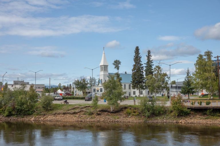
Mile 887: Whitehorse
Welcome to the largest city and capital of the Yukon Territory (they actually took the status from Dawson City to the north in 1953). Fun fact: 70% of the Yukon Territory’s population lives here in Whitehorse!
Whitehorse gained its name from the Yukon River rapids in this area reminiscent of the mane of a white horse.
The history of Whitehorse stretches back eons being home to indigenous peoples before it experienced its first surge in population during the old gold rush days. The city experienced yet another boom with the construction of the Alaska Highway as it served as one of the largest worker camps along the route.
Where to Stay in Whitehorse
Whitehorse Campgrounds & RV Parks
- Hi Country RV Park: An RV park close to town and features tent and RV camping. Tents are $37.50 per night, and RVs are $42.50-57.50 per night.
- Pioneer RV Park & Campground: Right in town, tents are $20-23 per night and RVs are $32-37 per night.
Whitehorse Hotels
Where to Grab a Meal in Whitehorse
- Pickapeppa
- Miner’s Daughter & Dirty Northern
- Antoinette’s Restaurant
- Belly of the Bison (inside the Edgewater Hotel)
- Night Market
Things to do in Whitehorse
- Whitehorse Visitor Center: Find out what all there is to do in and around Whitehorse, any upcoming events happening, or info on the remaining section of the Alaska Highway to the Alaska Border. There’s also a short film about the Yukon the center will play for you if interested.
- Whitehorse Millennium Trail: This 2.3 mile/3.7 kilometer loop follows the banks of the Yukon River and connects some of Whitehorse’s parks.
- Miles Canyon Suspension Bridge: Crossing the Yukon River, the Miles Canyon Suspension Bridge is worthy of a stop for the views of the canyon. You also will get access to trails that wind up the canyon here as well.
- Yukon Beringa Center: Those wanting to learn more about the natural history of the Yukon and the Bering Strait will love popping into this museum.
- Kwanlin Dün Cultural Centre: Learn more about the history and culture of the Kwanlin Dün People who have inhabited this area of the Yukon for centuries.
- SS Klondike National Historic Site: Sternwheelers were a major form of transport in northern areas such as Alaska in the Yukon back during the gold rush days. The SS Klondike was a sternwheeler boat that ran freight on the Yukon River between Whitehorse and Dawson City and began operation in 1929. In 1936 the SS Klondike hit a rock wall and sank and by 1937 a second SS Klondike was built. The second SS Klondike is the one on display in Whitehorse here.
- Yukon Transportation Museum: Learn more about the history of transportation in remote Yukon and the considerations that came along with its extreme weather and long winters. There is a $10 entry fee to enter.
- MacBride Museum: Learn about the history of the Yukon right on the banks of the river. There are over 40,000 artifacts stored here showcasing the Klondike Gold Rush, the First Nations People of the Yukon, and more. There is a $12 entry fee.
Services Available in Whitehorse
- Fuel (several to choose from)
- Grocery stores (several to choose from)
- Vehicle repair
- Dump station and water fill up
Mile 888-979: Whitehorse to Haines Junction
Mile 896: Eclipse Nordic Hot Springs: Just a little beyond Whitehorse take a turn around Mile 896 toward the north onto the Klondike Highway (Highway 2) before turning west onto Takini Hot Springs Road and following it to Eclipse Nordic Hot Springs. This is a luxurious hot spring and spa to relax at.
Mile 937: Dan K’e Ventures (Long Ago Peoples Place): At about Mile 397 you’ll take a turn onto Champagne Access Road to visit Dan K’e Ventures which translates to the Long Ago Peoples Place. The cultural tour ($41.50 per person- do call or email ahead to book) is recommended to get more insight into the Southern Tutchone People’s culture, traditions, construction techniques, and more.
Mile 943: St. Elias Lake Trail: St. Elias Lake actually sits within Kluane National Park. You can find details about the hike in the Kluane National Park section below.
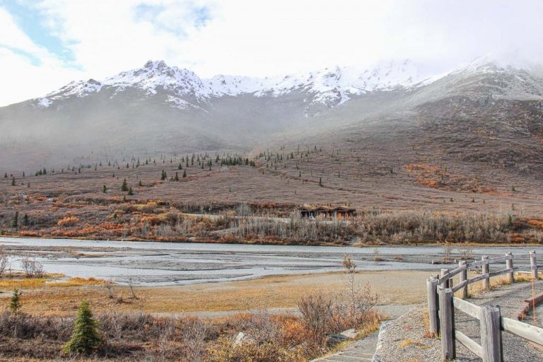
Mile 980: Haines Junction
Haines Junction is a small town located at the junction of the Alaska Highway and the Haines Cutoff (Highway 3) which leads to the border crossing to Haines, Alaska (this would be of use if you plan to take the ferry the remainder of the way to Alaska).
The town of Haines Junction is flanked by the St. Elias Mountains, giving the town a beautiful backdrop.
Those that plan to go deeper into Kluane National Park than where the Alcan brushes up against it further afield will surely find themselves in Haines Junction as this is the place to make arrangements for flightseeing and backcountry trips into the national park.
Mountaineers planning to ascend Mt. Logan, Canada’s highest peak, will usually make a stop here in Haines Junction as well.
Where to Stay in Haines Junction
Haines Junction Campgrounds & RV Parks
- FasGas RV Park: Gas station with a convenience store in Haines Junction that also features RV camping.
- Pine Lake Campground: Tent and RV campground. 3 miles outside town to the north of Haines Junction. $20 per night.
Haines Junction Hotels
Where to Eat in Haines Junction
Things to do in Haines Junction
- Da Kų Cultural Centre: Showcases artifacts and the history of the Champagne and Aishihik First Nations.
- Kluane National Park and Reserve Visitor Centre: Attached to the Da Kų Cultural Centre. The Kluane NP Visitor Center can provide information and tips for anyone planning to visit the remote national park as well as display historical information about the park, exhibits, and footage about the first mountaineers who summited Mount Logan.
- Dezadeash River Trail: Those wanting to get out of the car and take a hike can opt for the 2 mile/3.2 kilometer Dezadeash River Loop Trail that starts right from Haines Junction.
Services Available in Haines Junction
- Fuel (several to choose from)
- Grocery stores (Little Green Apple, otherwise convenience stores attached to gas stations)
- Vehicle repair
- Dump station and water fill up
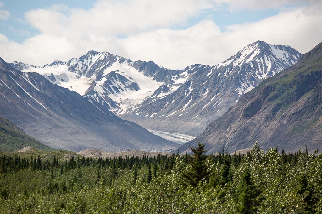
Mile 1020: Kluane National Park & Preserve
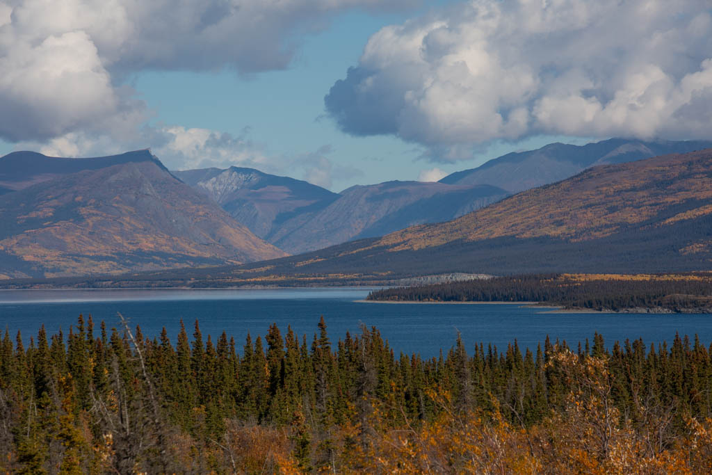
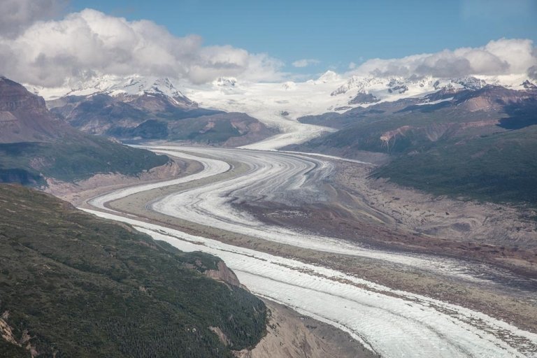
Kluane National Park is a massive park spanning over 20,000 square kilometers of raw nature that butts up against Wrangell St. Elias National Park & Preserve on the Alaskan side of the border.
Home to an array of wildlife, the largest icefield in the world outside the polar regions, as well as the second-highest peak in North America after Denali (and thus Canada’s highest peak).
Kluane National Park runs along a stretch of the Alaska Highway that passes by Kluane Lake where you will have the easiest access to the national park, otherwise, the remainder of Kluane National Park is extremely remote and usually requires booking an air taxi to fly you in.
In my opinion, Kluane is the most beautiful section of the road trip along the Alaska Highway hands down.
If you have the time to spare I would suggest setting aside a couple of nights to explore around some of these easier-to-access areas of the national park close to the Alcan.
Kluane National Park is exceptionally beautiful in September at the end of the main season when leaves turn vibrant yellows, golds, and oranges; berry bushes low down deepen into a vibrant red; and termination dust (snow) starts to creep down the peaks around the park.
Where to Sleep in Kluane National Park
- Congdon Creek Campground: Located about halfway between the southern end of Kluane Lake and Destruction Bay. Sites are first come, first serve. Both tent and RV camping are available. Tents are required to use the 20 sites with electric fences (because bears!). $20 per night.
- Destruction Bay Lodge: Located at Destruction Bay as the name suggests and features RV camping.
- Kathleen Lake Campground: Tent and RV camping, first come, first serve. Sites are $26 per night. Located south of Haines Junction at Mile 136/Km 219 of the Haines Cutoff Road (not the Alaska Highway).
- Kluane Cove: Located right on Kluane Lake at Destruction Bay. Free to camp at. Watch out for grizzlies.
Things to do in Kluane National Park
- St. Elias Lake Trail: This epic 4.8 mile/7.7 kilometer out and back trail through the first to reach St. Elias Lake. The trailhead begins near Lake Dezadeash at about Mile 943 on the Alaska Highway, a bit south of Haines Junction. St. Elias Lake still sits within Kluane National Park (it’s a bit confusing until you look at it on a map).
- Kathleen Lake: If you’ve only got a short time to dedicate to visiting Kluane National Park (aside from driving the Alcan through it), Kathleen Lake is a worthy stop. Kathleen Lake sits at Mile 136/Km 219 of the Haines Cutoff Road, so it’s a bit south of Haines Junction, but the lake still sits within Kluane National Park like the nearby St. Elias Lake Trail.
- King’s Thorn Peak Hike: This is a grueling summit but well worth the effort for the views. The 7.9 mile/12.7 (round trip) hike gains 4,507 feet/1,373 meters to reach the top. The trailhead to King’s Thorn Peak starts from the Kathleen Lake Campground.
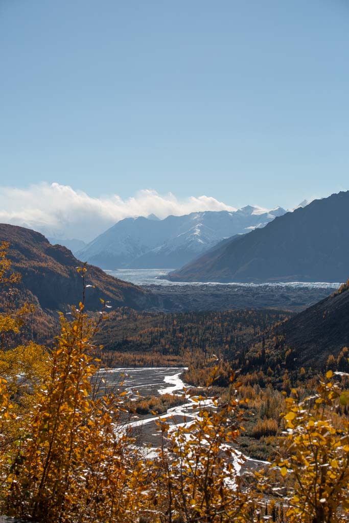
- Kluane Lake: 50 mile long Kluane Lake is impossible to miss as you’ll drive alongside it on the Alaska Highway for quite some time. It’s a beautiful milky turquoise owing to it being glacially fed, though Kluane Lake unfortunately is incredibly vulnerable to our ever-changing climate. You can take boats, kayaks, and canoes out onto Kluane Lake though do take caution as the waves can get massive on the lake.
- Silver City: At Mile 1016 of the Alaska Highway take a detour 3 miles/5 kilometers to the east down a gravel road to visit the ghost town of Silver City. It originally was a trading post and featured a roadhouse. This route led to some of the gold mines back during the Klondike days.
- Thechàl Dhâl Visitor Center: Sat in the ‘Ä’äy Chù Valley is the Thechàl Dhâl’ Visitor Center which is reachable by turning off the Alaska Highway at Mile 1024. The visitor center features exhibits about the flora and fauna of the area as well as the First Nations People that have inhabited the Kluane area.
- Sheep Creek Trail: Just a little further beyond the Thechàl Dhâl’ Visitor Center is the start of the Sheep Creek Trail. It’s an 8 mile/12.8 kilometer out-and-back trail that gains 2,395 feet/730 meters.
- Ä’äy Chù (Slim’s River) West Hike: Also starting from the Thechàl Dhâl’ Visitor Center, this is a long 27.4 mile/42 kilometer (round trip) trek that takes most anywhere between 2 and 4 days to complete. The trek is relatively easy, just long, and offers grand views of Kaskawulsh Glacier.
- Soldier’s Summit Trail: If you’re looking for a nice and gentle hike that won’t eat up too much time, the Soldier’s Summit Hike is a nice option at 2.2 miles/3.5 kilometers. The hike provides grand views of Kluane Lake and follows an old section of the original Alaska Highway. The trailhead is signposted on the Alcan and is located at Mile 1025.
- Destruction Bay: Located at Mile 1046, Destruction Bay is a small community on the shores of Kluane Lake. The small outpost gained its name in the 1940s when the construction camp here on the Alaska Highway was destroyed in a bad windstorm. Nowadays it’s mostly a convenient stop for visitors passing by on the Alcan for fuel, groceries, and accommodation.
- Kluane Museum of History: Located at Mile 1056 of the Alaska Highway is the Kluane Museum of History. Features wildlife exhibits, gemstones and minerals from the Yukon region, and tools and weapons of the Southern Tutchone people.
- Quill Creek: Located at Mile 1073 of the Alaska Highway, it was once home to the Wellgreen, a nickel mine owned by Hudson’s Bay Company that closed in 1973.
- Lake Creek: A campground and recreational area located at Mile 1112.
- White River: White River is more or less the northern end of Kluane National Park at about Mile 1129 of the Alcan. The Yukon Discovery Lodge is located here.
- Flightseeing in Kluane National Park: One of the best ways to access the remote areas or just get a different perspective on Kluane National Park is to take a flightseeing tour. There are a scattering of flight operators, mostly based in Haines Junction, however, there are some further north in Burwash on the shore of Kluane Lake.
Mile 1130-1201: Kluane National Park to Beaver Creek
There isn’t much to get out and do along this section of the Alaska Highway as it truly is bumf*** nowhere (and I mean that in the nicest possible way.)
If you were determined you could try to trudge into the backcountry out here I guess, though I wouldn’t recommend it since this area along the Alcan is teeming with wildlife.
So that brings me to- keep some binoculars handy and photographers have their telephoto ready because this is one of the best stretches of the Alaska Highway to spot wildlife.
Where to Stay Between Kluane National Park & Beaver Creek
- Lake Creek Campground: Located on the White River and just off of the Alaska Highway. Tent and RV camping are available for $20 per night. Open May 19-October 2.
- Snag Junction Campground: Campsites are $20 per night. Located about 15 minutes outside of Beaver Creek. Open May 19-October 2.
- Discovery Yukon Lodge: An ecotourism camp along the White River. Offers tent and RV camping and a lodge.
Mile 1202: Beaver Creek
With a tiny population of 100, Beaver Creek has all the trappings of a dusty border town. Beaver Creek is Canada’s westernmost city and is home to the White River First Nation.
The border crossing into Alaska is just beyond, so if it’s late you may want to consider spending the night here, as well as fill up on fuel.
Places to Stay in Beaver Creek
Where to Get Something to Eat in Beaver Creek
- Buckshot Betty’s Restaurant & Rooms
- Ida’s Motel & Cafe
Things to do in Beaver Creek
- Snap a photo with the ‘Welcome to Beaver Creek” sign: This is about the only attraction here in Beaver Creek for most travelers.
Services Available in Beaver Creek
- Fuel (Fas Gas Station)
- Grocery stores (A couple of convenience stores)
- Vehicle repair
Mile 1203-1225: Beaver Creek (Canadian Border Post) to the Alcan Port of Entry (US Border Post)
About 1 mile outside of Beaver Creek you’ll pass the Canadian Border Post, you do not need to stop here (if you’re leaving Canada and going into Alaska, if you are coming from Alaska and into Canada you will stop here).
Beyond that, you’ll pass through a long stretch of no man’s land between the two countries (nearly 23 miles to be exact).
At Mile 1225 you will reach the US side of the border and will proceed through immigration and customs. See my previous post about the Alaska Highway to read all the details you need to know in order to cross the border between Alaska and Canada (note that if you are leaving Alaska and entering Canada, you will not stop here at the US border post and will continue to the Canadian border post).
Note that Alaska is on Alaska standard time and Yukon is on Pacific standard time, so you will go back an hour entering Alaska and you will go forward an hour entering Canada.
Mile 1226-1313: The Alcan Border Crossing to Tok
Much like the Canadian side of the border, there isn’t much in the way of stops along the section of the Alaska Highway between the border and Tok.
The Alcan cuts through a portion of the Tetlin Wildlife Refuge, so keep an eye out for wildlife. Further on you will pass the Northway Junction (an access road to the community of Northway), views of the Tanana River, and the Tetlin Junction where it’s possible to head north along the Taylor Highway and up to the fun little mining town of Chicken.
Note that the prices listed in the Tok and Delta Junction sections are in USD.
Mile 1314: Tok
Welcome to Tok, your first glimmer of civilization after entering Alaska on the Alaska Highway.
Tok is a tiny town and there isn’t much in the way to do around here but there is a visitor center, fuel stations, a grocery store, and campgrounds/accommodation.
Note that many of you will not continue to the end of the Alcan in Delta Junction as I know most of you will be heading to the Anchorage area from Tok.
Where to Stay in Tok
- Alaskan Stoves Campground: Features RV and tent spots in addition to a lodge and hostel. In the middle of Tok.
- Fox n Firewood Cabins: Cabins for rent in Tok.
- Hide Away B&B: B&B style accommodation in Tok.
- Sourdough Campground: In the heart of Tok. Tent camping is on offer for $29 per night, RVs range from $45-60 per night, and rooms go for $129+ per night.
- Tok River State Recreation Site: 4.5 miles east of Tok and features tent and RV camping. $20 per night.
- Tundra RV Park: Just a hair east of the junction of the Alaska Highway with the Tok Cutoff. Tents go for $30 per night and RVs are $53-54 per night. Bar on site.
- Tok RV Village & Cabins: Located right by the Tok Airport and features both cabins and RV slots.
Where to Eat in Tok
- Fast Eddy’s
- Soho Thai Takeaway
- Sourdough Campground Cafe
Things to do in Tok
Tok Mainstreet Visitors Center: There isn’t heaps to do in Tok (I know from experience, one of my cousins and my aunt lived there for a span of time in the 1990s) but if you’re looking to spend a little time there it may be worth popping into the visitor center for info.
Services Available in Tok
- Fuel (several options)
- Grocery stores (Three Bears)
- Vehicle repair
- Dump station and water fill up
Mile 1315-1386: Tok to Delta Junction
For those bound and determined to complete the entire Alaska Highway, this is the final leg!
There aren’t a lot of stops along the final portion of the Alcan here, but it is a beautiful drive, to say the least.
Mile 1387: Delta Junction
You’ve made it alive to the end of the Alaska Highway- welcome to Delta Junction. Much like Tok, it’s a tiny middle-of-nowhere town.
Where to Stay in Delta Junction
- Alaska Country Inn: Small inn with good rooms and features a nice outdoor area.
- Alaska Frontier Inn: Located outside of town and is a small inn with nice rooms on offer.
- Delta State Recreational Site: On the north side of Delta Junction on the river. RV and tent slots are available. $20 per night.
- Quartz Lake Recreational Site: 14 miles north of Delta Junction. RV and tent camping are available. $20 per night.
- Trophy Lodge: Another good hotel option in Delta Junction
Where to Eat in Delta Junction
Services Available in Delta Junction
- Fuel (several)
- Grocery stores (a couple)
- Vehicle repair
- Dump station and water fill up
Continuing to Fairbanks or Anchorage
To be honest, Delta Junction (or Tok) is still pretty much a tiny town in the middle of nowhere so surely it won’t be your final stop.
Most will continue to Anchorage from Tok or Delta Junction with places of interest including Glenallen, Matanuska Glacier, Lion’s Head, Matansuka River, Palmer, and Eagle River.
Others will continue to Fairbanks. There aren’t a lot of major stops between Delta and Fairbanks but the drive is scenic.
A small portion will opt to head on down to Valdez, taking the Richardson in the opposite direction than those headed to Fairbanks. Stops en route to Valdez include Chitina and McCarthy- the gateway to Wrangell St. Elias National Park (though both these are a bit off the main route), and Thompson Pass.
Ready to Take on the Alaska Highway?
Ask any Alcan-related questions in the comments section below.
Need Travel Insurance for Alaska & Canada?
Start shopping plans over at battleface, my go-to travel insurance choice, or over at World Nomads.
More Posts From Canada & Alaska
The Carcross Desert: One of the World’s Smallest Dune Fields
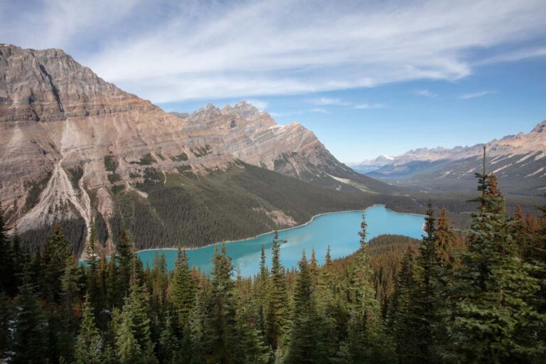
Peyto Lake: Everything You Need to Know Before You Go to Banff’s Most Beautiful Lake
The Ultimate Alaska Highway Guide: Driving the Alcan between Canada & Alaska
A Comprehensive Guide to Jasper National Park
Visiting Liard Hot Springs
A Guide to Banff National Park
The Best Places To See The Northern Lights in Alaska
9 Tips For Viewing The Aurora
Girdwood Travel Guide + 5 Things To Do In Girdwood, Alaska
Anchorage To Fairbanks Road Trip: One Week In Alaska

The Big Loop Alaska Road Trip
2 Day Anchorage Itinerary
Hiking The Mint-Bomber Traverse
Travel Alaska On A Budget
How To Visit Gates of the Arctic National Park
A Guide To The Denali Highway
Visit Spencer Glacier On The Whistle Stop Train
Visiting Byron Glacier
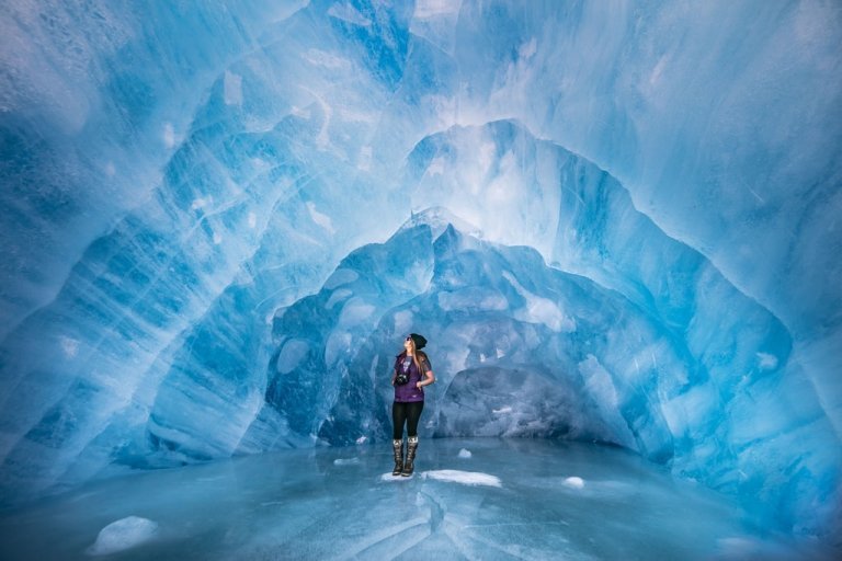
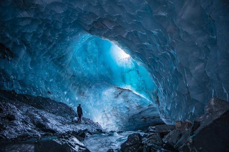
How To Get To Mendenhall Ice Caves
16 Best Day Hikes Near Anchorage, Alaska

What to Pack for Alaska, Written by a Local
Anchorage’s Best Hotels: Where to Stay in Anchorage
Biking to Knik Glacier in the Winter
A Day Hike Into ANWR
Fairbanks Travel Guide + 13 Things To Do In Fairbanks
Shrine of St. Therese In Juneau, Alaska
How Much Does It Cost To Travel In Alaska?
The Best Way To Explore Kenai Fjords National Park: Major Marine Tours
The Ultimate Alaska Highway Guide: Driving the Alcan between Canada & Alaska
Wrangell St. Elias Road Trip, Alaska
A Quick Guide To Hope, Alaska
How To Get A Denali Road Lottery Permit
The Rabbit Lakes Hike In Anchorage, Alaska
Kayaker’s Cove: My Favorite Escape From Seward
Homer Travel Guide + 14 Things To Do In Homer
34 Best Things To Do In Alaska
Williwaw Lakes Hike In Anchorage, Alaska
The Ultimate Alaska Travel Guide
Kenai Peninsula Road Trip
Anchorage Travel Guide + 20 Things To Do In Anchorage
Juneau Travel Guide + 19 Things To Do In Juneau
The Best Road Trips In The World
Denali National Park Travel Guide + 14 Things To Do In Denali
10 Reasons to Visit Alaska
Seward Travel Guide + 18 Things To Do In Seward
MacDonald Spit, My Favorite Coastal Alaska Destination
Visiting Virgin Creek Falls In Girdwood, Alaska
Free Things To Do In Anchorage
The Ultimate Alaska Road Trip Itinerary
K’esugi Ridge Hike in Denali State Park, Alaska
The Dalton Highway Road Trip
The Reed Lakes Hike In Hatcher Pass, Alaska
Snowbird-Bomber Hike in Hatcher Pass
10 Day Alaska Itinerary
Eagle & Symphony Lakes Hike, Alaska