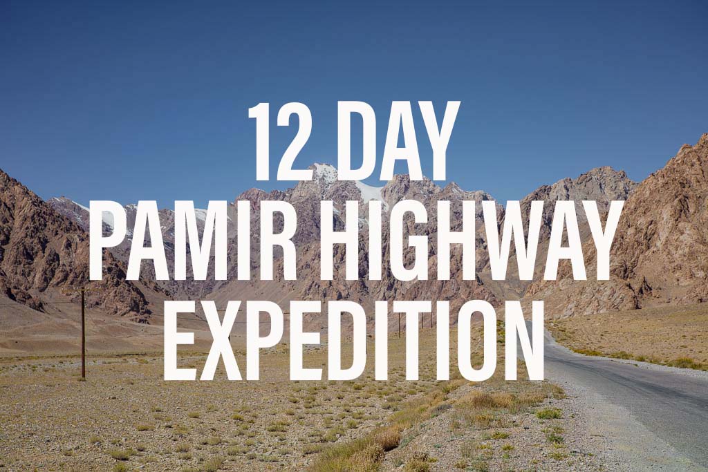
Bartang Valley Guide
Updated April 2024, The Bartang Valley Guide was originally written in December 2017
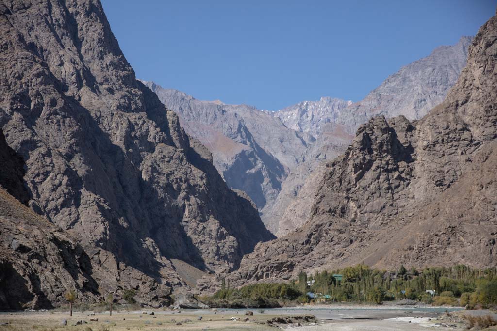
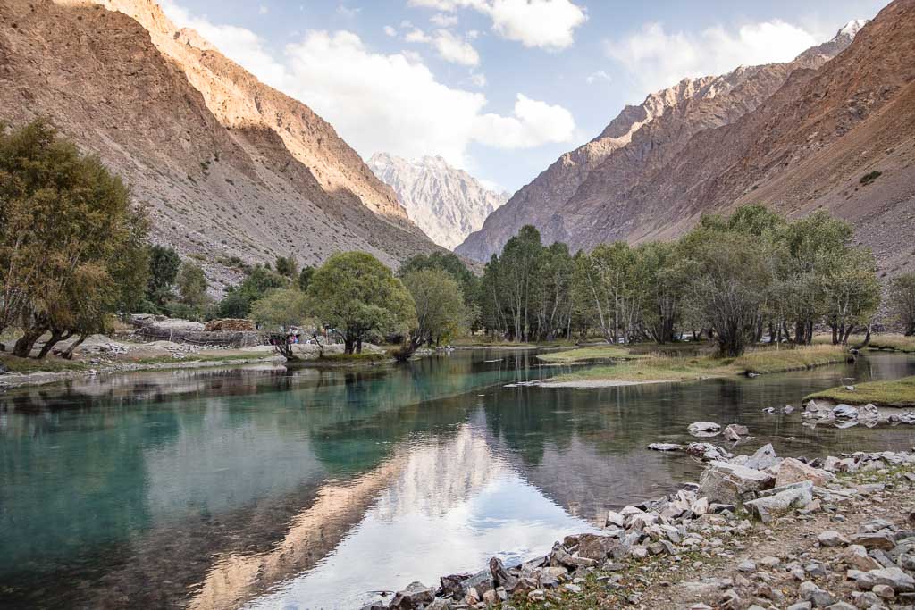
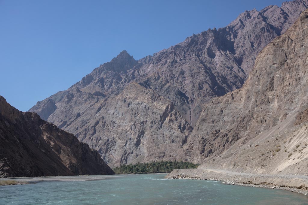
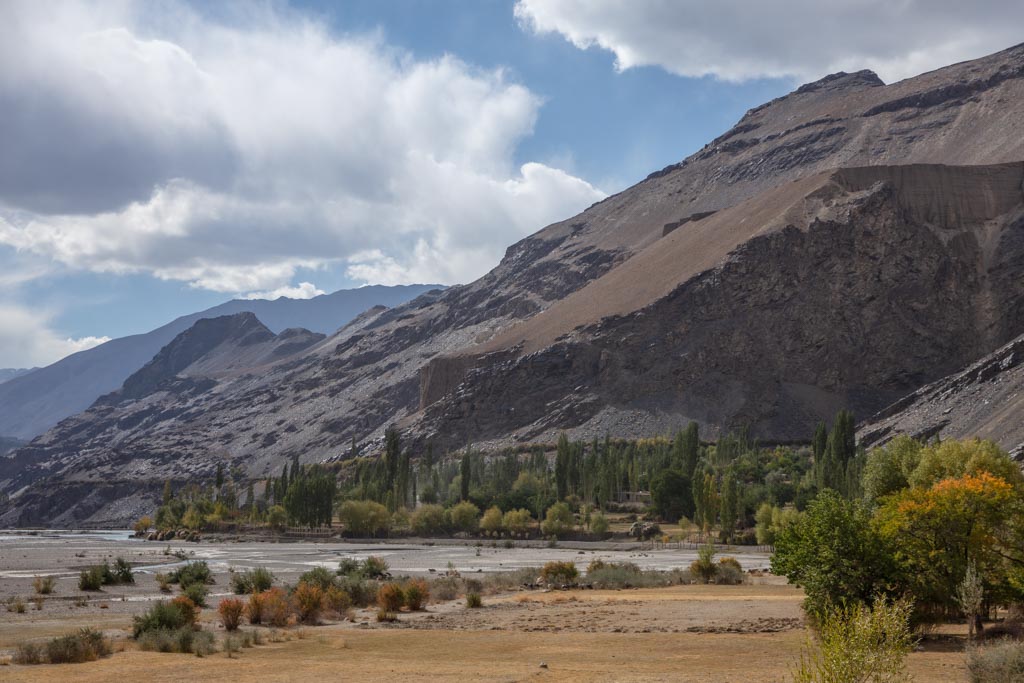
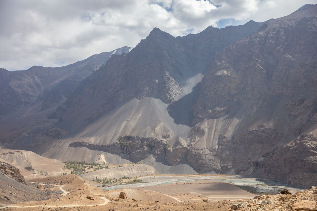
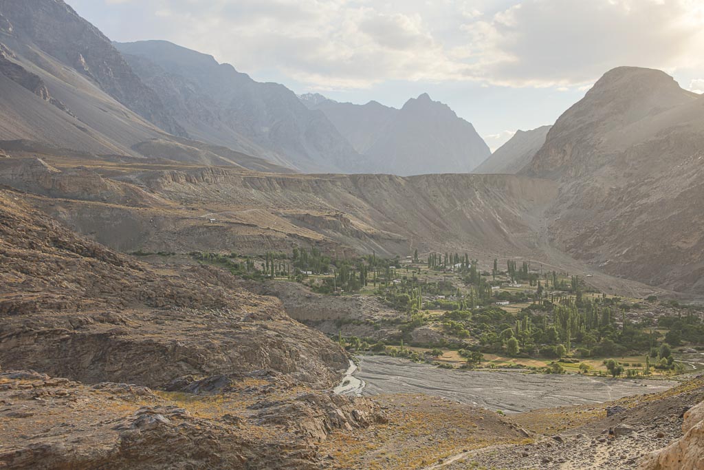
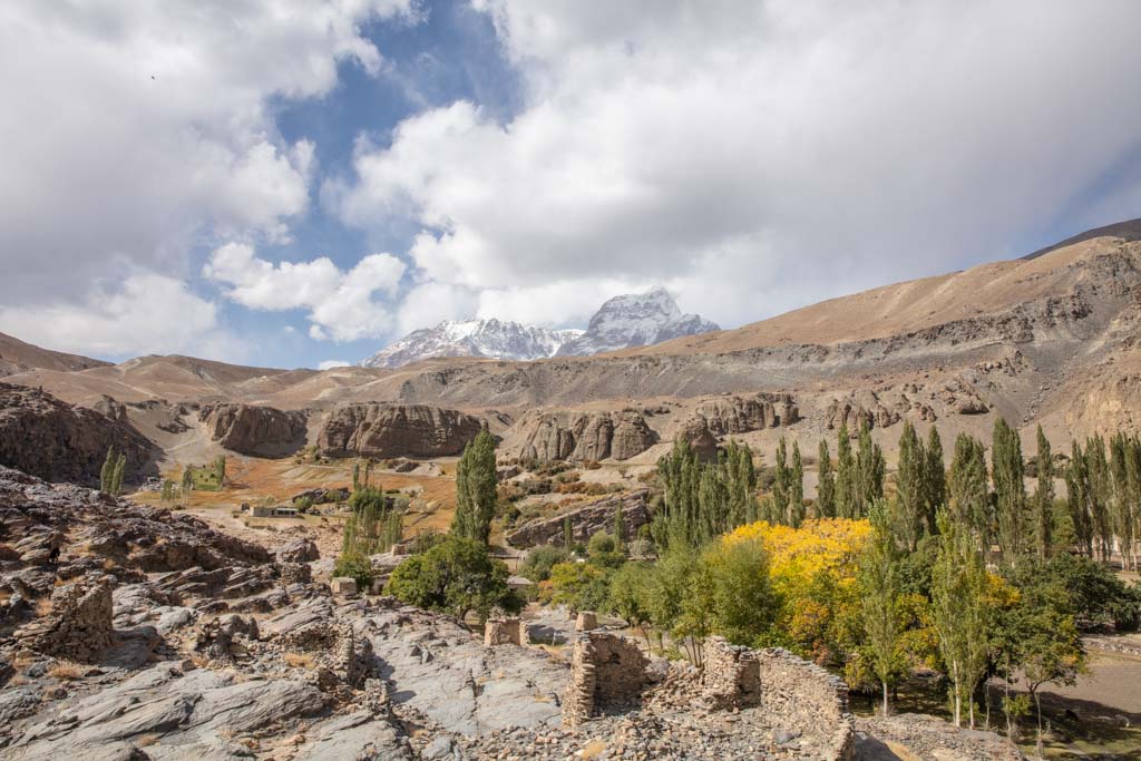
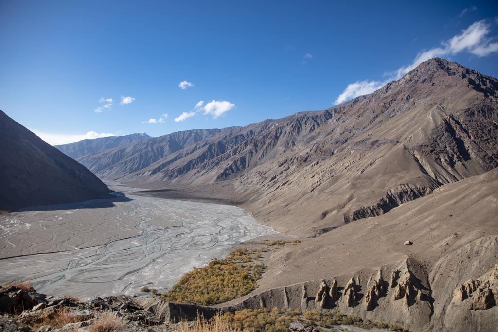
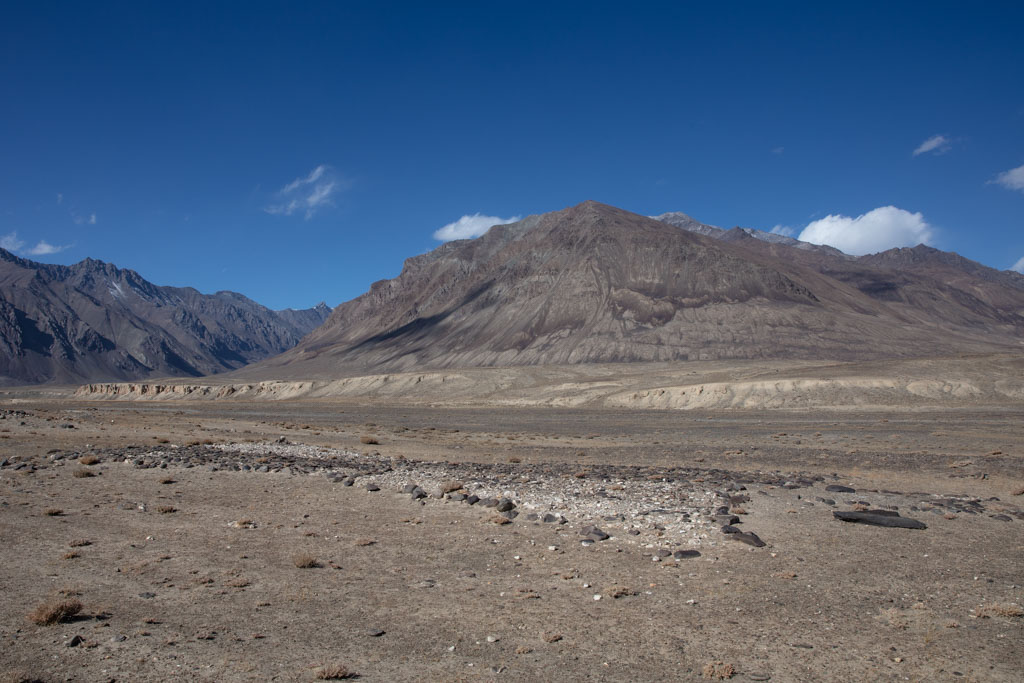
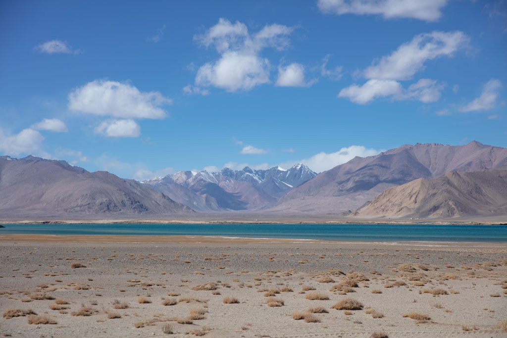
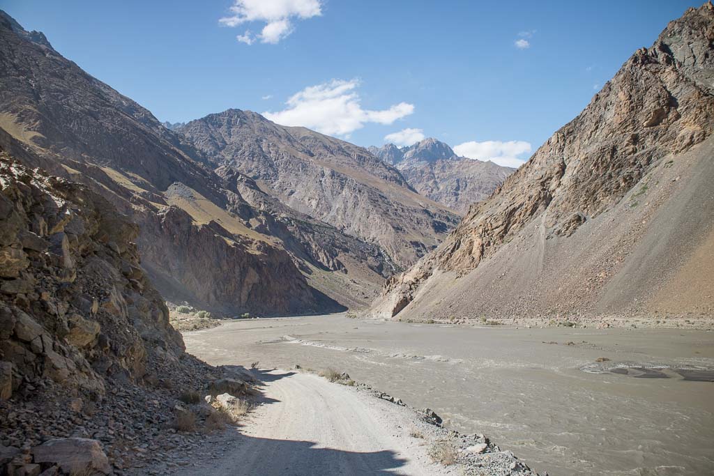
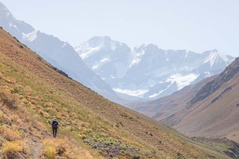
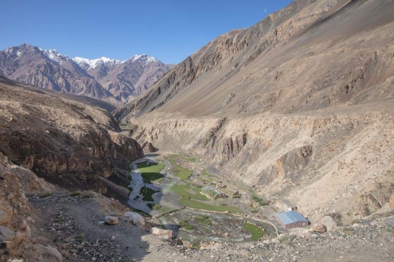
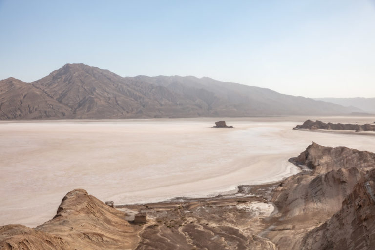
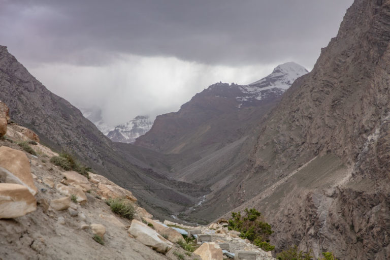
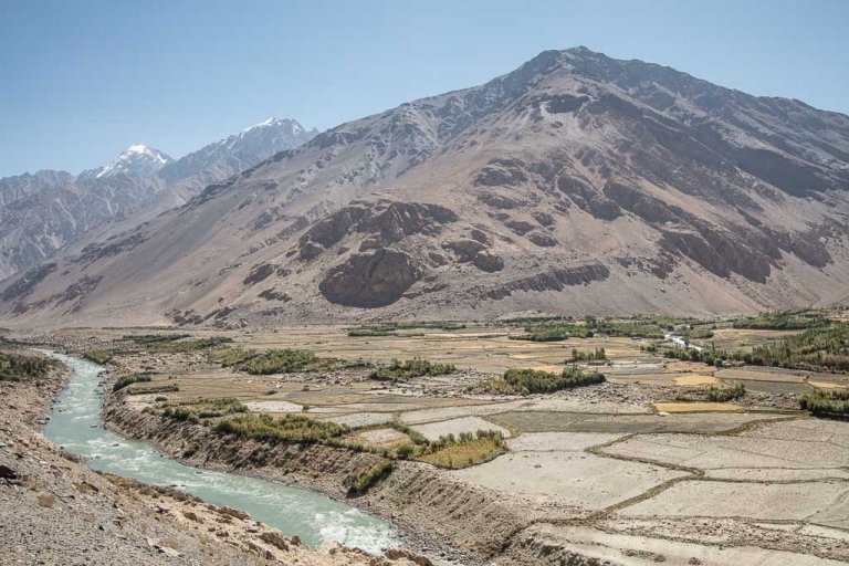
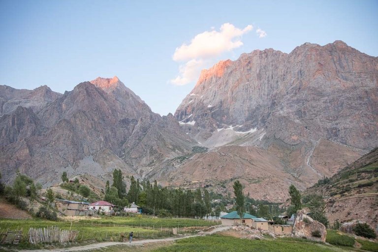
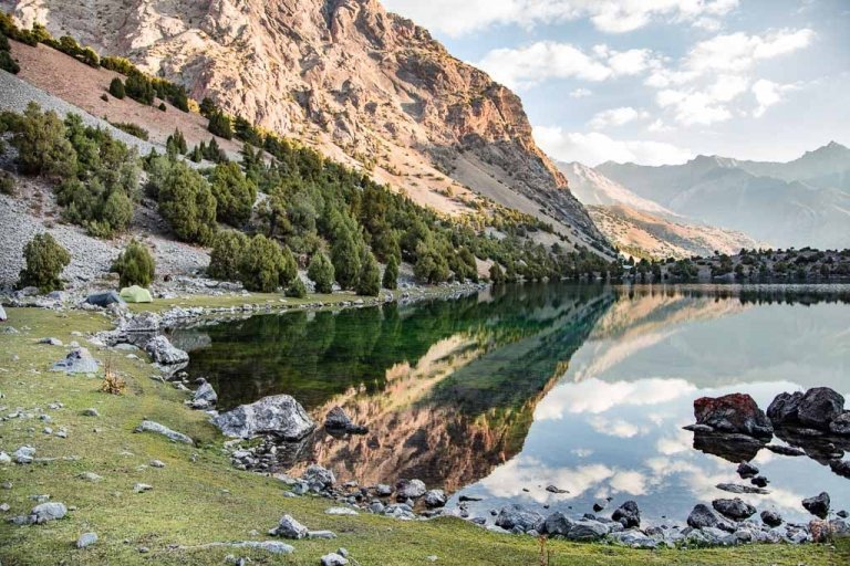
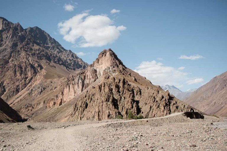
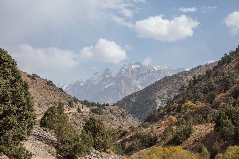
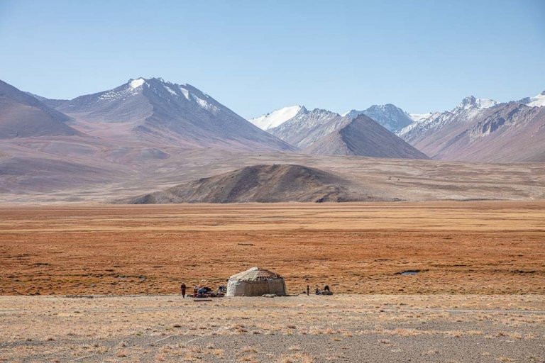
With flashes of green alluvial plains nestled along the Bartang River, sandwiched between stark and barren walls of rock- this is the Bartang Valley. The Bartang Valley is one of the most remote and desolate stretches of the famed Pamir mountains in Tajikistan. If you’re looking for an adventurous deviation from the famous Pamir Highway the Bartang Highway has all the makings of a true expedition into the wilds of Tajikistan.
With some of the Pamir’s most hospitable people, premier trekking, and beautiful villages a trip up the Bartang Highway surely won’t disappoint. To truly discover the beauty of the Bartang Valley and find the hidden gems- you’ll have to venture out beyond the highway.
The most popular trip into the Bartang Valley is the short trek to the beautiful little village of Jizeu. For more ideas for planning your visit to the Bartang Valley and the remainder of Tajikistan, I recommend getting a copy of Bradt Tajikistan.
Starting To Plan? Read The Ultimate Tajikistan Travel Guide
Need Travel Insurance and Evacuation Services for Tajikistan?
Start shopping for travel insurance plans over at IATI Insurance. Readers of the Adventures of Nicole get a 5% discount off your plan.
The Adventures of Nicole partners with Global Rescue to offer the world’s leading medical evacuation and security advisory services. To travel with peace of mind, shop evacuation coverage at Global Rescue.
Wanna join a group expedition on the Pamir Highway?
I will be leading a 12 day expedition down the Pamir Highway June 25-July 6, 2024. There is also an option for a 25 day Tajikistan Expedition that also includes a trek in the Fann Mountains.
- Bartang Valley Guide
- The Best Things to do Along the Bartang Valley
- Villages & Sites Along The Bartang Highway
- How to get to the Bartang Highway
- Getting Around Bartang Valley
- Services Along The Bartang Highway
- Trekking Along The Bartang Valley
- Permits
- Languages Spoken Throughout Bartang Valley
- Mobile Phone Coverage
- Safety
- Great Online Resources
- What To Pack
The Best Things to do Along the Bartang Valley
To discover and experience the true gems in the Bartang Valley you’ll need to stray off the main highway itself. Here are a few of the most stunning sites along the valley.
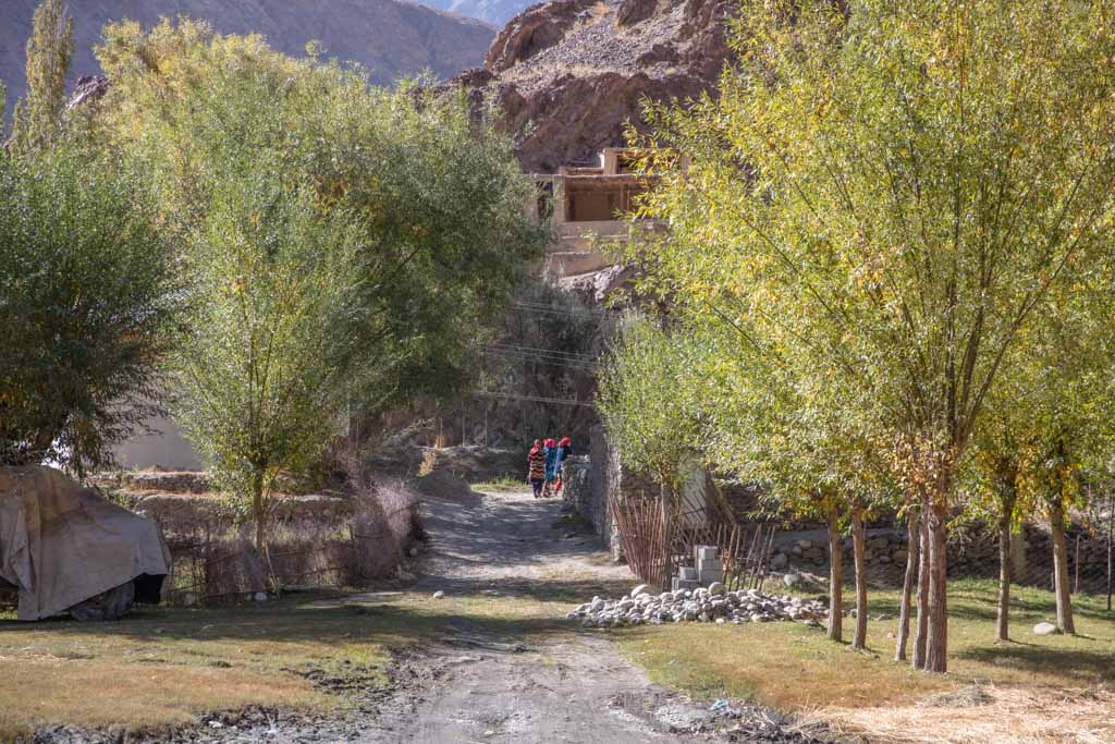
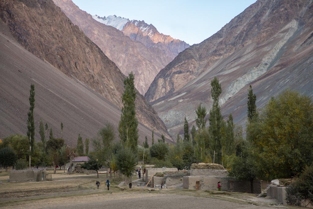
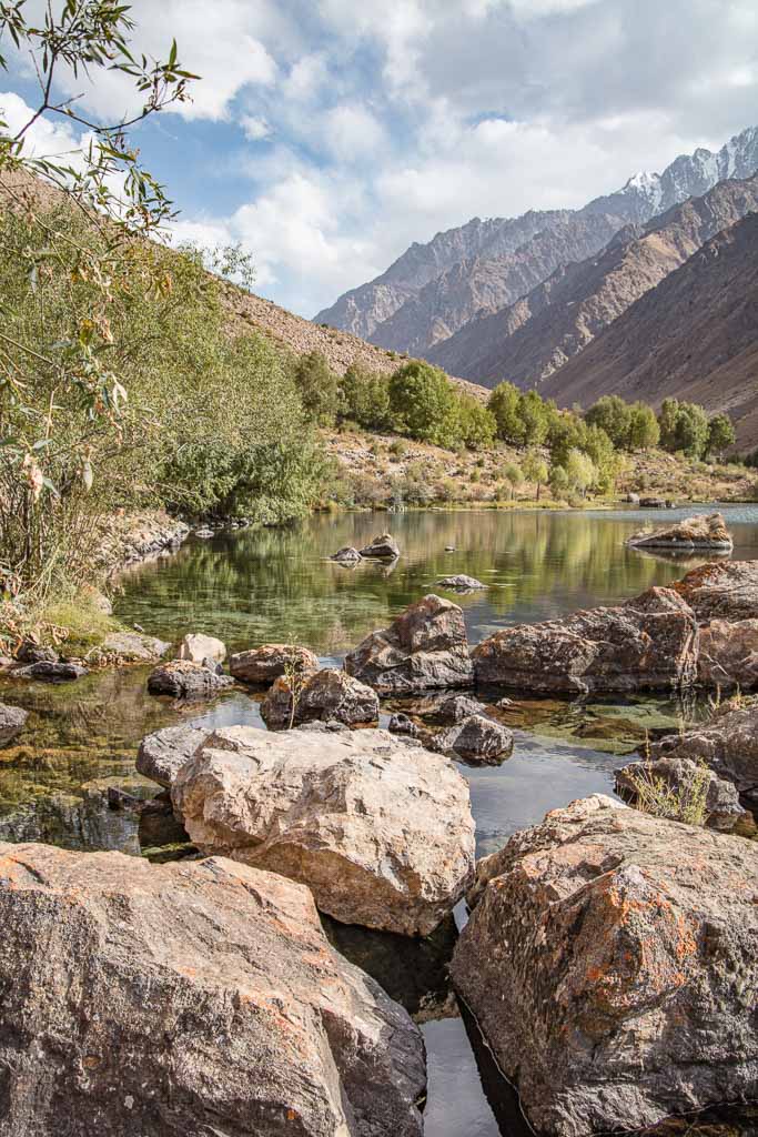
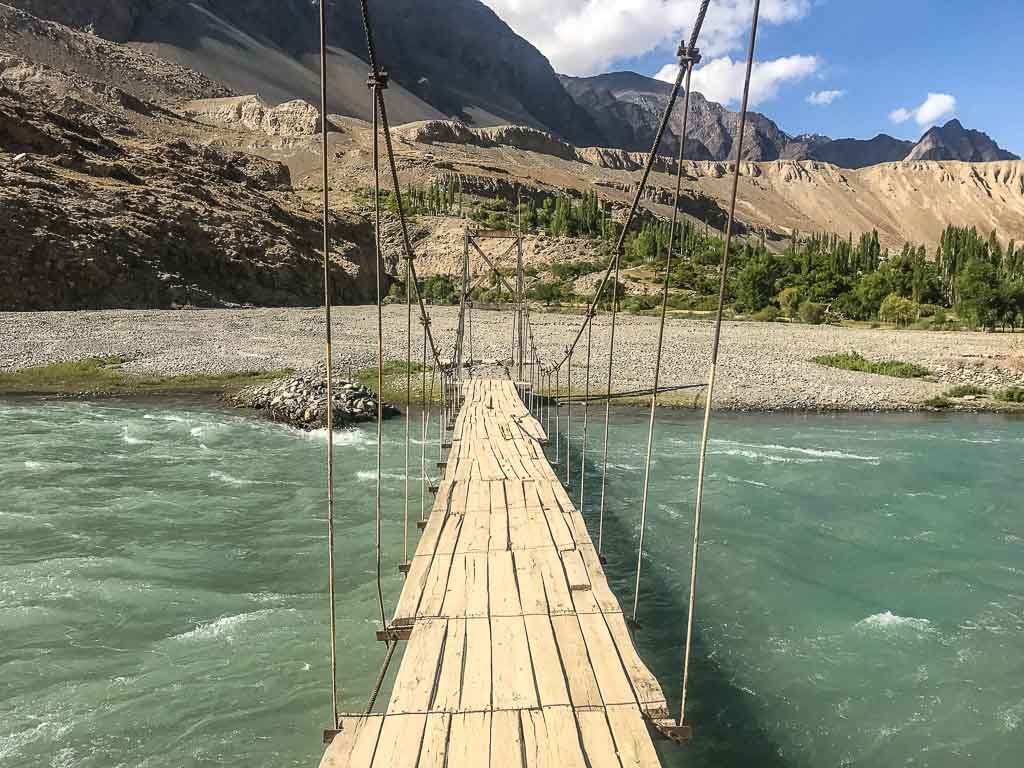
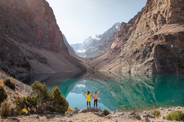
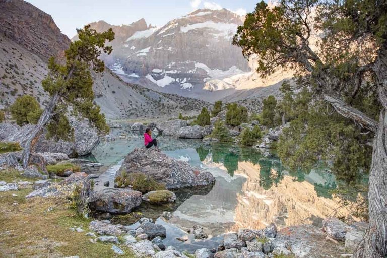
Trek to Jizeu Village
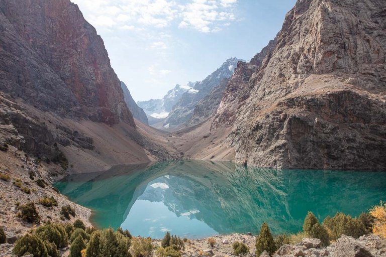
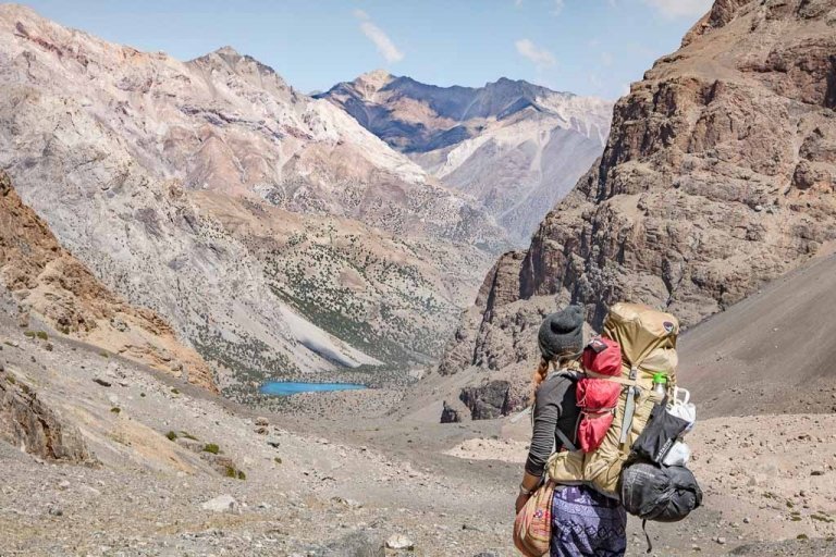
Jizeu is the most popular and well-known trip in the Bartang Valley. This short, yet somewhat steep 2 hour hike will take you to cross the raging Bartang River by cable bridge and continue up trails on loose shale to one of the most stunning villages in Tajikistan with pools of crystal clear water reflecting a mirror of the Pamiri sky.
Know before you go: The Jizeu Trek
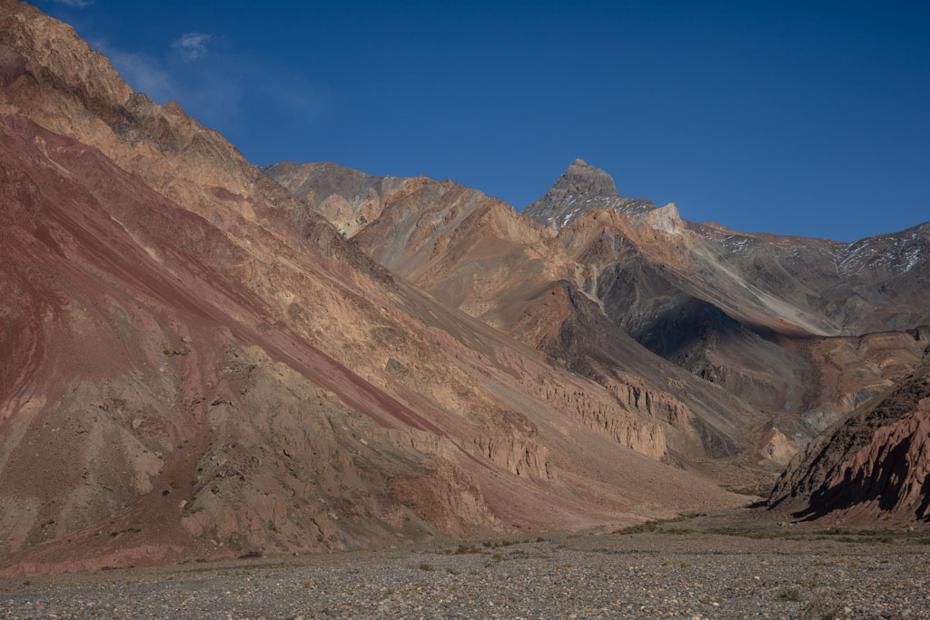
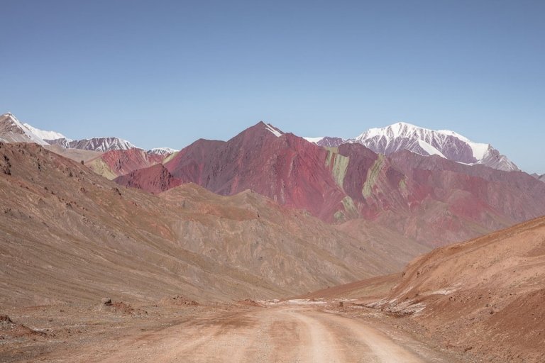
Where the River Turns Red
Between the villages of Vrinjavn and Yapshorv, a stream of red water enters the Bartang River. The red color is due to sediments in the water.
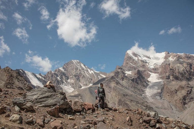
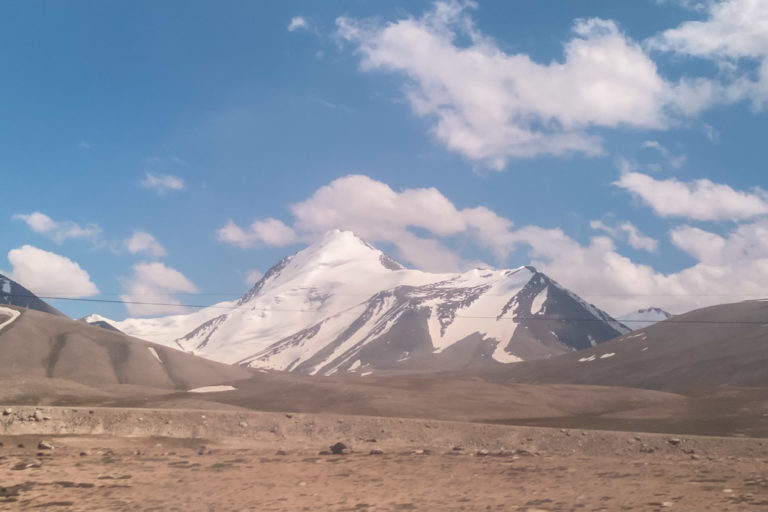
Trek to Peak Istiklol Base Camp
From the village of Roshorv, accessible by jeep track from Yapshorv it’s possible to trek to the basecamp for 6940 meter Peak Istiklol as a long day trip or an overnight trip. Of course, there is the potential to continue trekking for several days further afield over Khurjin Pass to reach Yazgulom Valley.
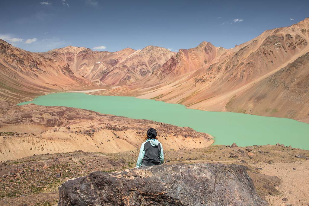
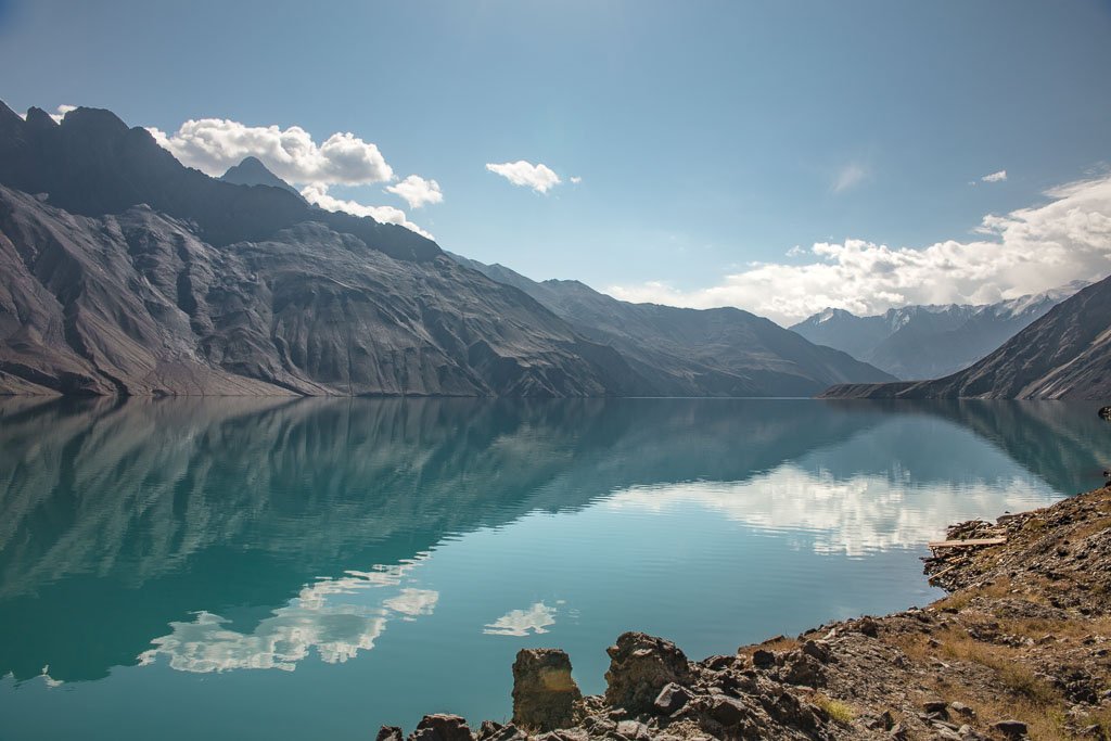
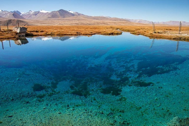
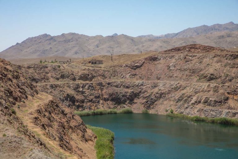
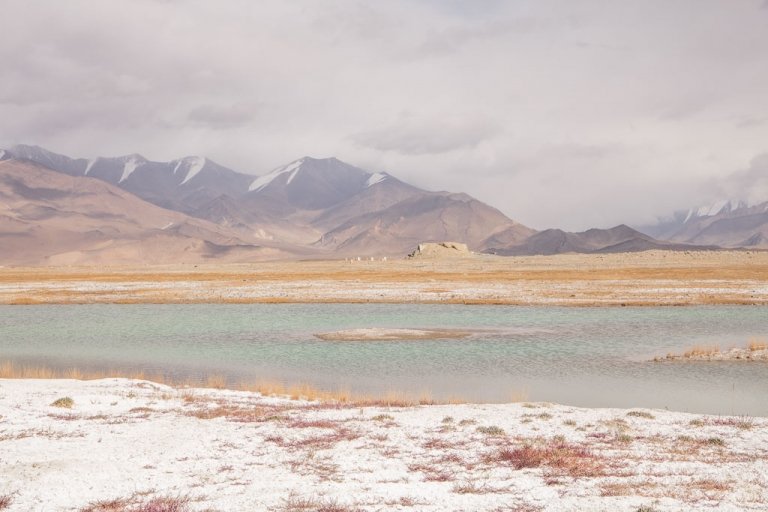
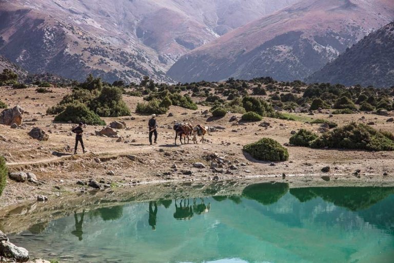
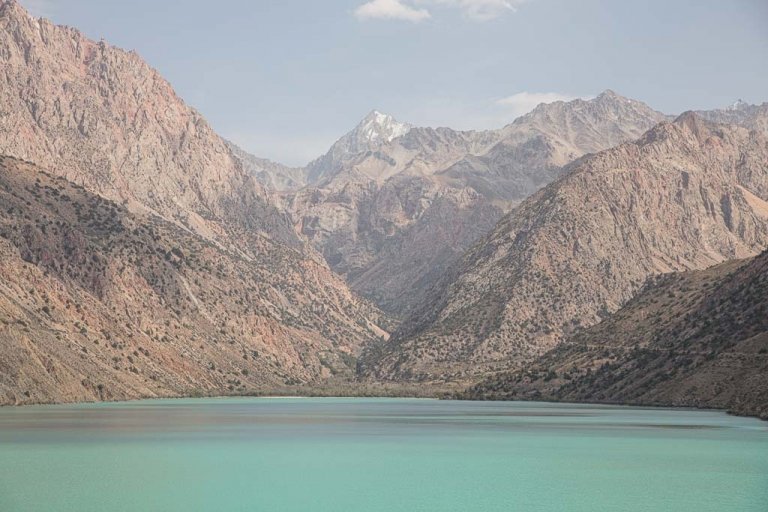
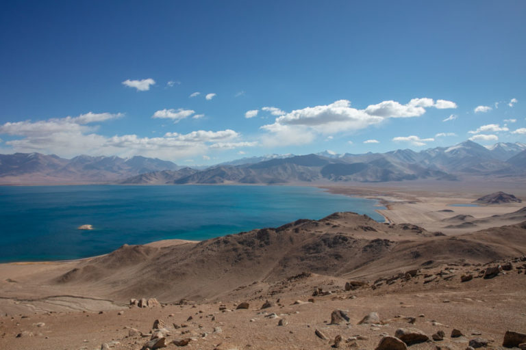
Hike to Lake Sarez
A potential disaster waiting to happen, yet beautiful nonetheless. This Lake was formed due to the damming off of the Murghab River when an entire mountainside dislodged, forming the Usoi Dam and subsequently filling the valley with water.
Special permits are needed to visit here and local guides are required. Contact Sarez Travel to arrange a trip out here.
Read: How To Get To Lake Sarez

Usoi Dam
The above-mentioned dam caused the valley to fill with water from the Murghab River creating Lake Sarez. The Dam is massive and sight all in itself.
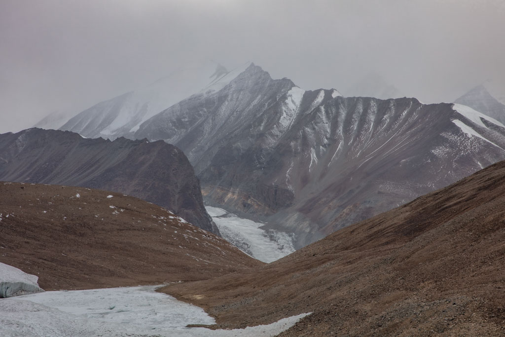
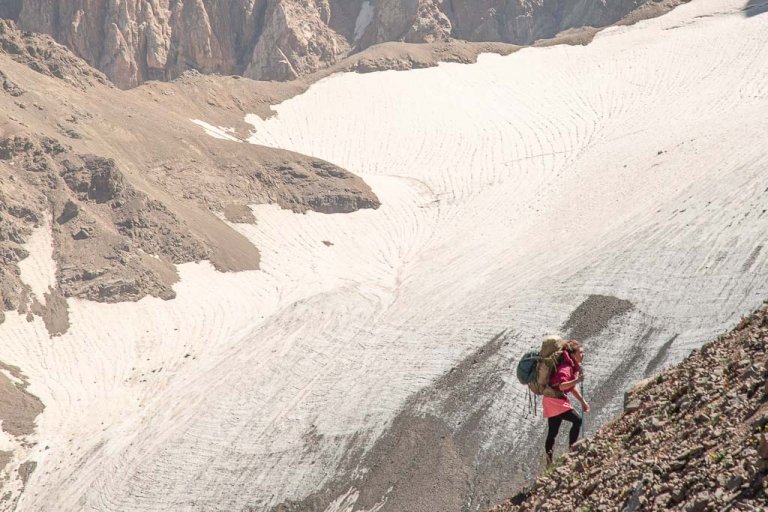
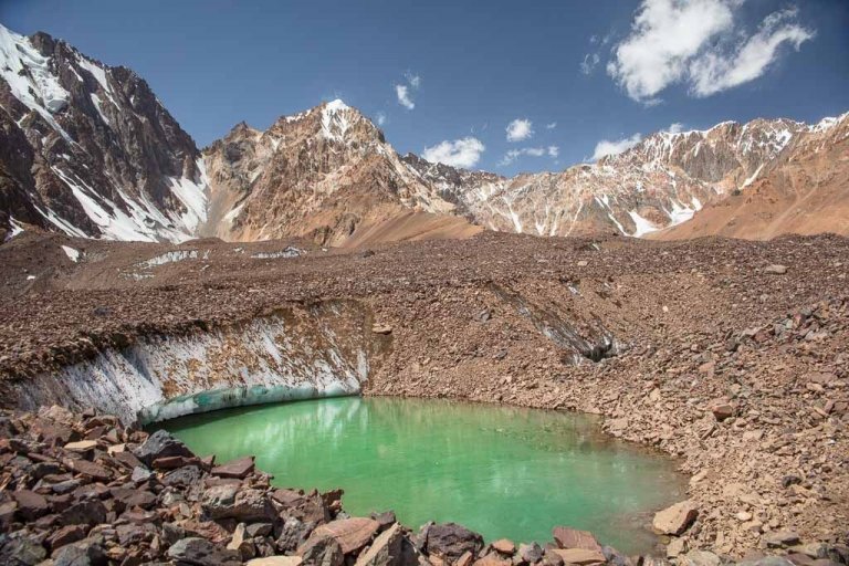
Hike to Grum Grijmailo Glacier
A 34 kilometer (68 km roundtrip, 21/42 miles) will bring you face to face with Tajikistan’s Grum Grijamilo Glacier from the village of Pasor. Pass through the beguiling Khafrazdara Valley to get here. Expect the trek to take 3-4 days.
Click here to get the info sheet on the trek from PECTA (also useful for visiting the Khafrazdara Valley mentioned below).
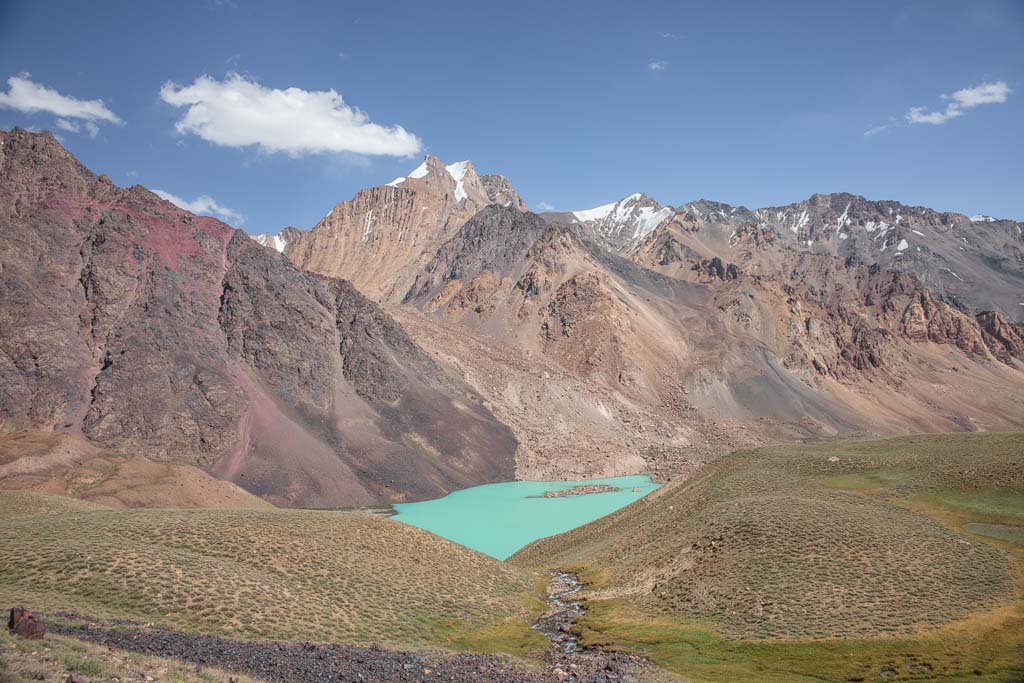
Trek Along Khafrazdara Valley
One of the most beautiful valleys and lakes on Earth. About 24 kilometers (15 miles) from Pasor at altitudes sometimes over 4,300 meters (14,000 feet).
Read: How To Get To Khafrazdara Valley
Take in the views at Kök Jar
While no longer technically in the Bartang Valley this is a site you’ll pass either on your way out or into the valley from the northeast. It’s home to a small forest and the site of a large meteor crater.
If taking on this journey from Kök Jar to Rushan, the views along the road (more of a death-defying jeep track that zigzags down into the bottom of the valley) as you descend into Kök Jar are some of the most beautiful in the Bartang Valley and arguably the Pamir.
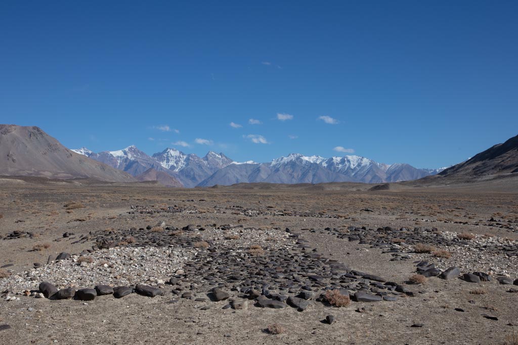
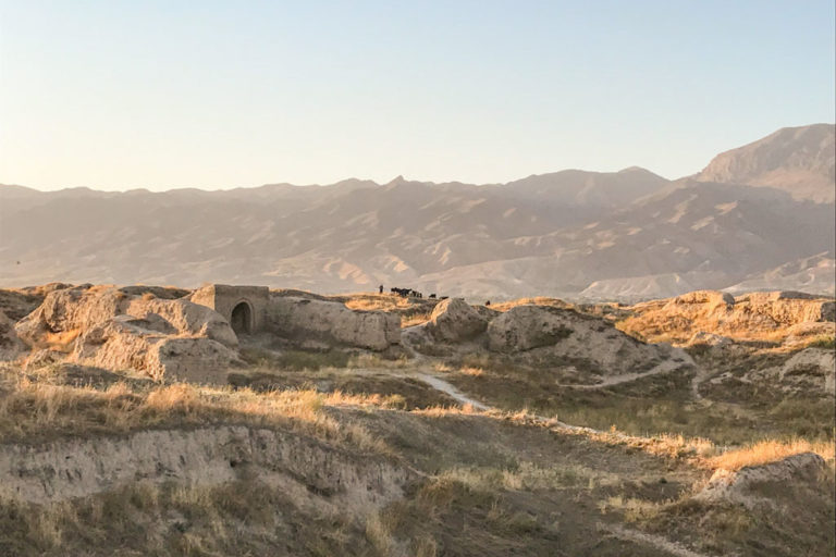
Visit the Ancient Geoglyphs at Shurali
Home to ancient geoglyphs that form a giant solar calendar made up of large stones. There are 15 geoglyphs in total, varying from 6 meters to 13 meters in size.
Looking for more hikes? Read the 10 best treks in Tajikistan
Villages & Sites Along The Bartang Highway
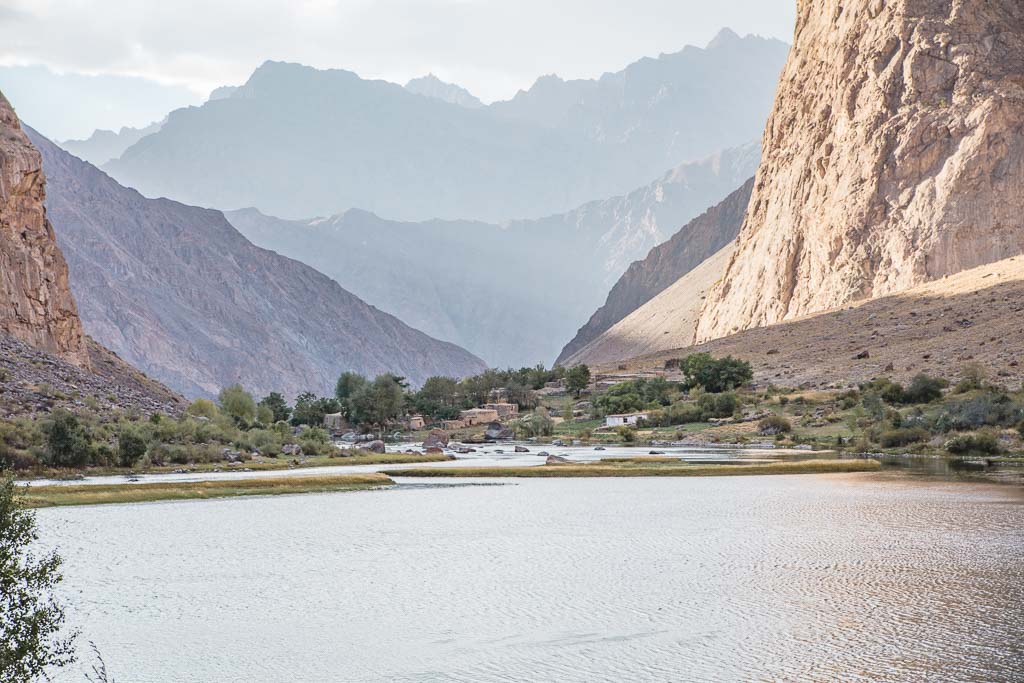
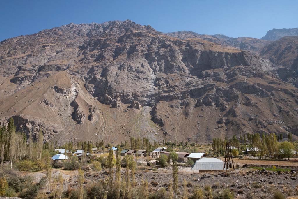
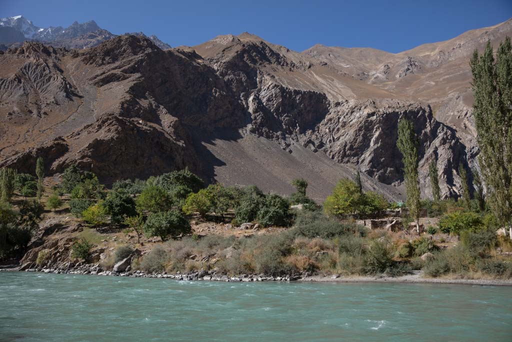
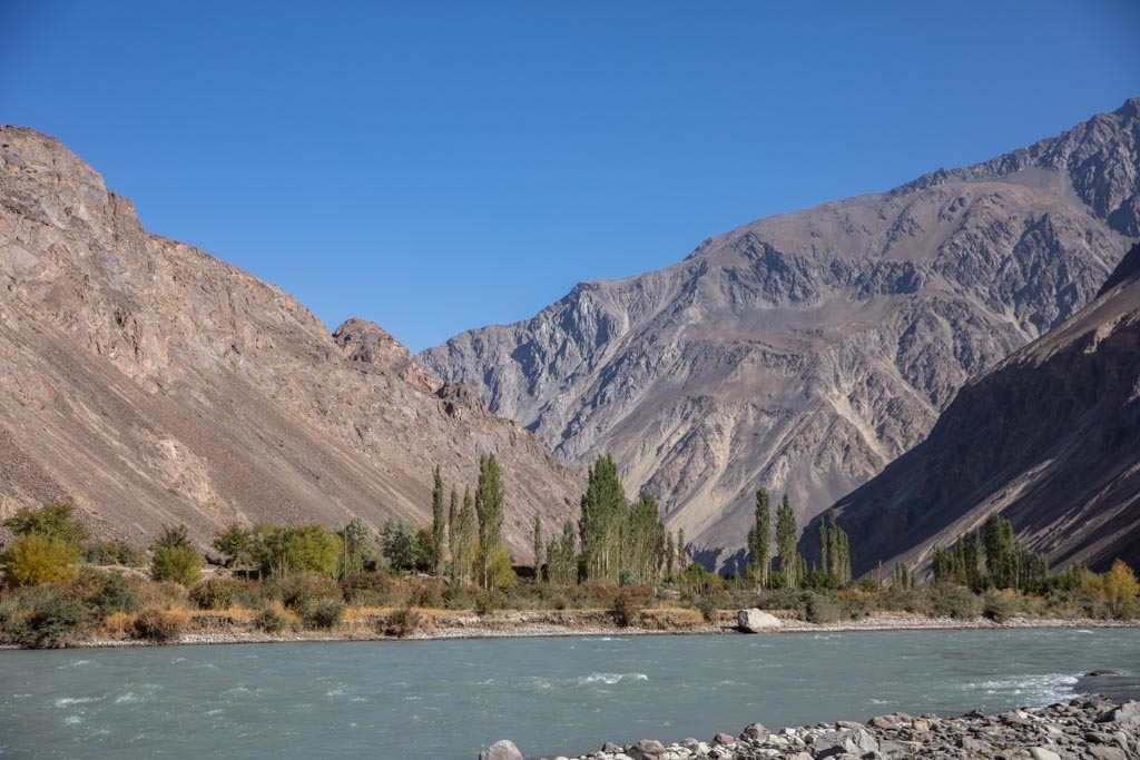
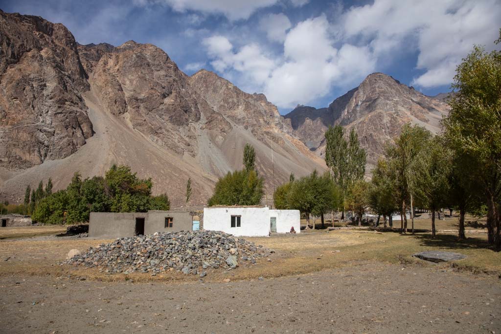
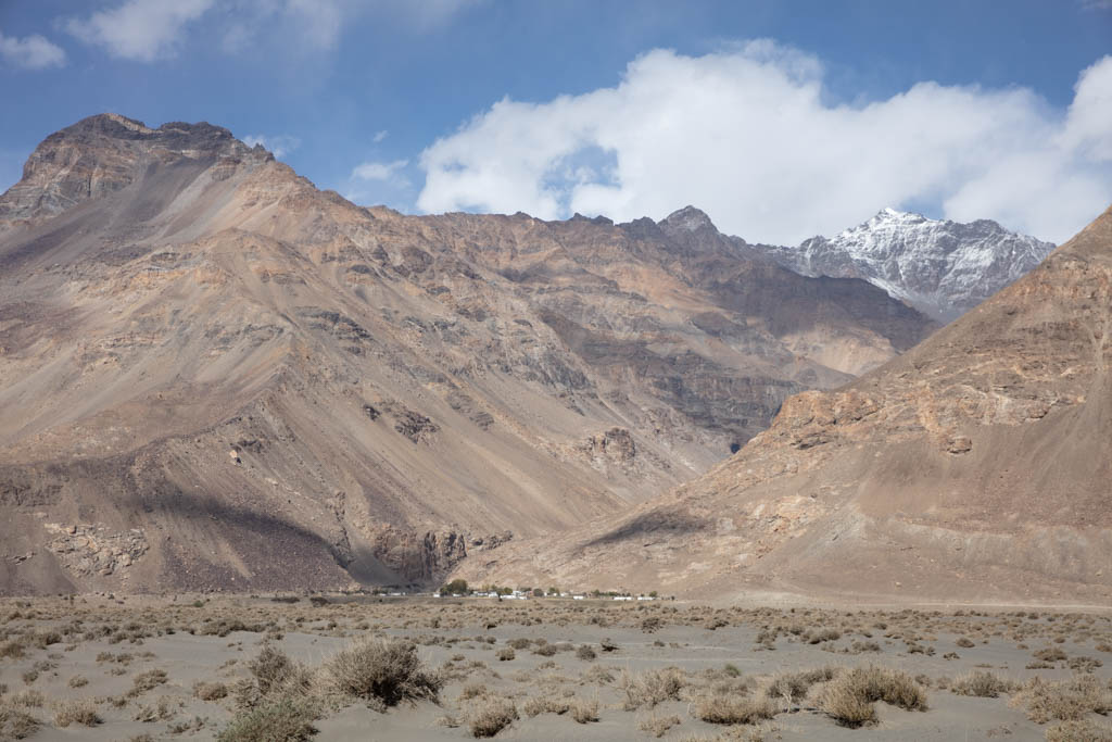
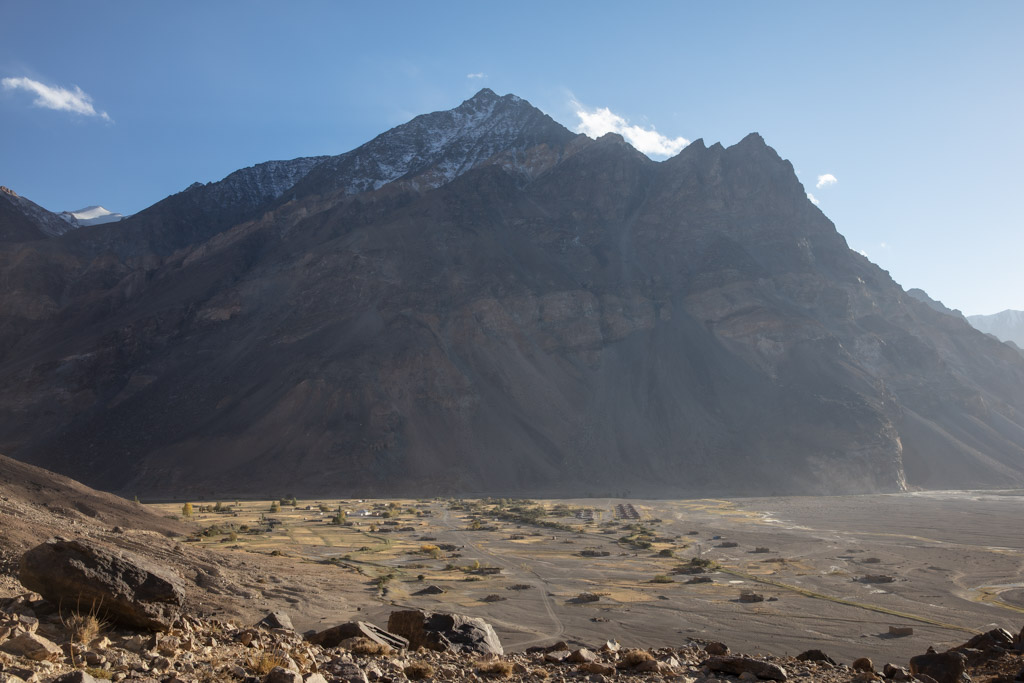
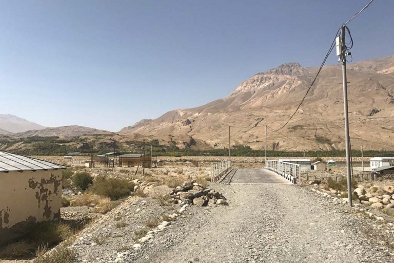
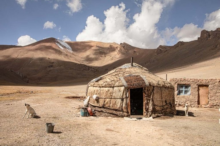
Village after village dot the Bartang Valley as you make your way along the highway. Some are no more than a scattering of a handful of homes, others are a little larger.

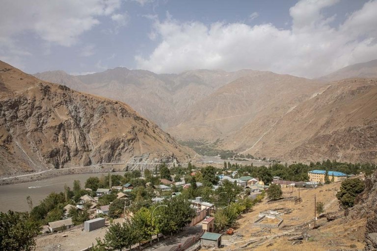
Rushan (Vomar)
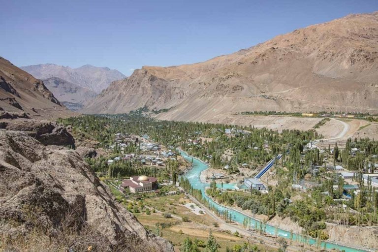
The jumping-off point for most Bartang Valley adventures. Rushan (also named Vomar) is located just off of the Pamir Highway, 65 kilometers north of Khorog. The village has a couple of petrol stations, several shops, chaikhanas (teahouses), car service, a bank, and homestays.
If you end up spending the night here try Mubarak Homestay +992 934052304 or Rushan Inn Guesthouse +992 935550049. Homestays can arrange transport to the drop-off point for Jizeu. You can also head to the taxi stand and try to catch a marshrutka or attempt to find a shared taxi headed up the valley to your final destination.
As far as things to do in Rushan there is the Qala i Vamar Fortress, a shrine to Shah Talib, and another shrine to Sayyed Jalol Bukhari worth visiting if you have some downtime there or are spending the night.
Shujand, Yemtz, Baghu & Red
Shujand is the next village you’ll reach after going about 10 kilometers beyond Rushan. There is a petrol station and a couple of shops here, though there aren’t really any attractions per se- aside from it being set in a pretty location.
Yemtz is a small village located another 6 kilometers past Shujand where the Bukhtara River feeds into the Bartang River. Yemtz is home to one of the most important shrines in all of the Bartang Valley- the Shrine of Mushkilkusho, as well as a small fortress that mostly remains in ruin, and a museum.
On the east end of the village you’ll find Akhor Homestay (+992 934773498) should you want to spend the night in Yemtz.
Continuing another 5 kilometers past Yemtz you’ll reach the village of Baghu where the Baghu River feeds into the Bartang. It’s mostly a small scattering of homes but does feature one homestay (+992 889998081).
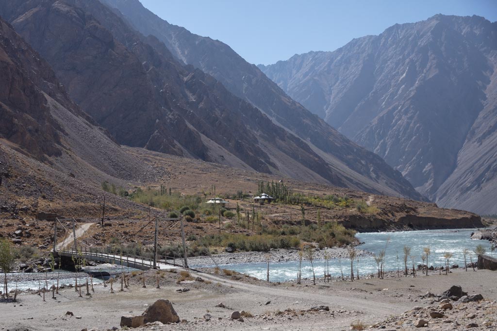
Another 3.5 kilometers beyond Baghu you will pass the footbridge that crosses over to the abandoned village of Red. Red was abandoned in 2012 when a flood in the Bartang Valley washed most every house in the village away.
Jizeu
As mentioned earlier, Jizeu is a stunningly beautiful village just a short 2 hour hike from the Bartang Highway. The footbridge that crosses the Bartang where the trek begins is located about 4 kilometers past Red where the Jizeudarya dumps into the Bartang River.
Once to Jizeu, you’ll have your pick of places to stay as 7 of the 14 homes in the village are homestays (although it can be done as a day hike, an overnight in gorgeous Jizeu is highly recommended).
For those looking to continue along the Jizeu Valley for a longer multi-day trek, it’s possible to continue on to the dazzling lakes of Tsakinkul, Toraz-Dogobkul, and Gumkul.
Khijez & Ravmed
Another 9 kilometers along the Bartang Highway from the bridge crossing the river for the Jizeu trek, is yet another bridge that crosses to the village of Khijez, located at the confluence of the Ravmeddarya and Bartang Rivers. Khijez is another small scatterings of houses, though there are two homestays there- Dishodar Homestay and Firuz Homestay (+992 931776686). Khijez mostly serves as a jumping-off point for adventures into the Ravmeddarya Valley.
A dirt road links Khijez to the village of Ravmed, located 17 kilometers to the southeast. From Ravmed, it’s possible to do a four day trek to Xobuist and Udarif to arrive at a glacial lake at the Foot of Patkhor Peak before returning to Ravmed. There are a couple of homestays marked on maps for Ravmed, though you may want to contact Gulbek Khujanazarov (+992 937710383) who heads the local nature conservancy and hosts visitors. Gulbek speaks English in addition to Russian and Tajik.
Dasht & Visav
Dasht and Visav sit on opposite sides of the Bartang River from each other about 5 kilometers from Khijez. Dasht is another small scattering of homes and features a homestay (+992 501025091), in addition to a small shop and a petrol station.
A footbridge connects Dasht to Visav Village across the river. Visav is home to the ruins of a 19th century fortress.
Siponj & Ravivd
Siponj Village (sometimes called Bartang on certain maps) is one of the larger in the Bartang Valley only 4 kilometers beyond Dasht and Visav.
The main attraction for visitors stopping in Siponj is the Bobo Alisho Shrine, an alleged tomb of Ali- located next to the school. Another interesting thing to do in Siponj is to visit the Mobegim Caves which served as a stowaway spot for locals looking to hide from slave hunters from Afghanistan as well as their own Shughni ruler who was known to sell his own people as slaves. The legend behind Mobegim Cave is tied to a local woman named Mobegim, famed for her beauty who hid here from passing looters.
Siponj has two homestays- Homestay Gulnora (+992 933145182) and Safarbek Homestay (+992 934170089), as well as shops. As Siponj is one of the larger villages along the Bartang Valley, it also serves as a transit hub- small tangems (vans) can be found waiting in a shady spot near the second (east) footbridge to Raviv.
Ravivd is not much more than a scattering of homes across the river from Siponj.
Darjomj, Razudj, Ajirkh
Another 10 kilometers northeast of Siponj the Bartang Highway crosses a bridge over the river to arrive in the village of Darjomj before continuing 3 kilometers and back over to the other side of the river before reaching the next village of Razudj. Both Darjomj and Razudj are fairly small, though both villages have a shop.
10 kilometers beyond Razudj you’ll reach Ajirkh, a small scattering of homes accessible by a bridge over the Bartang River. Driving another 15 kilometers will bring you from Ajirkh to Basid.
Basid & Chadud
Basid is a small village surrounded by beautiful green forest and great trekking opportunities that lead away from here. The main attractions in Basid are the Tomb of Hazrati Khoja Nuruddin as well as the Safdaron Shrine that is located high on a rocky outcrop above the village.
There are a couple of homestays in the village, although ask around to find out the location. Basid also functions as a transport hub as well as most of the shared cars only go this far up the valley (there are ones that will, but expect it to take possibly days to fill one with passengers). You can usually expect to find a UAZ that trundles the route from Khorog to Basid daily.
For those wanting to volunteer and do a working holiday experience, check out Pamir Link, which offers three-week projects led by a Swiss team that you may be able to take part in.
4 kilometers down the road beyond Basid will bring you to a bridge that crosses the river to the village of Chadud. Chadud is a smaller scattering of homes and is located about 3.5 kilometers before the turn-off to Badara.
Badara
A rough track turns east off of the Bartang Highway at the merger of the Badara River with the Bartang that after 9 kilometers will bring you to Badara, a tiny village perched in a gorgeous narrow valley.
There are two homestays in Badara, one ran by Kazakov Mamadyor (+992 900706910) and the other operated by Muborakqadam (+992 909195740), though don’t be surprised if you are quickly invited in by one of the friendly families in the village before you even have a chance to reach one of the homestays.
Badara has a kholodelnikkhana (ice-house) and two shrines. One of the shrines is dedicated to Firmon, who was sent by the Aga Khan III to the village of Badara.
The village is also a great jumping-off point for trekking into the high pastures around Mazanchud. It’s also possible to make a several-day long hike from Bachor and the beautiful blue lakes nearby and over Shtik Lazar Pass to end in Badara.
Yapshorv & Roshorv
Continuing another 18 kilometers along the Bartang Highway you’ll pass the village of Vrinjavn on the opposite side of the river before passing a Red River that flows into the blue Bartang. 6 kilometers further will bring you to the tracks that turns off the Bartang Highway to the north and continues 7 kilometers to the village of Roshorv.
Roshorv serves as a great starting point for those wanting to trek to the basecamp for Peak Istiklol or beyond over 4,810 meter Khurjin Pass to the remote Yazgulom Valley.
There are four shrines that can be found in Roshorv- Andrim, Borkhatsidj, Shah Hussein, and Shah Talib. Roshorv is also known as the home of Mamadyor Khujamyorov, a famous Pamiri singer.
Back down on the Bartang Highway, the road continues to scenic village of Yapshorv with a single homestay sat on the banks of the Yapshorv River. Yapshorv boasts one shrine, dedicated to King of Leopards otherwise known as Khoja i Shayuz.
Nisur & Barchidev
8 kilometers past Yapshorv will bring you to the turn-off for the village of Nisur and beyond to Barchidev. Nisur is located only about 1.5 kilometers off the main Bartang Highway.
Nisur features three shrines to Hazrat i Daood, Pir Nisur, and Shah Hussein. It once boasted a beautiful fortress that was almost completely destroyed in the 1911 earthquake that formed Lake Sarez. There is one homestay located in the village.
Barchidev is an adorable village at the jumping-off point for Lake Sarez (permit and local guide required). Continuing beyond Nisur it’s about 12 kilometers off the Bartang Highway.
Nurumuhammed who owns Sarez Travel– the company that arranges Lake Sarez permits and trips to the lake runs a homestay out of his family’s home +992 934072546.
Savnob & Rukhch
Savnob is likely the most scenic village sat along the Bartang Valley, located just a short distance past Nisur. The main attraction in Savnob is undoubtedly the 19th century Savnob Fortress that subsequently gave the village its former name of Tashkurgan, meaning stone tower in Turkic-based languages.
The Savnob Fortress is steeped in legend stating that a builder named Hasan built the fortress using his left hand after traveling from Khorosan after the King of Khorasan cut off his right hand following his construction of a castle there, in order to prevent him from building anything as grand ever again.
For those looking to spend the night in Savnob, try the Bartang Eco Homestay (+992 555557085).
Rukhch sits along the Bartang Highway about 12 kilometers past Savnob. Though there isn’t much of interest for most travelers passing by, the village was home to a fortress that was destroyed and some caves.
Bopasor, Pasor & Gudara
Another 13 kilometers east of Rukhch is the small village of Bopasor, home to the Shrine of Khoja Aliamdor, as well as the home village of the legendary Kyrgyz marauder Sahib Nazar.
Just east of Bopasor there is a set of tracks to the north that will bring you over a bridge crossing the Bartang River before bending west to reach the village of Pasor. Pasor serves as the starting point of likely the most beautiful trek in the Bartang Valley and the Pamir- Khafrazdara Valley and Grum Grijmailo Glacier.
From Bopasor, the Bartang Highway continues to the east and to the village of Gudara and the final village in the Bartang Valley. Gudara is home to three shrines dedicated to Hazrat i Daood, Shah Hussein, and Shah Talib.
If the road allows you to get beyond Gudara it should be possible to continue to Karakul and the Pamir Highway via Kök Jar and Shurali. The best time to attempt this is in the fall as the road gets flooded by the Gudara, Tanimus, and Kokubel Rivers in the spring and sometimes summer.
Kök Jar
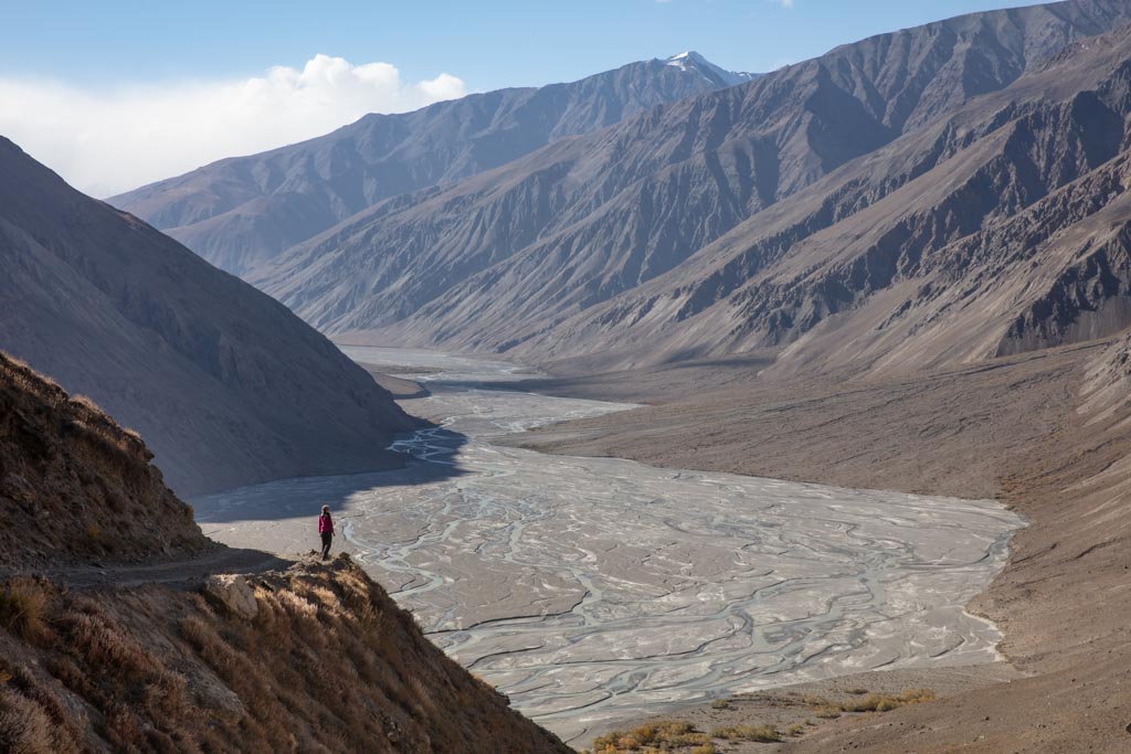
Continuing north along the Bartang Highway, you will be following the Gudara River to Kök Jar. The valley in these reaches is quite scenic with mineral-laden mountains and green bushes dotting the valley floor cut by the Gudara River.
At Kök Jar you will meet the mighty Tanimus River that flows out from the gnarl of glaciers in the Academy of Sciences Range to the west.
For those intrepid, a long trek is possible by following the Tanimus River from Kök Jar to reach Fedchenko Glacier and continue to the Vanj Valley to finish in Poi Mazar. This is a serious expedition-style venture that requires some technical skills, glacier crossings, and serious cold.
Continuing toward Karakul from Kök Jar, the tracks begin to snake up a harrowing cliff to Kök Jar Pass- for those heading in the direction of Karakul, make sure to stop along the way to take in the beautiful views of the Tanimus River Valley behind you.
Shurali
14 kilometers due east from Kök Jar you will reach the Shurali Geoglyphs. The geoglyphs are some of the best found in the Pamir, with 15 different geoglyphs ranging in size from 6 meters to 13 meters at the largest.
It was apparent that the designers of the Shurali Geoglyphs had a good grasp on astronomy as it was noted that one of the geoglyphic designs points to the spring and fall equinoxes while another points to the summer and winter solstices- hence why its referred to as a solar calendar. Solar calendars can be found scattered throughout the Pamir, especially the Wakhan as these sites would have pre-dated Islam in a time when Zoroastrianism and pagan beliefs dominated these valleys.
Dangi & Jalang
Continuing eastward through the Muzkol Valley you’ll eventually reach the Kokubel River taking a turn north to arrive at Dangi after 40 kilometers of driving from the Shurali Geoglyphs. You’ll know you’ve reached Dangi when you find a small bridge crossing over the Kokubel River.
You will find the occasional nomadic Kyrgyz family settling in the Dangi area in the summertime when they bring their flocks up to graze in the high pastures. There’s also a yurt camp that is typically set up for tourists in the summers that make it out here.
Following the Kokubel River to the northwest for about 12 kilometers along a set of rough tracks the veer off the main dirt track will bring you to the high pastures of Jalang.
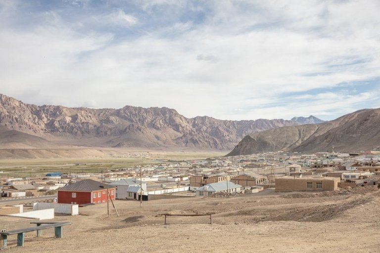
Karakul
14 kilometers further to the east from Dangi you’ll finally reach the southwest corner of Karakul Lake. The color of the water in this part of the lake is a beautiful turquoise blue.
In this part of the lake, it’s possible to head north along the western shore to reach the hunting camp of Jangjir.
The main tracks continue east, passing the turn for the start of the South Aral Peak Hike, and eventually meeting once again with the Pamir Highway where you can either continue north to Karakul Village or south to Murghab.
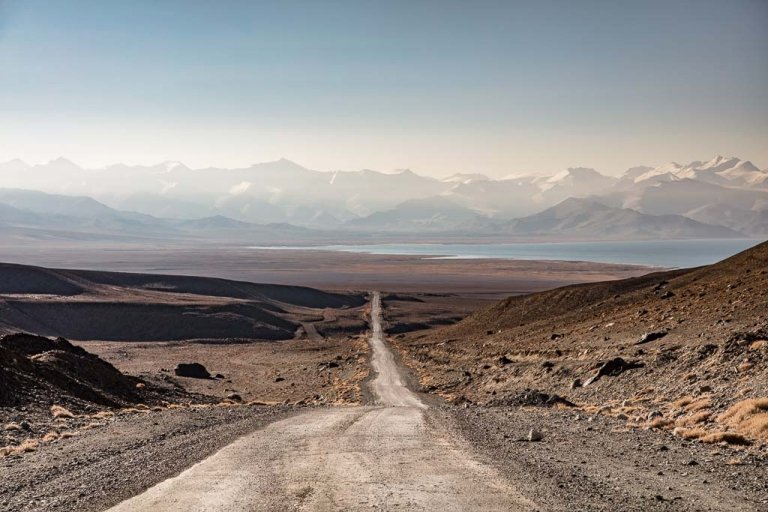
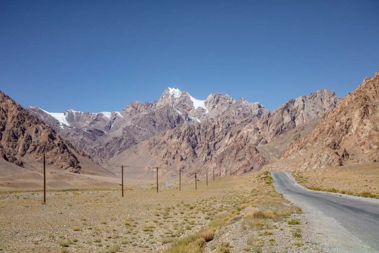
How to get to the Bartang Highway
The Bartang Highway runs in a northeasterly direction from the village of Rushan just off the Pamir Highway (M41) all the way up past Kök Jar and Shurali where shortly after it meets again with the M41 near Karakul.
Combine The Bartang Valley With The Pamirs: Read The Ultimate Pamir Highway Travel Guide
and create the perfect journey with my 10 day Pamir Highway itinerary
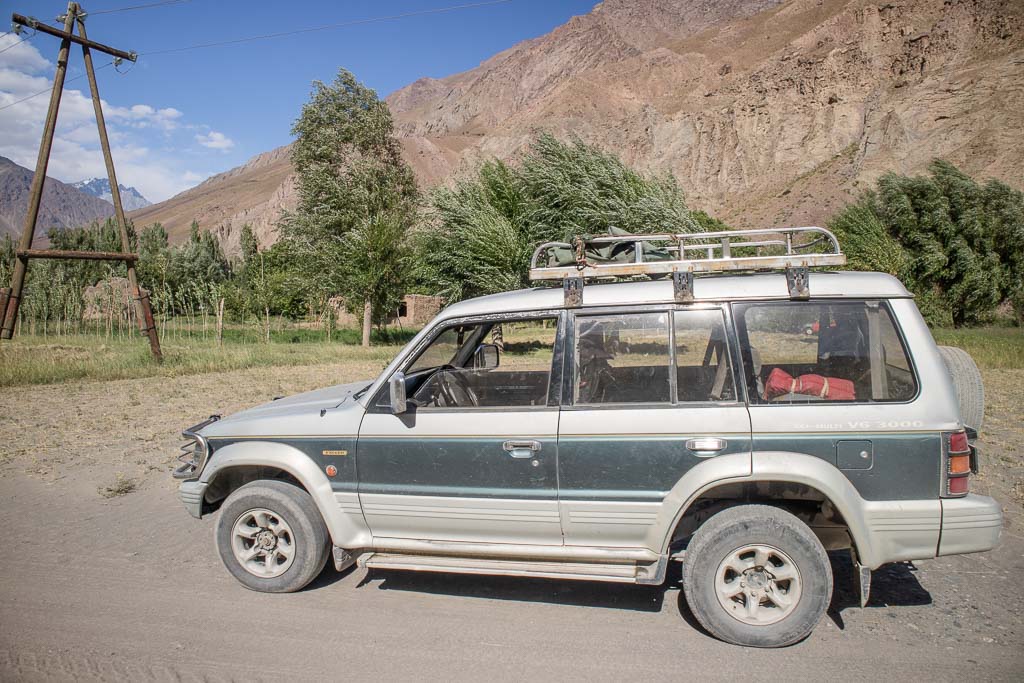
Getting Around Bartang Valley
There are several ways to get to and around the Bartang Valley- By hired 4×4, shared taxi/marshrutka, or by bicycle. If hiring a private 4×4 expect prices to ring in at around 0.70¢ to 0.90¢ per kilometer- and remember the entire length of the road is nearly 300 kilometers one way.
For shared taxis expect the easiest places to arrange them from to be from Khorog, followed by Rushan. There is a Khorog-Basid UAZ minibus on most afternoons (don’t expect it to go on Fridays though) for 40TJS per seat. Every few days in the afternoon there is usually a Khorog-Pasor shared taxi for 120 TJS per seat- but ask around at the main taxi stand at the bazaar in Khorog.
Getting a taxi to the cable bridge at the Jizeu trailhead will set you back 200 TJS from the taxi stand in Rushan, just slightly more from Khorog- a word of the wise: pre-arrange a pickup for when you plan to leave Jizeu. It’s a long walk back (hitching is difficult due to the infrequent traffic on the Bartang Highway), and there’s almost no shade. If you’ve forgotten to or didn’t- find Gulsha in Jizeu Village as he can usually arrange a car to come meet you for about 250 TJS.
Services Along The Bartang Highway
Services in the Bartang Valley are few and far between. It is best to come fully prepared as this is a pretty wild and remote region.
Gasoline/Petrol
While it is possible to get gasoline in a couple of villages along the Bartang Valley, it would be wise to fill up in Rushan (or Murghab if coming from the northeast) and even fill a gas can or two to get you through the entire 300 kilometers as it’s not unusual for there to be no gas available for purchase at all in remote areas due to lack of supplies coming out there.
Restaurants
There used to be a chaikhana between the turn-off for Badara and the village of Vrinjavn along the Bartang Highway. It is not signed, however, I did mark it on maps.me. Do note that it appeared to be shut when I came through the Bartang Valley in October 2021.
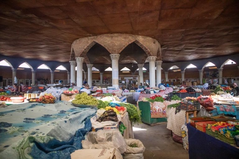
Food and Goods
Shops don’t typically have signs along the valley and in villages. If you do find yourself in need of anything stop into a village and ask around- likely there will be one home that acts as a shop that may have a couple of items on purchase (by items I mean likely the breakfast of champions: expired Chinese beer and Snickers Bars).
Car/motorbike Repairs
If you find yourself broken down along the Bartang Highway head to the nearest village and start asking around. Bartangi people are incredibly helpful and welcoming and may be able to sort out a part or help you patch up until you can exit the valley.
The shared taxi I took back from Pasor broke down around Chadud, it did take several hours and a jaunt to Chadud and then onto Basid but we managed to get the taxi repaired and continue on our way with the help of the locals.
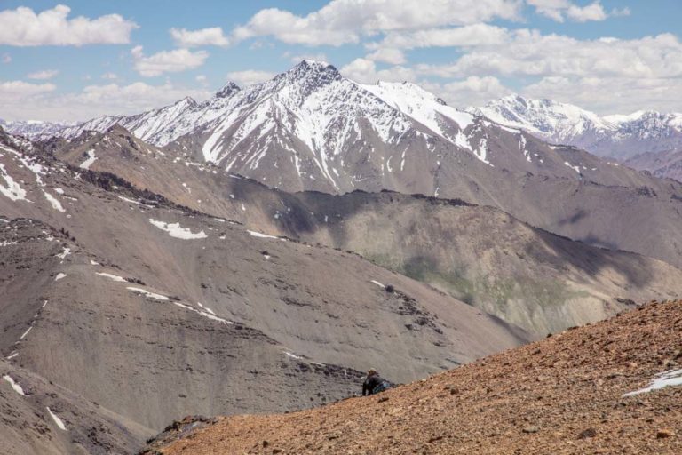
Trekking Along The Bartang Valley
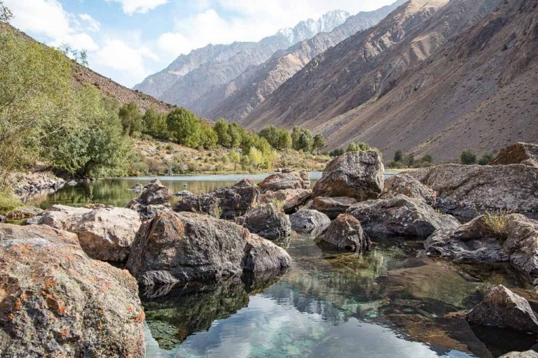
Like much of Tajikistan, the Bartang Valley has several beautiful hikes to offer. From short 1 to 2 day treks to strenuous multi-day treks, the valley has something to suit just about any level of hiker.
A very handy map to have on hand is the Pamirs Map by Markus Hauser, purchase it online here, or pick one up at the PECTA office in Khorog. Another handy tool I used out here was the Inreach Explorer + to map out treks by GPS and the SOS beacon gives some peace of mind.
Jizeu
The short trek to Jizeu is one of the most popular day treks in the Pamir and in the country, however, it is best to spend at least one night up in Jizeu village to experience the remote lifestyle and Bartangi hospitality.
Expect the trek to take about 2 hours on the way in, mostly uphill. Get dropped off for Jizeu (the taxi drivers all know it). Cross the cable bridge and follow the trail- it is occasionally marked by spray-painted rocks.
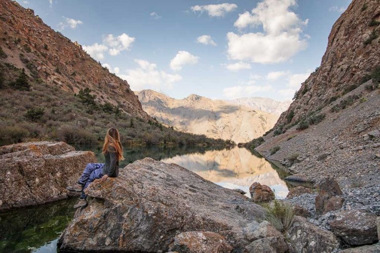
In a couple of hours, you’ll find yourself in a beautiful Pamiri village. Just beyond the village is a crystal clear lake.
Of the 14 homes in the village, 7 are homestays. I recommend Lola Homestay after my stay there in 2016. Read more about trekking to Jizeu here.
Jizeu-Ravmed Valley-Basid Trek
Homestays in Jizeu can help arrange guides and pack animals for the trek over the pass into Ravmed Valley onto Khijez and eventually on to Basid. Ravmed, Khijez, and Basid all have homestays available.
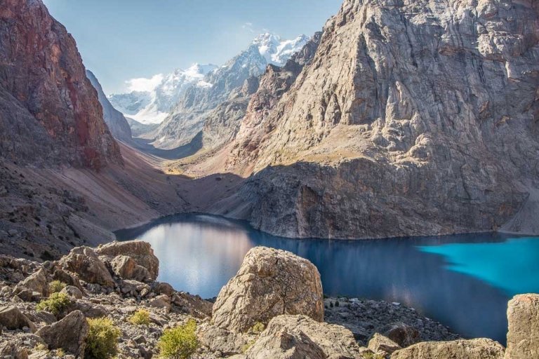
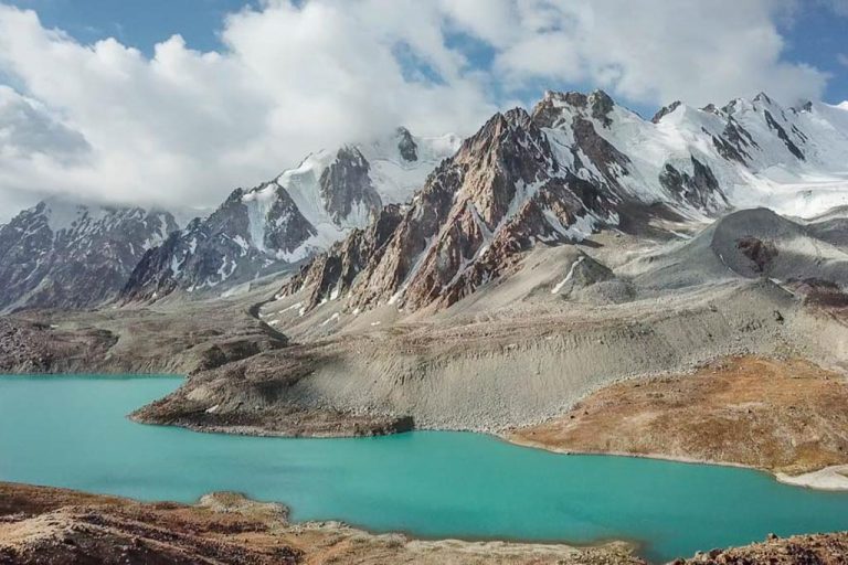
Khafrazdara Valley & Lake
From Pasor trek for 1-2 days to arrive in the beautiful Khafrazdara Valley with beautiful lakes surrounded by jagged mountains. This trek takes place all completely above 3,050 meters (10,000 feet). Trekking another day further will take you to face the Grum Grjimailo Glacier.
The final lake is located about 24 km (15 mi) from Pasor, making it a 48 km (30 mi) hike roundtrip.
Head to the PECTA office in Khorog and grab the info sheet on the trek (also useful for visiting the Grum Grijmailo trek mentioned below).
Grum Grijmailo Glacier
34 kilometers (21 miles) past Pasor you’ll find yourself at the face of the immense Grum Grijmailo Glacier. All high altitude. Follow the same trail mentioned to reach Khafrazdara Valley.
High Pastures around Basid & Badara
Numerous hiking trails around both villages of Basid and Badara will take you to the high pastures nearby to explore the green fertile lands. Ask around in either village for recommendations.
From Badara it’s possible to continue trekking beyond the pastures and over Shtik Lazar Pass and on to the mountain lakes of Bachor to either end in Bachor Village or Yashilkul. This trek will take around a week to complete for most.
Barchidev to Lake Sarez
The stunning Lake Sarez is worth the all day trek from Barchidev to witness- with perfect reflections of the Pamiri clouds above. You’ll leave Barchidev early in the morning and arrive over the Usoi Dam at the monitoring station on the shore of the lake by late afternoon.
Contact Sarez Travel to arrange necessary permits and guides to visit the lake. It has been known for visitors who don’t arrange necessary permits to be fined large sums of money for being found out there.
Permits
There are some necessary permits to visit this part of Tajikistan. For starters, most nationalities do require a visa to enter the country. There is an e-visa available to many nationalities for $50 USD, you can apply here.
GBAO Permit
You need a GBAO permit to visit any part of the Pamirs, thus making it necessary for the Bartang Valley. It is easiest to apply for it when you apply for your visa. You can apply for it at the same time you apply for the e-visa for $20, or if you must get a visa at a Tajik embassy just apply for it there.
If you arrive in Tajikistan and do not have a GBAO permit, it’s possible to get one from the OVIR office in Dushanbe for 20 TJS. Turn around time in September 2021 was 20 minutes.
Tajik National Park Permit
You do ‘need’ this to visit many areas along the Bartang Highway, and for many treks around Karakul, Murghab, Yashilkul, and more. You can apply for one in Khorog for 15 TJS per day at the PECTA Tourist office inside the Central Park.
I was told you could also pay for the permit if you run into local KGB (police or national park rangers) while out and about. I bought a permit this year (2017) since it costs pennies per day and I never once was asked for it.
In 2019 I did another trek in the Rasht Valley but within the bounds of the Tajik National Park. I met a park ranger (we actually stayed in his family guesthouse) and since we didn’t have a permit we just paid him our fees before we left which was no problem at all.
Lake Sarez Permit
To visit Lake Sarez from Barchidev you do need a permit. The only way of securing this permit that I can 100% vouch for is through Nurumuhammed at Sarez Travel for $50 USD per day.
I never could find reliable information if a permit is necessary if approaching from the south (trekking from Bachor and Yashikul) if you do know- let me know in the comments and I’ll add the information.
Languages Spoken Throughout Bartang Valley
Bartangi is the language spoken in villages along the Bartang Valley. It is a distinct dialect of Shughni and can differ from village to village. The last estimate found from 1990 ranged from 2,500 to 3,000 speakers.
Tajik is spoken by most in the area, Russian speakers are scattered about and it is possible to find a person here or there with English, French, or German language skills.
Mobile Phone Coverage
Surprisingly there is mobile coverage in the valley along the highway. Megafon and Tcell will work off and on, although once northeast of Basid the coverage is pretty minimal.

Safety
In general, the Bartang Highway is a safe place to visit in regard to crime. Just use common sense and the same precautions you would traveling anywhere.
Earthquakes: The Bartang Valley, as well as much of Tajikistan, is earthquake-prone. This is why I carry that SOS beacon with me. Locals in Pasor village told me about a large earthquake that struck Gudara in 2016- above an 8.0 on the Richter scale.
Getting Lost: This is a possibility on some of the treks if you’re inexperienced. Hire a guide if this is the case.
Great Online Resources
- Pamirs.org: A great all-around resource for all things Pamir. From trekking, visa & permit information, cycling, sport, and more!
- Trekking in the Pamirs: Jan Bakker’s website with information on many hikes all over Tajikistan (not just the Pamirs!).
- PECTA: Can help you arrange anything Pamir. Very responsive.
- Caravanistan: Saule is a wealth of knowledge on Central Asia. They are very responsive via email and can put you in contact with numerous tour agencies in the country.
- Indy Guide: Making travel in the whole of Central Asia & Mongolia easier by providing the largest community marketplace of Central Asian tour operators and drivers.
What To Pack
- Inreach Explorer+
- Solar charger
- External battery pack
- Backpack
- Daypack
- Hydration Pack
- 3 Season tent
- Sleeping bag
- Hiking Boots
- Lightweight cooking camp set
- Water Purifier
- Trekking Poles
- Headlamp
- Sunscreen
- Mosquito Repellant
- Prescription & Over the counter medications
- Toiletries
Maps
- The Pamirs Map by Markus Hauser
Guide Books
- Tajikistan and the High Pamirs by Robert Middleton & Hue Thomas. This is a huge book, but it has so much good info on Tajikistan from the history, great-game stories, travel information, and more.
- Bradt Guide Tajikistan by Sophie Ibbotson & Max Lovell-Hoare. By far this is the most up to date and useful travel guide in print on Tajikistan.
- Central Asia by Lonely Planet. Handy to have with you, especially if you’re doing a multi-country Central Asia trip, although don’t necessarily treat it like a bible. Things rapidly change and the currency can fluctuate so it’s not always dead on. The Central Asia Phrasebook by Lonely Planet I found this to be a handy item for Tajik, Russian and Kyrgyz phrases, not so much for the Wakhi phrase section.
- ‘Trekking In Tajikistan‘ by Jan Bakker & Christine Oriol. The much anticipated and hugely updated print version of Jan’s ebook. Jan has become a friend over the years and along with Christine have led trekking expeditions in the Pamirs, Fann, and the Wakhan Corridor in Afghanistan.
Have Any Questions About The Bartang Valley?
Ask in the comments section below!
More Posts from Tajikistan:
Trekking The Haft Kul in Tajikistan’s Fann Mountains
Two Week Tajikistan & Uzbekistan Itinerary
Tajikistan Itinerary For 1-4 Weeks
Must-Try Tajik Food: Best Food in Tajikistan
A Guide To Tajikistan’s Fann Mountains
The 10 Best Hikes In Tajikistan
Panjakent Travel Guide + 6 Things To Do In Panjakent, Tajikistan

17 Things To Do In Tajikistan
A Beginner’s Guide To Central Asia Travel: Discover The Silk Road
Panjakent-Samarkand Border Crossing Between Tajikistan & Uzbekistan
Rasht Valley, Tajikistan
How to Cross the Shirkhan Bandar Border Crossing Between Tajikistan & Afghanistan and get an Afghan Visa on the Border
The Gardan i Kaftar Hike In Tajikistan’s Rasht Valley
A Day Trip To The Taboshar Uranium Mines in Istiklol, Tajikistan
A Day Trip to Madiyan Hot Springs, Tajikistan
Windswept Desolation In Karakul, Tajikistan
Gumbezkul Pass Hike, Tajikistan
Murghab Travel Guide + 4 Things To Do In Murghab, Tajikistan
The Beautiful Bolshoi Allo Lake In Tajikistan’s Fann Mountains
Sarazm Ruins, Tajikistan: The Oldest City in Central Asia
How To Get To Khafrazdara Valley, Tajikistan
Qala i Khumb Travel Guide, Tajikistan
A Giant Salt Flat in Tajikistan? Welcome to Akhkon
Crossing Chimtarga Pass
How To Get To Timur Dara Lake, Tajikistan
A Guide to the Shokhdara Valley, Tajikistan

How To Get To Lake Sarez, Tajikistan
Trekking to Pik Engles Meadow in Tajikistan’s Wakhan Valley
Across Tajikistan In 80 Photos
Climbing Kyzyldong in Tajikistan’s Pamir Mountains
How To Get To Hisor Fort, Tajikistan
Crossing Kyzyl Art Pass Between Tajikistan & Kyrgyzstan
Tajikistan Border Crossings
Khorog Travel Guide + 7 Things To Do In Khorog
25 Day Tajikistan Expedition June 12-July 6, 2024
Is Tajikistan Safe? The Short Answer: Yes
Solo Female Travel in Tajikistan
Fann Mountains Trekking Expedition, Tajikistan June 12-23, 2024
Tajikistan Visa Guide: How to Get a Tajik Visa
Istaravshan Travel Guide + 9 Things To Do In Istaravshan
The Tajik Wakhan Valley Travel Guide
Jizeu Trek: Tajikistan’s Best Overnight Hike In The Pamirs
10 Reasons to Visit The Pamirs

12 Day Pamir Highway Expedition
The Best Road Trips In The World
A Simple Guide To Central Asia Visas
Yagnob Valley Trekking & Travel Guide
Iskanderkul & Sarytag Travel Guide, Tajikistan
Hike The Lakes Loop in Tajikistan’s Fann Mountains
10 Things To Do In Dushanbe + Dushanbe Travel Guide
Crossing The Qolma Pass Between Tajikistan & China
The Ultimate Guide To The Pamir Highway
10 Reasons To Visit Tajikistan
7 Tips For Solo Female Travel In Central Asia
A 10 Day Pamir Highway Itinerary including the Wakhan Valley
Bartang Valley Guide
The Best Restaurants In Dushanbe

Ishkashim Border Crossing Between Tajikistan & Afghanistan
Khujand Travel Guide + 14 Things to Do In Khujand
The Ultimate Tajikistan Travel Guide
Crossing Dukdon Pass In Tajikistan’s Fann Mountains
South Aral Peak Hike, Tajikistan
Visiting the Sary Khosar Nature Reserve, Tajikistan

How to Visit Childukhtaron, Tajikistan
Eastern Pamir Travel Guide
10 Off The Beaten Path Destinations For 2021
Travel with Me to China, Tajikistan and Pakistan in 2018!
I’m so so happy to have found your blogs on Tajikistan! Me and my girlfriend are planning to cycle the Bartang and Pamir Highways next year, we are avid cyclists from California and this is a dream of ours. Thank you for sharing your knowledge on this country
Thank you so much for this detailed guide for the Bartang. Myself and a friend are planning to take on the Pamir Highway and would like to go from Osh to Khorog including the Wakhan and then from Khorog make the journey up the Bartang Highway near Karakul and head back to Osh. We would like to do some trekking while in the Bartang.
Oh that’s great to hear, I’ve spent a lot of time in the Bartang. My two favorite hikes in the Bartang are Jizeu and Khafrazdara Valley/Grum Grijmailo Glacier.