How To Visit Gates of the Arctic National Park
Updated March 2024, How To Visit Gates of the Arctic National Park was originally published in January 2021
With no roads or even maintained trails leading in, Gates of the Arctic National Park is pure, unadulterated wilderness.
Whether you opt to fly into Circle Lake and make the arduous trek in the magical sliver of razor-toothed pinnacles known as the Arrigetch Peaks, or you walk in from the Dalton Highway straight up into the magnificent Brooks Range, Gates of the Arctic is bound to wow just about any adventurer who gets wound up in its icy cold grip.
Planning a trip up the Dalton? Check out my Dalton Highway itinerary
Need Travel Insurance and Evacuation Services for Alaska?
Start shopping for travel insurance plans over at IATI Insurance. Readers of the Adventures of Nicole get a 5% discount off your plan.
The Adventures of Nicole partners with Global Rescue to offer the world’s leading medical evacuation and security advisory services. To travel with peace of mind, shop evacuation coverage at Global Rescue.
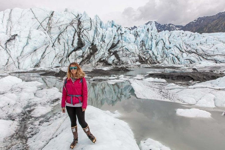
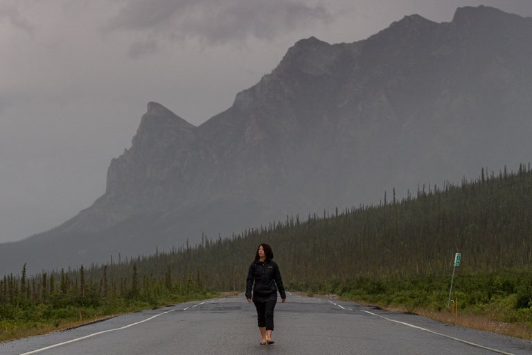
“Ok, this looks close enough, turn in here,” I said, as we swung the Crosstrek off the Dalton and into a tunnel of trees. We nosed up to a dike-like mound of rocks, and upon further inspection, a cross marking a man’s grave sat on the other side. But we weren’t fussed, at least I wasn’t- I camped in a cave at graveyard once in Armenia, on Friday the 13th to boot (true story).
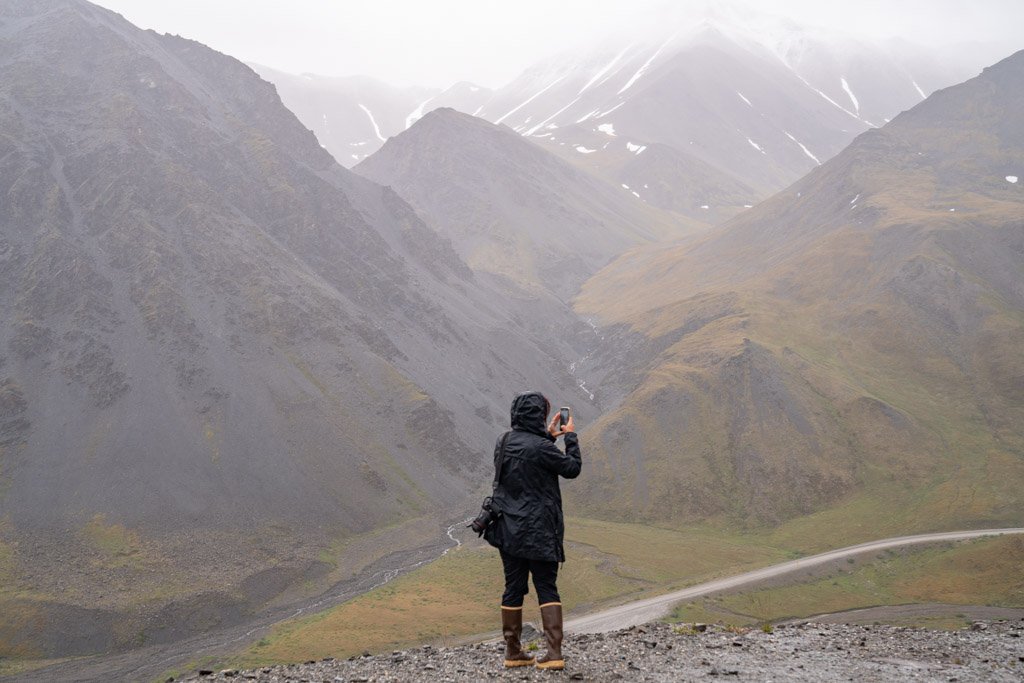
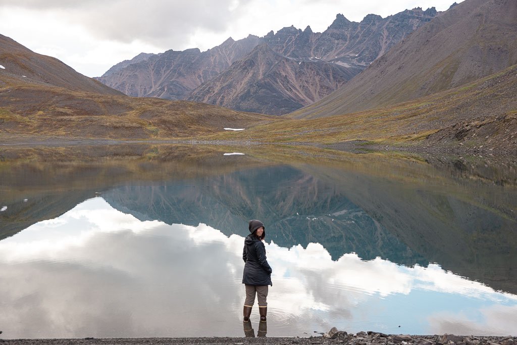
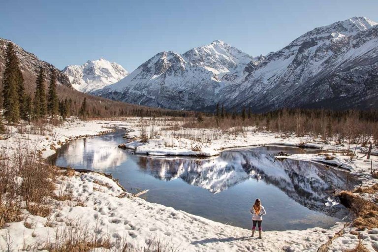
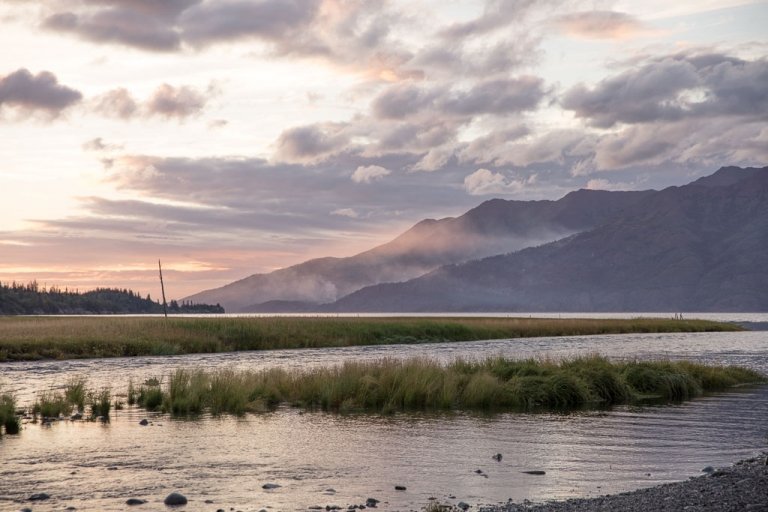
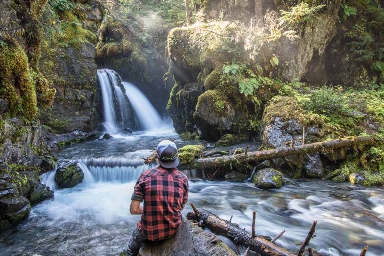
We had just completed a day hike into ANWR in the pouring rain earlier that day, just on the other side of Atigun Pass. With a map on my lap and maps.me open on my phone I was on the lookout for a suitable camping spot along the Dietrich River, from which we would begin our multi-day hike into Gates of the Arctic.
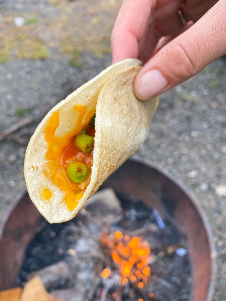
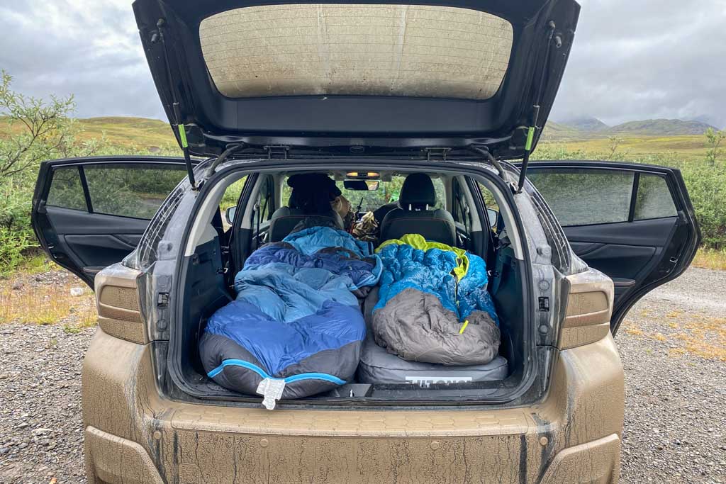
This place seemed just right, so we set up our car mattress and make some leftover campfire chicken tacos for dinner, and called it a night pretty soon after so that we could get an early start the next day as we started our journey into Gates of the Arctic National Park.
Read about our day hike into ANWR and how to plan your own trip
Getting To Gates Of The Arctic
2020 threw us all a bit of a curveball, did it not?
Welp, for me, 2020 foiled my plans to go out to the Arrigetch Peaks (among other things but that could be an entire series of blog posts on its own) this past summer, grounding most of the air taxis and leaving Kathryn at Backpack Alaska and I having to shelve our grand tour until 2021 (you can read more about the planned Arrigetch expedition here).
This postponement left me with a big hole in the middle of my summer here in Alaska, and thanks to the pandemic I didn’t have many options for other places to go- so I decided to go as far from home as I could without leaving Alaska- Prudhoe Bay.
My hair-brained plan? To drive the Dalton Highway to Prudhoe Bay, including a trek into ANWR and one into Gates of the Arctic (I may have omitted the “ANWR”, “Gates of the Arctic”, “walking”, “hiking”, and “wading across countless bodies of water” parts when pleading my case for why this road trip was a great idea).
So with my backdoor plan to get into Gates of the Arctic hatched we were off, in mid-July. You know, when mosquitos are the thickest (and subsequently blood thirstiest), and the sun never goes down because welcome to summer above the Arctic Circle #itsalways2pmheretillitswinterandthenitsalways3am.
Just beginning your planning for Alaska? Check out my Alaska travel guide for more
Planning Your Visit To Gates Of The Arctic
How To Get To Gates Of The Arctic
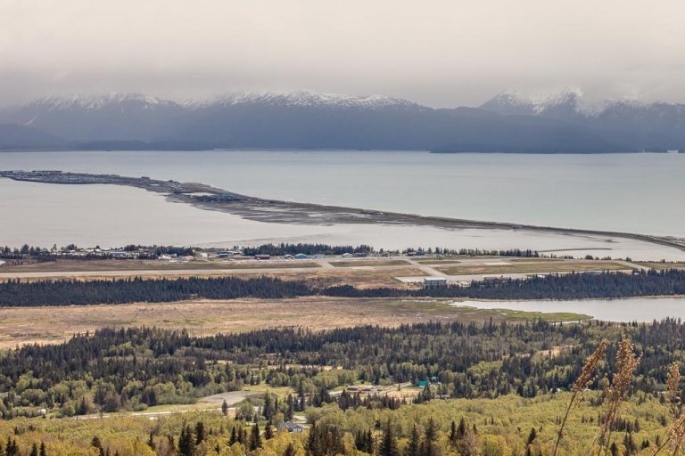
Coldfoot, a small town along the Dalton Highway is probably the best jumping-off point for most adventures into Gates of the Arctic (though some of you may fly directly into Bettles or Anaktuvuk Pass from Fairbanks). Coldfoot is reachable by an 8 hour drive from Fairbanks and is home to the Arctic Interagency Visitor Center, which can help provide guidance for visiting Gates of the Arctic.
Realistically there are three ways of getting into Gates of the Arctic National Park- by plane, on foot, and by pack raft.
Air taxi: Arriving in Gates of the Arctic by air taxi is the most common way of visiting the national park. Coyote Air and Brooks Range Aviation can provide air taxi service to several drop-off points and villages within Gates of the Arctic. Typical starting points include Anaktuvuk Pass and Circle Lake. Bettles, despite being located outside of the national park boundaries is another common spot to fly into and back out of for drops into the park.
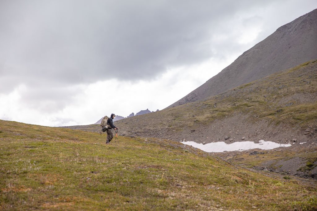
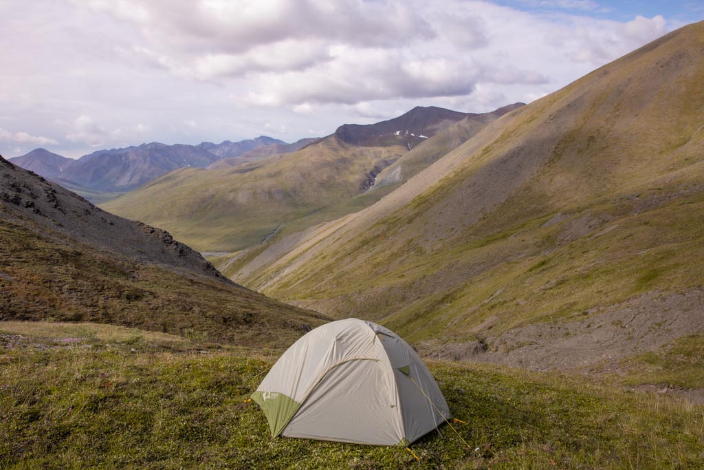
Hiking in: This is your most budget-friendly option as you’ll only have to front the cost of gas to get you here. Seeing that there are no established trails into Gates of the Arctic, you can pick just about any entry point to the park. We opted to cross the Dietrich River from the Dalton Highway, before climbing an unnamed pass to reach the park boundaries and on to follow Kuyuktavuk Creek toward Oolah Pass.
Pack raft: If you have a pack raft, this is a great way to expedite some of the process by floating your way into Gates of the Arctic. Check out this post about this group of four who traversed Gates of the Arctic from east to west on foot and by pack raft (two traversed the entire park, the other two joined in at Anaktuvuk Pass and continued to finish in Ambler). I’d have loved to have done this… maybe in 2022…
On a tour: By far the easiest way to arrange your visit to Gates of the Arctic is to fork over your money and join an organized expedition that handles all the logistics and details of the trip… but whoa there, I didn’t say it was easy- you’re still gonna need to haul all your own sh…gear in. Why not join (inserts shameless self-promotion) Kathryn and I’s Arrigetch Peak expedition this year?
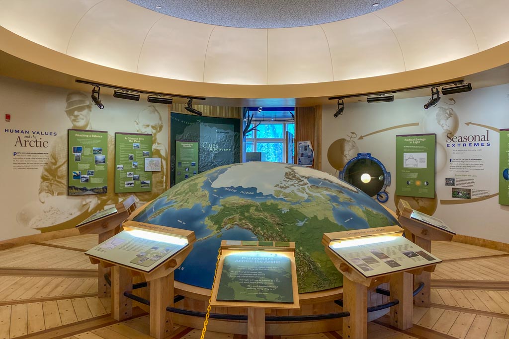
The Arctic Interagency Visitor Center
The Arctic Interagency Visitor Center in Coldfoot serves as a visitor center for all the public lands in the Alaskan Arctic. If you are passing through Coldfoot I’d recommend stopping in and paying a visit to gather information about your planned route. They provide backcountry registration (not mandatory but recommended), as well as a quick backcountry orientations course (30 minutes), and even bear canisters to borrow.
The Arctic Interagency can also provide weather forecasts (though Alaska weather is generally erratic) as well as any reported wildlife sightings in areas of the park. Similarly, the Bettles Ranger Station, if you’ll be starting from Bettles can provide some guidance and information.
Planning to hit other national parks in AK? Check out my posts on Denali NP and Kenai Fjords NP
Random Tips, FAQ, & Info To Help You Plan
- When was the park established: Gates of the Arctic was first designated a national monument in 1978, then was upgraded to a national park and preserve in 1980.
- Park entrance fee: Nada. Welcome to west bumblef**k nowhere, ain’t nobody around here to collect a fee.
- Does GOTA have a visitor center: It sure doesn’t, the closest thing is the Arctic Interagency in Coldfoot. This BLM office serves as a visitor center for all the parks, preserves, reserves, and BLM land in the Arctic. Go ahead, ask them all the questions (they are incredibly helpful and can offer some insight into your planned trekking/adventure route).
- Do I need a bear canister: Only if you want to live. You can pick one up on the internets or from an outdoor gear shop, but also, they can rent you one at the Arctic Interagency- though they are first-come, first-served so they can run out.
- Will I have mobile/cell service: NO!
- Where can I get a map: Grab a copy of the Nat Geo Gates of the Arctic map (though it is of limited help), for a better one it’s best to order a USGS map or do as I did and refer to this map on Caltopo. I’d also recommend downloading detailed maps onto a GPS device- like the Garmin Inreach Explorer+ that I use and swear by.
- Do I have to carry in all my gear: Buckle up that hip belt, cause that pack isn’t gonna carry itself. You have to be self-reliant out here. Gates of the Arctic isn’t for the faint of heart.
- Leave nothing behind: It should go without saying, but just like anywhere else in the outdoors, leave no trace and take all rubbish out with you.
What To Pack For Gates Of The Arctic
ALL THE THINGS! Okay, not really, but you’re going to need a lot of the things. I wasn’t kidding when I said self-reliant earlier, you truly are going to need to be able to handle any situation on your own out here, and if you can’t that’s okay- that’s why they’ve created tours to help out those that can’t or don’t want to (I can sometimes fall into this category- fully capable, just don’t always feel like it).
Either way, whether you go at it independently or as part of a package expedition, you are going to have to carry a whole lotta gear.
Gates Of The Arctic Packing List
This list is mainly what gear I recommend you take with you. I’m going to leave what clothing (aside from outerwear) to bring up totally up to you, but if you want to know what I brought with me, I had trekking pants, a hoodie, a t-shirt, hiking socks, a beanie, and leggings (for lounging around camp).
- Backpacking pack (I recommend 60-80L depending on your planned duration). I also recommend bringing a daypack if you plan to set up a base camp and take day trips.
- Raincover.
- 3-season tent.
- Sleeping bag and sleeping pad.
- Water purification system.
- Hydration reservoir.
- Camp stove and cookery set.
- Dehydrated meals.
- Bear Canister.
- Mosquito repellent. Get the nasty strong stuff too- the mosquitos out here are f*cking relentless.
- Bear spray. Gates of the Arctic is crawling with wildlife so it’s important to protect yourself. Pick up a can of bear spray at outdoor shops in Alaska. Some visitors may opt to carry a gun for protection.
- A comfortable rubber boot, or a waterproof hiking boot.
- Gaitors (to prevent water and roughage from getting into your boots).
- Rain jacket and rain pants.
- A brimmed hat with a head net.
- Sunglasses.
- Trekking poles.
- Garmin inReach Explorer+ (satellite GPS, SOS, and messaging device).
- Pack raft, if you’ll be using one (I recommend Alpacka).
Looking for a full on packing list for all your Alaska adventures? Check out my Alaska packing list
The Best Time To Visit Gates Of The Arctic
Late spring through early fall is the best time to visit Gates of the Arctic. There are pros and cons to each of these above-mentioned seasons. The winter months of November-March are best avoided as it’s brutally cold, with little to no daylight. The early spring is not a good time either with cool temperatures and still a lot of snow.
- June: Temperatures are comfortable and the bugs aren’t quite hellacious until around the 23rd or so of the month. You’ll also have 24 hours of daylight.
- July: Corresponds with the rain season, so plan to be clad in a rainjacket for a lot of the trip, but know that when the sun is out it will be miserably hot owing to the humidity and lack of darkness. Bugs are at their peak, so a bug screen is a must. You’ll still have 24 hours of daylight.
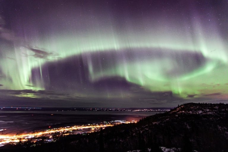
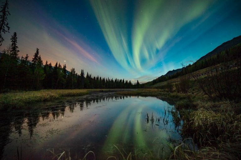
- August-September: Daytime temps are comfortable, with cool evenings and the bugs are finally dying off. You will have dark nights by mid-August so keep an eye out for the northern lights. Fall colors set in this time of year. The only downside of this time of year is you’ll want to make plans in advance as air taxis can fill up with hunters.
- October: Not quite winter yet, but snow can be expected. Temperatures are starting to get quite cold and daylight is really starting to dwindle.
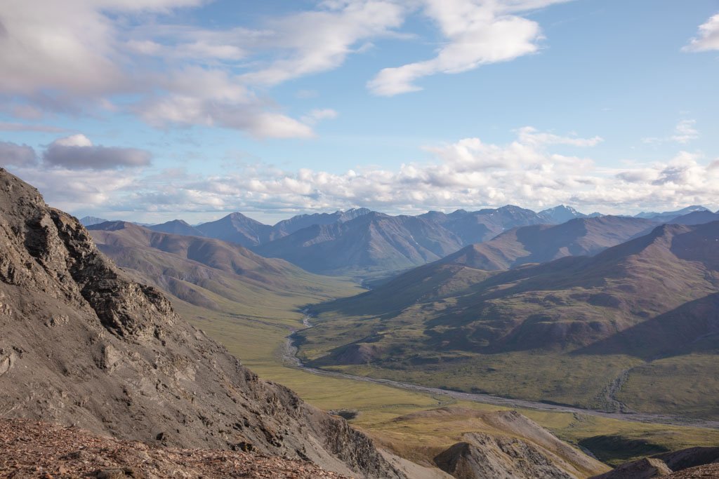
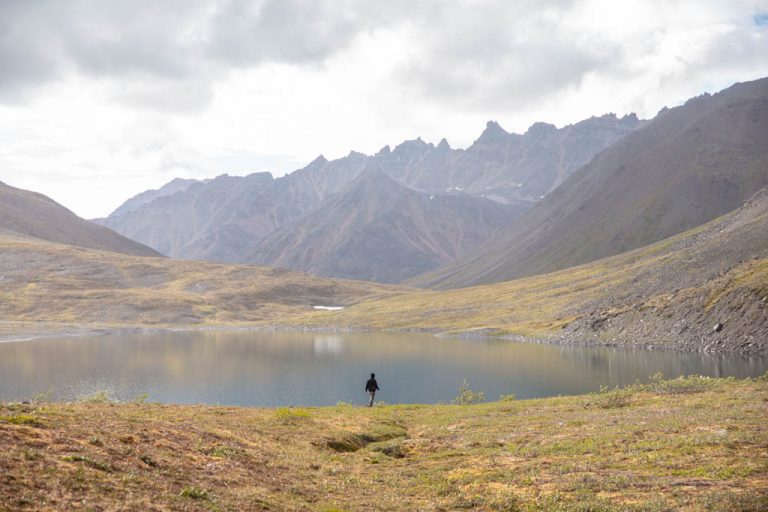
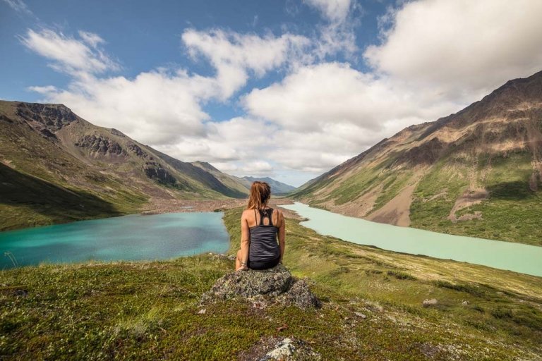
Places To Go In Gates Of The Arctic
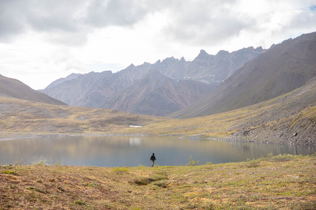
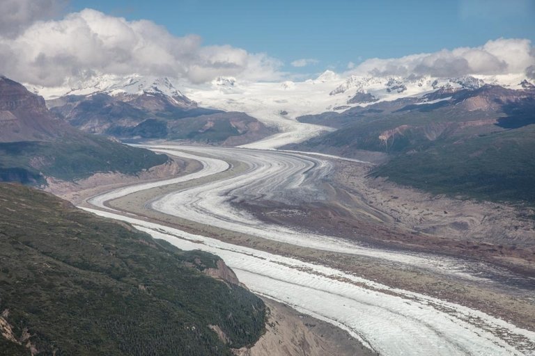
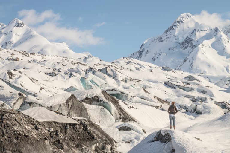
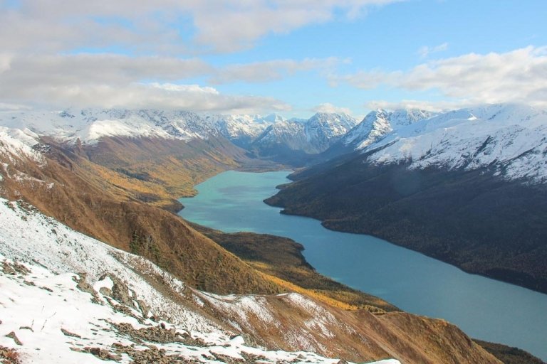
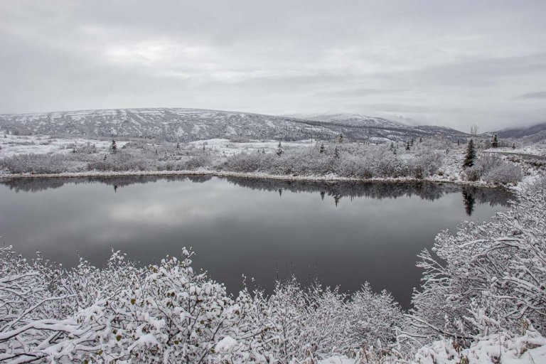
Let me preface this by saying, Gates of the Arctic is massive! At 8.4 million square acres, the national park and preserve area is roughly the size of the entire nation of Switzerland, just to give you an idea of just how vast it is. I’m going to include a few of the most commonly visited areas, but know that there is so much more to Gates of the Arctic than I could fit in a single blog post.
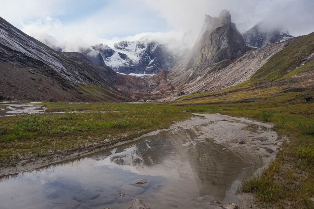
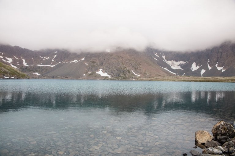
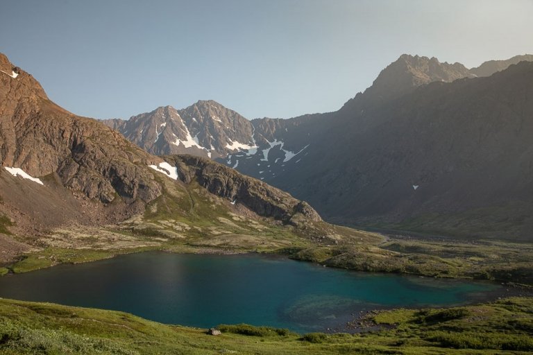
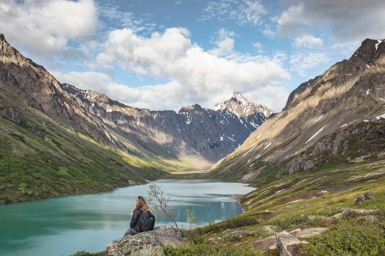
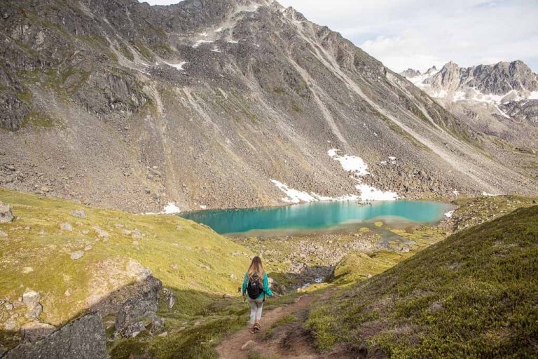
Alatna River Valley & Arrigetch Peaks
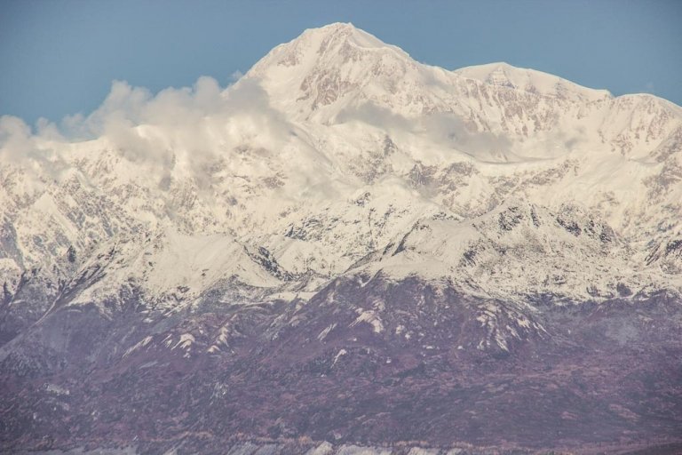
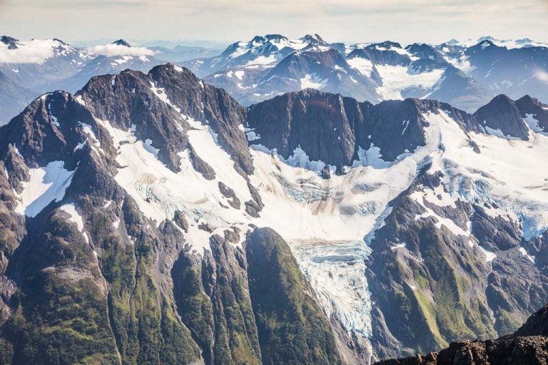
This is likely the most popular destination in Gates of the Arctic National Park, and it’s simple to see exactly why. The Arrigetch Peaks look like Patagonia meets Alaska on steroids with its gnarled granite spires nestled in the Endicott Mountains of the Brooks Range in the southwest of the national park.
Of course, the Alatna River gives access to the mighty Arrigetch, seeing most visitors dropped off at Circle Lake, then following the Alatna Scenic & Wild River to Arrigetch Peaks, which leads right into the heart of the Arrigetch.
Arrigetch means ‘fingers of the outstretched hand’ in Iñupiat which accurately describes the amphitheater of granite towers that will welcome you here. Most will set up a base camp on arrival to the peaks and make day trips exploring the valleys, with the Aquarius Valley being a favorite among most visitors.
The Arrigetch Peaks, and additionally Mount Igikpak, and Mount Doonerak, are good places to go for those looking for technical ascents in Gates of the Arctic National Park.
Anaktuvuk Pass
Anaktuvuk Pass is the main village within Gates of the Arctic National Park, with its name meaning ‘land of the caribou droppings in Iñupiat. It’s inhabited mainly by the Nunamiut, a nomadic Iñupiat people who have survived in the Brooks Range by hunting caribou, who eventually established a settlement here and nearby Tulugak Lake. Anaktuvuk Pass is home to less than 300 people.
Had it not been for Coronavirus, we would have loved to have made the 70 mile hike from the Dalton Highway near the Chandalar Shelf to Anaktuvuk Pass, but unfortunately for us, Anaktuvuk Pass like many off-the-road-system settlements and villages in Alaska closed to recreational visits.
Anaktuvuk Pass provides a good jumping-off point for those wanting to explore the John River and the North Fork Koyukuk. Anaktuvuk Pass is small enough, that there aren’t many things to do in the village itself per se, though it’s worth visiting the Simon Paneak Memorial Museum to learn more about the Nunamiut culture and history.
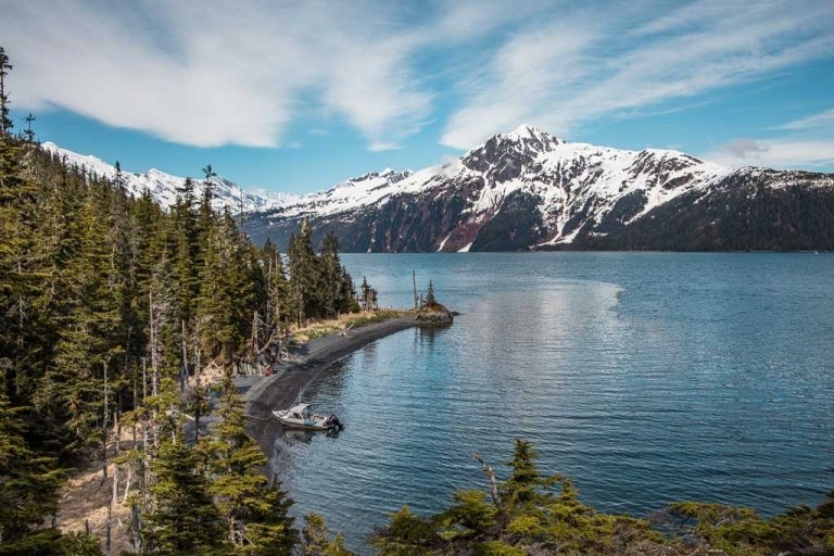
Kobuk River
The Kobuk River originates in the Endicott Mountains of the Brooks Range flowing westward out of the park. Kobuk River continues through the communities of Kobuk, Ambler, Shungnak, before crossing Kobuk Valley National Park (home to the famed Kobuk Sand Dunes) and on passing through the villages of Kiana and Noorvik, eventually dumping out into the Kotzebue Sound.
A pack raft trip can make a great way to experience both Gates of Arctic and Kobuk Valley National Parks together. Similar to Gates of the Arctic, Kobuk Valley will require you to be completely self-reliant, having no roads or established trails.
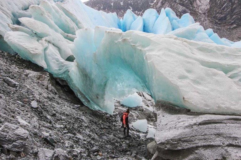
Kuyuktuvuk Creek
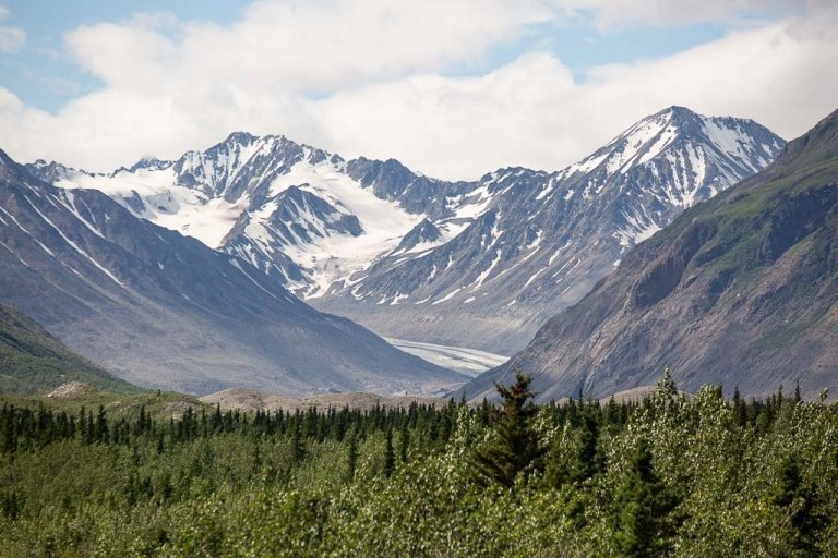
The Kuyuktuvuk Creek area is one of the easier to access parts of Gates of the Arctic from the Dalton Highway, hence why this was our chosen portal of entry. Kuyuktuvuk Creek originates in Oolah Pass, in the Brooks Range, making it a good marker of the route all the way to the Itkillik River that drops down the other side of Oolah Pass into the Oolah Valley. It’s possible to continue westward from Oolah Valley toward Anaktuvuk Pass or follow the valley southward to meet with the North Fork Koyukuk.
North Fork Koyukuk River & ‘The Gates’
The North Fork of the Koyukuk River is another stunning area of the park to be explored.
In fact, Frigid Crags and Boreal Mountain are the two mountains that gave the entire park its name. In 1929, Bob Marshall, a wilderness activist, writer, and forester was exploring the North Fork Koyukuk River and noted the pair of mountains on either side of the river as he passed through. He would go on to name this gateway the “Gates of the Arctic.”
Noatak River
The Noatak River originates from the north side of Mount Igikpak in the Schwatka Mountains of the Brooks Range. It flows through the western reaches of Gates of the Arctic before exiting into the Noatak National Preserve. It eventually empties into the Chukchi Sea via the Kotzebue Sound. A float trip on the Noatak River is the best way to explore this stunning area.
Trying to visit Alaska on the cheap? Check out my Alaska budget travel guide to learn how to save $$$
How To Plan Your Route In Gates Of The Arctic
For me, the hardest part was trying to figure out where to go (even harder now that I’ve gotten a taste of the Gates and now I want to explore as much of the park as possible). In all honesty, there is not a lot of information on Gates of the Arctic, and in reality, I doubt there ever will be.
Your best bet is going to be to grab a Gates of the Arctic map and just start looking at possible routes. I highly recommend checking out this Gates of the Arctic map on Caltopo that provides countless great potential routes and waypoints.

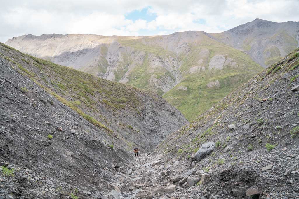
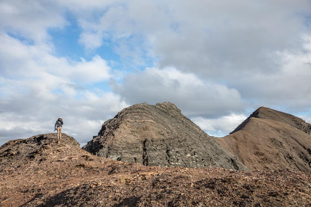
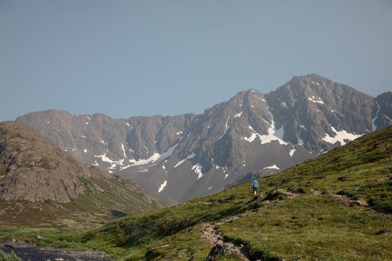
Trekking In Tundra
If you’ve never hiked in tundra before, get ready for one hell of a ride. To be honest growing up in Alaska, I’ve trekked quite a bit in alpine tundra, which isn’t the most fun, however, this real Arctic tundra can be absolute hell to trudge through. Sure, that field of tussock-riddled Arctic tundra may look inviting- but it’s ankle-twisting sedge-grass clumps and water-filled bogs with enough suction to suck off a boot are menacing once you’re out there in the minefield.
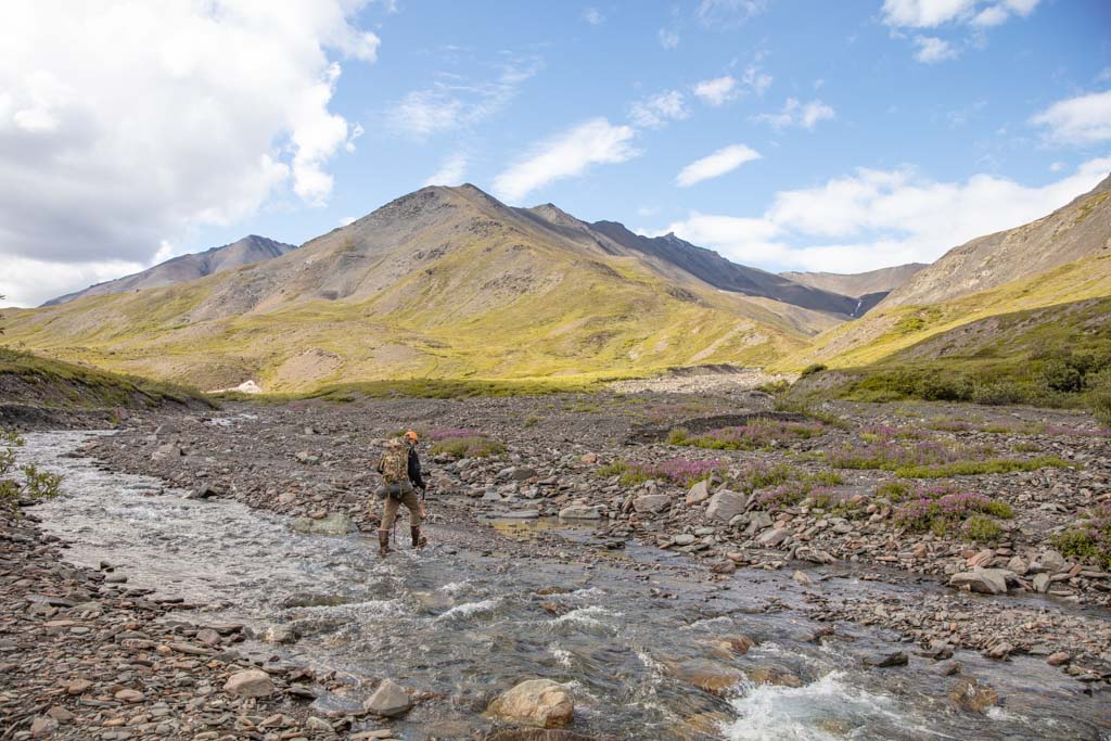
I’m not a religious user of trekking poles, though I do carry them on me for when I need a little help with steep slopes and uneven terrain, however, Gates of the Arctic made me a believer. I did the entire trek through Gates of the Arctic with trekking poles as they helped for when we were trudging across the tundra and crossing numerous creeks.
In general, when trekking in tundra it’s recommended to use a path (whether it be animal or human-created) where they exist. When hiking in areas without any trail or exposed rocks to aim for, you should always have your group walk in a fan rather than a single-file line to reduce the impact on the tundra.
When we were trekking on the higher slopes and mountain passes on our Gates of the Arctic trip we had to travel across plenty of alpine tundra too, arctic tundra’s less maniacal cousin. Care needs to be taken to not damage the sensitive lichens and mosses that populate these areas. In areas of alpine tundra, it’s advisable to walk along animal tracks where they do exist or look for areas of exposed rocks.
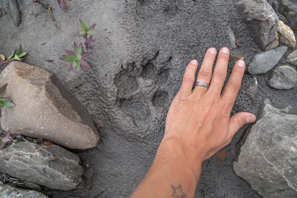
Wildlife In Gates Of The Arctic
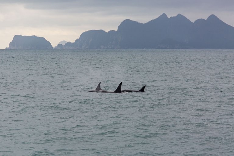
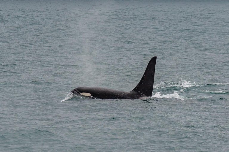
Most likely you’ll view wildlife during your time in Gates of the Arctic. Keep your eyes peeled for caribou, grizzly bears, wolves, Dall sheep, fox, wolverines, moose, and birdlife.
My Final Thoughts On Gates Of The Arctic?
In all honesty, I’m hooked. I’ll be back several times over. If you’re looking to truly get away from it all, this is most definitely the place for you.
Have Any Questions About Visiting Gate Of The Arctic?
Ask in the comments section below.
More posts from Alaska:
9 Tips For Viewing The Aurora
Girdwood Travel Guide + 5 Things To Do In Girdwood, Alaska
Anchorage To Fairbanks Road Trip: One Week In Alaska
The Big Loop Alaska Road Trip
2 Day Anchorage Itinerary
Hiking The Mint-Bomber Traverse
Travel Alaska On A Budget
How To Visit Gates of the Arctic National Park
A Guide To The Denali Highway
Visit Spencer Glacier On The Whistle Stop Train
Visiting Byron Glacier
How To Get To Mendenhall Ice Caves
16 Best Day Hikes Near Anchorage, Alaska

What to Pack for Alaska, Written by a Local
Anchorage’s Best Hotels: Where to Stay in Anchorage
Biking to Knik Glacier in the Winter
A Day Hike Into ANWR
Fairbanks Travel Guide + 13 Things To Do In Fairbanks
Shrine of St. Therese In Juneau, Alaska
How Much Does It Cost To Travel In Alaska?
The Best Way To Explore Kenai Fjords National Park: Major Marine Tours
The Ultimate Alaska Highway Guide: Driving the Alcan between Canada & Alaska
Wrangell St. Elias Road Trip, Alaska
A Quick Guide To Hope, Alaska
How To Get A Denali Road Lottery Permit
The Rabbit Lakes Hike In Anchorage, Alaska
Kayaker’s Cove: My Favorite Escape From Seward
Homer Travel Guide + 14 Things To Do In Homer
34 Best Things To Do In Alaska
Williwaw Lakes Hike In Anchorage, Alaska
The Best Places To See The Northern Lights in Alaska
The Ultimate Alaska Travel Guide
Kenai Peninsula Road Trip
Juneau Travel Guide + 19 Things To Do In Juneau
Anchorage Travel Guide + 20 Things To Do In Anchorage
Denali National Park Travel Guide + 14 Things To Do In Denali
The Best Road Trips In The World
10 Reasons to Visit Alaska
Seward Travel Guide + 18 Things To Do In Seward
MacDonald Spit, My Favorite Coastal Alaska Destination
Visiting Virgin Creek Falls In Girdwood, Alaska
Free Things To Do In Anchorage
The Ultimate Alaska Road Trip Itinerary
K’esugi Ridge Hike in Denali State Park, Alaska
The Dalton Highway Road Trip
The Reed Lakes Hike In Hatcher Pass, Alaska
Snowbird-Bomber Hike in Hatcher Pass
10 Day Alaska Itinerary
Eagle & Symphony Lakes Hike, Alaska
Twin Peaks & Eklutna Lake
The Perfect Coastal Alaskan Winter Getaway: Between Beaches
Kenai Fjords National Park Travel Guide
Best Hostels in Anchorage, Alaska
Free places to Ski & Snowboard Near Anchorage
10 Off The Beaten Path Destinations For 2021
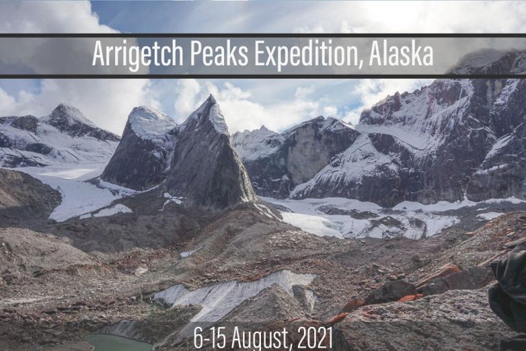
Arrigetch Peaks Expedition: Gates of the Arctic National Park, Alaska
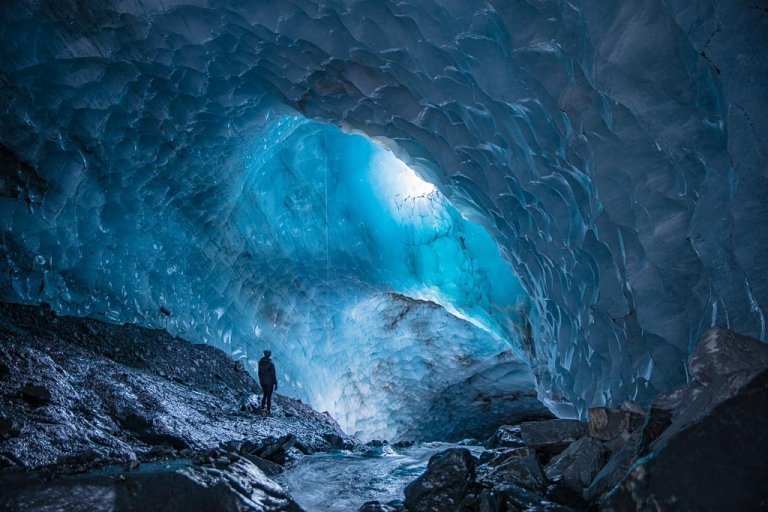
The Surreality of the Underbelly: The Mendenhall Cave, Inside a Glacier
The Road To Kantishna

this is great. I have day hiked off trail in Denali and I am hooked. I do plan to backpack in Denali once the bridge construction is done, but I am looking ahead and thinking of hiking into the park view the Dalton Highway. I will read your post about that part carefully and have more questions (this is a trip that will take place in 4-5 year, so plenty of time to plan).
Hey Carlos,
Gates of the Arctic really is true wilderness and one of my all time favorites at home in Alaska. Great that you’ll have plenty of time to plan, its a real expedition out there!
quick question: you have a link to caltopo (which is my goto place to draw routes) but the link is just to caltopo.com. Was there another to caltopo with routes ?
My husband and I are considering a trip to Gates of the Arctic next summer. We are from the lower 48. We are very fit and genuinely enjoyed doing 10+ mile “difficult” hikes in Yosemite and Banff. We’ve always had a hotel waiting for us at the end of the day, though. We are completely inexperienced in backcountry camping. I know we should do a guided trip, but I’m struggling with the length (they all seem 7+ days), cost, and a fear of small planes. How good/bad of an idea would it be for us to spend one day hiking west from the Dalton highway where you started, pitch a tent when we feel inclined, and hike back out the same way the next day? Is this still unwise if we pack bear spray, sufficient clothes, sleeping bags, food, etc?
Hi Emma,
I wouldn’t really recommend Gates of the Arctic as a first time true independent backcountry camping trip just because of the difficulty of terrain and the remoteness (no trails to follow, easy to get lost, etc), especially when there are plenty of more established places in Alaska to get a feel for backcountry backpacking/camping to ease yourself in. I’d at very least recommend taking on some easier trips in AK to get warmed up for Gates.
Hi Nicole! My friends and I are going to Gates of the Arctic in early August. We are all debating which shoes will be best. Some are saying waterproof boots, some are saying trail runners (so they dry off faster instead of staying wet like waterproof boots would once submerged in water). Your packing list also mentions rubber boots as an option. Did you or a friend backpack in rubber boots, or did you have them for just segments of your trip?
Hey Michelle,
I actually had both a pair of xtra tuffs and my hiking boots. I had no idea what to bring so took both and to be honest I ended up wearing the xtra tuffs most of the time! I also wore gaiters with them which I totally recommend for here.
Hi Nicole, I am trying to plan a backpacking trip from Summit Lake to Anaktuvuk pass, and we are trying to find someone who has done either this route or something similar, who can give us a more detailed account of the experience. In particular we are wondering about the likelihood of encountering poor weather conditions, the difficulty of the terrain, and how many miles we could realistically expect to cover per day. If you would be able to help us out that would be awesome, or if you could refer us to someone who has done this hike before, that would be great too! Thank you!
Hi Jeremy,
I did do a different route and of course, we were unable to trek to Anaktuvuk Pass because of the pandemic (the village was off-limits last summer), so I have limited info for you from my personal experience. I’m not sure if he did the same route you’re planning but when I was researching before my trip I did see a short article in Backpacker Magazine by Paxson Woelber about his trek from Atigun Pass to Anaktuvuk Pass. It may be worth reaching out and asking him about his route, you can contact him via his website here. I’d also recommend reaching out to the Arctic Interagency Visitor Center in Coldfoot by email at [email protected] right now as well (You can visit their website here too, but the center is only open from July-Sept). In my experience, the terrain in Gates of the Arctic is pretty hellacious because of all the tundra you’ll be walking on. In general, most people will say to plan to only cover half the distance you would normally in a day. Poor weather can be expected pretty much any time, but depending on what month you go some are better than others. We went mid-July, so pretty warm and sunny, a little rain, windy in the mountain passes, though the mosquitos are horrible then. I’ve heard good things about mid-late June and late August to early September from others though.