A Guide to Trekking in Bamyan, Afghanistan
Updated February 2024, A Guide to Trekking in Bamyan, Afghanistan was originally published in June 2021
After a recent return to Afghanistan for a month, I spent a large chunk of my travels trekking in Bamyan and neighboring Daykundi province– something that had been on my Afghan to-do list forever.
Bamyan province offers countless trekking opportunities for those patient enough to make the arduous journeys between different districts and valleys of the region. Coupled with the fact that Bamyan is a relatively secure province in terms of Afghanistan, it’s a dream destination for hikers and those looking to get beyond the well-trodden tourist trail (believe it or not, it does exist!).
From multi-day treks that blend cultural experiences, family-run homestays with beautiful mountain landscapes to serious mountaineering expeditions, to days hikes through winding canyons or up to craggy summits, trekking in Bamyan has something for just about everyone.
Unfortunately, I wrote most of this post a few weeks ago and as of recent (late June 2021), there seems to be some (more than usual) instability going on in neighboring Parwan Province near the Ghorband area that the road from Kabul passes through- the only feasible access point to the province. Enquire about the safety situation on the road while you plan your trip and of course while you’re on the ground in Afghanistan.
Start planning your time in Bamyan with the Bamyan Travel Guide
Need Travel Insurance and Evacuation Services for Afghanistan?
Start shopping for travel insurance plans over at IATI Insurance. Readers of the Adventures of Nicole get a 5% discount off your plan.
The Adventures of Nicole partners with Global Rescue to offer the world’s leading medical evacuation and security advisory services. To travel with peace of mind, shop evacuation coverage at Global Rescue.
Bamyan Treks
Valleys South of Bamyan Town
- Distance: Varies
- Duration: Varies
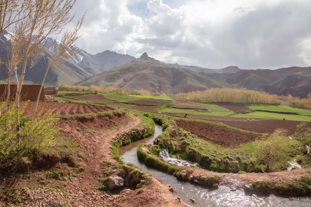
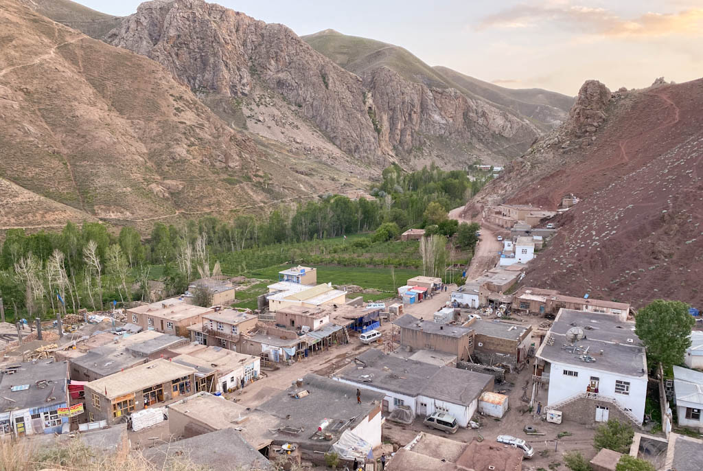
Several picturesque valleys extend from the south of Bamyan Town, populated by lovely Hazara families that shepherd animals and grow crops high on mountains sides. Using shepherding trails, it’s possible to combine a visit with I all or a single valley. From east to west the valleys are Dukani, Khushkak, Chapdar & Jowkhar, Qazan, and Foladi.
We designed a trekking route for a small group with Sajjad Hussaini that began in Khushkak Valley and cut across Chapdar & Jowkhar to arrive to Qazan Valley in the first full day of trekking. The second day allowed for a day hike to Qazan Lake, and then the final day took us from Qazan to Ali Beg village in Foladi Valley, including a visit to the Foladi Ice Cave.
Each valley has a road running up it from Bamyan, making it easy to customize a trip of your preferred distance and duration.
Getting to the Southern Valleys of Bamyan
The easiest way to reach any of the valleys is to arrange a car to take you and pick you back up. Expect this to cost about 4,000 AFS (return). This can be arranged by most guides in Bamyan, as well as by your accommodation in Bamyan Town.
Of course, shared taxis do exist for much cheaper in cost (similar to marshrutka in Eastern Europe and Central Asia). Ask around Bamyan Bazaar to get pointed to the right one.
Start planning your trip to Afghanistan with my full-on Afghanistan Travel Guide
GPX for Valleys South of Bamyan Town
Here are the GPX files and brief route descriptions for the valleys south of Bamyan Town. Please note that these are based on trekking I have completed myself in the area, but with that said, there are a number of other routes and possibilities.
Khushkak Valley to Qazan Village
- Distance: 14.66 km
- Duration: 1 day
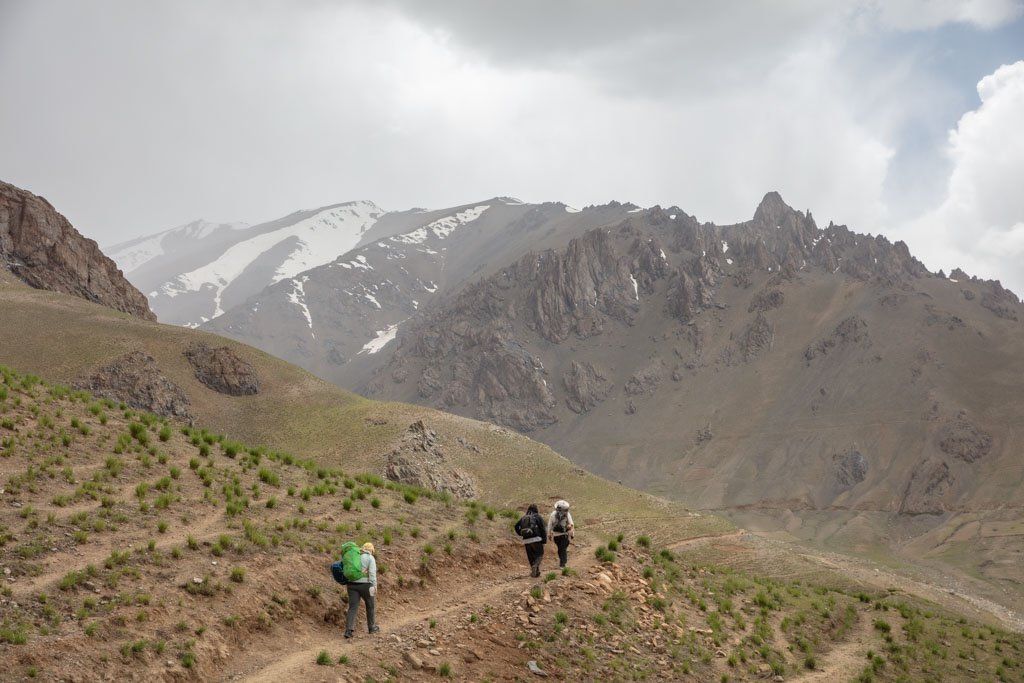
The trek between Chapkolek Village in Khushkak Valley and Qazan Village offers stunning mountain views and the chance to experience rural mountain life.
From Khushkak Village you’ll climb to the top of Khushkak Pass and descend down into Chapdar Valley, passing the ruined Qala ye Kafiree (Castle of the Non-Believers). In Chapdar Valley, you’ll pass through Sarykul Village as you veer toward the ‘right’ fork of the valley. From Sarykul you will hike up into another mountain pass.
The next valley you’ll arrive in is Jowkhar Valley, but you’ll stay a little south of the village in view. For those that want to take in a mountain lake, it’s possible to take a detour to the south to visit Jowkhar Lake. Back on the main path, you’ll trek up a third, yet small pass to arrive in Qazan Valley, finally being a bit south to arrive in the village.
Getting to the Chapkolek Village/Khushkak Valley
Plan to pay 2,000 AFS for transport to and from Chapkolek village.
Qazan Village to Qazan Lake
- Distance: 18.65 km
- Duration: 1 day
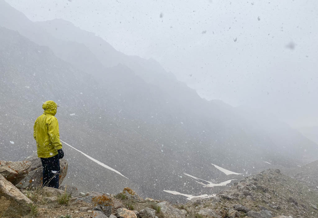
Qazan is a bright blue lake nestled in the Koh e Baba Mountains. Unfortunately, you’ll have to take my local friends’ word for it- we got snowed out about halfway up the lake and had to turn around.
From Qazan Village, a day hike can bring you to the beautiful Qazan Lake perched high in the Koh e Baba Mountains. It’s a pretty straightforward trek that follows shepherding paths up in the high summer pastures.
Unfortunately, we hit bad weather on this trek and made the decision to turn around back to the village about halfway up (it was a mix of rain, snow, and sleet falling in mid-May). Despite this, I did create a GPX file all the way to the lake using satellite images to roughly locate the shepherding trails beyond where we had made it to.
The route on Wikiloc I created from the map above shows the trek as a one-way at 9.32 km, but note that it is 18.65 km return.
Getting to the Qazan Lake Trek
Plan to pay 4,000 AFS for transport to and from Qazan village.
Qazan Village to Ali Beg via Foladi Ice Cave
- Distance: 10.57 km
- Duration: 1 day
This was the final stage of the trek we organized to the valleys south of Bamyan Town.
From Qazan Village we followed the valley to the south, bending to the southwest at the fork of the valley beyond the village. Eventually, you’ll reach the start of the climb up to the Foladi Ice Cave. It’s a bit of a scramble and the very last section before the cave opening requires caution as you’ll have to find some good holds to make it up some small rock faces.
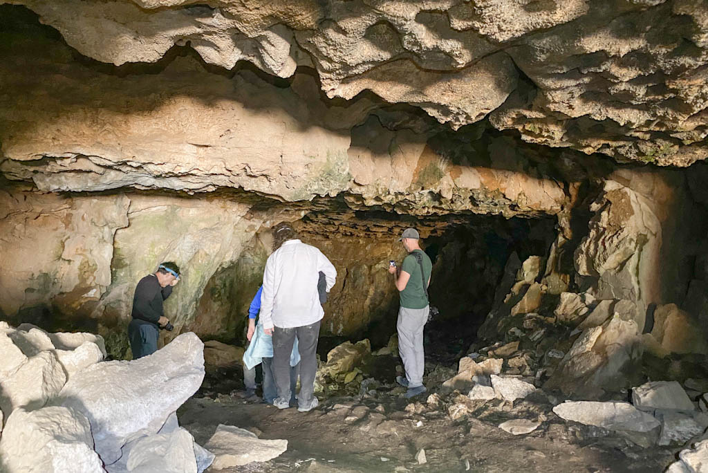
The Foladi Ice Cave is a strange sight to see as you’ll find ice inside pretty much any time of year bar mid-summer (June-August the ice will have melted). Make sure and bring a headlamp to be able to see inside.
From Foladi Ice Cave, follow the same route back down into the valley. A short distance away as you head back in a northeast direction you’ll veer onto a higher path that somewhat parallels the valley before making a turn into a pass. The path will bend to the northwest to go around a large rock formation and then turn roughly south-south around the rock.
The final ascent into the highest part of the pass offers sweeping views all around. The final descent is a beautiful site to see as you drop into fairytale-like Foladi Valley.
Note that if you do not wish to visit Foladi Ice Cave that there are several routes that connect Qazan to Ali Beg near Qazan Village.
For those that only want to visit Foladi Ice Cave, it is quickest to approach it from Qazan Village. The shortest route from Qazan Village to Foladi Ice Cave and back to Qazan Village is about 10 km.
Getting to Qazan and out of Ali Beg
Plan to pay 4,000 AFS for transport to Qazan village and out from Ali Beg.

Bamyan Town to Band e Amir
- Distance 60 km
- Duration 3 days
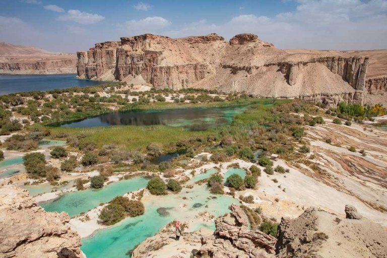
It’s possible to trek from Bamyan Town to the beautiful blue lakes of Band e Amir in about three days time.
Getting to the Bamyan-Band e Amir Trek
As this trek begins near Bamyan Town you won’t have the transport cost on the way there but will on the way back. Plan to pay about 1,500 AFS for your pick up from Band e Amir back to Bamyan Town. Note that there is a 200 AFS National Park fee for Band e Amir.
Plan to perfect visit to Band e Amir
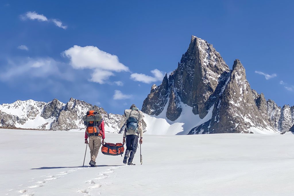
Koh e Baba Mountains
- Distance: Varies
- Duration: Varies
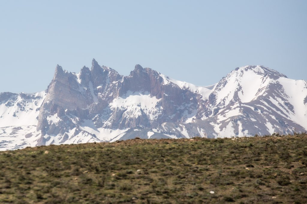
The Koh e Baba tower over Bamyan in their ice-capped glory, a western extremity of the Hindu Kush Range. The highest peak in the range is Shah Foladi standing at a staggering 5,100 meters.
You can summit several of the peaks in the Koh e Baba.
Getting to the Koh e Baba
As mentioned above for getting to the valleys south of Bamyan Town, you can expect it to cost around 4,000 AFS return.
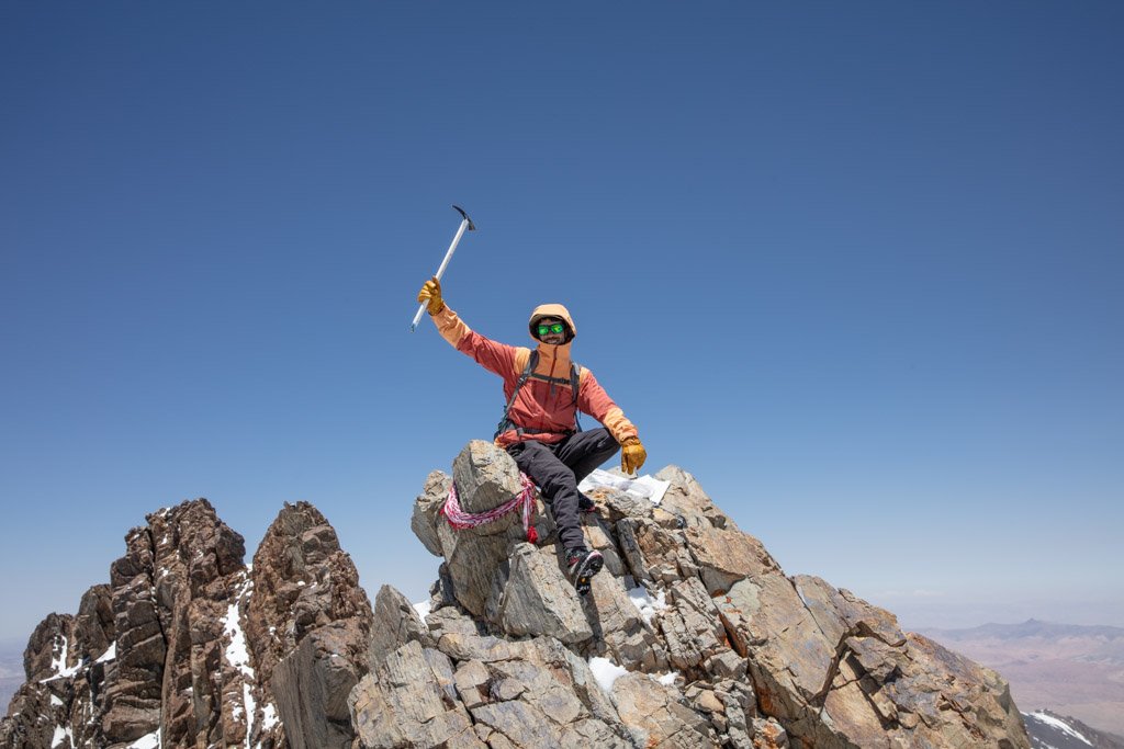
Shah Foladi
- Distance: 24 km (Bamyan side) 32 km (Wardak side)
- Duration: 3 days
GPX File for Shah Foladi Summit (Bamyan approach)
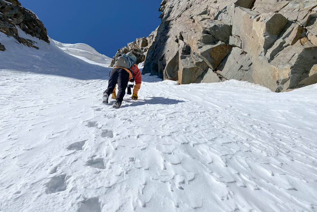
As mentioned before, Shah Foladi is the highest peak in the Koh e Baba. Two routes exist to the summit. The more difficult and somewhat technical ascent from the Bamyan side of the mountain and the easier and more gradual ascent of the Wardak approach.
The Bamyan approach is best attempted in March-May as you will need to climb a near-vertical wall of snow and ice. You will need ice axes and crampons to climb this side. A fixed rope does exist on the wall, but it can be buried under the snow.
Later into summer, a dangerous crevasse exists here on the wall which is why this route is only recommended in spring.
The Wardak approach is more gradual and less technical, though crampons would still prove helpful in the spring.
On either side of the mountain, a base camp location exists. Both are on the shores of a small lake. You will need three days for the average climber, one day to reach base camp, summit the second day, and then return from basecamp on day three.
I recommend hiring Sayyed Alishah Farhang to guide you to the summit as he has reached the top of Shah Foladi numerous times. Rates for mountaineering guides, including tent and food are $70 USD per day.
Don’t want to summit?
It’s possible to visit the basecamp for Shah Foladi as a day trip or overnight trip from Bamyan Town. June-September a beautiful little lake sits at the base of uniquely shaped Sarkh e Shah Foladi. Before June the lake will be mostly frozen.
Getting to the Shah Foladi Trek
A car from Bamyan Town to Ali Beg Village in Foladi Valley will cost around 4,000 AFS there and back.
Getting to the start of the Foladi Ice Cave Trek
Much like all the other treks around the valleys south of Bamyan Town, expect to pay about 4,000 AFS for transportation.
Babur Valley
- Distance: 5 km
- Duration: 3.5-4 hours return
Just east of Yakawlang District a valley believed to have been used by Mughal Emperor Babur to reach Bamyan, hence the name. Babur Valley makes a great day trip and is a popular picnic spot for Bamyan locals on Fridays.
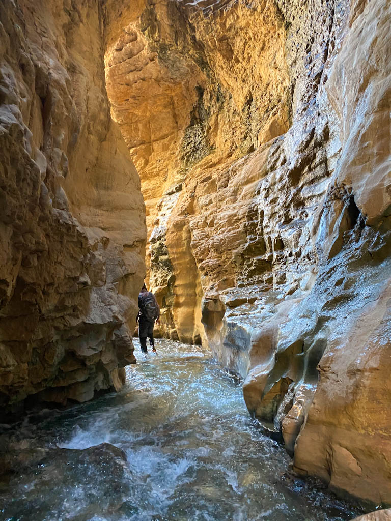
For this trek, you’ll want to wear a sturdy trekking sandal with good grip, and pants that can easily be rolled up as you’ll be trudging through a river for much of the hike.
The Babur Valley hike begins from a small parking lot just off the main Bamyan-Yakawlang Road. Quickly you’ll be at the river’s side, following its course as you enter into a narrowing valley.
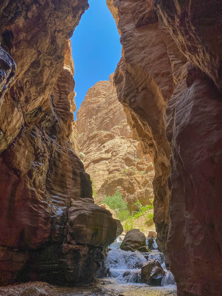
The best part of the hike comes next when you’ll enter into a narrow slot canyon, cut by the river. This is where you’ll want to roll up your pants as you can expect to be wading through mid-thigh deep water.
On the other side, the canyon widens a bit before coming to an almost cul-de-sac. The course of the main canyon continues to bend to the east, eventually bringing you to a steep section of boulders with the river flowing over them.
You’ll carefully climb the boulders, zigzagging a couple of times from one side to another. Once atop you’ll follow the river to eventually end in an amphitheater of high rock walls with an interesting waterfall that babbles down from high above.
The trek took just a bit under two hours to the furthest point, and another 1.5 hours to return back to the parking lot.
Getting to Babur Valley
Babur Valley is located just before you reach the town of Yakawlang. You can expect to pay around 3,000 AFS for a return trip from Bamyan Town. This is a popular picnic stop for locals as well so there’s some potential to hitchhike here.
Bamyan Plateau
- Distance: Varies
- Duration: Approximately 4 days
The Bamyan Plateau is a nature reserve and wildlife refuge located in the extremities of north Bamyan province. The plateau is home to the rare Persian leopard and the Afghan snow finch, so keep your eyes peeled for sightings.
The Bamyan Plateau is best visited between April and June. Friends mentioned that later into the summer that it gets too hot and that there are a lot of snakes.
Waras
The main route through the Waras District of southern Bamyan runs through an arid canyon. There is some trekking possible here, especially some relatively short treks around the district capital (also named Waras) that are only a few kilometers.
Due to how far away Waras is from Bamyan Town you’ll likely only come here if you’re passing by anyways on a longer trip to Daykundi Province from Bamyan.
Koh e Mekh
- Distance: 11 km
- Duration: 1 day
Koh e Mekh we stumbled across by accident. I arrived with Alishah and his brother to the village of Waras en route to Daykundi Province. The sun was starting to go down so we decided that we would look for a place to stay in the village.
Within a few minutes of arrival, we were pointed to a small chaikhana tucked off the main road that took in travelers passing through overnight. Ouch would have it, we would meet with local police officers that suggested us to climb Koh e Mekh.
Alishah excitedly listened as he had heard of this mountain before. They explained that we should visit the military post nearby the mountain to request an escort.
The people that live around Koh e Mekh can be suspicious, especially of outsiders… even more so a foreigner with a camera.
Koh e Mekh is ladened with gemstones and minerals and the locals are protective over this. An escort would help prove that we were in fact, just visitors, not prospectors who may be planning to set up mining operations there and possibly unearthing their important Mazars (shrines).
South of Waras, we passed the village of Band e Kusa, the nearest major settlement near Koh e Mekh. Just south of here was where we picked up our military escort from the post here.
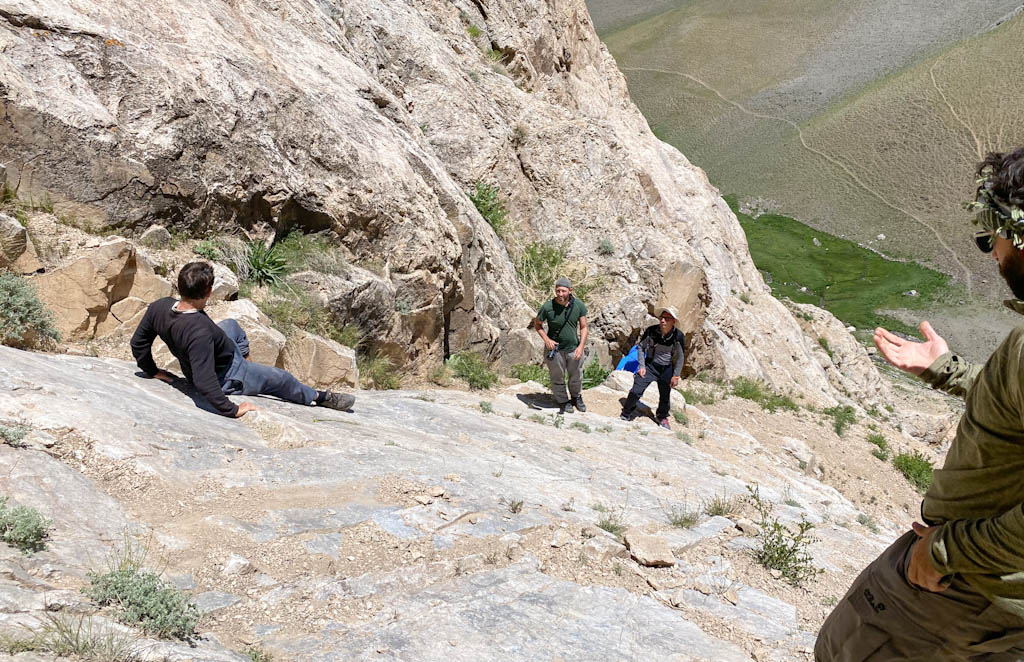
The trek begins from the village at the base of the mountain, after a long and slow drive on a track in horrible condition m, off the main route that connects south Bamyan to Daykundi.
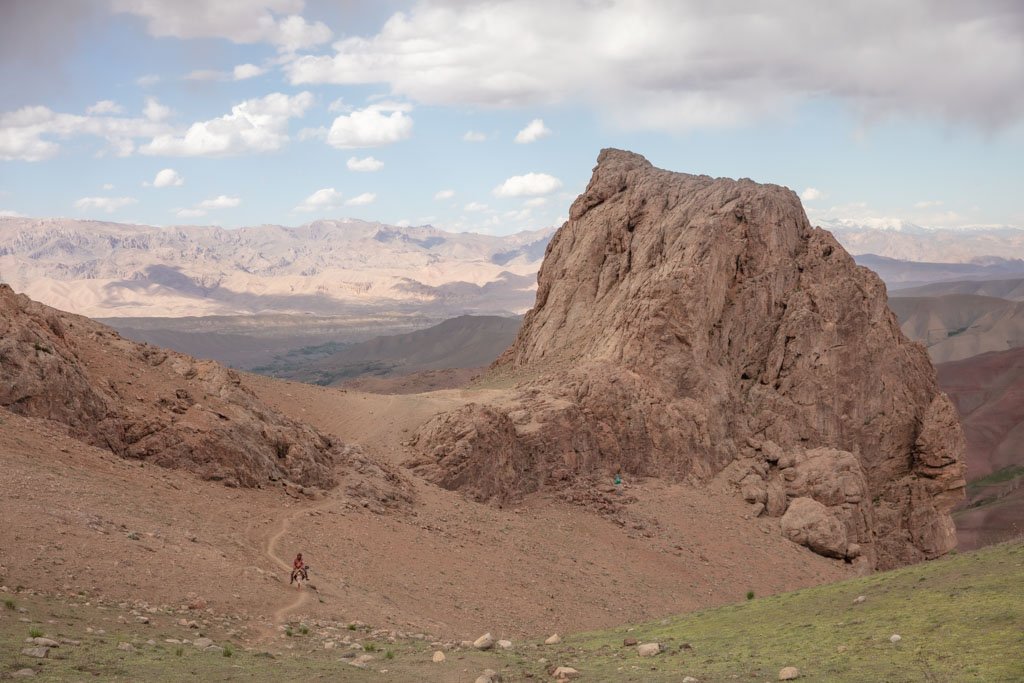
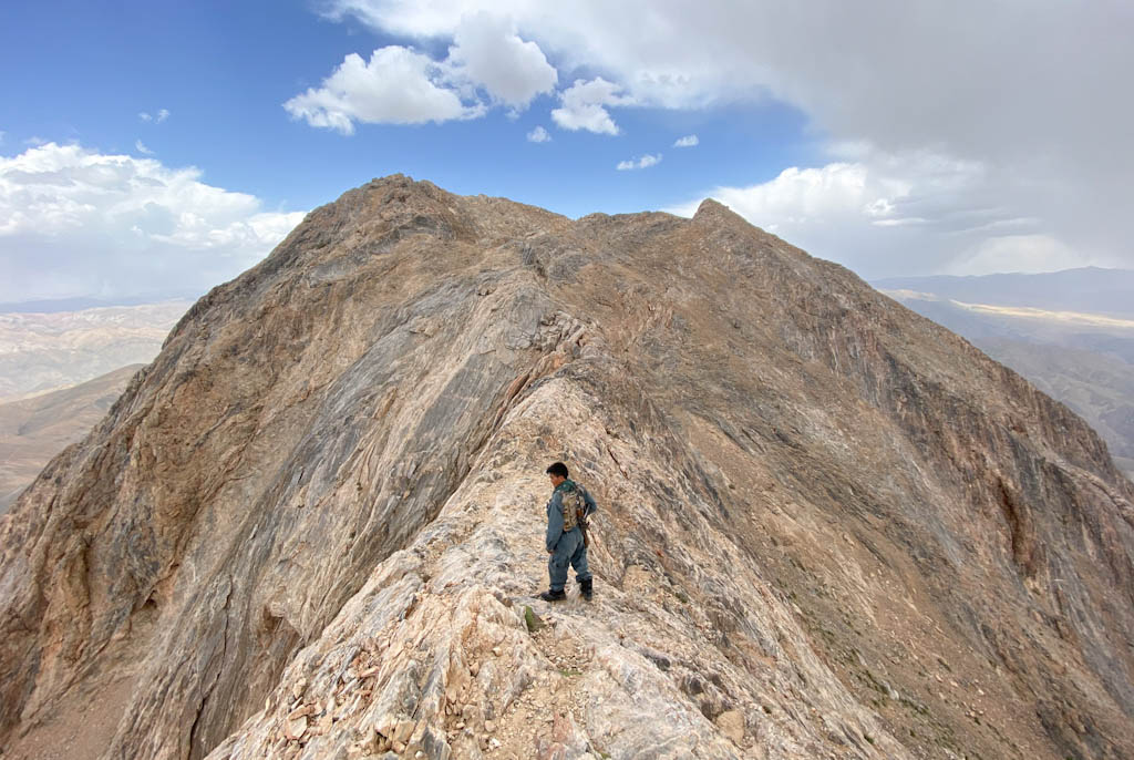
The hike meanders up the mountain that from a distance is roughly shaped like a shark’s tooth. In some areas, it did require a scramble. Knowledge of some basic rock climbing holds can be useful.
Eventually, you will pop up onto a ridge with sweeping views of the surrounding valleys and mountains in the distance. From here it’s a short jaunt to reach the highest point of the peak.
Do try to get an early morning start just after sunrise on this trek to avoid getting caught in an electric storm at the top as we did. The sky opened up on our descent with pelting hail, rain, rumbling thunder, and cold winds. Luckily there weren’t any lightning strikes.
Plan to spend a night at a chaikhana in Band e Kusa afterward as this trek to the top of Koh e Mekh will take you roughly 6 hours.
Read the full story on us getting caught in an electric storm at the summit of Koh e Mekh
Getting to Koh e Mekh
Same as mentioned in the section about Waras, the only reason you’d likely add a Koh e Mekh summit to your Bamyan itinerary is if you’re passing through to continue onto Daykundi Province.
Continuing beyond Bamyan: a wild journey through Daykundi Province
Bamyan Trekking Guides
Local guides do exist. I have worked with both Sajjad Husaini and Alishah Farhang and can recommend them both for guiding and making arrangements for trekking in Bamyan. Both men are also a part of the Bamyan Ski Club and can help facilitate winter visits to the mountains of Bamyan too.
Of course, if you’ll be making trekking in Bamyan a part of a larger trip throughout Afghanistan I recommend contacting Let’s Be Friends Afghanistan to set up your trip and connect you with Sajjad or Alishah.
If your trip is being planned a little more on the fly and you want to contact Sajjad or Alishah directly, please email me for contact info.
Have any questions about trekking in Bamyan?
Ask in the comments below.
More posts from Afghanistan:

Ishkashim Border Crossing Between Tajikistan & Afghanistan
Afghanistan Travel Guide
Crossing The Uzbekistan-Afghanistan Border At Hairatan
A Beginner’s Guide To Central Asia Travel: Discover The Silk Road
Bamyan’s 40 Tower of Chehelburj, Afghanistan
Very nice !