Titus Canyon: An Epic Death Valley Drive
Updated December 2025, Titus Canyon: An Epic Death Valley Drive was originally published in April 2024
The epitome of a desert wonderland, Titus Canyon is a must for those wanting to experience the rugged mountains, vibrant rock formations, and captivating historical relics sitting here on the fringe of Death Valley National Park.
The journey along Titus Canyon Road begins with a visit to the eerie remnants of Rhyolite, a ghost town steeped in the echoes of a bygone era. Then, buckle up for an adventure through a tapestry of geological marvels, where petroglyphs whisper tales of ancient civilizations and rare flora that thrive against the odds.
In this detailed travel guide to Titus Canyon, find everything you need to know to plan your adventure including all the must-see stops along the route, vehicle requirements, tips, and important information.
Need Travel Insurance and Evacuation Services?
Start shopping for travel insurance plans over at IATI Insurance. Readers of the Adventures of Nicole get a 5% discount off your plan.
The Adventures of Nicole partners with Global Rescue to offer the world’s leading medical evacuation and security advisory services. To travel with peace of mind, explore their evacuation coverage.
About the Titus Canyon Road
Titus Canyon is situated in the northern region of Death Valley National Park, approximately 27 miles (43 km) east of the Furnace Creek Visitor Center. Titus Canyon is accessible via a scenic drive that begins near the ghost town of Rhyolite, just outside the eastern boundary of the park.
The history of Titus Canyon Road is intertwined with the mining boom that swept through the area in the late 19th and early 20th centuries.
Attracted by the promise of riches, prospectors and miners flocked to the region in search of gold, silver, and other precious minerals.
Many of the mines are now abandoned and subsequent ghost towns are scattered along the route, bearing witness to this era of exploration and exploitation.
Today, Titus Canyon Road serves as a popular destination for adventurers and sightseers wanting to take in the rugged beauty of Death Valley.
Is Titus Canyon Road Open?
Due to flooding in the park as of February 2024, Titus Canyon Road remains closed. Check the NPS website for info regarding which roads are open and closed in Death Valley National Park.
Quick Info & Tips for Titus Canyon
- Distance: 27 miles one-way.
- Time: 2-3 hours.
- Starting point: Nevada Highway 374 (also known as Daylight Pass Road) located two miles east of the Death Valley National Park boundary.
- Road conditions: Titus Canyon Road is a rough dirt road that runs one-way from east to west. In some areas, the road is narrow and steep.
- Vehicle requirements: High-clearance, 2wd. 4WD may be necessary after bad weather.
- The best time to visit Titus Canyon: The cooler months of October to April are the best time to visit Titus Canyon to avoid the dangerously hot temperatures of the summer months in Death Valley.
- Get an early start: This is when there’s more likely to be other people driving Titus Canyon Road. The area isn’t frequently patrolled by park rangers and visitors get sparse in the afternoon. So you’ll want others around in the event of a breakdown or emergency.
- Pack in food and water: There are no restaurants or shops along the Titus Canyon Road so make sure you’re fully stocked up before heading out here.
- Weather warnings: Due to extreme heat, driving the road through Titus Canyon is not recommended in the summer months. Titus Canyon is also susceptible to flash floods, can be very muddy after rains, and in winter can be closed due to snow. Check with a ranger station in Death Valley National Park for current road and weather conditions.
Things to See Along Titus Canyon
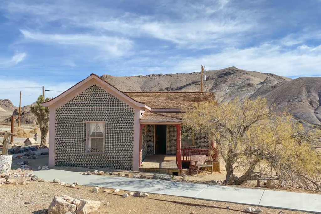
Rhyolite Ghost Town

Located just outside the eastern boundary of Death Valley National Park, just across the state line in Nevada, Rhyolite was once a bustling mining town teeming with promise and prosperity.
Established in the early 1900s during the height of the gold rush, Rhyolite quickly grew into a thriving community, offering amenities such as banks, saloons, schools, and even an opera house. At its peak, the town boasted a population of several thousand residents and garnered attention as one of the most promising mining settlements in the region.
The town’s fortunes proved fleeting, as the gold veins began to deplete and economic instability took its toll. By the early 1920s, Rhyolite became a ghost town, its streets deserted and its buildings left to decay in the harsh Mojave Desert sun.
Things to check out in Rhyolite include the iconic Cook Bank Building, the ruins of the Bottle House, and the sculptures of the Goldwell Open Air Museum, which add an artistic flare to the desolate landscape.
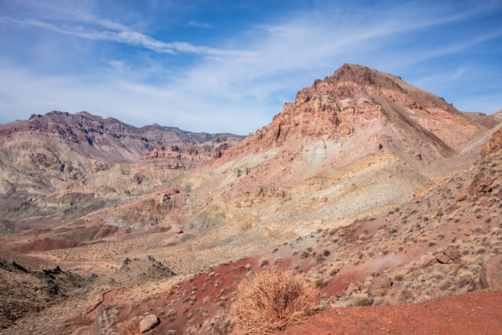
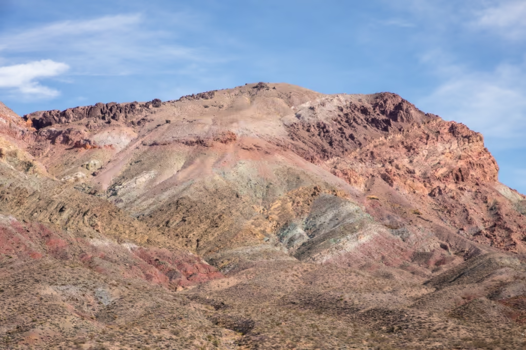
Titanothere Canyon & White Pass
A one-way road veers west from Titus Canyon Road across the Amargosa Valley, ascending into the Grapevine Mountains.
At White Pass, the road reaches Upper Titanothere Canyon, known for its multicolored rock deposits and ancient fossil beds dating back over 30 million years. Titanothere Canyon gained its name from a massive fossil or a titanothere skull that was unearthed here in 1933.
Titanothere Canyon to Lostman Spring Trail
Those wanting to explore Titanothere Canyon a bit more thoroughly can opt for the Titanothere to Lostman Spring Hike. The trek will take you into the lower reaches of Titanothere Canyon over roughly 4.5 miles.
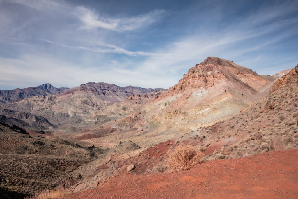
Red Pass Summit
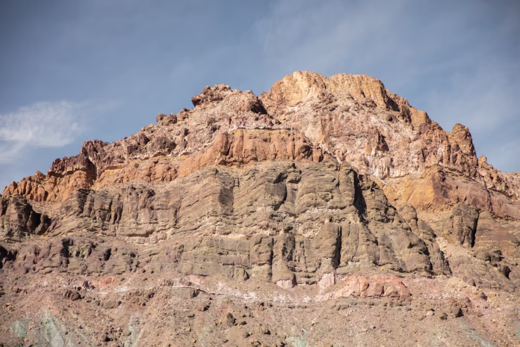
At 5,250 feet, Red Pass is the highest point along Titus Canyon Road. From Red Pass Summit you will have stunning panoramic views of the surrounding desert landscapes and rugged terrains of Death Valley.
Thimble Peak Trail
Standing at 6,381 feet, Thimble Peak is the most prominent pinnacle of the Grapevine Mountains.
That said, Thimble Peak is not visible from Red Pass Summit, but for those who want to take on a challenging trek, Thimble Peak is a great hike to add to your Titus Canyon itinerary.
You’ll begin the trek from Red Pass and the mountain will eventually come into view. Make your way up the north face of Thimble Peak to reach its summit.
Leadfield Ghost Town
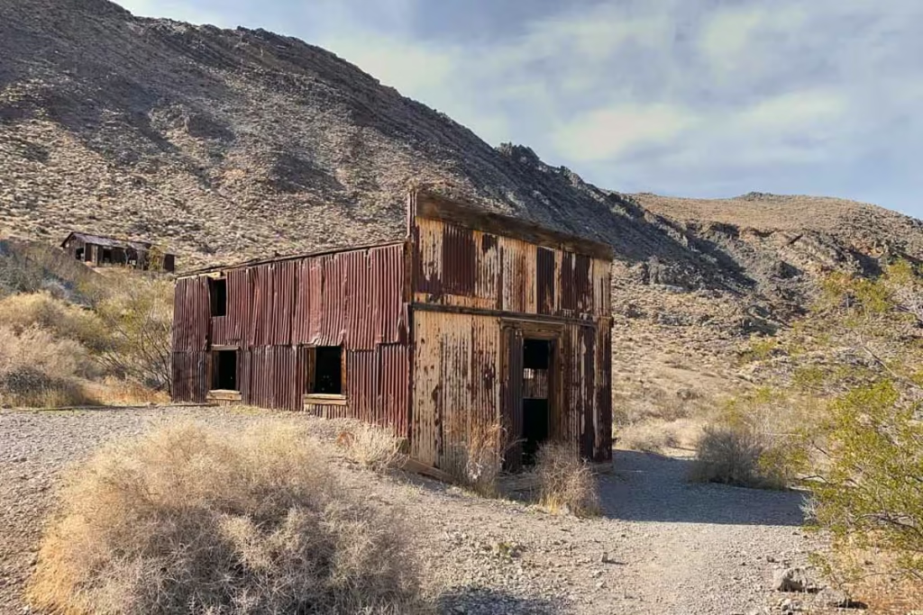
Leadfield is another ghost town in the Death Valley area. It experienced a boom from 1926 to 1927 due to lead deposits, hence the town’s name.
Leadfield’s heyday fizzled out as swiftly as its resources were depleted. The town now sits largely in ruin, with shacks and numerous abandoned mines.
Upper Titus Canyon Hike
For an adventure in Titus Canyon’s upper drainage, park your vehicle approximately 0.7 miles below Leadfield.
From here, hike up a gravel wash, traversing through a vibrant, broad valley. After roughly 2.5 miles reach a narrow side canyon on the right.
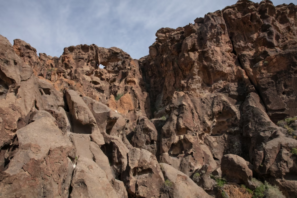
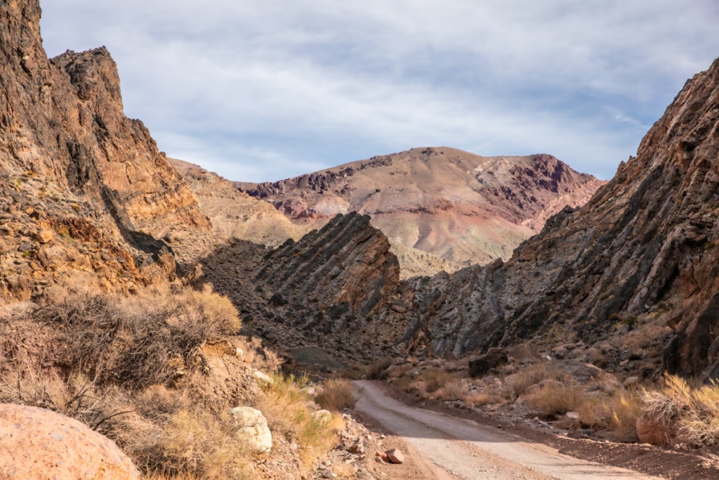
Titus Canyon
Below Leadfield, Titus Canyon Road descends into the main branch of Titus Canyon. Towering limestone cliffs loom over the expansive wash, showcasing intricate folds shaped by monumental geological forces over millions of years.
Eventually, the canyon opens wide, to expose the desert landscapes of Death Valley.
Klare Springs
Klare Springs is the best place to spot Big Horn Sheep in Titus Canyon as the odds are the greatest due to Klare Springs being the best water source in the area.
Another popular feature to check out in Klare Springs is the abundant petroglyphs found in the area. Native Americans frequented the area historically to hunt the Big Horn Sheep that populated the cliffsides around Klare Springs.
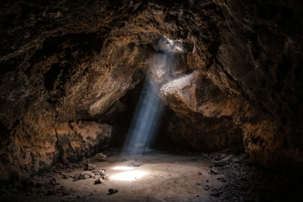
Titus Canyon Narrows
The last 1.5 miles of Titus Canyon are most visually impressive. This is Titus Canyon’s narrowest section, with walls constricting to less than 20 feet apart in some places.
Upon entering the narrows, the road veers away from the wash and descends through what can often be the most challenging terrain of the entire journey, so it’s advisable to take a walk to scout this segment before attempting to drive through it.
Fall Canyon Trail
From a parking lot near the Titus Canyon Narrows, you’ll find the trailhead for Fall Canyon Trail, one of the most beautiful hikes found along Titus Canyon.
Shaped by flash floods flowing down from the mountains beyond, Fall Canyon is remote, colorful, and narrow. This out-and-back hike is roughly 6.1 miles.
Scotty’s Castle Road
You’ve made the road trip along Titus Canyon entirely once you reach Scotty’s Castle Road.
Scotty’s Castle Road leads to several of Death Valley’s main attractions including the Racetrack, Eureka Dunes, Ubehebe Crater, and Scotty’s Castle.
Have Any Questions About Titus Canyon?
Ask in the comments section below.