Hiking the Peaks of the Balkans Trail Through the Accursed Mountains
Updated June 2026, Hiking the Peaks of the Balkans Trail Through the Accursed Mountains was originally published in June 2024
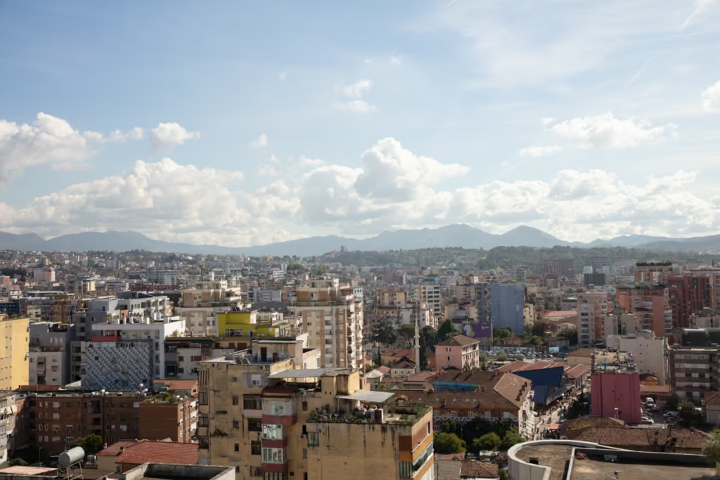
Looking to trek what may be one of the most beautiful alpine areas of Europe without the crowds that the more famous Dolomites or Swiss Alps attract? Meet the Peaks of the Balkans.
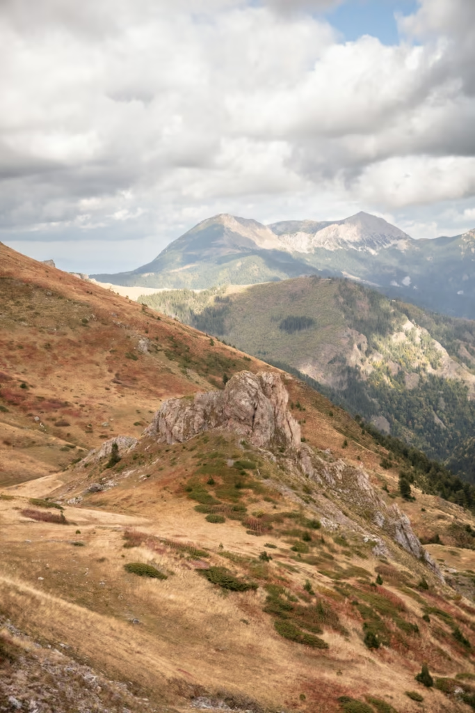
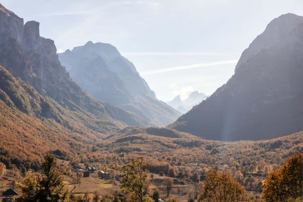
From the peaks of Northern Albania to the rugged terrain of Kosovo and Montenegro, every day revealed the untamed allure of the Balkans region and new challenges.
Spanning 192 kilometers (depending on the route you take) across Albania, Montenegro, and Kosovo, the Peaks of the Balkans Trail promises a journey into traditional Balkan culture and warm hospitality.
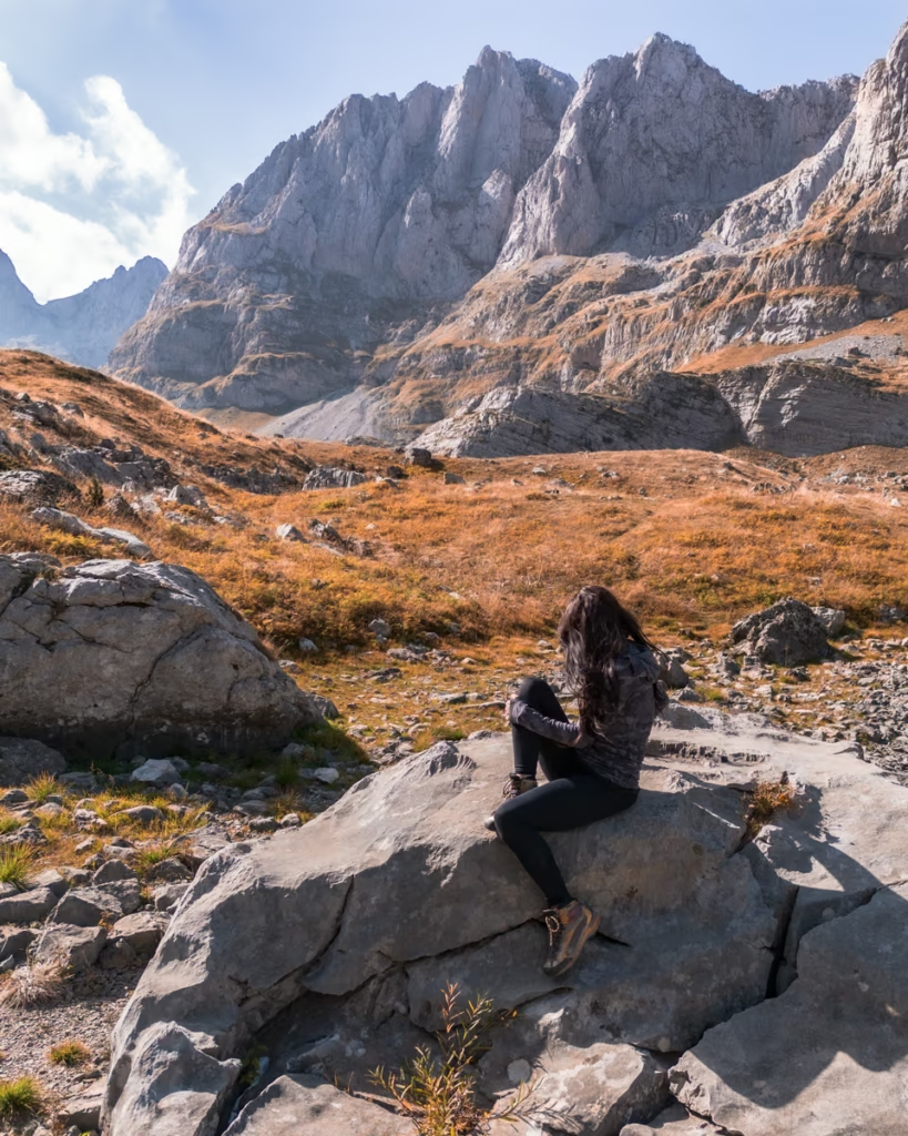
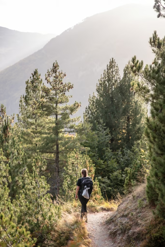
The Peaks of the Balkans Trail is a hidden trekking gem of trekking that few hikers seem to know about. I’m always looking to find new and unheard of nature to explore and this time my quest led me to solitude amidst charming villages and serene meadows.
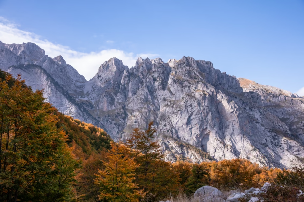
Amidst the solitude of the Accursed Mountains in the Dinaric Alps, it’s the families and rich history of the region that truly make the Peaks of Balkans a special hike. Staying with local families offered intimate glimpses into their lives, fostering connections that transcend borders and the strife that marred this region in the 1990s.
Established in 2012 as part of a peace project by a German development organization, the Peaks of Balkans trail embodies the spirit of sustainable tourism, uniting war-torn countries through shared landscapes and shared stories.
Need Travel Insurance and Evacuation Services?
Start shopping for travel insurance plans over at IATI Insurance. Readers of the Adventures of Nicole get a 5% discount off your plan.
The Adventures of Nicole partners with Global Rescue to offer the world’s leading medical evacuation and security advisory services. To travel with peace of mind, explore their evacuation coverage.
The Best Time to Hike the Peaks of the Balkans Trail
Generally speaking, the best time of year to hike the Peaks of the Balkans Trails is between mid-June and mid-September but note that you’ll want to be prepared for anything no matter the season.
We did the Peaks of the Balkans in mid-October and generally had decent weather with a couple of days of storms and rain. That said, there was a lot of snow in the earlier 2023 season and even fatalities on Valbonë Pass in May.
Hiking the Peaks of the Balkans Independently
We opted to take on the Peaks of the Balkans hike independently. I do have years of independent trekking experience in much less developed regions and nations such as Tajikistan, Yemen, Alaska, Afghanistan, and so on, and my friend Bekah whom I did the trek is an expert spreadsheet planner, so planning and executing the Peaks of the Balkans was an easier task for us.
That said, you’ll need to take time to decide on which route you’ll take, determine if you are physically capable, how many days you’ll need, make reservations for accommodations, gather the necessary permits, and figure out transportation. Arranging all of this is straightforward but does take a little advance planning.
There are also hazards along the Peaks of the Balkans to be aware of, such as inclement weather, avalanches, and natural disasters. I had an Instagram follower message me after posting a photo from our Peaks of the Balkans stint in Kosovo saying that she did the trek in a group and they ran into not one but two bears on the Kosovo portion (if you keep up on my blog, you’ll know I was mauled by a bear in Tajikistan, so that’s something I’m a bit more weary of since then).
Luckily we had no major issues along our hike, the biggest annoyance we ran into was a perv who we hitched a ride with from Rugova toward Gur i Kuq who started driving in completely the wrong direction of where he was headed (and ultimately the general direction we were headed) and ultimately thought we were looking to make a sexy time with him (we 1000% were not).
That all said, I found the Peaks of the Balkans hike to be perfectly fine to take on independently as long as you’re confident and prepared for it. If that isn’t you, that’s no problem, you can find guided treks of the Peaks of the Balkans fairly easily (more on this below!).
For those who want a hybrid Peaks of the Balkans expedition, some companies will handle all the logistics (transport, accommodations, permits, etc.) for a fee and then you’ll be free to do the trek itself independently.
Getting a Peaks of the Balkans Permit
If taking on the Peaks of the Balkans hike, you’ll be traversing the borders between Albania, Kosovo, and Montenegro without encountering official border formalities.
To adhere to immigration regulations, you should possess a Peaks of the Balkans Permit listing all the borders you intend to cross, along with corresponding dates.
Initially, we planned to handle the permits independently, navigating the bureaucratic process in Albania, Kosovo, and Montenegro ourselves. However, after weighing the complexities, we opted for assistance and enlisted the services of Zbulo, who efficiently obtained all the necessary documents within a week. Our permit cost about 45€ for both of us (you can include several people on one permit). We highly recommend utilizing their expertise for permit arrangements.
It is recommended to apply at least 14 days in advance of your Peaks of the Balkans start date to ensure you receive your permits in time. This is especially true for those who take on the trek in the peak of the peak season- July and August.
While some trekkers venture out onto the Peaks of the Balkans trail without this permit, it’s crucial to acknowledge the potential risk of a €300 fine per person if caught without one.
It’s worth noting that throughout our journey along the Peaks of the Balkans route we encountered no officials, underscoring the variable enforcement of permit regulations.
Booking Homestays & Guesthouses or Camping
If planning to stay in homestays and guesthouses along the Peaks of the Balkans route, it’s advisable to make reservations in advance.
During high season they can book up and in the early and late parts of the year, it’s good to make reservations as many families will close their doors for the season.
Either way, the families who host you will need to make sure they have enough food and supplies for the number of guests they’ll have each night.
If planning to camp, you’ll want to have all the necessary gear and food supplies for your journey.
You will find our guesthouse and homestay recommendations in each day section for the Peaks of Balkans hike itinerary.
Best Mapping App for the Peaks of the Balkans hike
This just boils down to preference. I like to use Organic Maps (formerly Maps.me) for dropping pins, Gaia GPS for recording tracks, and Wikiloc for posting the GPX files online later. My friend Bekah whom I did the Peaks of the Balkans, prefers Google Maps offline. All seem to work great, so go with whichever you’re the most comfortable using.
Going on a Guided Trek of the Peaks of the Balkans
There are several independent trekking guides as well as travel companies offering guided Peaks of the Balkans hiking trips of various lengths.
If you don’t want to go at it alone, want to join a fun group of hikers, and have all the logistical headaches taken care of, a Peaks of the Balkans hiking tour is a great option.
Hike the Peaks of the Balkans Independently but have the Logistics Arranged for You
For those who want a hybrid Peaks of the Balkans expedition, some companies will handle all the logistics (transport, accommodations, permits, etc.) for a fee and then you’ll be free to do the trek itself independently.
You can expect this service to cost approximately €500-600.
Zbulo is a great option for this.
The Peaks of the Balkans Itinerary
Here is our Peaks of the Balkans itinerary that we modified in order to squeeze the trek into 10 days but also make room to add a day trip to Buni Jezerce from Vusanje.
Because of this modification, we started the trek from Valbonë rather than Theth like most trekkers would. So, for those who do plan to start in Theth, I’ve included the distance and elevation gain info below.
Theth – Valbonë
- Distance: 16.4 km
- Elevation gain: 1175m
- Where to stay Theth: Guesthouse Rrashkadoli
- Where to stay in Valbonë: Hotel Fusha e Gjesë
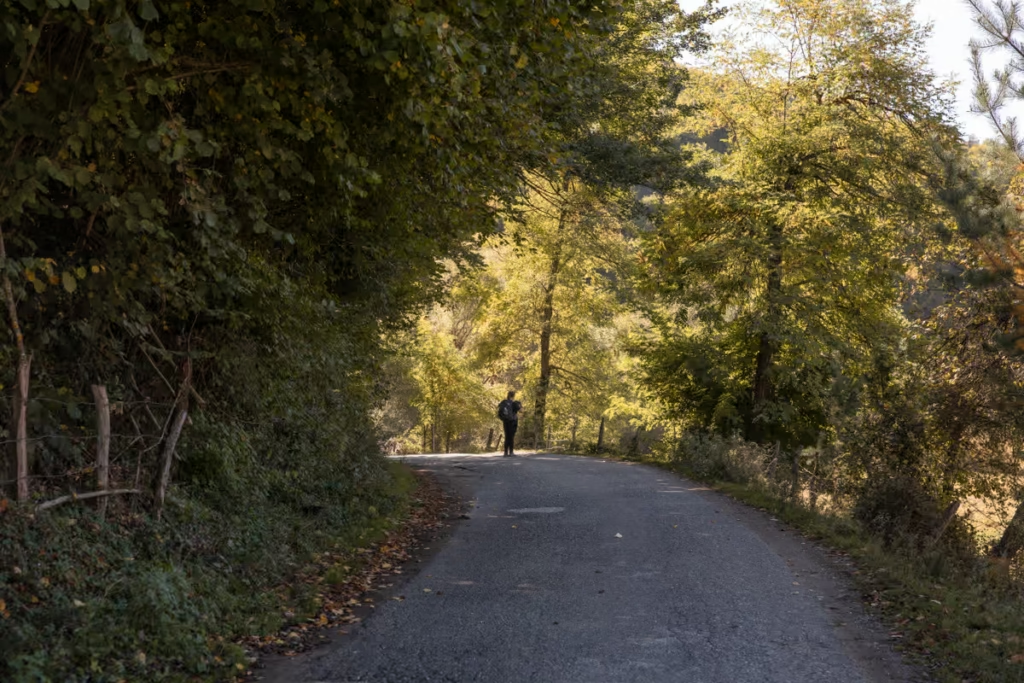
Starting from Theth at 745 meters, this first section (if starting here, unlike we did) will bring over 1000 meters up and over the Valbonë Pass at 1759 meters, and finally down to Valbonë, sat at 995 meters. This route follows an ancient track that once linked age-old tribal regions.
The trail is well-beaten and if trekking in the peak season, you can expect to be sharing the trail with plenty of others.
Do take caution coming up and over Valbonë Pass in inclement weather and during the spring or fall seasons as snow isn’t unheard of then and if the weather is rainy it can be quite slippery.
The descent to Valbonë is pretty straightforward, eventually reaching Rragam village and finally meeting a gravel road flanked by pine trees.
This road, connecting Valbonë with Rragam, leads to the end point at Hotel Fusha e Gjesë. Valbonë center lies 3.5 kilometers northeast along a paved road, but do note that the village of Valbonë is quite scattered.
How to Get to Theth
Theth serves as a popular starting point for those embarking on the Peaks of the Balkans Trail, with the most accessible city being Shkodër.
A daily furgon (minibus) departs from Shkodër at 7 am, reaching Theth around 9 am. Tickets for the furgon cost 10€ per person.
If you’re traveling from Tirana to Theth, it’s advisable to have your own vehicle or opt for a taxi for a single-day journey. Bus travel from Tirana to Theth necessitates an overnight stay in Shkodër.
Day 1: Valbonë – Çerem
- Distance: 11.3 kilometers
- Elevation gain: 507 meters
- Where to stay in Valbonë: Hotel Fusha e Gjesë
- Where to stay in Çerem: Kujtim Gocaj Guesthouse
Starting at Hotel Fusha e Gjesë just outside of Valbonë, the journey starts along a paved road into the village. We did pass a couple of bunkers just off of the road on the way that are worth making a brief stop to check out. There are also some other bunkers just off of the dry river bed but they are sat on what is now private property.
After roughly 4.9 kilometers from leaving Hotel Fusha e Gjesë, we reached the point where we turned off of the paved road and toward Çerem near the village of Dragobi.
The path from the main road to Çerem is well-marked and easy, making a gradual ascent through the forest up to Çerem at 1179 meters.
We reached our accommodation in Çerem for the night at Kujtim Gocaj Guesthouse in the early evening, where we had epic sunset views over the village for the evening before sitting down to a homecooked dinner with Sophie and Regina, two other women we met on the trail.
We all had breakfast together the following morning, before packing up our leftovers for a picnic lunch and hitting the trail.
Do note that this is the lower path that connects Valbonë and Çerem. There is another, more challenging path that takes you over 2039 meter Prosllopit Pass.
How to Get to Valbonë
Getting to Valbonë is quite the journey, especially if coming from Tirana all in one day. Because of this, most trekkers starting in Valbonë will opt to visit Shkodër and spend at least a night there before continuing to Valbonë.
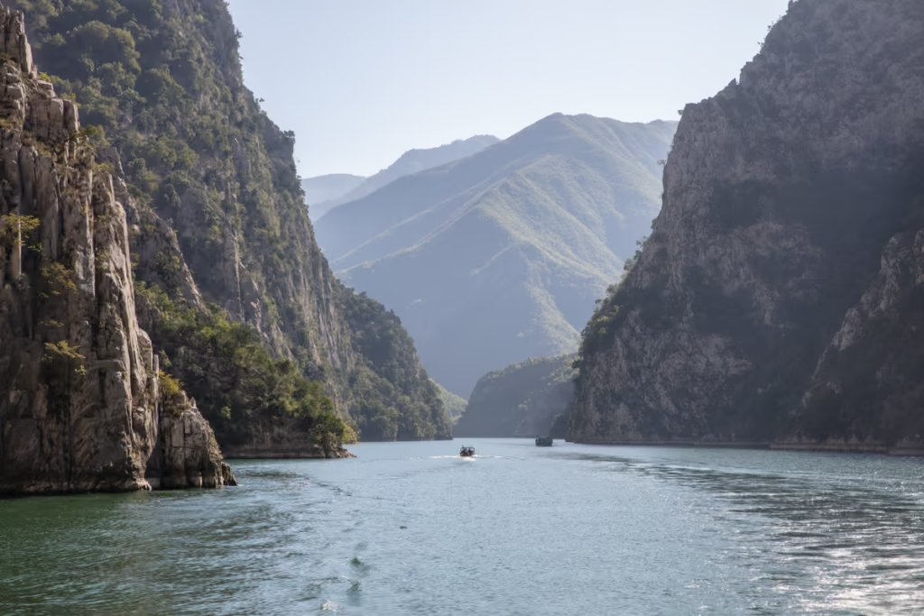
We did make the journey from Tirana to Valbonë in a single day, involving a furgon (minibus) from Tirana to Koman, the ferry across Koman Lake to Fierze, and another furgon from Fierze to Valbonë
If you plan to make the journey from Tirana to Valbonë, check out my post on getting from Tirana to Valbonë to gather all the details and plan your own journey.
Day 2: Çerem – Dobërdol

- Distance: 16.8 kilometers
- Elevation gain: 930 meters
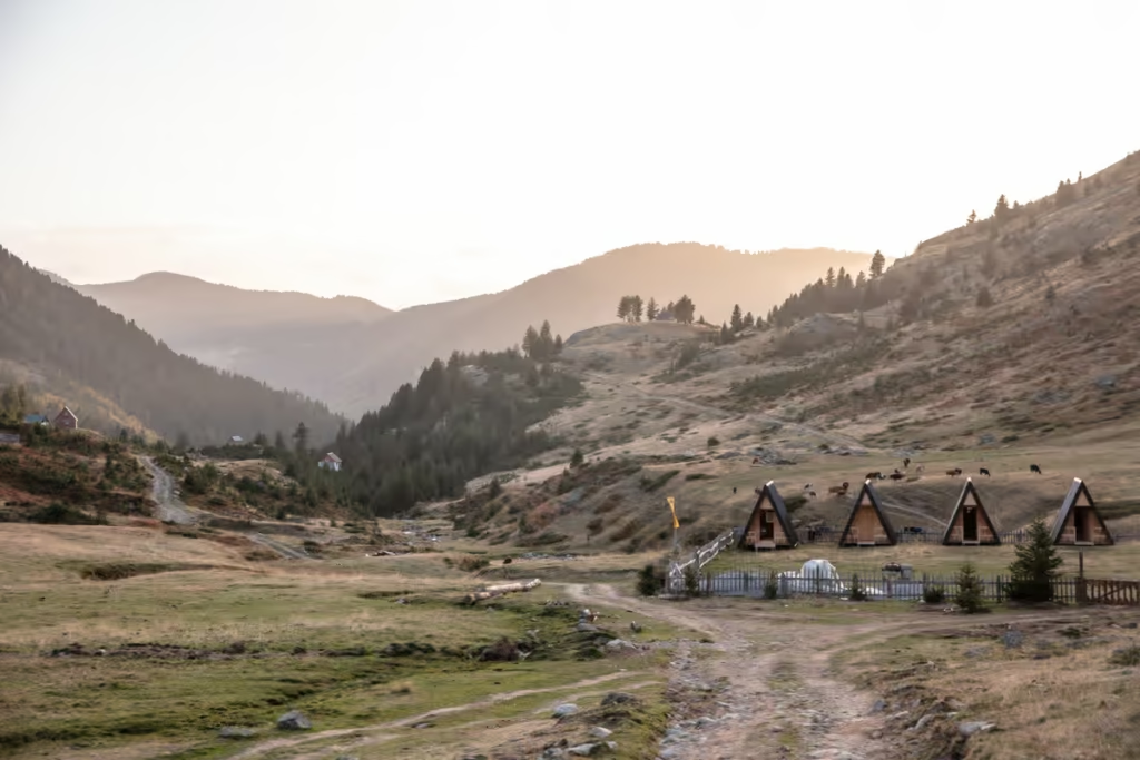
- Where to stay in Dobërdol: Guesthouse Bashkimi
The route from Çerem to Dobërdol starts along a 4WD track, gradually meandering up to the Panorama Balcony Viewpoint after 4.4 kilometers.
Walking beyond Panorama Balcony, we continued through the forest and reached the Vranica Pass border between Albania and Montenegro. Just over the border we made it to the top of 1625 meter Vranica Pass and had our picnic lunch there, sat among stunning views.
Another 30 minutes of walking beyond Vranica Pass brought us back across the border into Albania once again. The path continues to weave in and out of the forest, making a gradual ascent up to 2022 meter Varri Çeke Hasanit Pass before descending to the village of Dobërdol at 1800 meters.
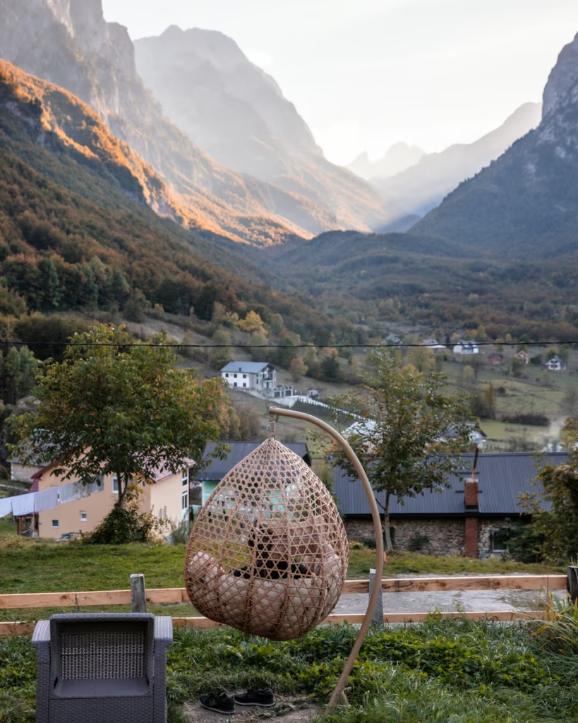
With flashes of bright red and brown mountainsides abound, sat at the Albania-Montenegro-Kosovo tri-border, Dobërdol was absolutely stunning to reach just before sunset.
We were greeted by Sophie and Regina once again, who had gotten a slightly earlier start out of Çerem than us reaching their stopping point for the night at Bujtina Leonard a bit before us. After a quick chat, we continued up to Guesthouse Bashkimi where we were staying for the night.
The family at Guesthouse Bashkimi was warm and welcoming, serving up a delicious dinner of cabbage-stuffed burek and jani me fasul (a delicious Albanian white bean soup) to us and another solo trekker who was staying at the guesthouse too.
Later, upon chatting with the family, we found out were relatives of the family who ran the Kujtim Gocaj Guesthouse in Çerem where we spent the night prior.
Day 3: Dobërdol – Milisevc
- Distance: 21.3 kilometers
- Elevation gain: 880 meters
- Where to stay in Milishevc: Kulla Guesthouse
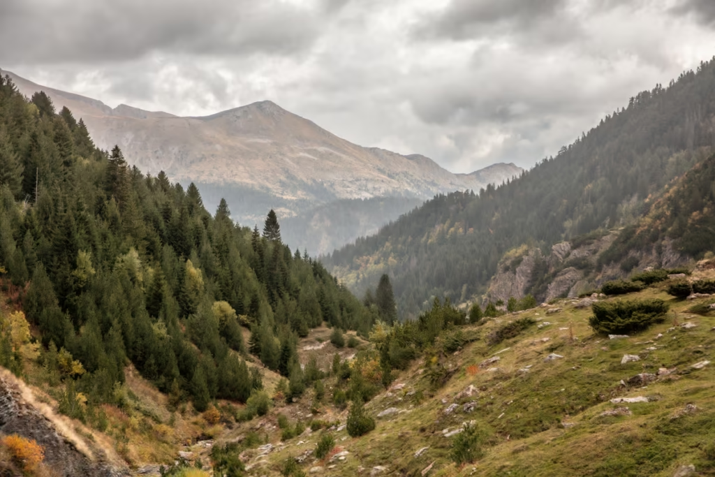
Beginning from Guesthouse Bashkimi, we meandered along small footpaths up the hillside. There are many paths, but generally, just head up toward the spine that serves as the natural border between Albania and Montenegro.
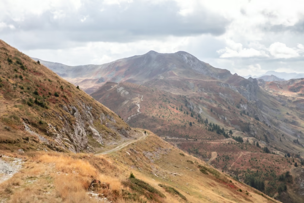
The path we took zigzagged up eventually taking us near the 2170 meter Tri-Border Peak between Albania, Kosovo, and Montenegro. The path follows the course of the ridge line, briefly dipping into Montenegro for a while before merging with the Dinarica Trail bending along the Kosovo-Montenegro border, crossing Bogice Pass and Belegu Pass, remaining on the border/ridgeline for several kilometers until finally reaching 2252 meter Roshkadol Pass.
Along the ridgeline leading up to Roshkasol Pass, we rain into hail, snow, sleet, and wind. Eventually, as we descended Roshkadol Pass, we briefly got some snippets of sunshine, giving us a brief opportunity for a picnic lunch.
Continuing down the path from where we had our lunch we began running into heaps of blueberry bushes, which slowed us down a bit as we kept stopping to pick and snack on them on the way down, eventually losing the main path.
We did eventually find our way back on track in a broad valley as it began to rain. The rain became more intense as we popped out onto a dirt road, eventually reaching the Kosovar village of Roshkadol.
Beyond Roshkadol, still following the course of the road, we finally passed an information sign for the Peaks of the Balkans and onto the village of Zllonopoj.
It was getting dark as we passed through Zllonopoj, following a zigzagging trail into the forest above the village, passing shepherds returning home for the evening from grazing their cows at higher pastures.
Eventually, we emerged from the forest and to the start of Milishevc village, reaching Kulla Guesthouse just after dark.
On arrival, we found Sophie and Regina, along with two more German women staying there for the night before we all dug into a dinner of jani me fasul and pumpkin-stuffed burek, homecooked by our guesthouse host family.
Day 4: Milisevc – Rugova
- Distance: 10.3 kilometers
- Elevation gain: 460 meters
- Where to stay in Rugova: Hotel Gryka
Originally, we planned to trek from Milishevc to Rekё e Allagёs on the fourth day of our Peaks of the Balkans trek, but we ended up bailing a bit early.
Leaving Milishevc we briefly followed the dirt road through the village before following a goat trail that ascended a verdant hill, reaching the top of Bjeshka e Lumbardhit Ridge after about three kilometers.
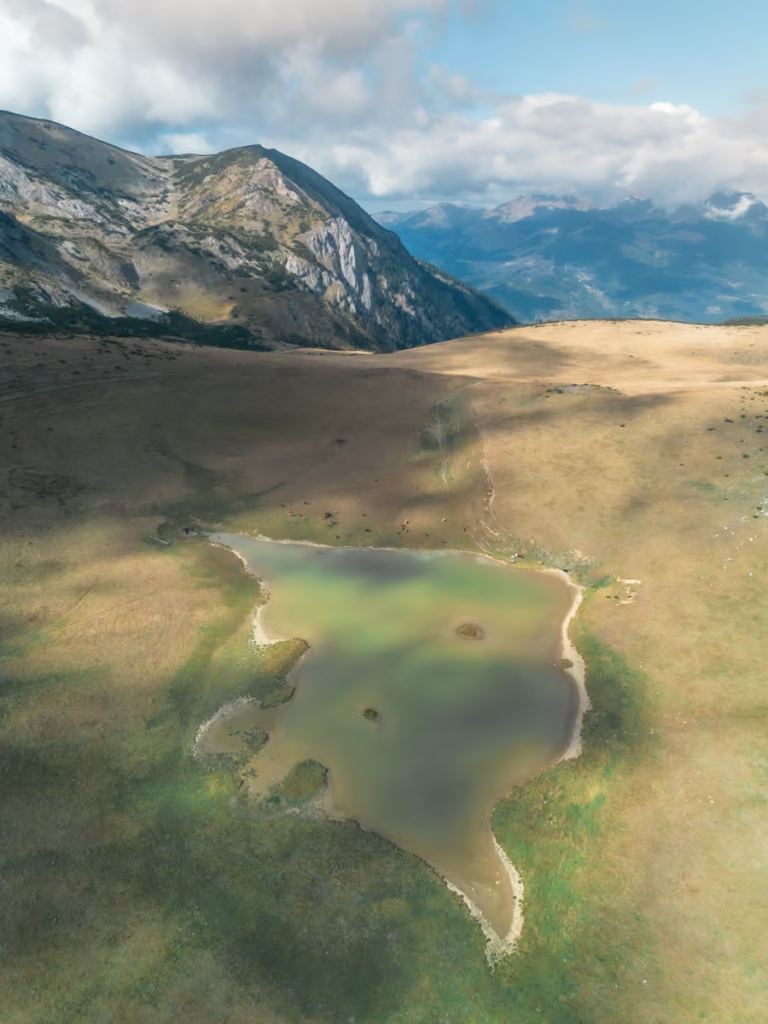
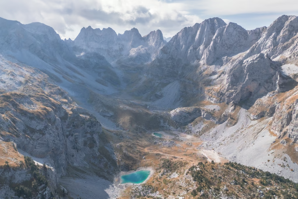
Another two kilometers down a gradual incline, we reached the meadows encompassing dazzling little Lumbardt Lake where we paused for lunch among grazing cows along the lakeshore with views of Gjeravica Mountain (Kosovo’s tallest peak) and Marjashi Peak.
Continuing beyond Lumbardt Lake to the north, the trail eventually descends into the forest. After descending about 400 meters in elevation the trail merges with a rough dirt road that we followed for a while before continuing back into the forest once again on a mule track that descends quite quickly to the driveway for Hotel Gryka.
I had gone ahead of Bekah and arrived at the hotel first, which felt like a sign that we should call it early and stay in Rugova for the night. As I waited for Bekah a younger man came over and asked if we wanted to stay, to which I laughed and told him probably and that I was just waiting for my friend. He said he’d be waiting inside the hotel restaurant for us.
Before I could even open my mouth to ask Bekah was already entranced by the super Soviet-esque derelict carnival swing ride in the parking lot and told me we were staying here. She messaged the family at the Mustafa Hakaj Guesthouse in Rekё e Allagёs to let the family know that we weren’t going to make it.
That evening we gorged on a dinner of Kosovar Reisling, spicy peppers stuffed with cheese, and fli.
Day 5: Rugova – Gur i Kuq
- Distance: 12 kilometers
- Elevation gain: 872 meters
- Where to stay in Gur i Kuq: Gur i Kuq Hotel & Restaurant
Day 5 of our journey along the Peaks of the Balkans trail took us to the little resort village of Gur i Kuq. The majority of the route today was along the M9 highway, so we ultimately decided to try and hitchhike some of it since it was Bekah’s birthday.
Once we were on the main M9 a car stopped and offered us a ride toward Kuqishtë, a village near the turn-off up toward Gur i Kuq.
Before Kuqishtë, the driver took a turn and when Bekah asked where he was going since we had thought we would get dropped near Kuqishtë on the main M9, he said he was taking us up to a viewpoint. Soon after he revealed his plan to have sex with us up there, so we promptly got out of the vehicle. Luckily, we weren’t too far from Kuqishtë, so we made it down to the village and then continued the walk along a paved road up to the Gur i Kuq Hotel & Restaurant.
We spent the remainder of the day having drinks and snacks at the restaurant’s outdoor pavilion with panoramic views of Rugova Valley.
Day 6: Gur i Kuq-Babino Polje
- Distance: 14.4 kilometers
- Elevation gain: 1235 meters
- Where to stay Babino Polje: Isov Ranch
This is a point where our plans changed once again. Bekah wasn’t feeling up to the walk to Babino Polje as we had planned on Peaks of the Balkans day 6, so ultimately we decided to make the journey to the city of Plav, via Pejё.
We asked one of the staff members at the restaurant who was super helpful and welcoming the evening before about getting to Plav. He said he wasn’t sure but that his friend knew. He made a couple of phone calls and was able to source the furgon driver’s number for the Pejё to Plav segment. He then sent us on our way back to Kuqishtë where we waited at a small stop for the Nikçi Bus. The bus departs at 9:00 am, taking about one hour to reach Pejё, and cost 5€ each.
Since we skipped the Gur i Kuq-Babino Polje and Babino Polje-Plav, I’ll include the route notes we had prepared for our Peaks of the Balkans route.
The first section of today’s Peaks of the Balkans hike starts with a steep ascent to 1860 meter Lake Leqinat, with a brief plateau before ascending to an elevation of 2262 meter at Jelenka Pass. Just before you reach the top of Jelenka Pass (about 5 kilometers from Gur i Kuq, you’ll cross from Kosovo into Montenegro.
The path follows a mountain ridge before descending to the picturesque high valley of Babino Polje.
Had we made it to Babino Polje, we had made a booking at Isov Ranch for the night after hearing good things.
Day 7: Babino Polje – Plav
- Distance: 11.2 kilometers
- Elevation gain: 230 meters
- Where to stay in Plav: Ema Guesthouse
Again, as mentioned above we did not do this portion of the Peaks of the Balkans, having last minute opted to go via Pejё to Plav, so the following is based on our trail notes we made in preparation for the Peaks of the Balkans hike.
The first section of the Peaks of the Balkans hike goes from the mountain village of Babino Polje to Lake Hrid. You’ll first ascend a gravel road snaking up the mountainside to an elevation just over 2000 meters. Press on until you arrive at Katun Bajrovic, marked by trail signs.
Past Katun Bajrovic the path leads into the forest and roughly 40 minutes beyond lies Lake Hrid. The trek to Lake Hrid from Babino Polje is mostly downhill to an elevation of approximately 1250 meters.
Lake Hrid is a great break point for lunch before continuing toward Plav.
Beyond Lake Hrid, you’ll make a small uphill ascent to Veliki Hrid and follow it until you descend onto Treskavica Hill, passing by the Treskavica summer shepherd huts, following the Treskavica River. Eventually, you’ll meet a small road leading toward Kofiljaca, which you will cross over.
The trail skirts the northern side of Kofiljaca Mountain and dips into the forest until the village of Korita.
From here, follow a dirt road until it intersects with asphalt. At the road, turn left and continue onto the town of Plav.
Although, we did not do the Gur i Kuq-Babino Polje-Hrid Lake-Plav section of the Peaks of the Balkans trek, reaching Plav was a nice change from the more remote areas we had been trekking through.
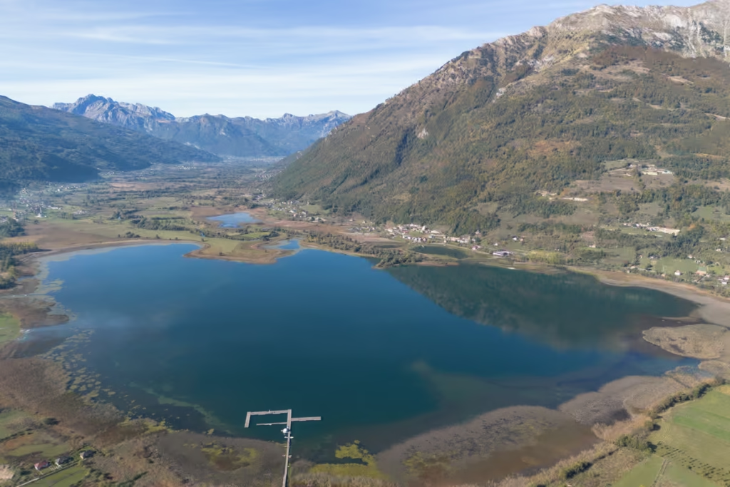
Plav is a smaller city set around a beautiful lake, encircled by mountains. We had opted to book the Ema Guesthouse which is set just a short walk from the lake.
We arrived at Plav by a furgon from Pejё in the late afternoon, giving us enough time to walk to the guesthouse, drop off our backpacks, and get the last bit of sun over the lake.
Plav has a scattering of restaurants to choose from and supermarkets to pick up food to cook. We decided to grab dinner just up the road at Cafe & Restaurant Timm, where I grabbed a tavë which is a popular dish throughout this portion of the Balkans.
Day 8: Plav – Vusanje
- Distance: 15.9 kilometers
- Elevation gain: 142 meters
- Where to stay in Vusanje: Dedushi Guesthouse & Cabins
There are actually two routes from Plav to Vusanje, one along a tarmacked road that eventually turns off onto a dirt road the rest of the way, or along a trekking route.
As Bekah still wasn’t feeling 100%, we opted to walk to road to Vusanje.
Following the paved road out of Plav, we stayed along the southwestern shore of Plav Lake until the lake’s end and continued to the village of Gusinje.
In Gusinje, we stopped at a little convenience shop and had drinks and snacks before continuing onto a dirt road that bent to the south.
The road passes villages and pastures along the way, finally bringing us to our stop at the Dedushi Guesthouse & Cabins where we would be staying the next two nights to allow for a day trip to Buni Jezerce.
Day 9: Vusanje – Buni Jezerce – Vusanje
- Distance: 22 kilometers
- Elevation gain: 1677 meters
- Where to stay in Vusanje: Dedushi Guesthouse & Cabins
The day trip from Vusanje to Buni Jezerce is a long one but well worth the effort. In my opinion, I thought Buni Jezerce was the most beautiful part of the Accursed Mountains and our Peaks of the Balkans hike.
For those that want to shorten their trekking day, it’s possible to find a driver with a 4WD in Vusanje to take you as far as Katun Zastan, greatly reducing your trekking distance (8 kilometers shorter one way, 16 kilometers shorter round trip).
Note that there is a national park booth you’ll pass along the road where you’ll need to pay a 3€ fee for national park entry. Another thing to note is that you cross the border from Montenegro into Albania just before you reach Buni Jezerce.
Check out my other post to read the full route description for the Buni Jezerce day hike from Vusanje.
Day 10: Vusanje – Theth
- Distance: 21.35 kilometers
- Elevation gain: 1110 meters
- Where to stay in Theth: Guesthouse Rrashkadoli
The trail from Vusanje to Theth starts from Grla Waterfall. From the waterfall, follow a dirt road, turning left at the first fork. Walk about one kilometer until you find the Eye of the Grasshopper marked by a trail sign on the right. You’ll then descend to see the spring.
Continue on the gravel road for roughly 4 kilometers through the valley, where you’ll pass Lake Ropojan (although it may be dry later in the season). Past the lake to reach a border stone marking the Montenegro-Albania border.
The trail then ascends through a forest to reach the meadows of Runica, surrounded by mountains. Beyond Runica, make the final push up into 1707 meter Pejes Pass.
The trail descends 1000 meters into Theth. Do exercise caution on the steep descent, especially if it’s raining or snowing as the path can be super slippery.
Have any questions about the Peaks of the Balkans Hike?
Ask in the comments section below.