Abudelauri Lakes, Georgia: Hiking Guide to the Colorful Lakes
Updated September 2026, Abudelauri Lakes, Georgia: Hiking Guide to the Colorful Lakes was originally published in December 2023
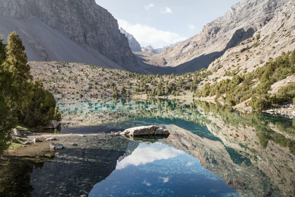
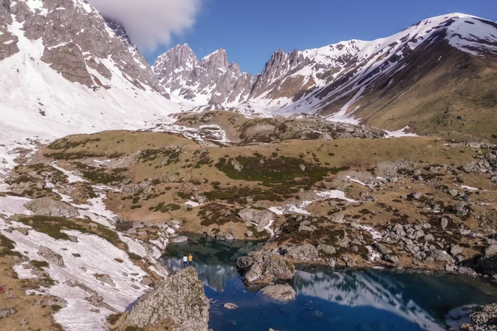
Abudelauri Lakes are three colorful alpine lakes in Georgia’s remote Khevsureti region, tucked beneath the jagged Chaukhi Massif. The three lakes, known as Blue Lake, Green Lake, and White Lake, sit at roughly 2,600 to 2,800 meters above sea level and are one of the most unusual hiking destinations in the Georgian Caucasus.
I first discovered Abudelauri Lakes while poking around satellite maps for lesser-known places to explore in Georgia. At the time, there wasn’t much practical information about hiking to the lakes, so I decided to figure out the route myself.
Today, there are two main ways to hike to Abudelauri Lakes: the shorter route from Roshka and the more challenging Juta to Roshka trek over Chaukhi Pass. The Roshka route is the easiest option for seeing the lakes, while the Juta route is a much bigger mountain trek that combines the lakes with the Chaukhi Massif and a 3,340-meter pass.
In this guide, I’ll cover how to get to Abudelauri Lakes, the best hiking routes, trail distances and elevation gain, the best time to visit, what to pack, and what to know before you go.
Need Travel Insurance and Evacuation Services?
Start shopping for travel insurance plans over at IATI Insurance. Readers of the Adventures of Nicole get a 5% discount off your plan.
The Adventures of Nicole partners with Global Rescue to offer the world’s leading medical evacuation and security advisory services. To travel with peace of mind, explore their evacuation coverage.
Abudelauri Lakes Hiking Quick Facts
| Where are Abudelauri Lakes? | Khevsureti, northern Georgia |
| Nearest village | Roshka |
| Number of lakes | Three: Blue, Green and White |
| Lake elevation | Approximately 2,600–2,800 m |
| Best time to visit | June-July |
| Easiest route | Roshka to Abudelauri Lakes |
| Long-distance route | Juta → Chaukhi Pass → Abudelauri Lakes → Roshka |
| Difficulty | Easy to moderate from Roshka; challenging over Chaukhi Pass |
| Day trip possible? | Yes, from Roshka |
| Camping | Possible near the lakes |
Abudelauri Lakes: The Three Colorful Lakes
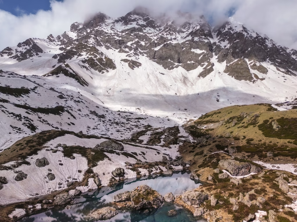
Abudelauri Lakes are a group of three alpine lakes in Khevsureti, Georgia: Blue Lake, Green Lake, and White Lake. They sit beneath the Chaukhi Massif in the Greater Caucasus at elevations of roughly 2,600 to 2,800 meters.
What makes Abudelauri Lakes particularly unusual is that each lake has a distinctly different appearance. Blue Lake and Green Lake sit relatively close together, while White Lake is farther away beneath the Chaukhi Glacier.
The colors aren’t just a trick of the light. White Lake gets its milky appearance from carbonate-rich water, while glacial sediments contribute to the blue and green hues of the other lakes.
The landscape around the lakes is classic high Caucasus terrain, with broad alpine valleys, rocky slopes, glacial features, and the dramatic peaks of the Chaukhi Massif looming nearby.
Where are the Abudelauri Lakes?
Abudelauri Lakes are located in Khevsureti, a mountainous region of northern Georgia, within the Mtskheta-Mtianeti area. The lakes sit beneath the Chaukhi Massif, with the remote village of Roshka providing the easiest access.
The closest major tourist base is Stepantsminda (Kazbegi), while Tbilisi is the main starting point for travelers arriving from Georgia’s capital.
There are two principal hiking approaches. The shorter route starts near Roshka and is the easiest way to visit all three Abudelauri Lakes. The more demanding route begins in Juta, crosses Chaukhi Pass, and descends toward the lakes before continuing to Roshka.
Best Time to Visit Abudelauri Lakes
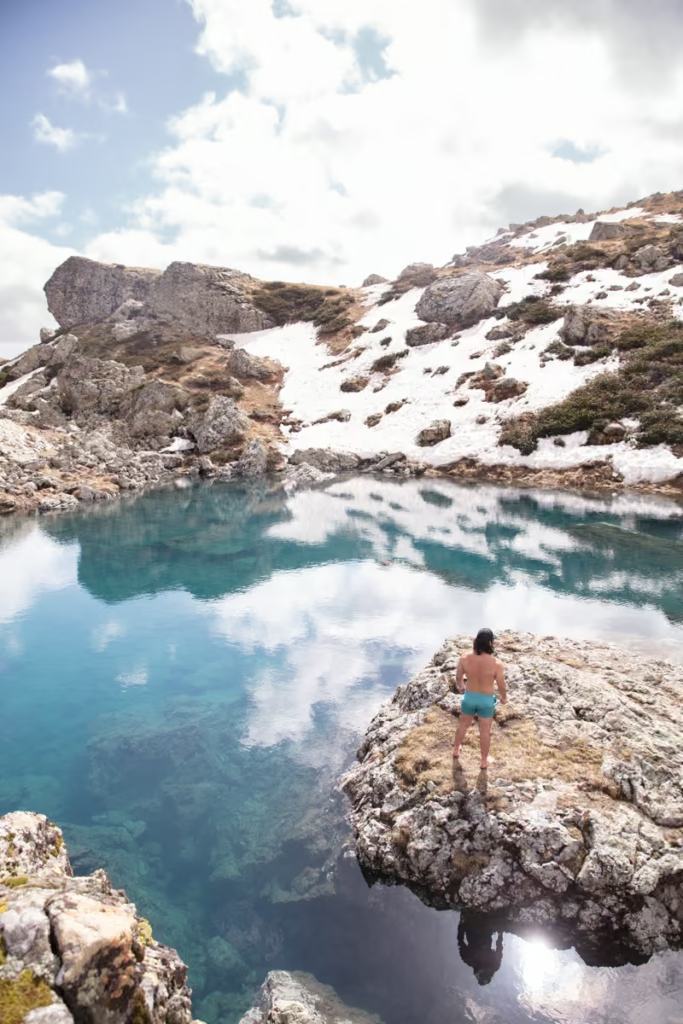
The best time to hike to Abudelauri Lakes is June and July, when the trails are generally accessible, the surrounding valleys are green, and the lakes tend to have their best water levels. Georgia Travel also recommends June and July for the Abudelauri Lakes and Juta-Chaukhi Pass routes.
June: Early June can still feel like winter at 2,600–2,800 meters. Snow can linger around the higher sections of the trail, and the vegetation may not yet be fully green. This was my experience when I visited in early June.
July: This is my pick for the best overall conditions. The alpine landscape is greener, wildflowers are out, and the lakes are generally at good water levels.
August: You can still hike to Abudelauri Lakes, but water levels can be significantly lower later in the summer, particularly during hot, dry periods.
September: Hiking can still be possible in early September, but conditions become increasingly unpredictable as autumn approaches. Snow and colder weather can arrive quickly at high elevations.
If seeing the lakes at their most colorful and full is your priority, I’d aim for late June through July.
Abudelauri Lakes Hiking Routes
There are two main hiking routes to Abudelauri Lakes:
- Roshka to Abudelauri Lakes: The easiest and shortest option for visiting the lakes.
- Juta to Roshka via Chaukhi Pass: A much longer mountain trek that crosses Chaukhi Pass and visits Abudelauri Lakes along the way.
You can also hike from Juta to Abudelauri Lakes and return to Juta, although this is substantially longer than approaching from Roshka.
If your only goal is to see Abudelauri Lakes, hike from Roshka. If you want a proper multi-day Caucasus trek, take the Juta-Chaukhi Pass-Roshka route.
Roshka to Abudelauri Lakes
Distance: 3.4 km one way | 6.8 km return (to Roshka)
Time: 1 day
Elevation gain/loss: 240 m
The Roshka route is the easiest way to hike to Abudelauri Lakes and the option I’d recommend if your main goal is to see the three lakes without crossing a high mountain pass.
The trail starts near the end of Roshka and follows the valley toward the Chaukhi Massif. The exact distance varies depending on your starting point and which of the lakes you visit, but expect roughly 10 km for a full loop and around 500 meters of elevation gain on the newer Roshka route. Current hiking routes also vary depending on whether White Lake is included.
The trail climbs gradually through a broad mountain valley before reaching the lakes beneath the Chaukhi Massif. Blue and Green Lakes are relatively close together, while White Lake sits farther away and requires an additional rocky section of trail.
Allow around 4–6 hours for the hike, depending on your route, pace, stops, and how long you spend at each lake.
The Roshka route is not technically difficult, but this is still a high-altitude mountain hike. Weather can change quickly, and the trail can become muddy or rocky after rain.elauri Green and Abudelauri White Lake before continuing back the same way you came to Roshka.
Roshka Route Stats
| Difficulty | Easy to moderate |
| Distance | Roughly 10 km for the newer loop |
| Elevation gain | Around 500 m |
| Time | Around 4–6 hours |
| Highest point | Around 2,800 m |
| Start | Roshka |
| Best for | First-time visitors and day hikers |
Route distances vary between GPS tracks because several approaches and loops now exist around Roshka. Check your current GPS track before setting out rather than relying solely on an old distance listed online.
Juta to Roshka via Chaukhi Pass and Abudelauri Lakes
Distance: 14.7 km
Time: 1-2 days
Elevation gain/loss: +1007 m | -1203 m
The Juta to Roshka trek is the more challenging way to visit Abudelauri Lakes. Rather than simply hiking to the lakes and returning, this route crosses 3,340-meter Chaukhi Pass and connects the Kazbegi area with Khevsureti.
The trek is usually completed in one or two days, with two days being the more comfortable option if you’re camping near Abudelauri Lakes. June and July are the best months recommended for the crossing.
The route combines several of the best landscapes in this part of Georgia: Juta Valley, the jagged Chaukhi Massif, high alpine terrain, Chaukhi Pass, and the three Abudelauri Lakes.
Follow the signs to Zeta Camp and walk beyond Fifth Season (these, as well as the Juta Guesthouse, are also great places to spend the night before taking off!). Here you will have lovely views of Chaukhi Massif.
The path continues past several campsites. After about 45 minutes to an hour beyond Fifth Season, you will need to cross a river near a waterfall.
Beyond the river crossing, you will reach an A-frame building and then continue uphill (requiring two more river crossings) to reach Upper Juta Valley, a popular shepherding area.
Make sure to fill up on water in the Upper Juta Valley as there is no more water until Abudelauri Lakes.
The final stretch into the pass should take about one hour to make the steep walk to reach 3341 meter Chaukhi Pass.
The descent from Chaukhi Pass is one of the trickiest sections of the hike. The terrain is steep and loose, with shale and scree underfoot. A newer trail line heads farther east and descends more gradually along the ridge, while the older route drops more directly through loose scree. The newer line is generally easier on the knees, but neither option should be treated casually.
Trekking poles are particularly useful here, and I’d take your time rather than trying to bomb downhill just because the elevation profile is finally pointing in the right direction.
Expect the descent from Chaukhi Pass to Abudelauri Lakes to take about two and a half to three hours.
The following morning, follow the route down from the Abudelauri Lakes staying to the left side of a wide verdant valley.
The final section of the trek is short uphill to reach an information board for the hike on the dirt road to Roshka.
Note that for those a bit quicker, it’s possible to do this route in a single long day from Juta to Roshka.
Juta to Abudelauri Lakes via Chaukhi Pass
Distance: 11.4 km one way | 22.8 km return (to Juta)
Time: 2 days
Elevation gain: 1203 m
Follow the instructions mentioned above about the one-way hike from Juta to Roshka. After a night camping at Abudelauri Lakes, make your way back to Juta to wrap up your trek.
The Three Abudelauri Lakes
Abudelauri Blue Lake
Blue Lake is one of the two lower Abudelauri Lakes and sits along the main route from Roshka. Its deep blue color comes from glacial water and sediment, with the surrounding Chaukhi peaks making an especially dramatic backdrop.
Abudelauri Green Lake
Green Lake sits close to Blue Lake and gets its distinctive greenish color from glacial sediments and the way light interacts with the water. The two lakes can easily be visited together on the Roshka hike.
Abudelauri White Lake
White Lake is the highest and most distinctive of the three Abudelauri Lakes, sitting at roughly 2,800 meters beneath the Chaukhi Massif. Its milky appearance comes from carbonate-rich water.
White Lake also requires a little more effort to reach because it sits farther from the main route. If you have the time and conditions are good, I think it’s worth adding.
Camping at Abudelauri Lakes
Camping is possible near Abudelauri Lakes, making the Juta-to-Roshka route particularly appealing as a two-day trek. There are established camping areas around the lakes, although conditions and facilities can change from season to season.
If you’re camping, bring a tent, sleeping bag suitable for cold mountain nights, sleeping pad, stove if needed, and enough food for the duration of your trek.
There is also a mountain hut near the lakes, but don’t plan your entire trek around being able to use it. Recent trail reports indicate that facilities and operations have been limited, so an independent camping setup is the safer assumption.
How to get to Roshka
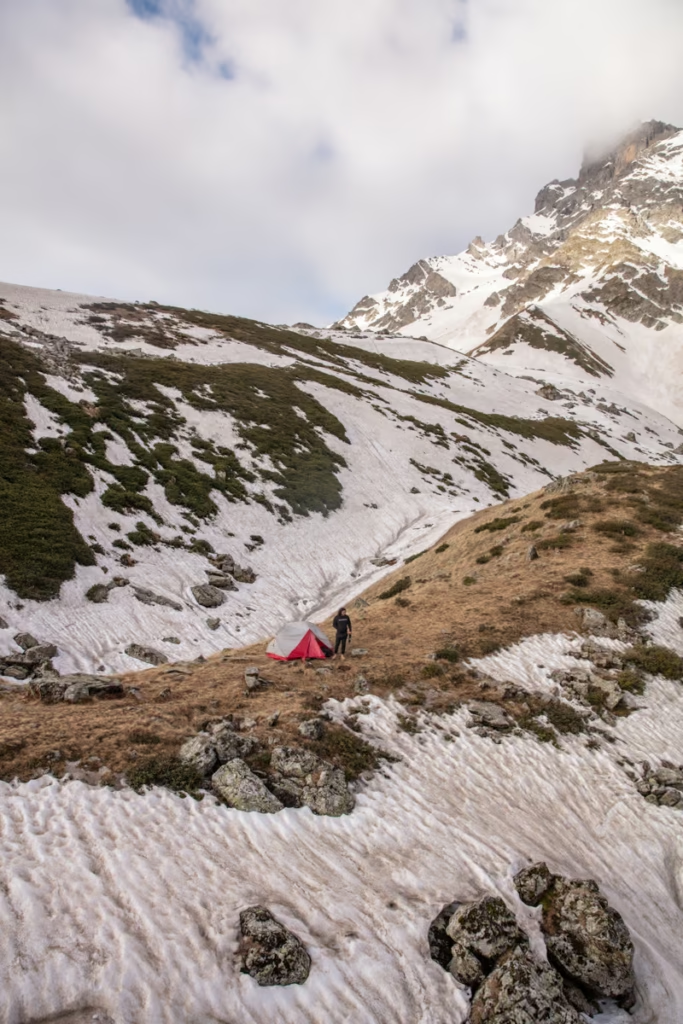
How to Get to Roshka
Roshka is remote, and reaching the trailhead is considerably more complicated than reaching Juta. The final approach is on an unpaved mountain road, so a high-clearance vehicle or 4WD is recommended, particularly after rain. The final road into Roshka as rough and unsuitable for ordinary low-clearance cars.
From Tbilisi, the usual route heads north through Zhinvali and Barisakho before continuing toward Roshka.
Public transportation options are limited, so if you aren’t driving, your easiest option is generally to arrange a 4WD transfer, private driver, or organized day hike rather than trying to piece together public transportation on the day. There are infrequent marshrutka from Tbilisi to Barishako. From Barishako, you can usually arrange a ride to Roshka for about 70 GEL
How to Get to Juta
Juta is the starting point for the Chaukhi Pass route to Abudelauri Lakes. The village sits at the end of a mountain road branching from the Georgian Military Highway near Snostskali Valley .
The easiest way to reach Juta is by private vehicle, rental car, taxi, or organized tour. If you’re staying in Stepantsminda, you can also arrange transportation from there.
Mountain Freaks operates a seasonal bus between Kazbegi and Juta, which can be useful if you’re hiking independently. Check the current departure times before your trip because mountain transport schedules can change but as of last update, the bus left at 09:15 am from Kazbegi (it returns from Juta at 16:30 pm daily) for 45 GEL.
Which Abudelauri Lakes Hike Is Best?
For most travelers, I recommend hiking to Abudelauri Lakes from Roshka. It’s the easiest route, can be completed as a day hike, and gives you access to all three lakes without having to cross a 3,340-meter mountain pass.
Choose Roshka if:
- You primarily want to see the three lakes
- You have one day
- You don’t want to cross Chaukhi Pass
- You’re a relatively inexperienced mountain hiker
Choose Juta to Roshka if:
- You want a proper Caucasus trekking experience
- You want to hike beneath the Chaukhi Massif
- You’re comfortable with steep, rocky terrain
- You have one or two days
- You want to combine Chaukhi Pass and Abudelauri Lakes in one trek
If I were choosing based purely on the lakes, I’d go from Roshka. If I were choosing based on the overall adventure, I’d take the Juta-to-Roshka route.
Is the Abudelauri Lakes Hike Difficult?
The Roshka route to Abudelauri Lakes is generally easy to moderate, while the Juta-to-Roshka route over Chaukhi Pass is considerably more demanding.
The biggest factors aren’t technical climbing but rather altitude, weather, river crossings, steep terrain, and loose rock. The Chaukhi Pass route reaches around 3,340 meters and has a steep descent on loose terrain.
Weather can change quickly in the Caucasus, so check the forecast before setting out and be prepared to turn around if conditions deteriorate.
If you’re hiking independently, download your maps before leaving. Cell service can be limited or nonexistent in the mountains.
Have any questions about the hike to Abudelauri Lakes?
Ask in the comments section below.
Posts from Georgia
Uplistsikhe Travel Guide: How to Visit
Tbilisi Metro: A Complete Guide
Georgia-Armenia Border Crossing Guide
Tbilisi’s Soviet Bunkers
Abudelauri Lakes, Georgia: Hike Guide
Exploring the Wine Regions of Georgia

Ultimate Guide to Georgian Food & Cuisine
Pankisi Valley Travel Guide
How to get from Telavi to Pankisi Valley, Georgia
Tbilisi Travel Guide
8 Unique & Cheap Places To Travel In Summer 2026
Georgian Wine: Georgia Uncorked
The Best SIM Cards & eSIMs for Georgia
Visiting the Rkoni Bridges, Georgia
Best Road Trips in the World