Bentonite Hills Guide, Utah: Explore Mars-Like Landscapes & MDRS
Updated September 2026, Visiting the Bentonite Hills in Utah, a Rainbow Mars was originally published in June 2023
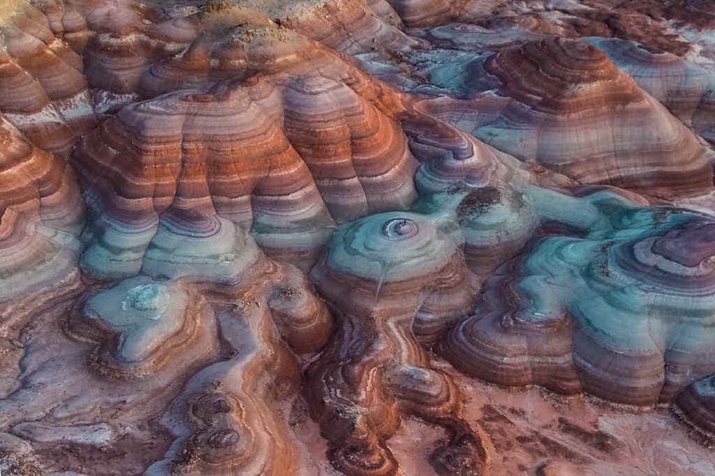
The Bentonite Hills are one of Utah’s strangest landscapes, with bands of red, purple, gray, green, and brown clay forming smooth, rolling hills that look almost otherworldly. Located near Capitol Reef National Park in Southern Utah, the Bentonite Hills are a popular stop for photographers and road trippers exploring the Cathedral Valley area.
But getting here isn’t quite as simple as plugging the destination into Google Maps and driving up in a rental car. Road conditions can change quickly, the clay becomes extremely slick when wet, and some routes require a high-clearance vehicle. Here’s everything you need to know about visiting the Bentonite Hills, including where they are, how to get there, the best time to visit, what vehicle you need, and what else to see nearby.
\After having relocated from Alaska to Colorado and then a few months later to Utah they were on the top of my list in the new state I decided to set up camp in.
I had just returned from running a Socotra Island Expedition and had some free time which I decided to use to visit my parents down in Nevada as they had moved from Alaska to the desert.
Naturally, the Bentonite Hills instantly were put on my drive itinerary from Salt Lake City to Vegas, albeit a bit of a detour from the most direct route down the I-15.
My parents spent a couple of years living in Southern Utah, so I’m no stranger to the alien landscapes the state is riddled with, so I was honestly a little surprised when I found out about the Bentonite Hills from some friends who had visited themselves as it’s not too far from Goblin Valley, which I had visited back about 10 years ago.
So if you’re planning your own visit to the Bentonite Hills or are putting together a Utah road trip itinerary that might be including a journey along Highway 24 to Capitol Reef National Park to the west or Goblin Valley to the east, you’re in the right place.
In this guide, you’ll find everything you need to know before you set out to visit the Bentonite Hills and tips to get the best photographs of them.
Need Travel Insurance and Evacuation Services?
Start shopping for travel insurance plans over at IATI Insurance. Readers of the Adventures of Nicole get a 5% discount off your plan.
The Adventures of Nicole partners with Global Rescue to offer the world’s leading medical evacuation and security advisory services. To travel with peace of mind, explore their evacuation coverage.
- The Closest Thing to Mars on Earth: The Bentonite Hills
- The Funky Geology of the Bentonite Hills
- Mars on Earth: The Mars Desert Research Station
- Why Are the Bentonite Hills So Colorful?
- Where Are the Bentonite Hills?
- Bentonite Hills Map
- How to get to the Rainbowy Mountains of Bentonite Hills, Utah
- Do you Need a 4WD to Visit the Bentonite Hills?
- Best Time to Visit the Bentonite Hills
- How Long Do You Need at the Bentonite Hills?
- Things to Do at the Bentonite Hills
- How to get the Best Photos of the Bentonite Hills
- Hiking in the Bentonite Hills
- Other Places to Visit Near the Bentonite Hills
- Where to Stay & Camp Near the Bentonite Hills
- Add the Bentonite Hills to your Utah Highway 24 Road Trip
The Closest Thing to Mars on Earth: The Bentonite Hills
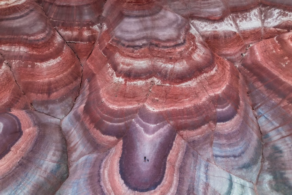
Interestingly, the Bentonite Hills are one of the handful of places on Earth that are almost exactly similar to Mars from a landscape and climate perspective. (Fun fact: another Mars-like place I’ve been is the McMurdo Dry Valleys in Antarctica).
Because of this, a portion of the Bentonite Hills is home to the Mars Desert Research Station (MDRS).
The Funky Geology of the Bentonite Hills
According to the National Parks Service, the Bentonite Hills date back over 140 million years to the Jurassic Period.
Bentonite is a type of clay that forms when volcanic ash meets seawater in most cases but sometimes in freshwater and swampy areas too.
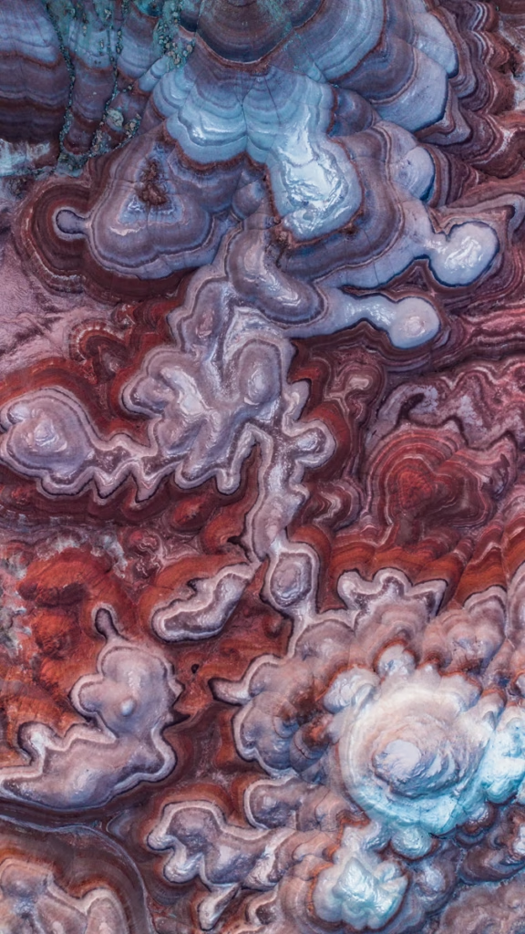
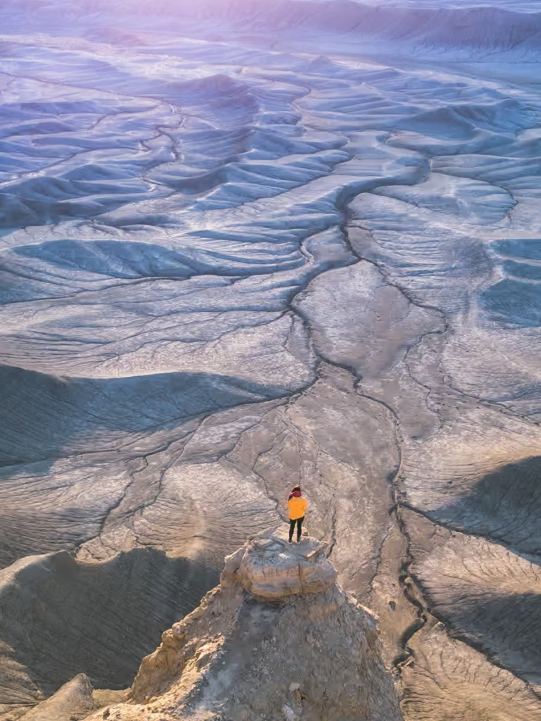
The surface of the Bentonite Hills is often described as popcorn-like (it did remind me of the now-generally-hated popcorn ceiling texture).
The bentonite clay that forms these hills gets this popcorn appearance from the bentonite clay absorbing rainwater and drying out over and over again.
Mars on Earth: The Mars Desert Research Station
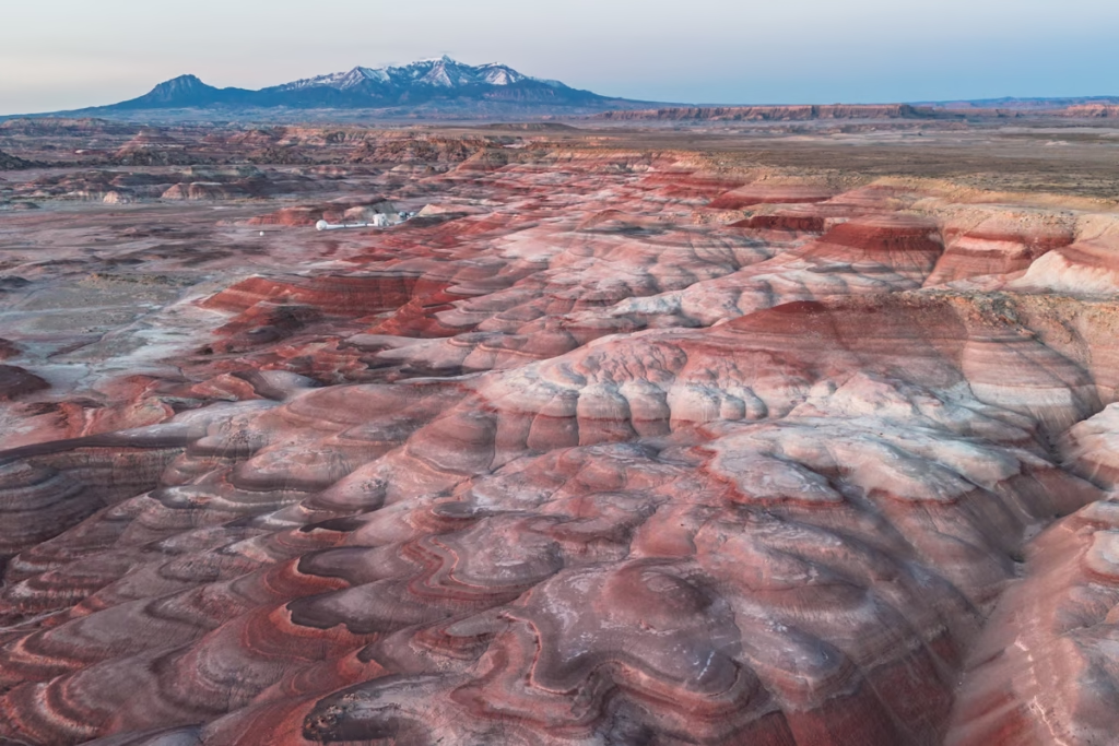
The Mars Desert Research Research Station (MDRS) is a research facility used to prepare for human exploration of Mars. The Bentonite Hills were chosen for the MDRS location because of their likeness to the surface of Mars.
Different gear such as spacesuits and tools are tested out here at the MDRS.
Scientists also use the station to develop different field tactics that will be necessary for humans to explore the surface of Mars.
The MDRS is one of three simulated Mars analog habitats in the entire world.
If you’re wondering where the others are located, they can be found in Nunavut Province, Canada, and next to the Krafla Rift Volcano, Iceland.
A fourth is in the planning stages and is slated to be located in Australia near the Arkaroola Sanctuary about 320 miles from Adelaide.
Why Are the Bentonite Hills So Colorful?
The unusual colors of the Bentonite Hills come from the a layer of sedimentary rock deposited during the Jurassic Period. The sediments include mud, silt, fine sand, and volcanic ash that accumulated in ancient swamps and lakes.
The different colors reflect the conditions in which those sediments were deposited.
Red, reddish-orange, reddish-brown, and purple layers contain iron oxide, particularly the mineral hematite. These colors indicate sediments that were exposed to oxygen-rich conditions, such as ancient rivers, floodplains, and shallow lakes.
Green, gray, and grayish-white layers formed under lower-oxygen conditions, including deeper lakes or environments where sediments were in contact with groundwater.
The result is the striped, softly rounded landscape that makes the Bentonite Hills look almost extraterrestrial. The “Mars” comparison isn’t entirely random, either. It’s just that, unlike Mars, you can actually drive here without needing NASA to approve your mission.
Where Are the Bentonite Hills?
The Bentonite Hills are in southern Utah, near Capitol Reef National Park and the small town of Hanksville. The colorful clay hills sit outside Capitol Reef National Park on Bureau of Land Management (BLM) land.
The official Bentonite Hills location is accessed via South Cow Dung Road, which branches from Utah State Route 24 east of the Capitol Reef area. The Bentonite Hills are located approximately at 38.412250, -110.785944.
If you’re coming from Hanksville, you’ll reach the area by heading west along Highway 24. From the Capitol Reef side, South Cow Dung Road provides access to the Bentonite Hills.
Bentonite Hills Map
Bentonite Hills coordinates: 38.412250, -110.785944
Nearest town: Hanksville, Utah
Main paved road: Utah State Route 24
Access road: South Cow Dung Road
Nearby area: Cathedral Valley
Nearest national park: Capitol Reef National Park
Tip: Download an offline map before heading into this area Cell service can be poor or nonexistent.
How to get to the Rainbowy Mountains of Bentonite Hills, Utah
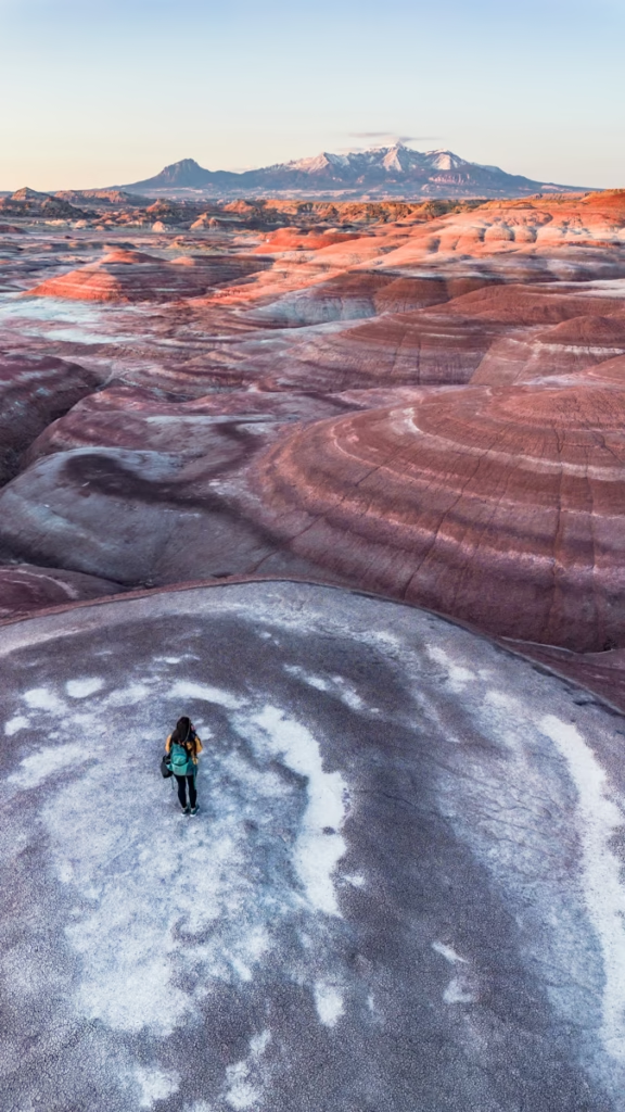
The Bentonite Hills are located a short detour from Utah’s Highway 24, east of Capitol Reef National Park and just a little west of the town of Hanksville.
Once you turn off Highway 24 it’s a rough dirt road the remaining 3 miles to the most colorful part of the Bentonite Hills.
I made it to the Bentonite Hills in my 2012 Kia Soul. The road was rocky in sections and had a couple of stretches with fairly large potholes but overall I had no problems reaching the Bentonite Hills.
Just take it slow and drive cautiously and should be fine.
Although, if it’s rained recently and the road is a mess I would consider walking part of the road as I could see it possibly becoming impassible under the right (ok, more like wrong) conditions.
Note: On Google Maps there is another area a few miles to the west that are referred to as the Bentonite Hills, this is accessed from Hartnet Road. These are not the Bentonite Hills I am referring to in this post.
Getting to the Bentonite Hills Step-by-Step
- From Highway 24 turn north onto South Cow Dung Road (I’m not kidding!). There is no street sign for S Cow Dung Road but this is the name labeled on Google Maps.
- Once you turn onto Cow Dung Road, drive another 3 miles to the turn-off to the Mars Desert Research Station (MDRS).
- Continue past the turn-off to MDRS, there are several great spots to pull off the main dirt road and park starting about 0.25 miles beyond the MDRS turn-off and further down. I parked about 0.50-0.75 miles beyond MDRS.
- Once you decide on a spot to park, continue the remaining way on foot. I followed what looked like a lightly trodden path that extended westward from Cow Dung Road to a crazy colorful section of the Bentonite Hills by chance but honestly, I think just about anywhere west of the road will be dripping with pigment.
From Salt Lake City
If you’ll be coming from Salt Lake City as I did, budget in a 3 hour 45 minute to 4 hour 30 minute drive depending on the time of day you depart and what part of Salt Lake City you’ll be coming from.
I live on the south side of Salt Lake and reached the Bentonite Hills in 3 hours 45 minutes, however, I did leave Salt Lake City at 2:00 am to hit blue hour just before sunrise.
- Take the I-15 south from SLC.
- From the I-15, take the exit for the US-6 E toward Price.
- After about 70 Miles on the US-6 E take the exit for the I-70 west toward Salina.
- Take exit 149 onto UT 24 E toward Hanksville.
- Turn north onto South Cow Dung Road.
From St. George (or Vegas)
From St. George, plan for a 4 hour 30 minute to 5 hour drive depending on traffic (plan for about 6 hours 30 minutes from Vegas).
- Take the I-15 N to exit 95 to get onto the UT-20 E.
- From the UT-20 E turn on to the US 89 N and then briefly onto the UT-62 E and Browns Lane to eventually reach the UT-24 E.
- From the UT-24 E turn north onto S Cow Dung Road.
From Moab
Moab is about 2 hours from the Bentonite Hills making it a closer base for exploring the rainbow domes unless you opt to stay in Hanksville or Goblin Valley.
- Take the US-191 N from Moab and after about 30 miles get on the I-70 W.
- From I-70, take exit 149 onto UT-24 E.
- Turn north onto S. Cow Dung Road.
Do you Need a 4WD to Visit the Bentonite Hills?
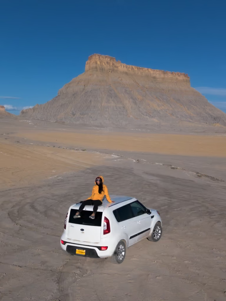
While the road into the Bentonite Hills and the Mars Desert Research Station is rough, you don’t need a 4WD vehicle to get here (most of the time anyway).
Maybe if it has been a long time since the road was graded or there have been recent heavy rains then I could see South Cow Dung Road possibly being impassible with a 2WD vehicle.
If you are comfortable driving on rough dirt tracks reaching the Bentonite Hills should be easy, just take it slow and drive cautiously.
Those who want to visit the ‘other Bentonite Hills’ on the Hartnet Road route should be treated as a backcountry road requiring a capable, high-clearance vehicle.
Is 4WD or High Clearance Required?
Not necessarily in dry conditions, but may be necessay if the road conditions degrade or it rained recently. High-clearance vehicles are not needed to get up South Cow Dung Road most of the time.
Can you visit in a 2WD car?
I had no problem getting up South Cow Dung Road to the Bentonite Hills on any of my visits to the area. As mentioned before, it may not be possible in a 2WD if it has rained recently, so do take that into consideration.
Can you Visit in a Rental Car?
Only if your rental vehicle is specifically appropriate for the road and the rental agreement allows travel on unpaved backcountry roads.
What Happens When it Rains at the Bentonite Hills?
This is the big one. Bentonite clay absorbs water and becomes extremely slick and gummy, and roads through the Bentonite Hills can quickly become impassable. Even a capable four-wheel-drive vehicle isn’t a guarantee of getting through after significant rain.
Best Time to Visit the Bentonite Hills
The best time to visit the Bentonite Hills is during the spring or fall, when temperatures are generally more comfortable for exploring southern Utah’s exposed desert landscapes.
Best Season
Spring and fall offer the best balance of comfortable temperatures and generally favorable conditions. Summer can be brutally hot, with temperatures in Cathedral Valley reaching the upper 90s°F, while winter can bring freezing temperatures, snow, and difficult road conditions.
Best Time of Day
For photography, aim for early morning or late afternoon around sunrise and sunset. Lower-angle sunlight brings out the contrasting bands of red, purple, gray, green, and brown in the hills and gives the rounded formations more texture.
Midday works for seeing the landscape, but the harsh overhead light can flatten the colors and leave you squinting at your camera screen like you’ve personally offended the sun.
Best Weather Conditions
Dry weather is essential. Check the forecast before leaving and avoid the area if significant rain is expected.
While wet clay can sometimes make the colors appear more saturated in photographs, that is absolutely not a reason to visit immediately after a storm. The same water that intensifies the colors can turn the roads into impassable clay.
How Long Do You Need at the Bentonite Hills?
You can see the main Bentonite Hills area in about 30 minutes, but I’d allow 1-2 hours if you want time to photograph the landscape, explore the surrounding area on foot, and wait for better light.
Things to Do at the Bentonite Hills
The Bentonite Hills aren’t a traditional hiking destination. There are no established trails through the Bentonite Hills, and the fragile clay surface can be damaged by footprints and tire tracks. It is recommended to limit foot travel to firm, previously disturbed areas and wash bottoms.
Photograph the Colorful Hills
Photography is the main attraction. The alternating bands of red, purple, gray, green, brown, and orange create some of southern Utah’s most unusual landscapes, particularly around sunrise and sunset.
Explore the Surrounding Badlands
You can explore the landscape on foot, but stick to firm, previously disturbed areas and designated routes rather than wandering across the fragile clay formations.
Watch Sunrise or Sunset
The low-angle light around sunrise and sunset brings out the colors and contours of the hills. If you’re visiting specifically for photography, this is when I’d want to be here.
Combine the Visit With Cathedral Valley
The Bentonite Hills can make a great addition as part of a larger Cathedral Valley road trip. The route includes overlooks, sandstone formations, the Gypsum Sinkhole, the Temples of the Sun and Moon, and other geological features.
Just remember that this is remote backcountry. Bring plenty of water, food, fuel, emergency supplies, and a reliable map. Cell service can be poor or nonexistent.
How to get the Best Photos of the Bentonite Hills
In the broad sun of midday, I’ll be honest, the Bentonite Hills just aren’t that striking.
And truth be told, I thought all the photos I had seen online and on Instagram were heavily photoshopped- that is until I reached the Bentonite Hills and experienced blue hour there.
Yes- they really are wildly colorful.
The Beauty of Blue Hour at the Bentonite Hills (Yes, your Photos will be more Colorful)
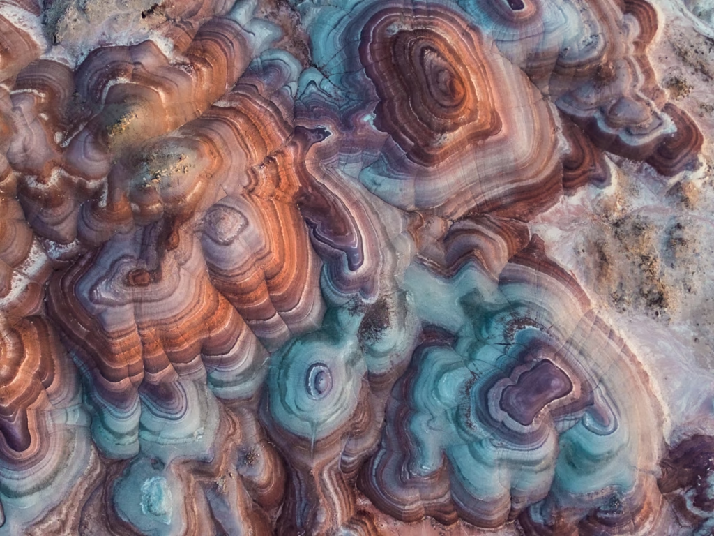
Blue hour, that time in the morning about 30 minutes before the sun peeks over the horizon, and that last 30 minutes in the late afternoon just before the sun dips below it is the best time to photograph the Bentonite Hills.
During blue hour, the stripes of blue, green, and purple really do come out, making photos extra dramatic.
But Golden Hour at Bentonite Hills is Still Pretty Cool too
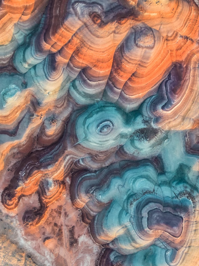
Continuing (or starting if at sunset) to shoot into golden hour will almost inevitably happen while you’re out here exploring the Bentonite Hills.
The golden rays of the sun will give the photos a warmer feel, but once the sun is high up and golden hour is over (or it’s before golden hour), your photos will start to look a bit flat.
Droning the Bentonite Hills for an Epic Perspective
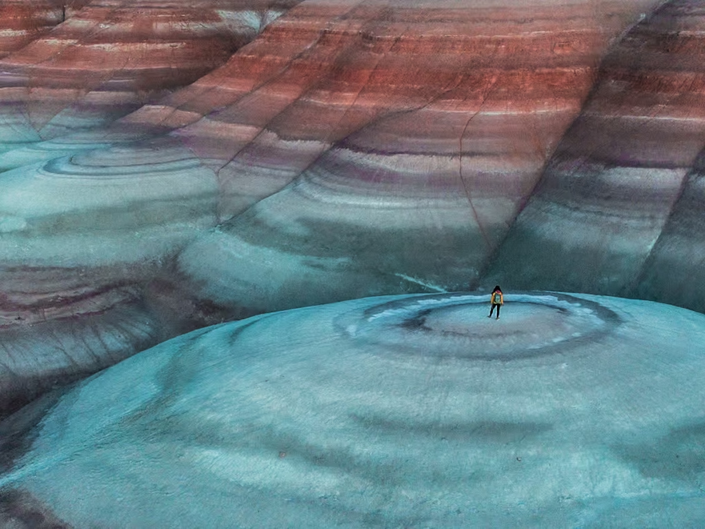
While you can still get some stunning shots with your phone or your camera, a drone will get you the best shots of the Bentonite Hills.
Aerial views give some wild perspective to the Bentonite Hills that you just won’t get otherwise (unless maybe you flew over low in a plane).
Note that drones are allowed here at Bentonite Hills, though they are not allowed on the MDRS research area, you will see a sign along the dirt road demarcating that it is designated research land and that drones are not allowed and you will pass another stating that you are now leaving the MDRS research area. So just make sure you’re out of this area, pretty simple.
Using ND Filters to get Great Photos of the Bentonite Hills in the Harsh Midday Sun
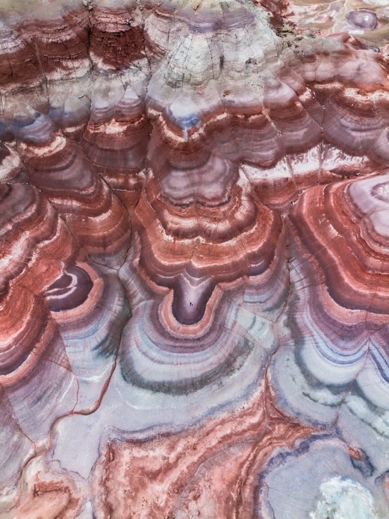
Shot in the afternoon with an ND16 filter on my drone
Couldn’t time it to get here for blue hour or just couldn’t roll out of bed before the crack of dawn? ND filters are your best friend here.
Neutral density (ND) filters will modify the amount of light being let into your camera or drone. An ND filter will make the striped colors pop at the Bentonite Hills if you end up finding yourself photographing or droning in the midday sun.
Hiking in the Bentonite Hills
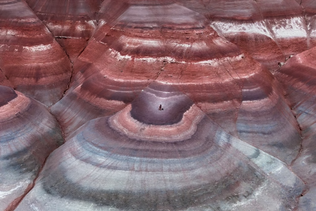
While it is possible to hike around in the Bentonite Hills, they are quite fragile, and care should be taken to try and limit damage to their clay surface.
The hills are named after the type of clay they are comprised of- bentonite.
So if you do want to hike around the Bentonite Hills, make sure to stick to already established paths/previously disturbed areas (note that there are no official trails here, but you will find some commonly used footpaths, the wide washes between the “ranges” of hills, and the narrow washes leading up between hills.
When walking on the indented washes between the hills, do be careful as there are some holes where the clay deposit must have been hollow underneath.
If visiting during blue hour make sure to have a headlamp or torch handy to help you spot these if descending back to your vehicle in the dark.
Other Places to Visit Near the Bentonite Hills
- Cathedral Valley
- Capitol Reef National Park
- Goblin Valley
- Factory Butte
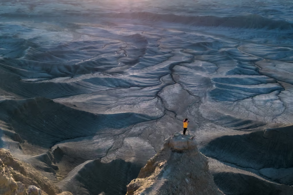
- Moonscape Overlook
- Long Dong Silver
- Little Egypt
- Hanksville
- Torrey
Where to Stay & Camp Near the Bentonite Hills
You can camp near the Bentonite Hills just off the road- this is what I did.
Do note that there are no facilities here whatsoever, it is BLM land but it isn’t an established campground or anything, so you’ll need to plan to pack everything out with you and plan for the fact that there are no toilets.
Beyond the Bentonite Hills, along Highway 24 there are a range of places to camp on BLM or state park lands in established campgrounds (many of these come with a fee).
If you’re looking for a hotel to stay in Hanksville, the only place I could find was the Whispering Sands Motel. Otherwise, you can opt to stay in a lodge or resort over in Torrey on the other side of Capitol Reef National Park.
Bentonite Hills FAQ
Are the Bentonite Hills in Capitol Reef National Park?
No. The official Bentonite Hills are outside the Capitol Reef National Park boundary on BLM land.
Is there a trail at the Bentonite Hills?
No. There are no established trails through the Bentonite Hills. Stay on designated roads and limit walking to firm, previously disturbed areas to avoid damaging the fragile clay formations.
Are the Bentonite Hills the same as the Mars Desert Research Station?
Yes and no. The colorful bentonite formations along Cow Dung Road run along side the Mars Desert Research Station.
The Mars Desert Research Station itself is a private research facility and is not open to visitors, although the public can view it from the designated area along Cow Dung Road.
Add the Bentonite Hills to your Utah Highway 24 Road Trip
The Bentonite Hills are one of those places in Utah that feel too strange to be real. Bands of red, purple, gray, green, and brown clay ripple across the landscape, creating a scene that looks more like another planet than the Utah desert. And while the colorful hills are certainly the main attraction, the journey to get there is part of what makes the experience memorable.
If you have your own vehicle and favorable conditions, I’d absolutely add the Bentonite Hills to a your Utah road trip. Even better, combine them with Moonscape Overlook, Long Dong Silver, Little Egypt, the Cathedral Valley Loop and other locations to give yourself a full day to explore the strange geological landscapes scattered across this remote corner of the region.
Utah has no shortage of famous landscapes, but some of my favorite places are the ones that require a little more effort to reach. The Bentonite Hills fall firmly into that category. They’re colorful, unusual, wonderfully remote, and a reminder that you don’t always need to follow the most famous road in Utah to find something worth pulling over for.
Have any questions about Visiting the Bentonite Hills?
Ask any questions you have about the Bentonite Hills in the comments sections below.
Posts from Utah
Moonscape Overlook Guide, Utah
Bentonite Hills Guide, Utah
Utah Highway 24 Road Trip Guide
Pink Waters at Stansbury Island, Utah
Utah’s Pink Lake at Spiral Jetty
Long Dong Silver, Utah
Two Week American Southwest Road Trip
Wind Cave Hike in Logan Canyon, Utah
Fifth Water Hot Springs, Utah: A Hike to Scenic Pools
Visiting the Bonneville Salt Flats, Utah
Visiting Goblin Valley, Utah
7 Day Southern Utah Road Trip Itinerary
Little Egypt Geological Area, Utah
Antelope Island State Park Near Salt Lake City
Factory Butte, Utah