
Visiting the Bentonite Hills in Utah, a Rainbow Mars
Updated March 2024, Visiting the Bentonite Hills in Utah, a Rainbow Mars was originally published in June 2023
The Bentonite Hills are a strange and colorful clay formation situated in Utah. After having relocated from Alaska to Colorado and then a few months later to Utah they were on the top of my list in the new state I decided to set up camp in.
I had just returned from running a Socotra Island Expedition and had some free time which I decided to use to visit my parents down in Nevada as they had moved from Alaska to the desert.
Naturally, the Bentonite Hills instantly were put on my drive itinerary from Salt Lake City to Vegas, albeit a bit of a detour from the most direct route down the I-15.
My parents spent a couple of years living in Southern Utah, so I’m no stranger to the alien landscapes the state is riddled with, so I was honestly a little surprised when I found out about the Bentonite Hills from some friends who had visited themselves as it’s not too far from Goblin Valley, which I had visited back about 10 years ago.
So if you’re planning your own visit to the Bentonite Hills or are putting together a Utah road trip itinerary that might be including a journey along Highway 24 to Capitol Reef National Park to the west or Goblin Valley to the east, you’re in the right place.
In this guide, you’ll find everything you need to know before you set out to visit the Bentonite Hills and tips to get the best photographs of them.
Need Travel Insurance and Evacuation Services for Utah?
Start shopping for travel insurance plans over at IATI Insurance. Readers of the Adventures of Nicole get a 5% discount off your plan.
The Adventures of Nicole partners with Global Rescue to offer the world’s leading medical evacuation and security advisory services. To travel with peace of mind, shop evacuation coverage at Global Rescue.
The Closest Thing to Mars on Earth: The Bentonite Hills
Interestingly, the Bentonite Hills are one of the handful of places on Earth that are almost exactly similar to Mars from a landscape and climate perspective. (Fun fact: another Mars-like place I’ve been is the McMurdo Dry Valleys in Antarctica).
Because of this, a portion of the Bentonite Hills is home to the Mars Desert Research Station (MDRS).
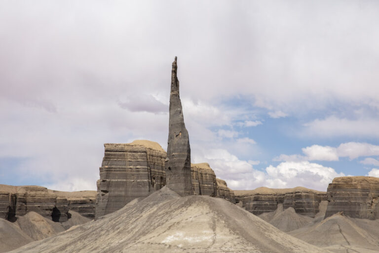
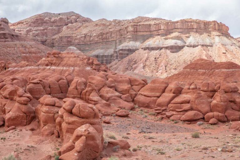
The Funky Geology of the Bentonite Hills
According to the National Parks Service, the Bentonite Hills date back over 140 million years to the Jurassic Period.
Bentonite is a type of clay that forms when volcanic ash meets seawater in most cases but sometimes in freshwater and swampy areas too.
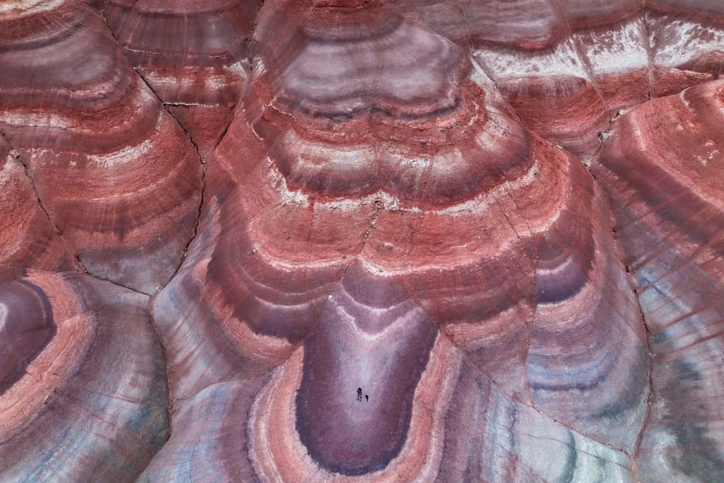
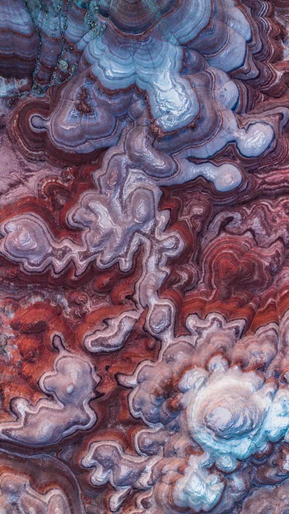
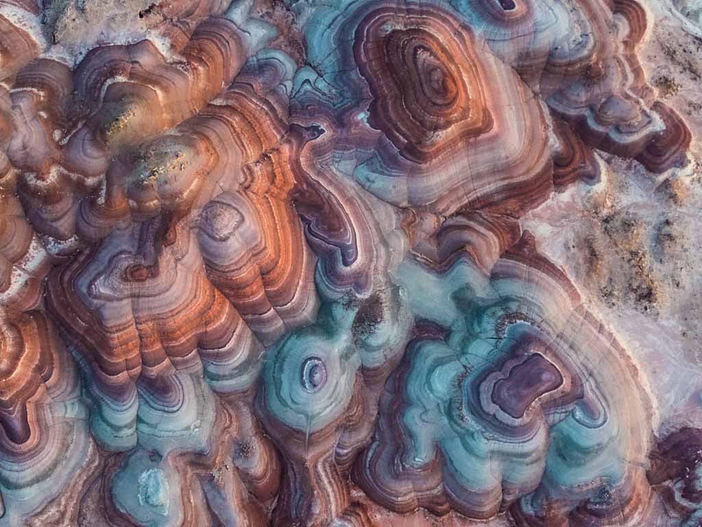
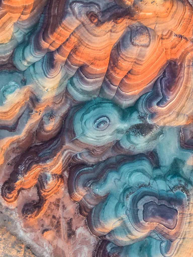
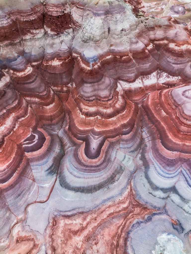
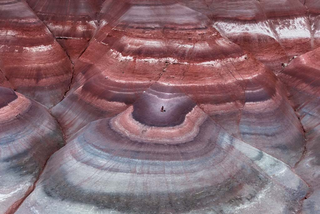
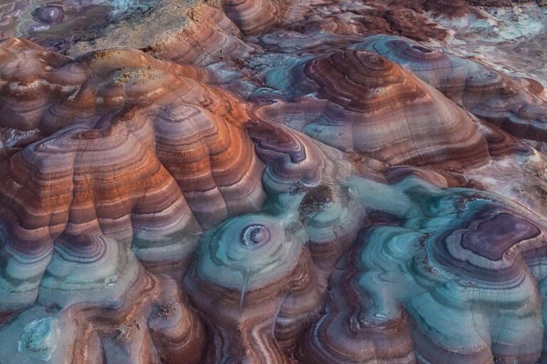
The surface of the Bentonite Hills is often described as popcorn-like (it did remind me of the now-generally-hated popcorn ceiling texture).
The bentonite clay that forms these hills gets this popcorn appearance from the bentonite clay absorbing rainwater and drying out over and over again.
Mars on Earth: The Mars Desert Research Station
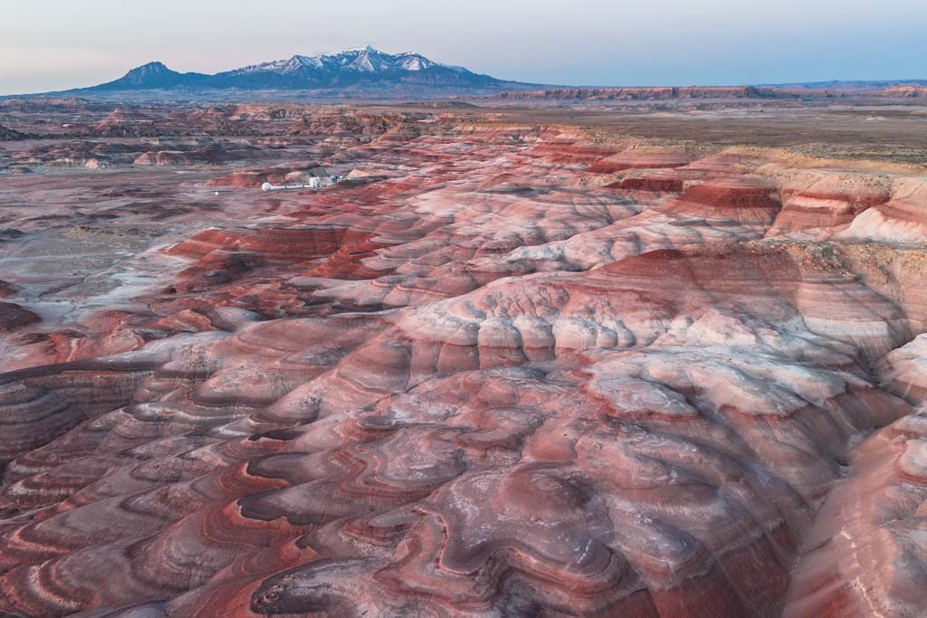
The Mars Desert Research Research Station (MDRS) is a research facility used to prepare for human exploration of Mars. The Bentonite Hills were chosen for the MDRS location because of their likeness to the surface of Mars.
Different gear such as spacesuits and tools are tested out here at the MDRS.
Scientists also use the station to develop different field tactics that will be necessary for humans to explore the surface of Mars.
The MDRS is one of three simulated Mars analog habitats in the entire world.
If you’re wondering where the others are located, they can be found in Nunavut Province, Canada, and next to the Krafla Rift Volcano, Iceland.
A fourth is in the planning stages and is slated to be located in Australia near the Arkaroola Sanctuary about 320 miles from Adelaide.
How to get to the Rainbowy Mountains of Bentonite Hills, Utah
The Bentonite Hills are located a short detour from Utah’s Highway 24, east of Capitol Reef National Park and just a little west of the town of Hanksville.
Once you turn off Highway 24 it’s a rough dirt road the remaining 3 miles to the most colorful part of the Bentonite Hills.
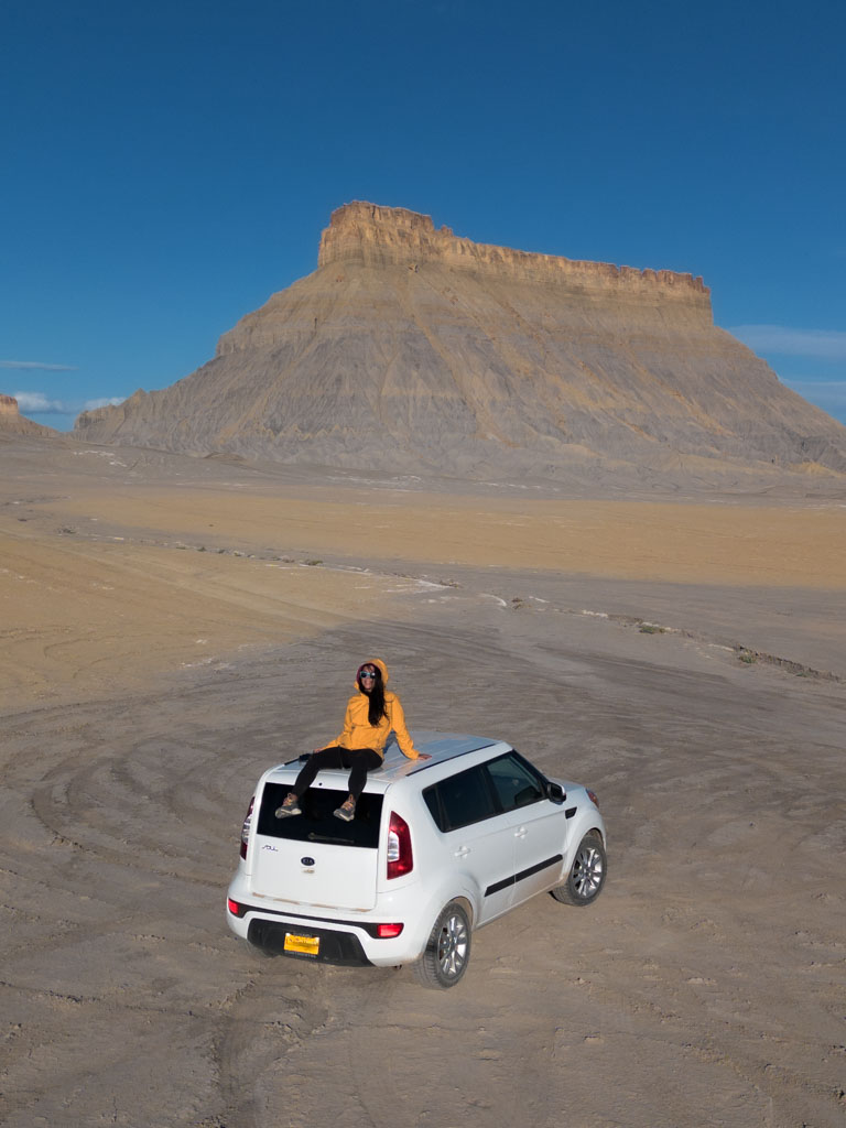
I made it to the Bentonite Hills in my 2012 Kia Soul. The road was rocky in sections and had a couple of stretches with fairly large potholes but overall I had no problems reaching the Bentonite Hills.
Just take it slow and drive cautiously and should be fine.
Although, if it’s rained recently and the road is a mess I would consider walking part of the road as I could see it possibly becoming impassible under the right (ok, more like wrong) conditions.
Getting to the Bentonite Hills Step-by-Step
- From Highway 24 turn north onto South Cow Dung Road (I’m not kidding!). There is no street sign for S Cow Dung Road but this is the name labeled on Google Maps.
- Once you turn onto Cow Dung Road, drive another 3 miles to the turn-off to the Mars Desert Research Station (MDRS).
- Continue past the turn-off to MDRS, there are several great spots to pull off the main dirt road and park starting about 0.25 miles beyond the MDRS turn-off and further down. I parked about 0.50-0.75 miles beyond MDRS.
- Once you decide on a spot to park, continue the remaining way on foot. I followed what looked like a lightly trodden path that extended westward from Cow Dung Road to a crazy colorful section of the Bentonite Hills by chance but honestly, I think just about anywhere west of the road will be dripping with pigment.
From Salt Lake City
If you’ll be coming from Salt Lake City as I did, budget in a 3 hour 45 minute to 4 hour 30 minute drive depending on the time of day you depart and what part of Salt Lake City you’ll be coming from.
I live on the south side of Salt Lake and reached the Bentonite Hills in 3 hours 45 minutes, however, I did leave Salt Lake City at 2:00 am to hit blue hour just before sunrise.
- Take the I-15 south from SLC.
- From the I-15, take the exit for the US-6 E toward Price.
- After about 70 Miles on the US-6 E take the exit for the I-70 west toward Salina.
- Take exit 149 onto UT 24 E toward Hanksville.
- Turn north onto South Cow Dung Road.
From St. George (or Vegas)
From St. George, plan for a 4 hour 30 minute to 5 hour drive depending on traffic (plan for about 6 hours 30 minutes from Vegas).
- Take the I-15 N to exit 95 to get onto the UT-20 E.
- From the UT-20 E turn on to the US 89 N and then briefly onto the UT-62 E and Browns Lane to eventually reach the UT-24 E.
- From the UT-24 E turn north onto S Cow Dung Road.
From Moab
Moab is about 2 hours from the Bentonite Hills making it a closer base for exploring the rainbow domes unless you opt to stay in Hanksville or Goblin Valley.
- Take the US-191 N from Moab and after about 30 miles get on the I-70 W.
- From I-70, take exit 149 onto UT-24 E.
- Turn north onto S. Cow Dung Road.
Do you Need a 4WD to Reach the Bentonite Hills?
While the road into the Bentonite Hills and the Mars Desert Research Station is rough, you don’t need a 4WD vehicle to get here (most of the time anyway).
Maybe if it has been a long time since the road was graded or there have been recent heavy rains then I could see South Cow Dung Road possibly being impassible with a 2WD vehicle.
If you are comfortable driving on rough dirt tracks reaching the Bentonite Hills should be easy, just take it slow and drive cautiously.
How to get the Best Photos of the Bentonite Hills
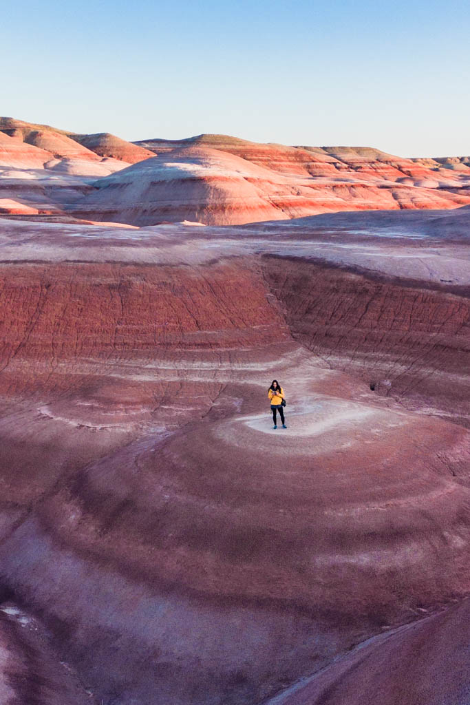
In the broad sun of midday, I’ll be honest, the Bentonite Hills just aren’t that striking.
And truth be told, I thought all the photos I had seen online and on Instagram were heavily photoshopped- that is until I reached the Bentonite Hills and experienced blue hour there.
Yes- they really are wildly colorful.
The Beauty of Blue Hour at the Bentonite Hills (Yes, your Photos will be more Colorful)
Blue hour, that time in the morning about 30 minutes before the sun peeks over the horizon, and that last 30 minutes in the late afternoon just before the sun dips below it is the best time to photograph the Bentonite Hills.
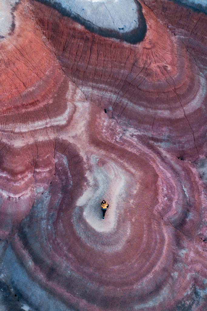
During blue hour, the stripes of blue, green, and purple really do come out, making photos extra dramatic.
But Golden Hour at Bentonite Hills is Still Pretty Cool too
Continuing (or starting if at sunset) to shoot into golden hour will almost inevitably happen while you’re out here exploring the Bentonite Hills.
The golden rays of the sun will give the photos a warmer feel, but once the sun is high up and golden hour is over (or it’s before golden hour), your photos will start to look a bit flat.
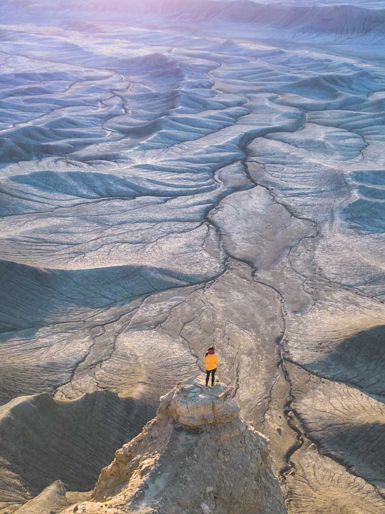
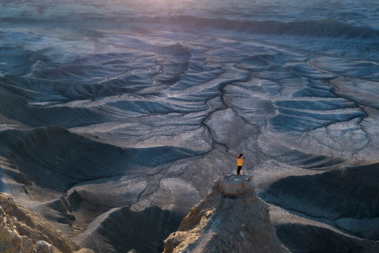
Droning the Bentonite Hills for an Epic Perspective
While you can still get some stunning shots with your phone or your camera, a drone will get you the best shots of the Bentonite Hills.
Aerial views give some wild perspective to the Bentonite Hills that you just won’t get otherwise (unless maybe you flew over low in a plane).
Note that drones are allowed here at Bentonite Hills, though they are not allowed on the MDRS research area, you will see a sign along the dirt road demarcating that it is designated research land and that drones are not allowed and you will pass another stating that you are now leaving the MDRS research area. So just make sure you’re out of this area, pretty simple.
Using ND Filters to get Great Photos of the Bentonite Hills in the Harsh Midday Sun
Couldn’t time it to get here for blue hour or just couldn’t roll out of bed before the crack of dawn? ND filters are your best friend here.
Neutral density (ND) filters will modify the amount of light being let into your camera or drone. An ND filter will make the striped colors pop at the Bentonite Hills if you end up finding yourself photographing or droning in the midday sun.
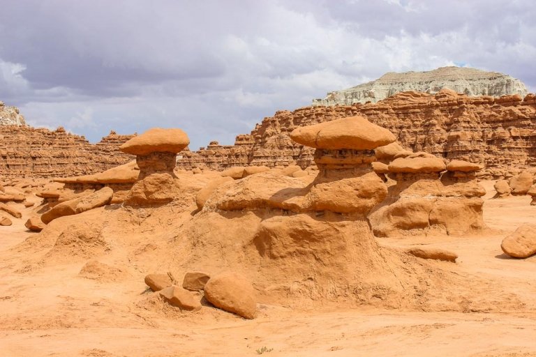
Hiking in the Bentonite Hills
While it is possible to hike around in the Bentonite Hills, they are quite fragile, and care should be taken to try and limit damage to their clay surface.
The hills are named after the type of clay they are comprised of- bentonite.
So if you do want to hike around the Bentonite Hills, make sure to stick to already established paths/previously disturbed areas (note that there are no official trails here, but you will find some commonly used footpaths, the wide washes between the “ranges” of hills, and the narrow washes leading up between hills.
When walking on the indented washes between the hills, do be careful as there are some holes where the clay deposit must have been hollow underneath.
If visiting during blue hour make sure to have a headlamp or torch handy to help you spot these if descending back to your vehicle in the dark.
Other Places to Visit Near the Bentonite Hills
- Cathedral Valley
- Capitol Reef National Park
- Goblin Valley
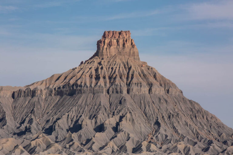
- Factory Butte
- Moonscape Overlook
- Long Dong Silver
- Little Egypt
- Hanksville
- Torrey
Where to Stay & Camp Near the Bentonite Hills
You can camp near the Bentonite Hills just off the road- this is what I did.
Do note that there are no facilities here whatsoever, it is BLM land but it isn’t an established campground or anything, so you’ll need to plan to pack everything out with you and plan for the fact that there are no toilets.
Beyond the Bentonite Hills, along Highway 24 there are a range of places to camp on BLM or state park lands in established campgrounds (many of these come with a fee).
If you’re looking for a hotel to stay in Hanksville, the only place I could find was the Whispering Sands Motel. Otherwise, you can opt to stay in a lodge or resort over in Torrey on the other side of Capitol Reef National Park.
Have any questions about Visiting the Bentonite Hills?
Ask in the comments sections below.
More posts from Utah

Utah Highway 24: The Most Alien Road Trip in the USA
Visit Factory Butte Along Utah Highway 24
Otherworldly Views At Moonscape Overlook, Utah
Long Dong Silver, Utah: A Hilariously Named Hike Off of Highway 24
Visiting the Bentonite Hills in Utah, a Rainbow Mars
The Wind Cave Hike in Logan Canyon, Utah
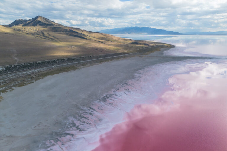
The Pink Waters at Stansbury Island
Antelope Island State Park Near Salt Lake City
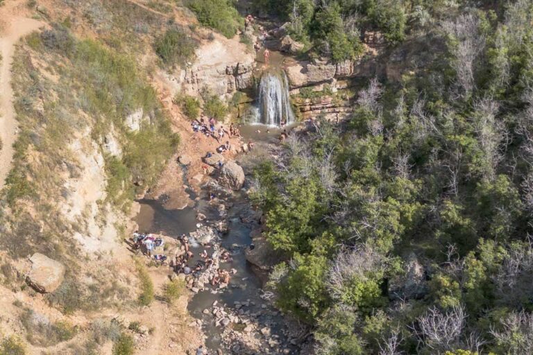
Visiting Fifth Water Hot Springs Near Salt Lake City, Utah
A Two Week American Southwest Road Trip
The Little Egypt Geological Area, Utah: A Miniature Goblin Valley
Everything You Need To Know To Visit Goblin Valley, Utah
Utah’s Pink Lake at Spiral Jetty
The Best Road Trips In The World
Plan An Epic 7 Day Southern Utah Road Trip
I can’t believe how close we have been to this beautiful area on our way to Vegas. We may have to put this on our list for next year. Your descriptions are wonderful and very helpful. I suppose investing in a drone is a must for this trip. Thank you Nicole
Hi Cathy,
Definitely worth a trip back for- so many hidden gems along Highway 24! For Bentonite, it’s quite pretty from ground level but a drone really gives some perspective as to how unique an area the Bentonie Hills really are!