I visited The Ross Sea region of Antarctica on a semi-circumnavigation of the southern-most continent in partnership with Oceanwide Expeditions. Of course, all opinions are my own.
Sailing The Lemaire Channel
Updated July 2026, Sailing The Lemaire Channel was originally published in December 2020
Merry Christmas everyone! Today I’m throwing it back to my day (and night) in the Lemaire Channel.
Back in 2017, I traveled aboard the M/V Ortelius on a month-long voyage from New Zealand to semi-circumnavigate the Antarctic continent before taking a bend back north to travel the Antarctic Peninsula in its entirety up to Ushuaia, Argentina.
I specifically selected Oceanwide Expeditions’ Ross Sea Expedition when I was brought aboard as a media representative because of the unusual and remote places included on the itinerary.
If you read this blog often, you’ll know I tend to cover remote places and offbeat destinations. Though Antarctica is most definitely both of those things, the Lemaire Channel is world-famous, nicknamed the Kodak Gap because photographers back in the day blew through all their film there.
So the Lemaire Channel was not a drawing factor for me when posed with choosing which itinerary I would cover (and you’ll see why I was sorely mistaken).
Start planning your own trip: The Antarctica Travel Guide
Need Travel Insurance and Evacuation Services?
Start shopping for travel insurance plans over at IATI Insurance. Readers of the Adventures of Nicole get a 5% discount off your plan.
The Adventures of Nicole partners with Global Rescue to offer the world’s leading medical evacuation and security advisory services. To travel with peace of mind, explore their evacuation coverage.
Where is the Lemaire Channel & What Makes it So Special?
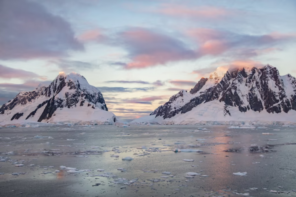
The Lemaire Channel is a strait that separates Booth Island from the Kyiv Peninsula of Graham Land, which forms the western shore of the Antarctic Peninsula. Lemaire Channel is about 11 kilometers in length and is only 1,600 meters wide at its widest. Near vertical Andes-esque mountains, draped in hanging glaciers seem to tumble effortlessly into the iceberg-strewn passage, making it among the most alluring locations Antarctica has to offer.
These steep peaks are a unique feature that blesses the Lemaire Channel with some of the stillest waters in the southern seas, which are regarded as generally quite violent. These high mountains block winds and waves, rendering an almost lake-like appearance in these water sandwiched between Booth Island and the Kyiv Peninsula.
Spotted initially by a German expedition in 1870, it wouldn’t be until 1898 that a Belgian expedition led by Adrien de Gurlach first traveled along this famous stretch of water. Gerlach named the channel after Charles Lemaire, known for his explorations of the Congo by the Belgians during Leopold II’s terroristic reign over Congo Free State and subsequent conquests, who oddly never stepped foot on the Antarctic continent.
Need some inspiration: Read 10 Reasons to Visit Antarctica
A Photographic Journey Through Lemaire Channel
Exiting Penola Strait, Day One
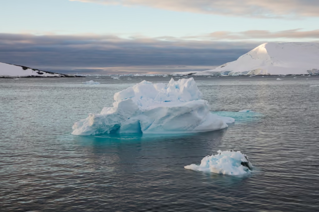
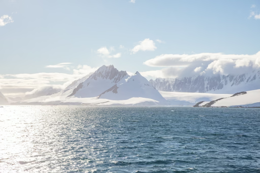
In the afternoon we left Wordie Hut on Winter Island (and others that were at Vernadsky Station which I still to this day am kicking myself for choosing Wordie over it) over in the Argentine Islands up the Penola Strait bound for none other than Lemaire Channel. This little iceberg was bobbing along in Girard Bay between Havgaard and Pleneau Islands.
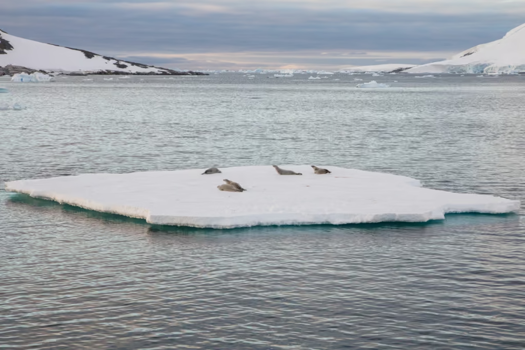
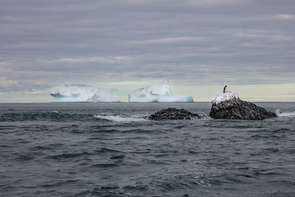
Crabeater seals lazing about on an ice flow in Girard Bay with ice-and-snow covered Pleneau Island in the background. Their name is a bit of a misnomer as these particular seals do not eat crabs at all. Their main food source is krill.
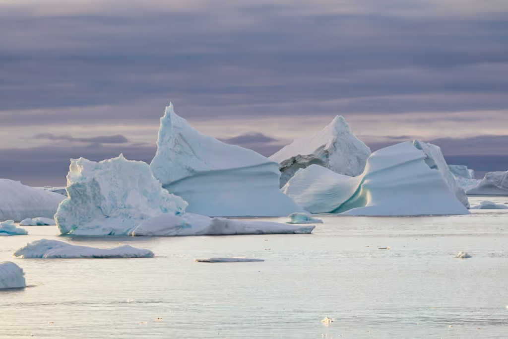
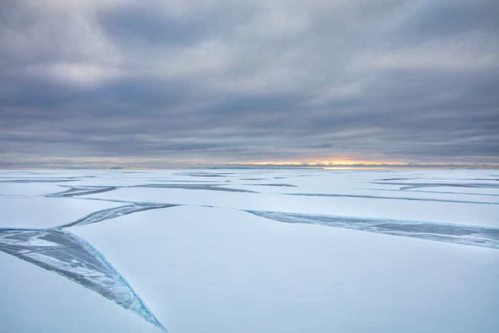
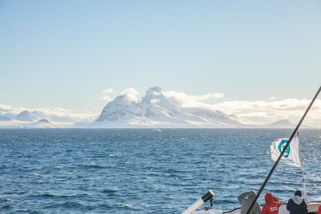
Icebergs in Girard Bay in the late afternoon as we continued north toward the Lemaire Channel. This was the most exciting day we’d had in over a week after leaving the Ross Sea and being hit with bad weather and low clouds that prevented us from making a landing in nine days, and getting off for a zodiac cruise in seven.
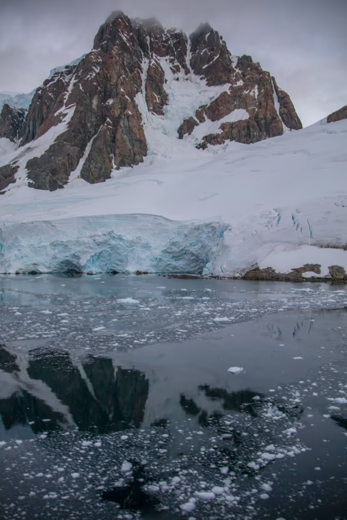
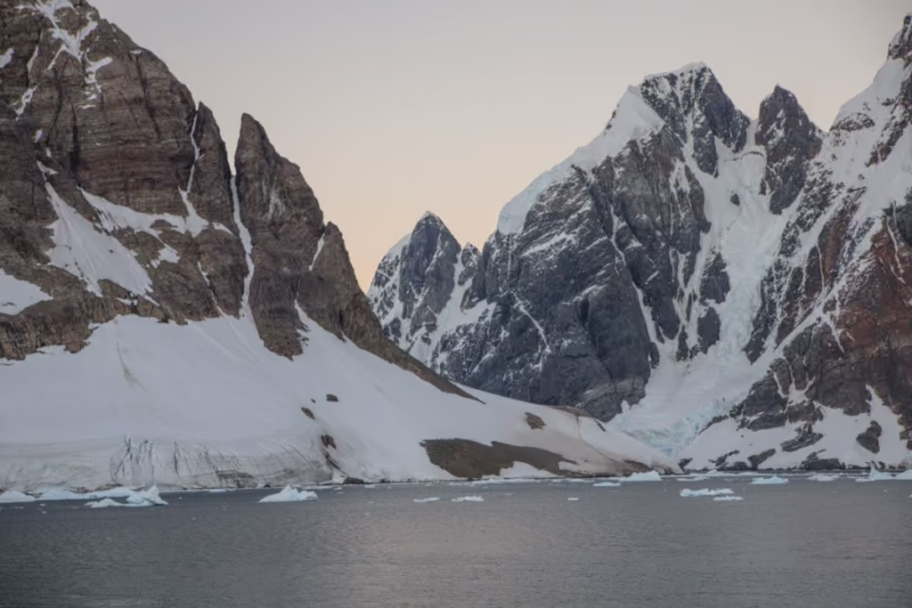
Meanwhile, from the other side of the ship, we had views of Hotine Glacier tumbling down from the Graham Land coast, while an ice floe of three seals looks onward. Separated by a jagged ridge, Hotine Glacier is quite interesting as it dumps into both Girard Bay pictured here, and Deloncle Bay further north.
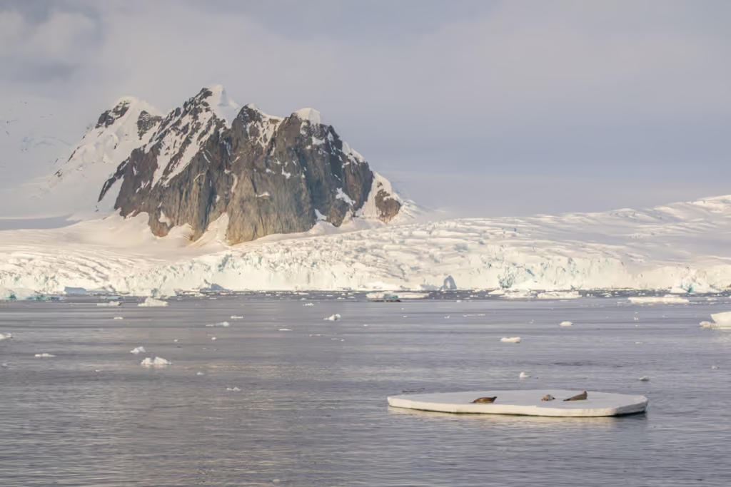
Our first glances of Booth Island, which forms the western flank of the Lemaire Channel from across Girard Bay as the light drops lower and lower along the ice-covered mountainside.
Looking to the west the sunset off to a great start over Pleneau Island as we inched closer to Lemaire Channel. I felt like I was darting from one side of the ship to other, constantly trying to see the happenings on either side of the ship.
Want to read about my wild times in Ross Sea? Check out my posts on Franklin Island and the McMurdo Dry Valleys
Into Lemaire Channel
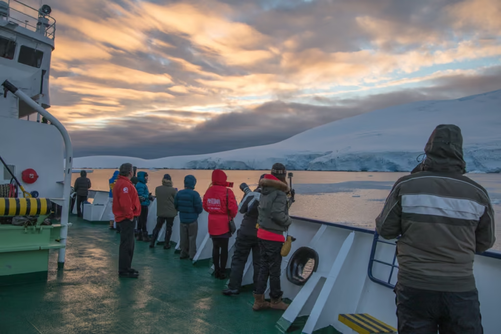
Getting our first clear views of Lemaire Channel right at sunset was an unforgettable experience. We were finding out about this time that we were going to be able to enter the channel.
It’s not unheard of for icebergs to clog up Lemaire Channel, preventing ships from crossing it. However, we did have the fortune of visiting Antarctica from mid-February to mid-March (this was March 11), the most likely time of year to find the channel ice-free.
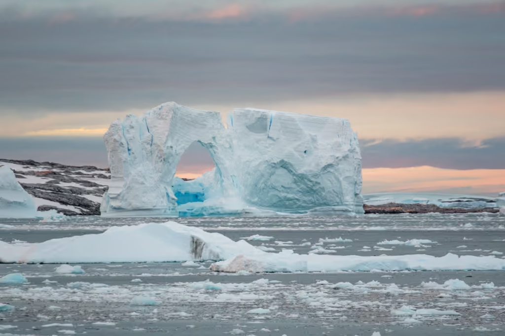
One of my favorite things we saw as we began our crossing of the Lemaire Channel was this massive ice arch near Pleneau Island. It was about this time the first calls for dinner to be served were made… and ignored by about 95% of the ship (I mean how could you head inside and miss out on these views?!).
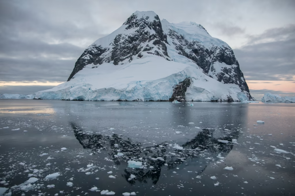
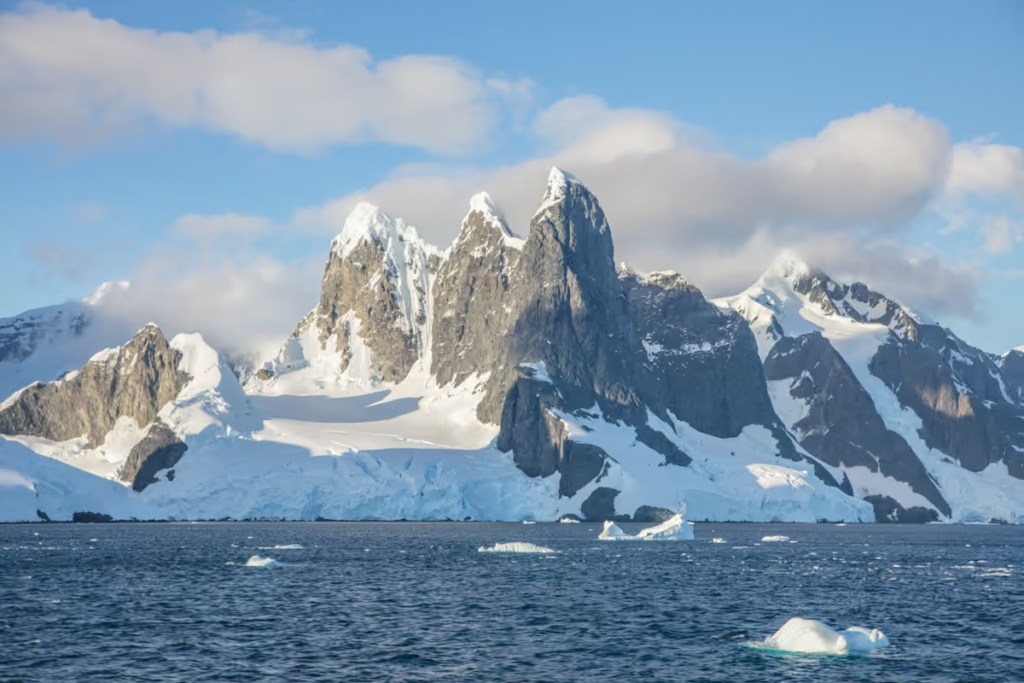
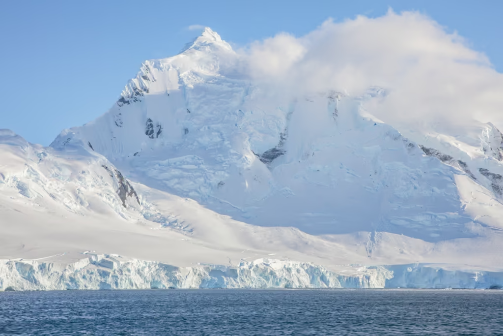
Getting up-close views of Booth Island. Booth Island is about 8 kilometers long and forms the northeastern part of the Wilhelm Archipelago.
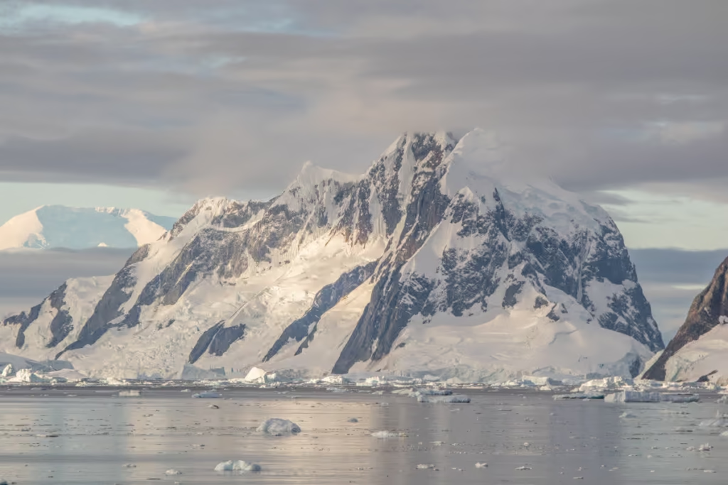
At 980 meters, Wandel Peak is the highest point on Booth Island, creating a perfect barricade, blocking out the eastbound winds that pummel Booth Island’s western shore. High and mighty Wandel Peak helps Lemaire Channel offer those mirror-like perfect reflections.

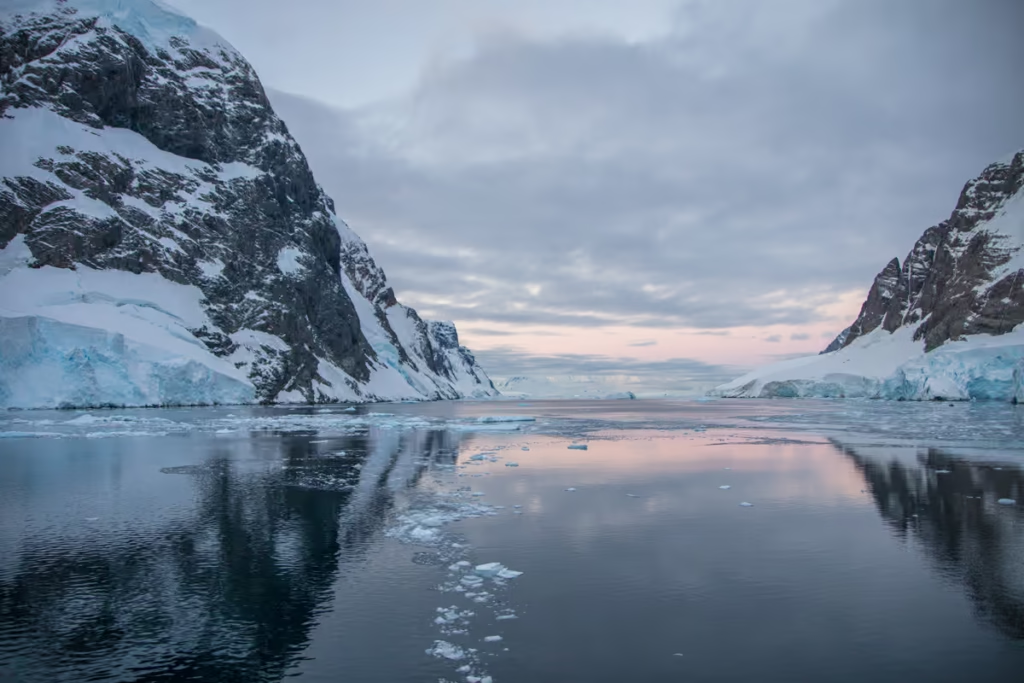
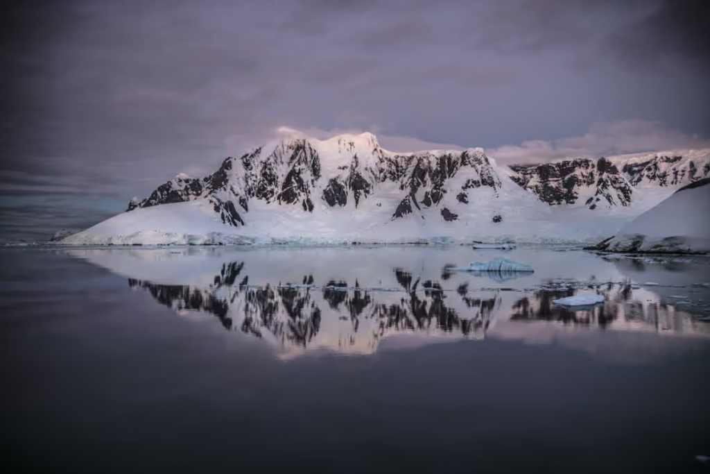
Into Lemaire Channel at last, the waters went almost dead calm (I’m an avid water-reflection junkie). Views of Booth Island to the left and the jagged Peaks of Graham Land to the right, just south of Deloncle Bay.
Pick up a copy of Bradt’s Antarctica wildlife guidebook before you set off for Antarctica
Entering Into Deloncle Bay, the Middle of Lemaire Channel
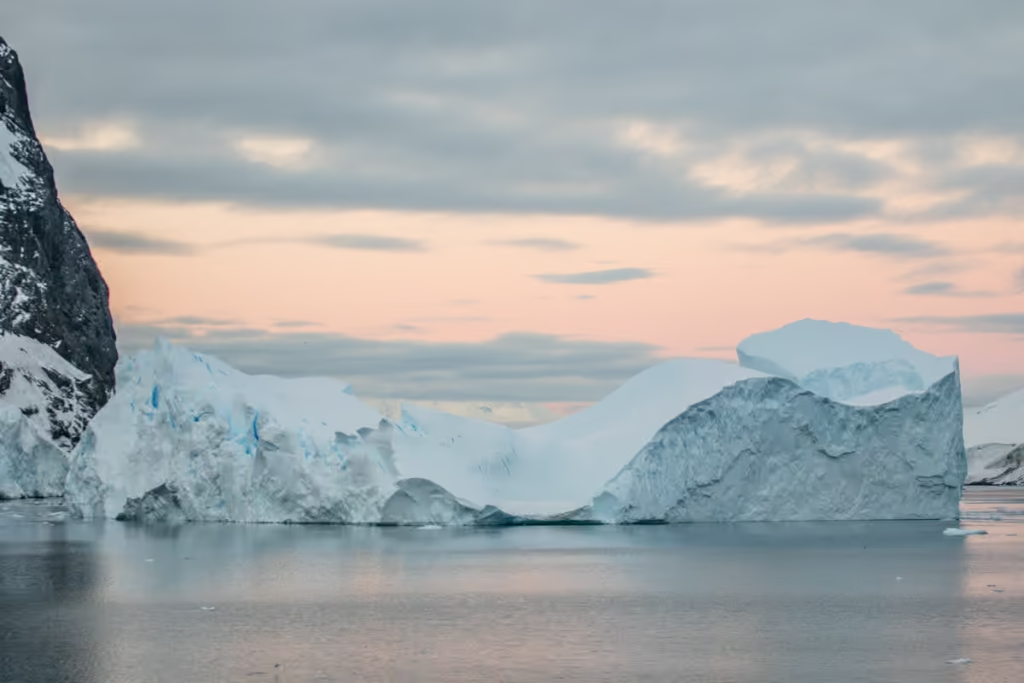
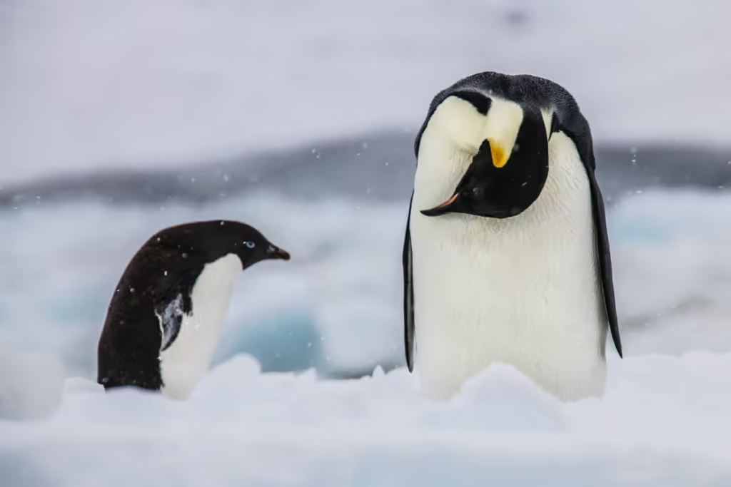
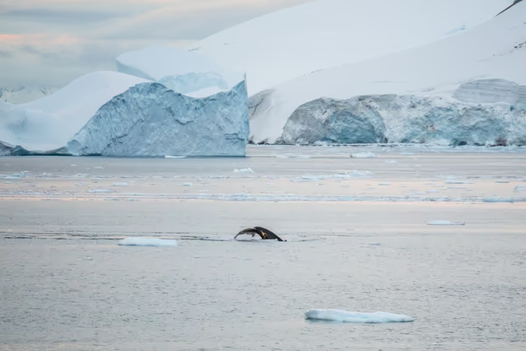
Another massive iceberg on the northern end of Deloncle Bay. You may recognize this iceberg from earlier in the blog post in the photo of the whale’s tail in front of it. Lemaire Channel is famed for its abundance of orcas, crabeater seals, and penguins.
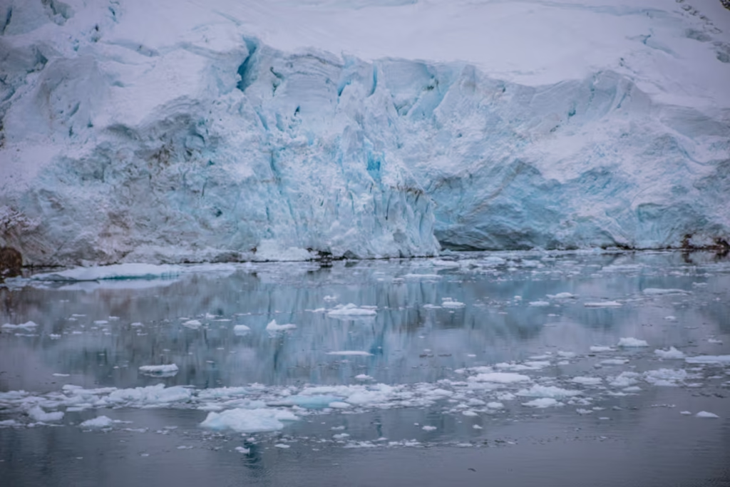
The other side of Hotine Glacier as it pours out into Deloncle Bay with reflections of its craggy blue face in the water.
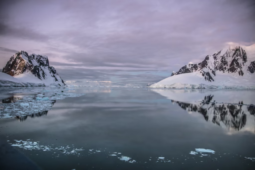
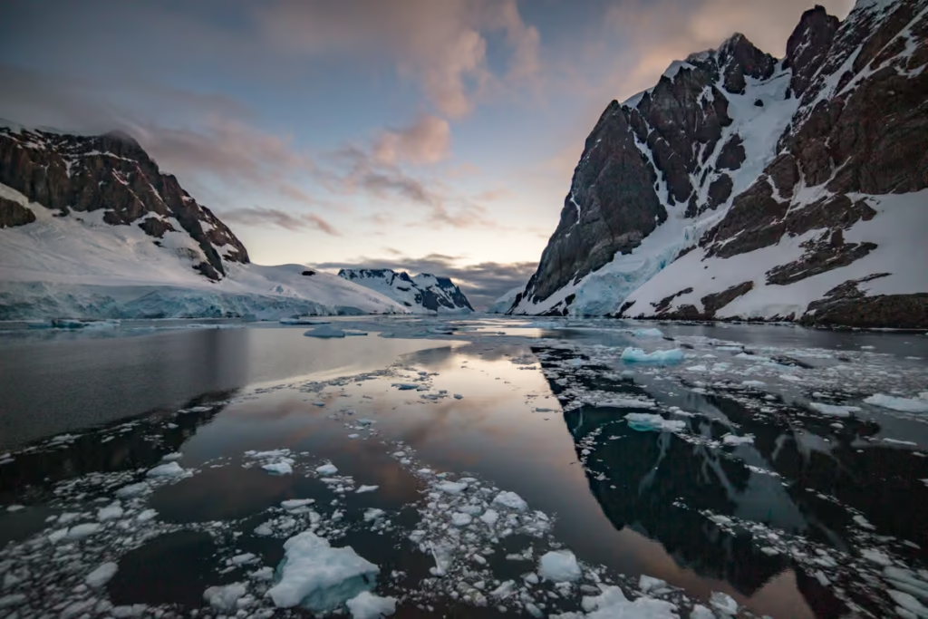
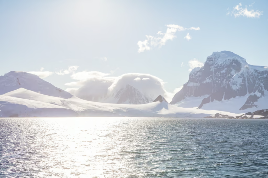
The water became mirror-like as we continued on toward the northern end of the Lemaire Channel. With both the northern fringe of Booth Island and Graham Land’s Loubat Point in view as we began into blue hour with lavender skies above.
Perfect sunset views of the rugged faces and ice-capped peaks of Loubat Point from across Delconcle Bay and some of my most favorite views of this day.
Check out off the beaten path Antarctica- McMurdo Sound
Spending the Night in Lemaire Channel
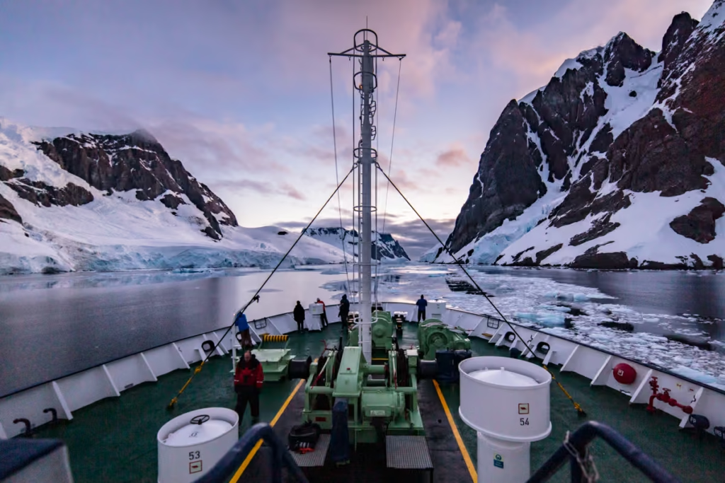
Views from the deck as we turned back into Lemaire Channel for the evening, hiding behind Booth Island to protect us from the strong winds that batter the rest of the Antarctic Peninsula.
The last bits of evening light on Lemaire Channel. After continually ignoring call-after-call to dinner to take in these last moments, going to bed hungry was a sacrifice I was willing to make.
Early Morning Sunrise on Lemaire Channel, Day Two
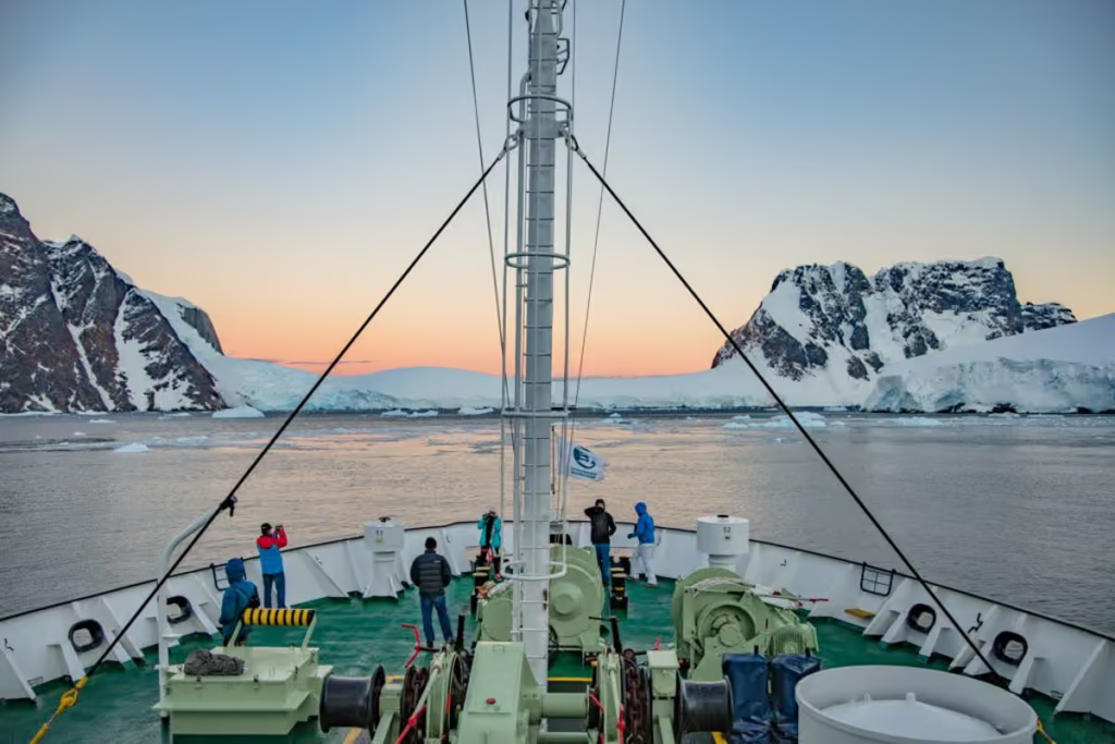
A handful of us got an early start to catch sunrise over Booth Island from Lemaire Channel.
I stayed up half the night stargazing on deck with a small glimmer of hope of seeing the aurora australis (we didn’t get that lucky), so it was more of nap. I had no issues dragging myself out of bed after only a couple short hours of sleep for these views.
Views east to the craggy peaks of Graham Land as the sun began to rise behind them, signaling golden hour.
A Goodbye to Lemaire & a Hello to the Danco Coast
Waving goodbye to our magical sunrise and sunset in the Lemaire Channel and onto Cape Renard. Cape Renard marks the northern end of Lemaire Channel where it dumps out into Flandres Bay and the separation of Graham’s Land to the south from the wild Danco Coast to the north.
Gorgeous morning views as we made our way into Flandres Bay (after I had breakfast of course since I skipped out of last night’s dinner. This day we were bound north along the Antarctic Peninsula to explore Paradise Harbor and Andvord Bay.
Some early views of the Danco Coastline with jagged peaks becoming reminiscent of my time in the Andes the year prior to my Antarctic voyage.
Looking to Plan Your Own Trip to Antarctica?
Shop the best deals on polar cruises on GAdventures as well as over at Intrepid Travel. If you’re looking for truly bespoke and/or special interest trips, I recommend checking out Spirit of Sydney.
Have Any Questions About the Lemaire Channel?
Ask in the comments section below.