
Klondike Highway Road Trip: Skagway to Dawson City
Klondike Highway Road Trip: Skagway to Dawson City Was originally published in 2026
Driving the Klondike Highway from Skagway to Dawson City is one of those road trips where the route itself is the destination.
The highway climbs out of Alaska from Skagway through the spectacular mountains of White Pass, crosses into British Columbia, passes the turquoise waters of Emerald Lake and the surreal dunes of Carcross Desert, continues through Whitehorse and deep into the Yukon wilderness, then follows the Klondike River toward Dawson City.
I spent considerable time exploring this part of the Yukon, having driven the Klondike Highway several times, and what I love most about the Klondike Highway is how quickly the scenery changes. One minute you’re looking at cruise ships and historic buildings in Skagway, the next you’re surrounded by alpine tundra. Farther north, the landscape opens into enormous stretches of boreal forest, rivers and mining country before eventually dropping you into Dawson City’s wonderfully scruffy Gold Rush streets.
If you’re planning a Klondike Highway road trip, this guide covers everything you need to know, including the best stops, how long to allow, where to stay, driving tips, and what to see between Skagway and Dawson City.
Quick Guide to the Klondike Highway
| Detail | Information |
|---|---|
| Route | Skagway, Alaska to Dawson City, Yukon |
| Distance | About 444 miles / 715 km |
| Countries | United States and Canada |
| Main highway | Klondike Highway |
| Best season | Late May through September |
| Major stops | Skagway, Carcross, Whitehorse, Carmacks, Pelly Crossing, Dawson City |
| Border crossing | Skagway, Alaska / Fraser, British Columbia |
| Ideal trip length | 3-5 days |
| Longer road trip | 5-7+ days |
The Klondike Highway is considerably more than a way of getting from Skagway to Dawson City. Along the route you’ll encounter landscapes and communities tied closely to the history of the Klondike Gold Rush, as well as living Indigenous cultures and some of the Yukon’s most distinctive scenery.
What Is the Klondike Highway?
The Klondike Highway is a major north-south route connecting Skagway, Alaska with Dawson City, Yukon. The highway is 444 miles long, or about 715 km, from Skagway to Dawson City.
It crosses from Alaska into British Columbia before entering Yukon and eventually reaches Dawson City, the historic heart of the Klondike.
The highway is sometimes divided into the South Klondike Highway and North Klondike Highway. The southern section runs approximately 158 km from Skagway to the Alaska Highway near Whitehorse, while the entire route continues north from there to Dawson City.
This distinction can get confusing when planning a trip because you’ll see both names used. If you’re searching for the Skagway to Dawson City road trip, however, you’re looking at the full Klondike Highway.
Klondike Highway History
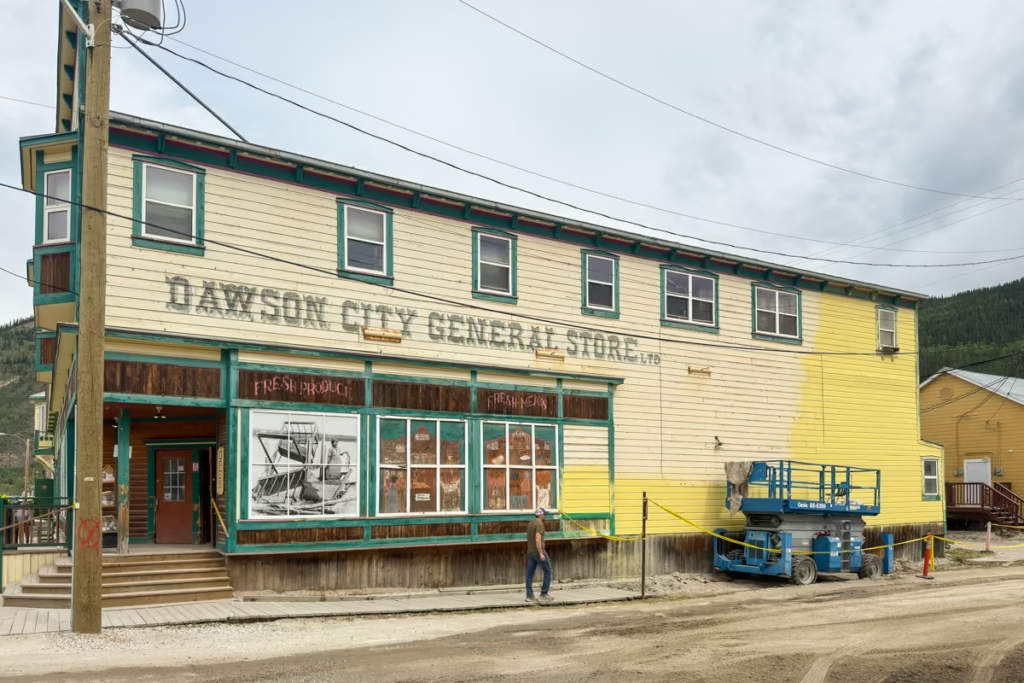
The modern highway is only the latest chapter in a much older transportation corridor. Long before the Gold Rush, Indigenous peoples traveled and traded through the region. Then came the Klondike Gold Rush.
Gold was discovered near the Klondike River in 1896, and news of the strike soon triggered an international stampede. Skagway and the neighboring White Pass became major gateways for people heading toward the Yukon interior.
The White Pass & Yukon Route railway reached Bennett in 1899 and Whitehorse in 1900, replacing much of the arduous overland travel associated with the earlier trails.
Eventually, roads replaced the riverboats that had carried people and supplies through the Yukon.The Klondike Highway was completed in the 1950s, creating the modern road connection between the Yukon interior and the communities farther south. Parks Canada records the completion of the Klondike Highway in 1953.
Klondike Highway Map and Route
The basic Skagway to Dawson City route looks like this:
Skagway → White Pass → Fraser → Carcross → Whitehorse → Braeburn → Carmacks → Pelly Crossing → Stewart Crossing → Dawson City
The southern portion is dramatically mountainous, with the road climbing through White Pass before dropping into the Yukon.
After Whitehorse, the landscape becomes increasingly remote. The road winds through boreal forest and along rivers and lakes before reaching Dawson City.
Why Drive the Klondike Highway?
There are faster ways to travel between Alaska and the Yukon, like the main route along the Alaska Highway, but the Klondike is a historic route that takes you off the beaten path and allows access to the Top of the World Highway.
The Klondike Highway road trip connects several of the most interesting places in northern Alaska and Yukon while following a corridor shaped by centuries of Indigenous travel, the Klondike Gold Rush and the development of modern transportation routes.
The scenery is also wildly varied. Near Skagway, the road climbs through steep mountains and waterfalls. Around Carcross, you’ll find bright turquoise lakes, desert-like dunes and expansive mountain views. Near Whitehorse, the landscape opens up around the Yukon River. Farther north, the highway becomes quieter and more remote before reaching the historic mining landscape around Dawson City.
The route also follows a historical corridor. During the Klondike Gold Rush, Skagway and the White Pass were major gateways for stampeders heading toward the Yukon interior. The White Pass & Yukon Route railway eventually reached Whitehorse in 1900, changing how people and supplies moved through the region.
Today’s highway is much less dramatic than hauling supplies over a mountain pass with a packhorse, thankfully.
Best Stops on the Klondike Highway
If you’re driving the Klondike Highway from Skagway to Dawson City, these are the stops I’d prioritize.
Skagway, Alaska
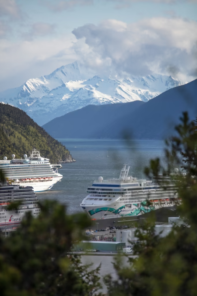
Start your road trip in Skagway, the historic Gold Rush town at the southern end of the highway.
Skagway exploded during the Klondike Gold Rush as tens of thousands of stampeders arrived hoping to reach the goldfields. Today, the historic downtown is preserved as part of Klondike Gold Rush National Historical Park.
Before leaving town, walk along Broadway and explore the historic buildings. The White Pass & Yukon Route Railway is another major attraction, following the historic route into the mountains.
It’s worth giving Skagway at least a full day rather than treating it as somewhere to collect your rental car and immediately escape.
The town is touristy, especially when cruise ships are in port, but there are still plenty of ways to experience its history beyond the souvenir shops.
White Pass
Leaving Skagway, the Klondike Highway climbs dramatically toward White Pass.
This is one of the most spectacular sections of the entire road trip.
The landscape changes rapidly as you climb away from the coastal environment. Waterfalls tumble down the mountainsides, rocky peaks surround the highway, and eventually the vegetation becomes much more sparse.
The same pass became one of the major routes used by Klondike Gold Rush stampeders. The original White Pass Trail was notoriously dangerous, while later transportation improvements eventually transformed the corridor.
Carcross
Carcross is one of my favorite stops on the southern Klondike Highway.
The small community sits between mountains and lakes and has strong connections to the Inland Tlingit and Tagish peoples. Today, it’s also known for its arts scene, historic buildings, and outdoor recreation.
Don’t just stop for fuel and continue driving.
Carcross Desert
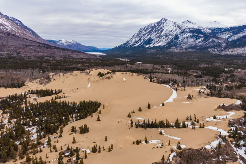
The Carcross Desert is one of the strangest sights along the Klondike Highway.
Calling it a desert is technically a little generous, since the area receives considerably more precipitation than a true desert. What you’re looking at are glacial lake sediments that were deposited thousands of years ago and later exposed by changing water levels.
The result is a field of pale sand dunes sitting beneath Yukon mountains.
Make sure to pop over to the Carcross Plaza and into the Carcross Visitor Center to get information on more activities in the general area.
The dunes are immediately accessible from the highway, making this one of the easiest stops to add to a Skagway to Dawson City road trip.
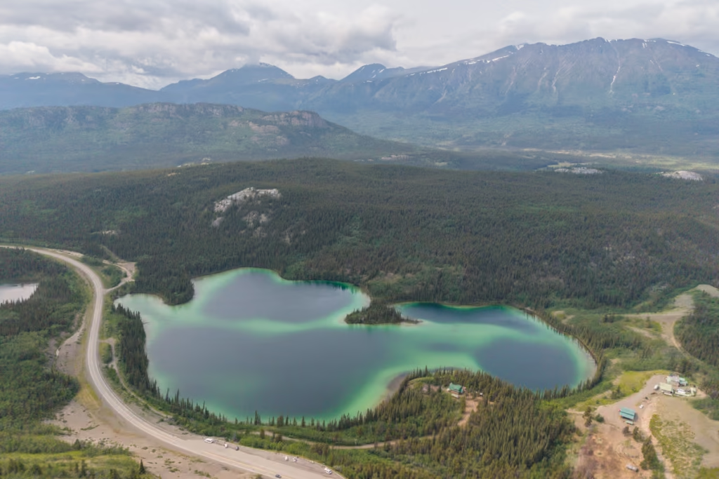
Emerald Lake
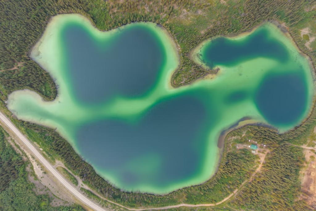
A few minutes beyond Carcross, stop at Emerald Lake.
The lake gets its intense green-blue color from light interacting with fine sediment suspended in the water. On a sunny day, the color will have you rubbing your eyes, questioning if it’s real.
There is a roadside viewpoint where you can pull over and take in the lake, but I’d allow more time than a quick photo stop if you’re photographing the route.
Whitehorse
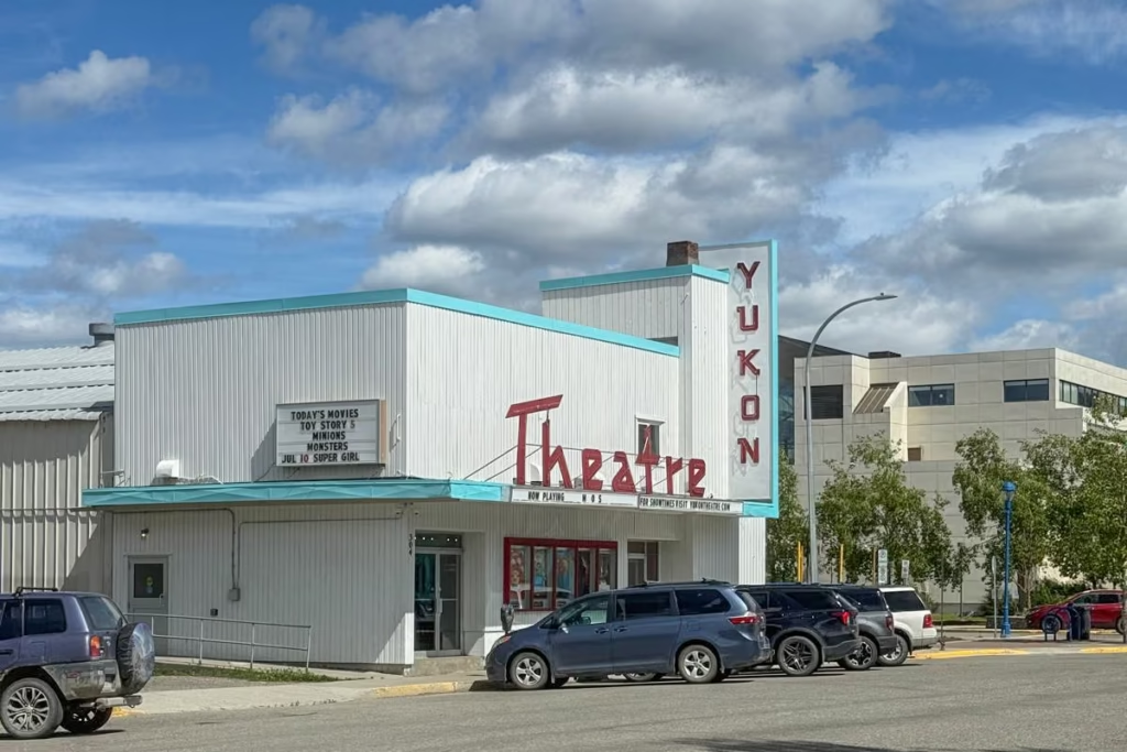
Eventually, the Klondike Highway reaches Whitehorse, the capital of Yukon and the largest community on the route.
Whitehorse makes an excellent overnight stop on a Klondike Highway road trip, particularly if you’re traveling slowly and want time to explore rather than simply use the city as a fuel stop.
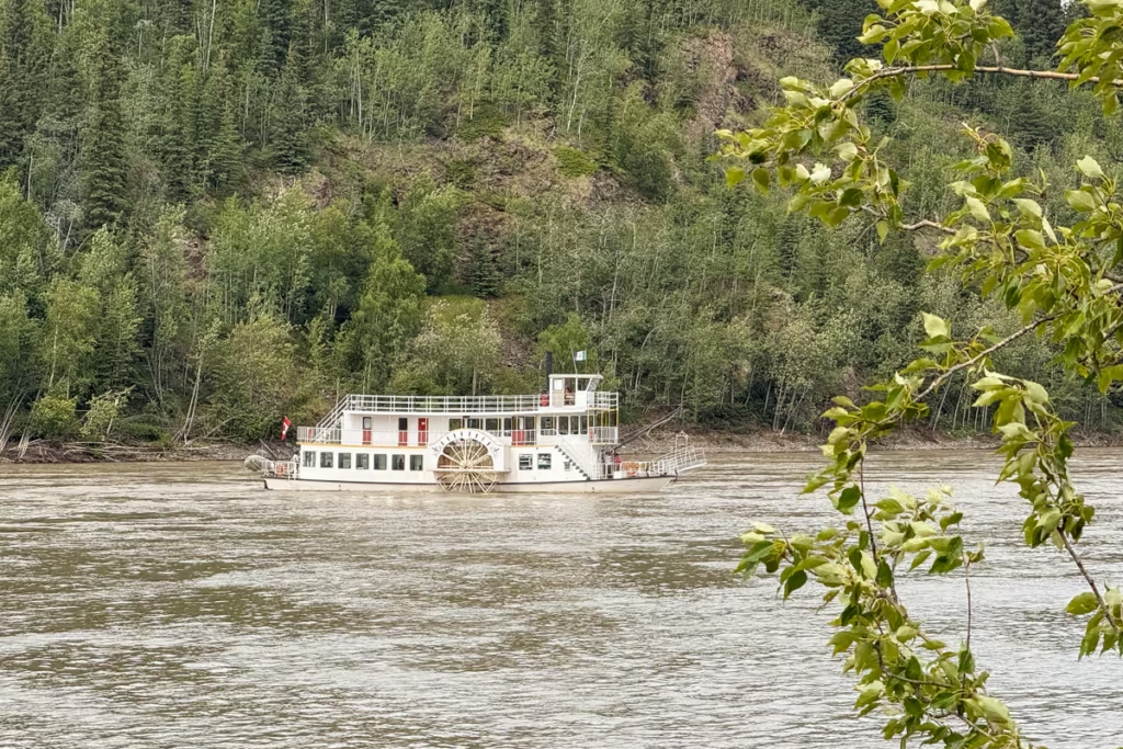
One of my favorite historical stops is the S.S. Klondike National Historic Site, where you can see one of the Yukon River’s historic sternwheelers.
The S.S. Klondike was built in Whitehorse in 1929 and later operated between Whitehorse and Dawson City. Its final years of commercial operation ended after highways made river transportation increasingly obsolete.
That history helps put the highway into perspective. Before modern roads, the Yukon River was one of the major transportation arteries connecting the interior with the outside world.
Carmacks
Carmacks sits along the Yukon River and is an important service stop on the highway.
The community takes its name from George Carmack, one of the men associated with the discovery of gold in the Klondike.
Carmacks is a useful place to refuel, get groceries and break up the drive between Whitehorse and Dawson City.
If you’re camping, it also gives you options for spending the night rather than attempting the entire distance in one go.
Pelly Crossing
The highway continues north through increasingly remote Yukon landscapes before reaching Pelly Crossing.
The community is located along the Pelly River and is home to the Selkirk First Nation.
This is an important point to remember when traveling the Klondike Highway: you’re not simply driving through empty wilderness. The highway passes through the traditional territories of Indigenous peoples whose connections to these lands long predate the Gold Rush and modern road network.
Stewart Crossing
At Stewart Crossing, the Klondike Highway meets the Stewart River.
It’s another practical stop rather than somewhere you’ll necessarily spend hours exploring, but the river and surrounding landscape are a good reminder of how closely Yukon transportation has always been tied to its waterways.
Klondike River and Goldfields
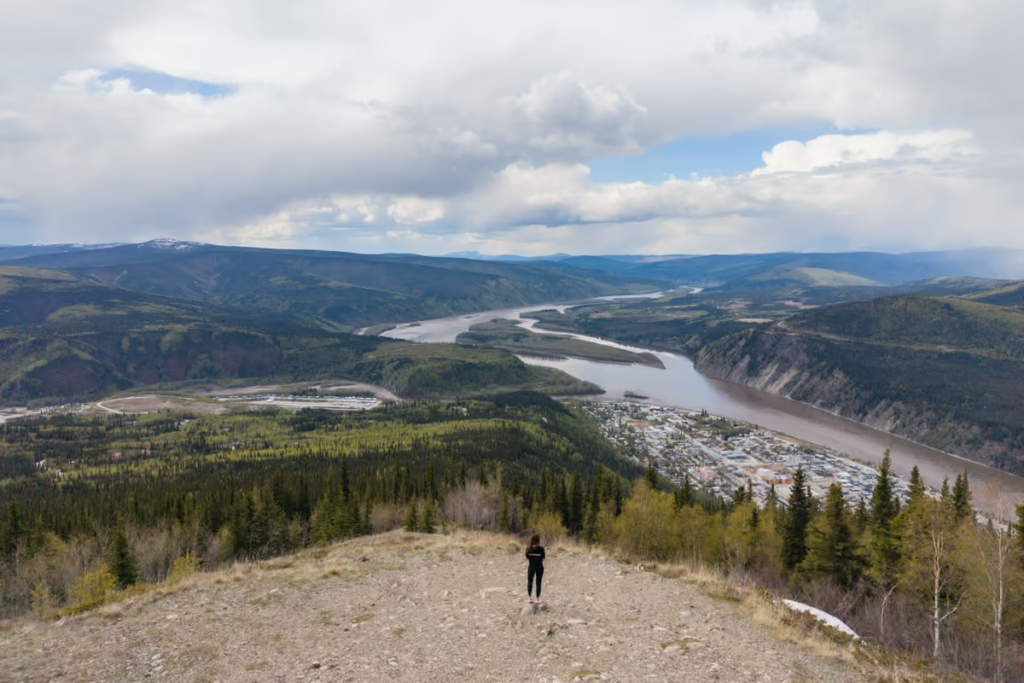
As you approach Dawson City, the highway enters the historic Klondike mining district.
This is where the road trip starts feeling increasingly connected to the Gold Rush story you’ve been following since Skagway.
There are numerous historic mining roads and turnoffs around the Klondike River and Bonanza Creek area.
If you have time, don’t rush straight into Dawson City. Give yourself time to explore some of the surrounding landscape.
The Yukon government still identifies numerous historic and recreational sites along the Klondike Highway and surrounding Goldfields roads. Some of the smaller mining roads are narrow and steep, and aren’t appropriate for large RVs.
Dawson City
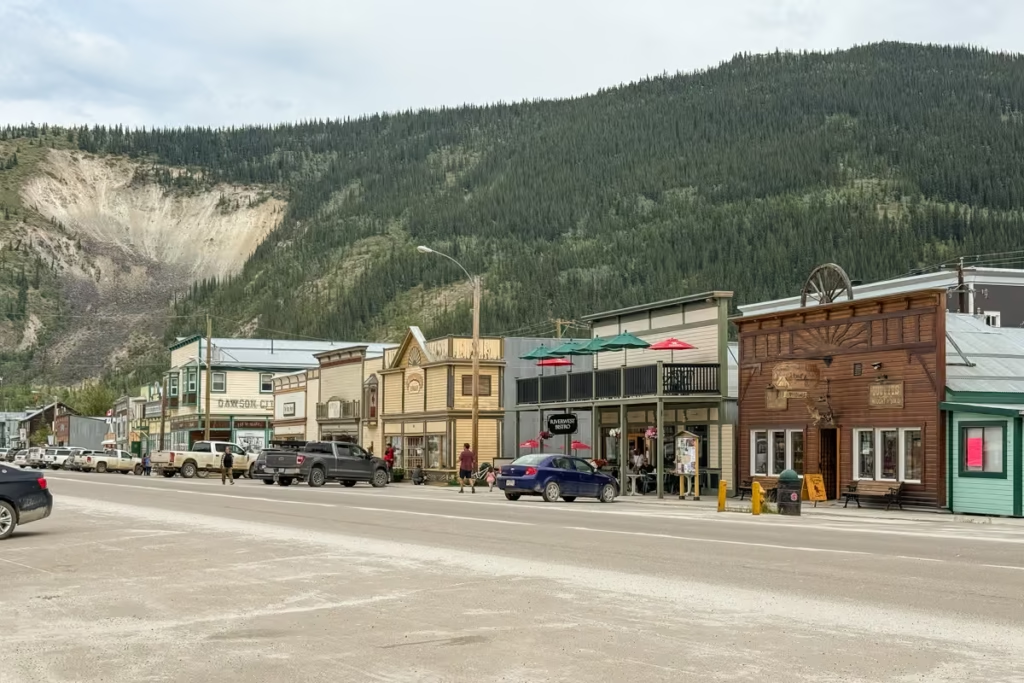
And then, finally, Dawson City.
After hundreds of miles of highway, the sudden appearance of Dawson’s colorful historic buildings and wooden boardwalks feels almost surreal.
Dawson was created at the confluence of the Klondike and Yukon Rivers following the 1896 gold discovery. More than 100,000 people set out for the Klondike, although only around 30,000 reached Dawson during the height of the rush.
At its peak, Dawson was enormous by northern standards, with an estimated population of 20,000 to 30,000 during the height of the Gold Rush.
Today, its historic buildings, unpaved streets and surviving mining landscape make it one of the most fascinating places to finish the Skagway to Dawson City road trip.
Dawson deserves at least two nights.
How Long Does the Skagway to Dawson City Drive Take?
The Skagway to Dawson City drive is about 444 miles / 715 km, but I would not plan to drive it in a single day.
Technically, you can cover the distance relatively quickly in a long single day.
Practically, you’d miss most of the reason for doing the road trip.
My Recommended Klondike Highway Itinerary
2 days: Possible, but rushed
3 days: Minimum I’d recommend
4-5 days: Much better
7+ days: Ideal if you want hiking, side trips and time in Dawson City
Day 1: Skagway to Whitehorse
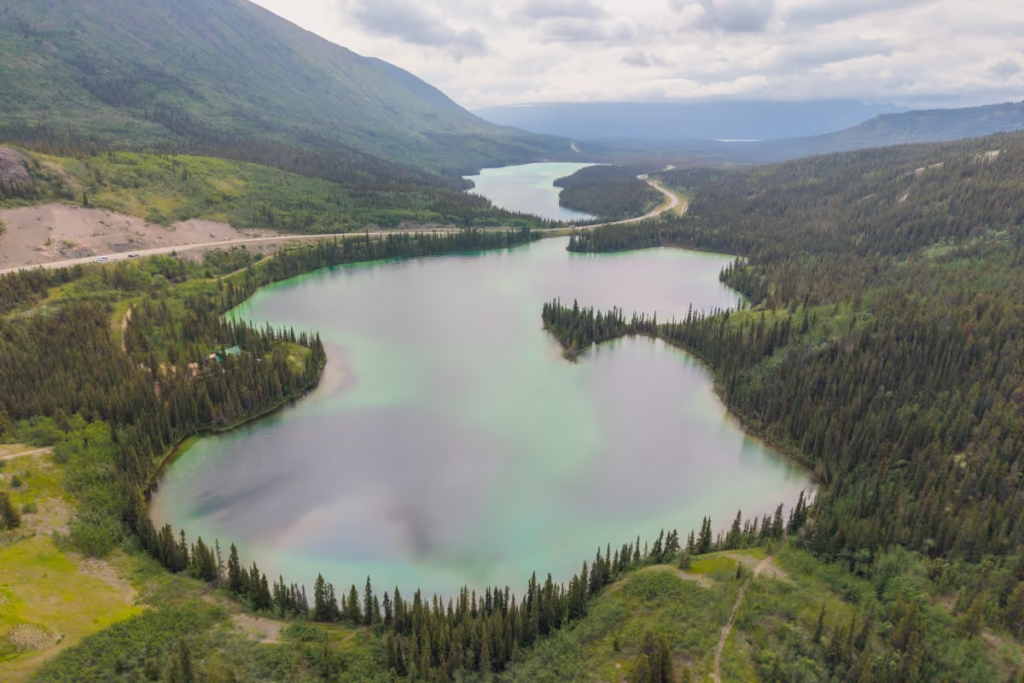
Start in Skagway, Alaska, then follow the South Klondike Highway into Canada. The road climbs from sea level through the Coast Mountains toward White Pass Summit, at 3,292 feet, with dramatic alpine scenery along the way.
Continue past Tormented Valley and Tutshi Lake, then stop at Carcross Desert and brilliant blue-green Emerald Lake. In Carcross, take some time to explore the historic community. 53 kilometers/33 miles north of Carcross, the Klondike Highway meets the Alaska Highway and continues along it to Whitehorse until the two routes split once again.
Spend the night in Whitehorse tonight.
Where to Stay in Whitehorse
Edgewater Hotel
Raven Inn Whitehorse
Skky Hotel
Day 2: Whitehorse
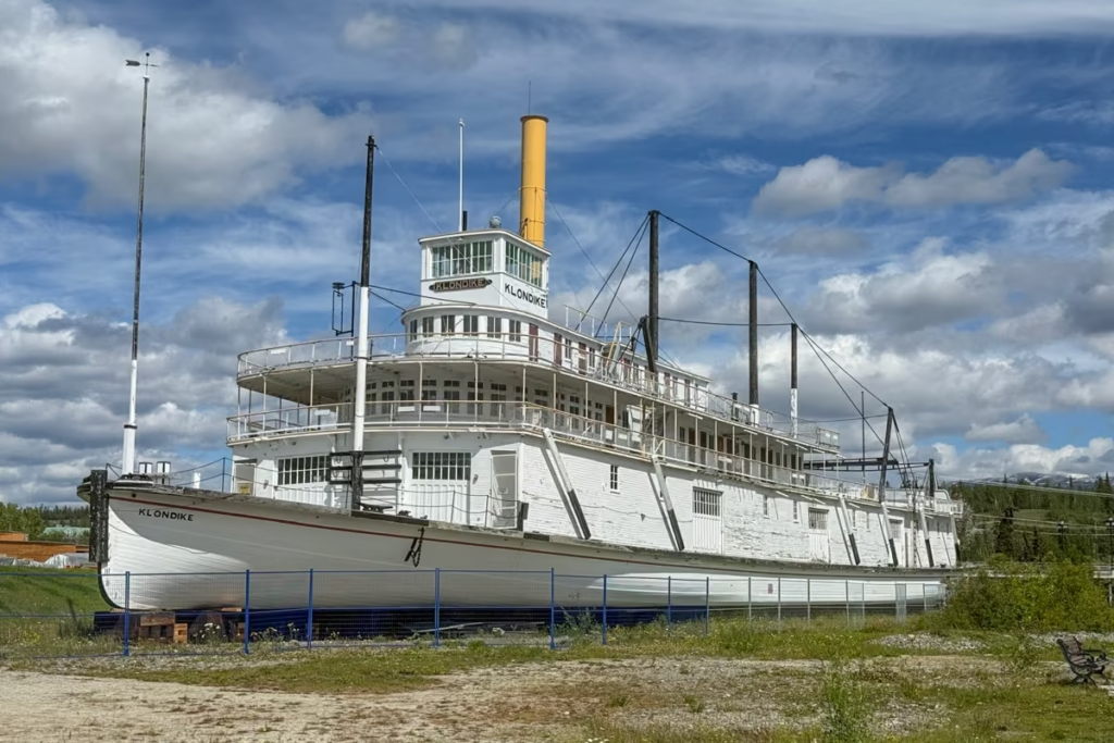
Spend the day exploring Whitehorse, starting at the MacBride Museum of Yukon History to learn about the Yukon’s Indigenous cultures, Gold Rush history, mining, and the construction of the Alaska Highway. After that, head over to the Kwanlin Dün Cultural Centre to learn more about the history and contemporary culture of the Kwanlin Dün First Nation and other Yukon First Nations. Then walk along the Yukon River to the S.S. Klondike National Historic Site, a restored sternwheeler that highlights the river’s importance to transportation in the Yukon.
In the afternoon, head to Miles Canyon for views of the turquoise Yukon River cutting through dark basalt cliffs. If you have more time, visit the Yukon Wildlife Preserve to see northern wildlife including caribou, elk, and lynx.
Plan to spend the night again in Whitehorse.
Day 3: Whitehorse to Carmacks
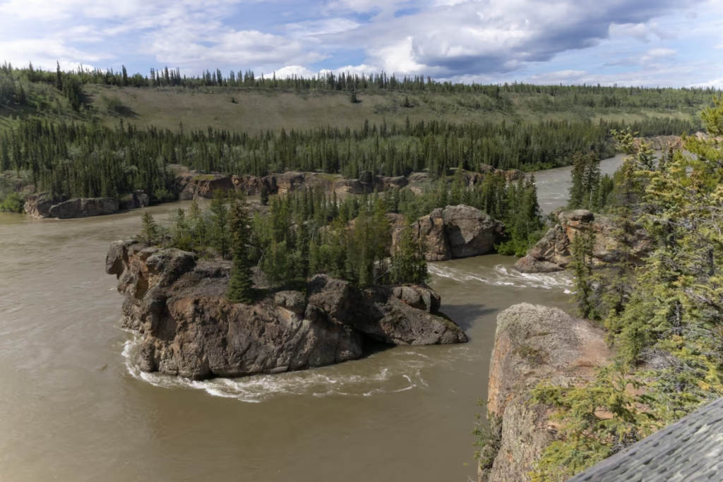
Have a leisurely breakfast and grab any supplies you may need for the road trip before continuing north on the Klondike Highway.
Stop at Braeburn Lodge for one of its famously oversized cinnamon buns, then continue toward Five Finger Rapids. A short trail leads to a viewpoint overlooking the Yukon River, where four basalt islands divide the rushing water.
Continue to Carmacks, a small community along the Yukon River and a useful overnight stop.
Day 4: Carmacks to Dawson City
Continue north through the Yukon wilderness toward Dawson City. Stop in Pelly Crossing, home of the Selkirk First Nation, to learn more about the area’s Indigenous history and culture.
Continue through Stewart Crossing, where the landscape opens into broad interior valleys, before making the final stretch toward Dawson City.
Arriving in Dawson feels like stepping straight into the Klondike Gold Rush. Spend the evening wandering its unpaved streets and historic wooden boardwalks.
Day 5: Dawson City
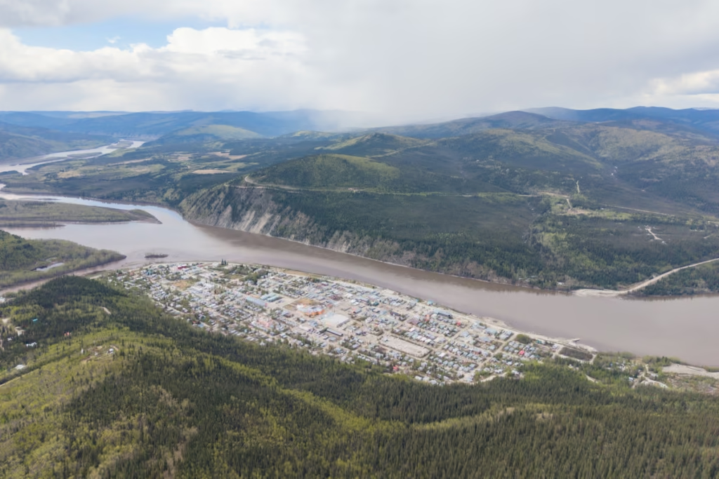
Give yourself at least one or two days to explore Dawson City and the surrounding Klondike mining district. Walk the historic streets, visit Bonanza Creek, explore the old goldfields, and learn about the people and events that transformed this remote corner of Yukon during the Klondike Gold Rush.
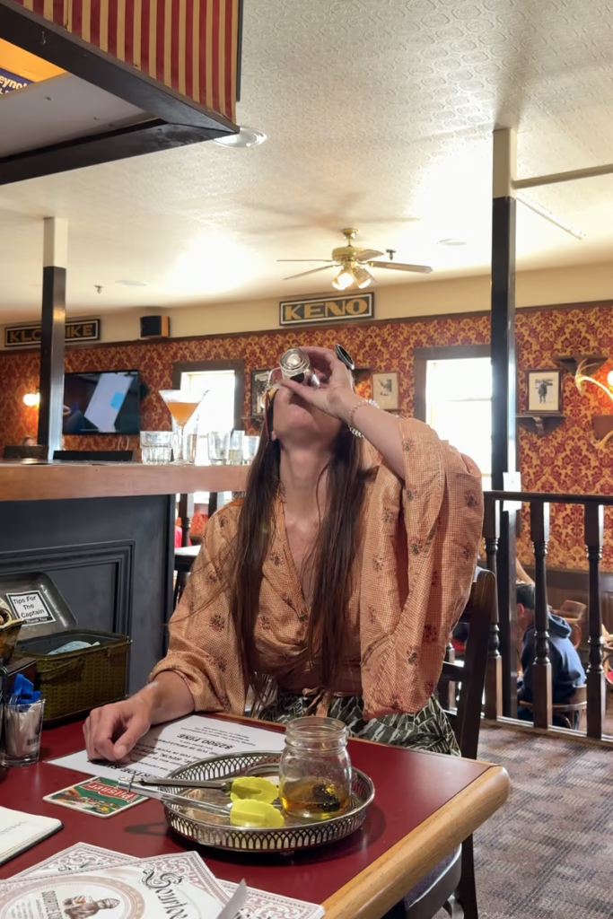
Dawson City has quite a bit of fun things to do in town too. Two of its most famous things to do are to do the infamous sour toe shot at the Sourdough Saloon and catch the cancan show at Diamond Tooth Gerties Gambling Hall.

If you’re continuing rather than retracing your route, you can take the George Black Ferry across the Yukon River and begin the Top of the World Highway, creating a larger loop through Alaska.
Best Time to Drive the Klondike Highway
The best time for a Klondike Highway road trip is generally the summer season, when services are operating and the days are extremely long.
May: Spring has sprung in the Yukon, though May can still see some snow along the way.
June: Excellent for long daylight hours and emerging summer landscapes.
July: Peak summer and generally the busiest period.
August: A great month for road trips, with summer conditions but shorter crowds than the height of July.
September: Fall colors can be spectacular, particularly farther north, but services begin winding down and weather becomes more unpredictable.
I would avoid planning this as a casual winter road trip unless you’re specifically prepared for northern winter driving.
Is the Klondike Highway Paved?
Most of the main Klondike Highway is paved, making it considerably easier to drive than some of the more remote Yukon and Alaska routes. That doesn’t mean you should treat it like an interstate highway.
Distances are long, weather can change quickly, and wildlife is common. Once you’re away from the larger communities, services become sparse.
Also remember that the highway crosses an international border, so you’ll need appropriate travel documents and should check the current Canadian and U.S. entry requirements before your trip.
Gas and Services on the Klondike Highway
Fuel planning is important. You won’t be constantly surrounded by gas stations once you leave Whitehorse, so I recommend filling up whenever you have the opportunity rather than gambling on making it to the next station. The same goes for food and water.
I also recommend downloading offline maps before leaving Whitehorse. Cell service can be inconsistent or absent in remote sections.
And don’t forget the wildlife. Moose, black bears, grizzlies and other animals can be encountered along northern highways. Keep your eyes on the road and slow down when visibility is limited.
Klondike Highway Road Conditions
Check road conditions immediately before setting out, particularly during shoulder seasons. The Klondike Highway has a reputation for being notoriously bad, and I can attest to this.
For the Yukon portion, 511 Yukon provides current information on road conditions, closures, construction, weather alerts and highway cameras.
For the Alaska section around Skagway, check Alaska 511, which provides road conditions, construction, closures, weather information and cameras.
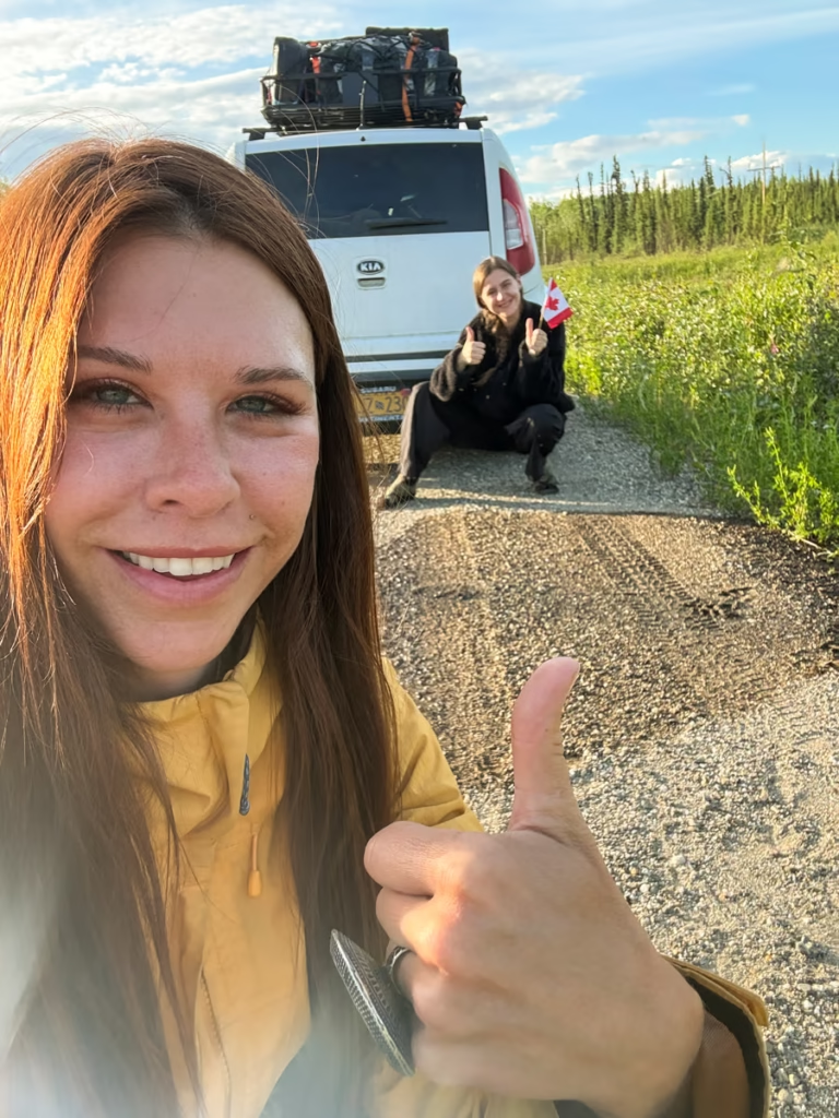
To give you an idea, I have had bad luck on the Klondike Highway. I nearly hit two giant grizzly bears that ran out in front of me on the road late in the evening near Dawson City. Moments later, my tire sensor light came on. So I kept driving a bit further up the road to get further away from where I sighted the bears to change my fully obliterated tire.
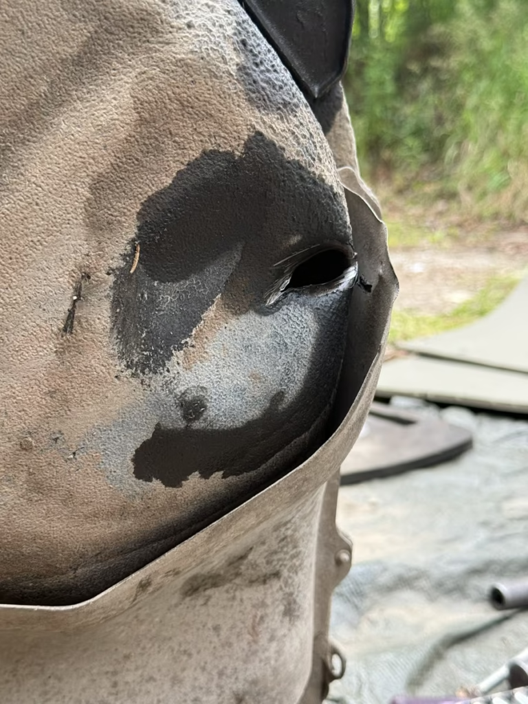
Another time, nearing Dawson City, I hit a giant piece of semi truck shrapnel left behind in the road that punched a hole in my fuel tank. Luckily, a local guy from up near Inuvik towed us up to Rock Creek and helped us get a new fuel tank up from Whitehorse.
Where to Stay on the Klondike Highway
For a comfortable Klondike Highway road trip, I’d use these as your main overnight bases:
Skagway: 1-2 nights
Carcross: 1 night if you want a slower trip
Whitehorse: 1-2 nights
Carmacks: 1 night for breaking up the drive
Dawson City: 2-3 nights
If you’re camping, there are additional options along the route.
For example, the Yukon River Campground is across the river from Dawson City and is accessible by the George Black Ferry during its operating season. The campground has more than 100 sites and is particularly convenient for combining camping with time in Dawson.
The Klondike River Campground is another option approximately 20 km outside Dawson City, with a short interpretive trail through old-growth forest.
Can You Drive the Klondike Highway in an RV?
Yes, but I’d approach the trip differently in an RV than in a car.
The main highway itself is accessible, but some of the side roads around the historic mining areas are narrow, steep, or unsuitable for large vehicles.
For an RV trip, I’d stick primarily to the main highway and designated campgrounds, and check individual road conditions before taking side roads.
Klondike Highway vs. Top of the World Highway
If you’re traveling between Dawson City and Alaska, you have another spectacular option: the Top of the World Highway.
Rather than returning south along the Klondike Highway, you can continue east from Dawson toward the Yukon-Alaska border and eventually connect with the Taylor Highway in Alaska.
The route is considerably more remote and includes long stretches with limited services. Alaska DOT notes that the Taylor and Top of the World highways are largely gravel, with steep and narrow sections and long distances between services.
That makes it a fantastic addition to a larger Yukon-Alaska road trip, but I’d plan it separately rather than treating it as simply an extension of the Klondike Highway.
Klondike Highway Road Trip Tips
Fill up when you can: Don’t wait until your fuel light comes on in the Yukon wilderness.
Carry snacks and water: Even when the map shows a community ahead, services can be limited or operating seasonally.
Download offline maps: Cell service isn’t something I’d rely on for the entire route.
Start early: You’ll have more time for roadside stops, wildlife sightings and photography.
Don’t underestimate the distances: A few hundred miles in the Yukon can take much longer than expected once you add stops.
Watch for wildlife: Slow down and stay alert, especially around dawn and dusk.
Bring your passport: You’re crossing the U.S.-Canada border.
Check road conditions: Use 511 Yukon and Alaska 511 immediately before departure.
Leave room for spontaneity: This is one of those roads where the best stop might be the one you didn’t plan.
Is the Klondike Highway Worth Driving?
Absolutely, it’s one of the great historical transportation corridors of the North.
The road crosses international borders, climbs over a Gold Rush pass, passes impossibly blue lakes and strange desert dunes, cuts through the Yukon wilderness and eventually arrives in a town that still feels remarkably connected to its Gold Rush past.
What I enjoyed most was the sheer change in landscape. Skagway feels coastal and dramatic. White Pass feels alpine and almost severe. Carcross is unexpectedly desert-like. Whitehorse feels distinctly northern but urban by Yukon standards. Farther north, the road becomes quieter and wilder until Dawson suddenly appears at the end of it all. That progression is what makes the Klondike Highway road trip so memorable.
Have Any Questions About the Klondike Highway?
Ask in the comments section below.
Posts from Alaska & Canada
Alaska Highway Road Trip: Alcan Guide
Denali Highway Alaska Road Trip Guide
Girdwood Travel Guide
Klondike Highway Road Trip: Skagway to Dawson City
Prince of Wales Island Travel Guide
Seward Highway Road Trip Guide
Two Days in Anchorage: The Perfect Anchorage Itinerary
Golden Circle Route: Yukon & Alaska Road Trip

Between Beaches: An Alaskan Winter Getaway
A Guide to Jasper National Park
Free Places to Ski & Snowboard Near Anchorage
Liard Hot Springs in British Columbia
A Guide to Banff National Park
The Best Hostels in Anchorage, Alaska
A Quick Guide to Hope, Alaska
Shrine of St. Therese in Juneau, Alaska
Wrangell St. Elias Road Trip
A Guide to Hiking to Flute Glacier
Anchorage’s Best Hotels
Denali National Park Travel Guide
Silverbow Inn: One of the Best Places to Stay in Juneau
Hiking to Exit Glacier
Spencer Glacier Whistle Stop Train
Visiting Byron Glacier
Best Day Hikes Near Anchorage
Big Loop Alaska Road Trip
Travel Alaska on a Budget
