Trekking to Pik Engles Meadow in Tajikistan’s Wakhan Valley
Updated January 2024, Trekking to Pik Engles, Tajikistan was originally published in January 2022
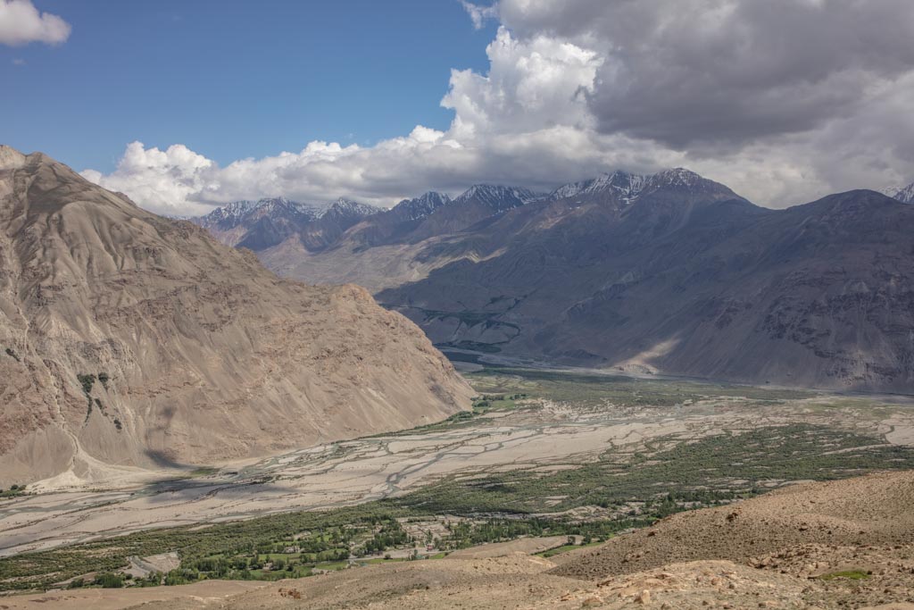
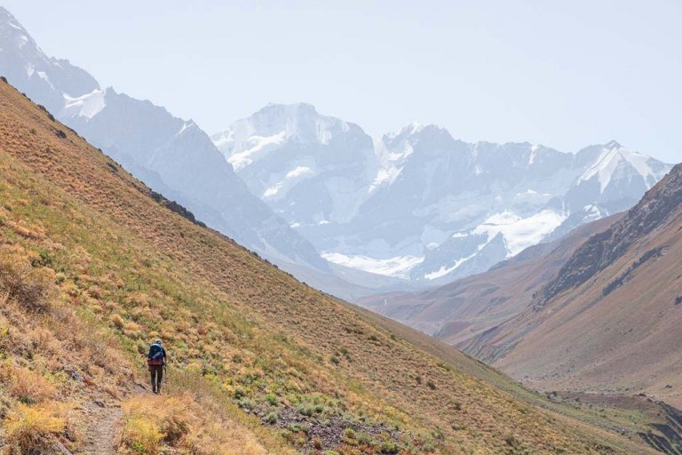
Returning to the Tajik Wakhan, I had moved the trek to Pik Engles Meadows to the top of my priority list, located in the southern sliver of Tajikistan sitting on the border with Afghanistan.
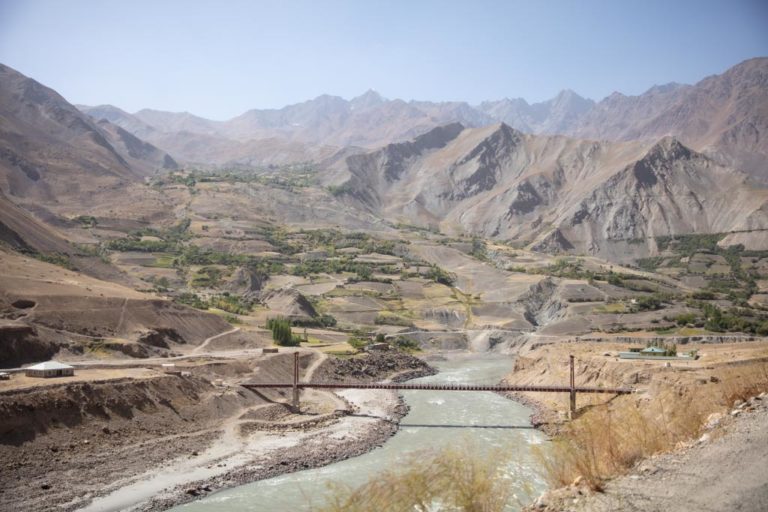
The trek to Pik Engles’ southern meadows was straightforward, easy for Tajikistan- owing to the mostly well-beaten paths leading from Zong and Langar that meet at the valley’s mouth.
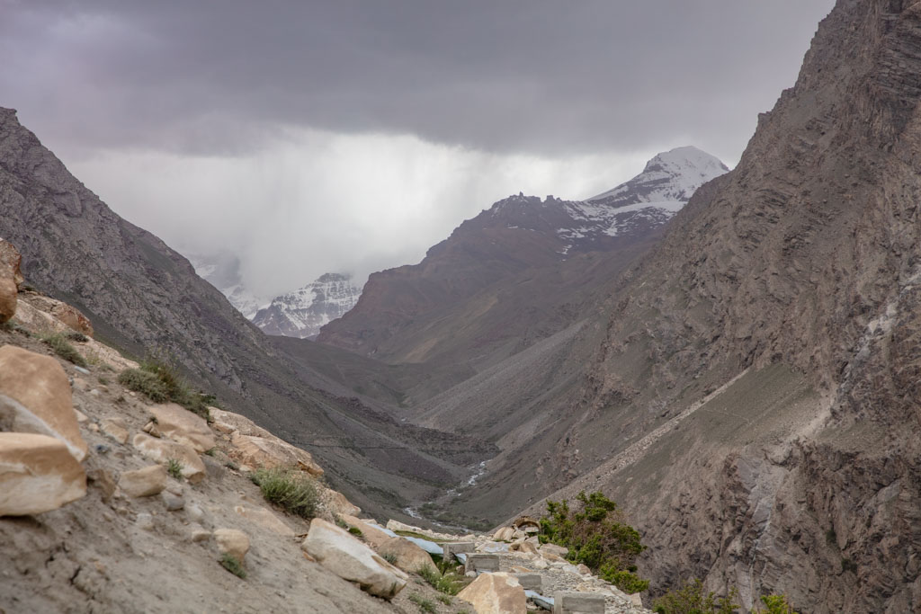
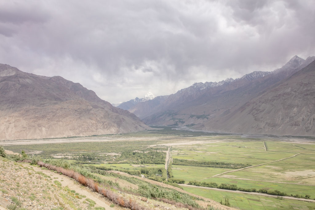
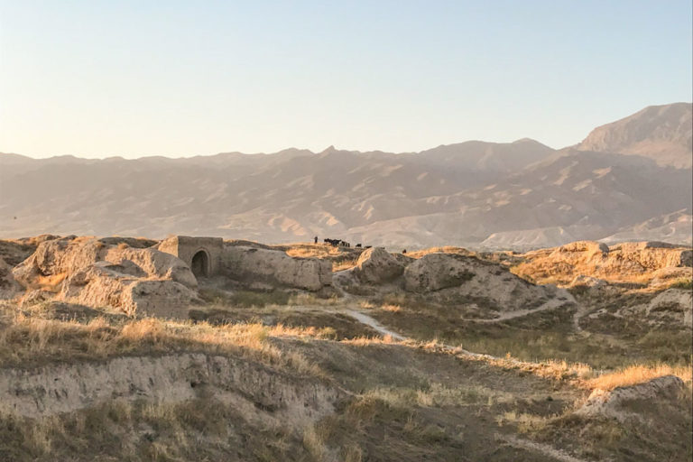
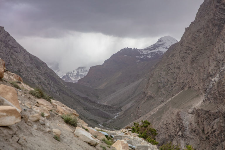
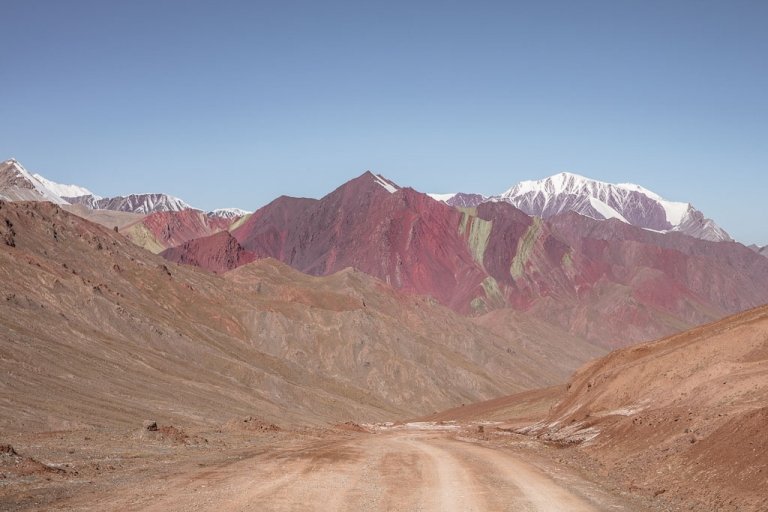
What I didn’t expect, was to get caught up in a June storm. Before rounding the corner into the valley from Zong I was chased by a menacing dust storm.
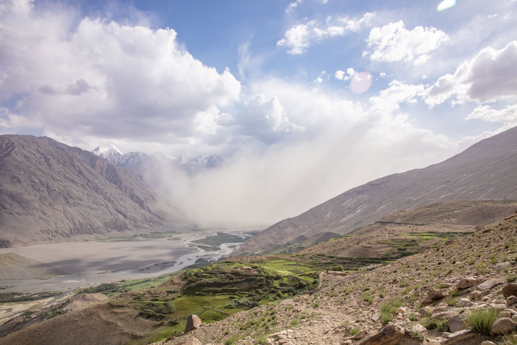
I would turn around from time to time to watch the opaque beigeness grow in every direction, inching closer and closer, cloaking the Hindu Kush Range sat across the Wakhan Valley on the Afghan side entirely.
Wanna join a group expedition on the Pamir Highway?
I will be leading a 12 day expedition down the Pamir Highway June 25-July 6, 2024. There is also an option for a 25 day Tajikistan Expedition that also includes a trek in the Fann Mountains.
Need Travel Insurance and Evacuation Services for Tajikistan?
Start shopping for travel insurance plans over at IATI Insurance. Readers of the Adventures of Nicole get a 5% discount off your plan.
The Adventures of Nicole partners with Global Rescue to offer the world’s leading medical evacuation and security advisory services. To travel with peace of mind, shop evacuation coverage at Global Rescue.
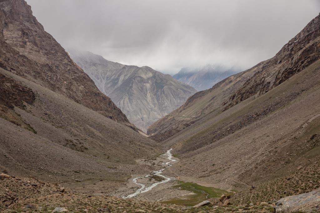
Luckily, as the storm’s full wrath reached me I was just bending the turn into the side valley carved by the Kishtijarob River that leads into Pik Engles Meadow. My luck would run out about a kilometer further into the valley as the rain began to fall, heavily.
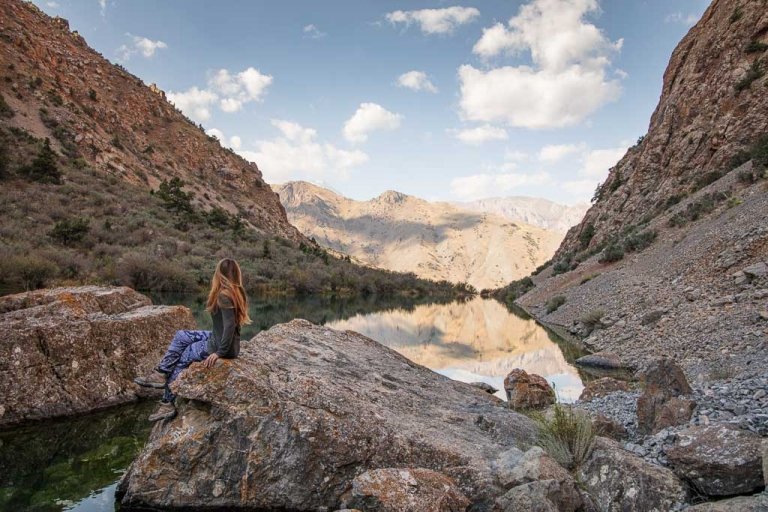
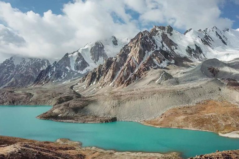
The remainder of the walk was off and on across patches of boulders, slipping along the way and rolling up a couple of grassy hills to arrive at the famed Meadows under Pik Engles, shrouded in heavy clouds down to the bases of the mountains in the valley as the sun dipped below the horizon.
Plan your visit: The Tajik Wakhan Valley Travel Guide
Getting to the Pik Engles Meadows Trailhead
There are realistically two starts to reach Pik Engles. One from Zong, which is a longer more gentle ascent, and the other from Langar- shorter and noticeably steeper.
From a local recommendation, I opted to begin from Zong and end in Langar, though you can choose to flip-flop these or return to the same village from which you started.
Shared taxis and cars that will likely give you a lift for a small fee ply the route from Khorog and Ishkashim to Langar and back along the Tajik Wakhan Valley.
From Ishkashim and Khorog you can sometimes find a shared taxi going all the way to Langar leaving when full, usually in the earlier morning. A shared taxi from Khorog to Langar will cost 160 TJS and take about 8 hours, from Ishkashim to Langar plan for 90 TJS and 5 hours. If planning to start from Zong rather than Langar, let the driver know and they will let you off at Zong.
Start your adventure with the Tajikistan Travel Guide for ideas
Don’t forget to grab A copy of Bradt’s Tajikistan Guidebook before you go
The Pik Engles Meadow Hike
Distance
19.5 km
Elevation gain
912 m+ | 1,144 m-
Time
2 days (9 hours of walking time in total)
Pik Engles Meadow Trek: Day 1
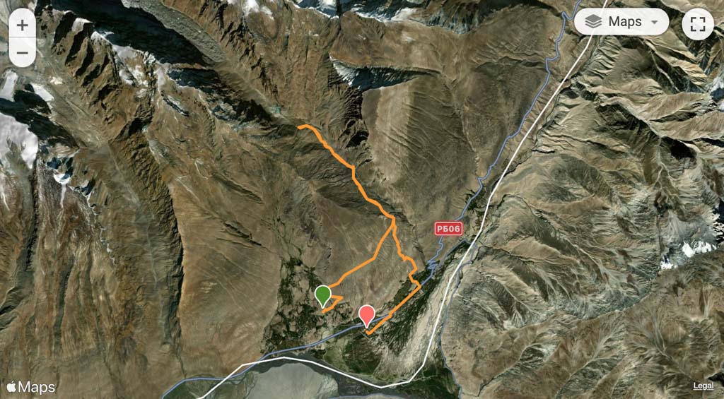
Starting from the end of the drivable dirt road in Zong the path to Pik Engles is pretty obvious, following an old roadbed to the east that eventually deteriorates into a trail, steadily gaining elevation before the path bends back to the west, zigzags a couple of times and then takes off to the east again. Eventually, this path meets with an irrigation canal which you will follow into Kishtidjarob River Valley.

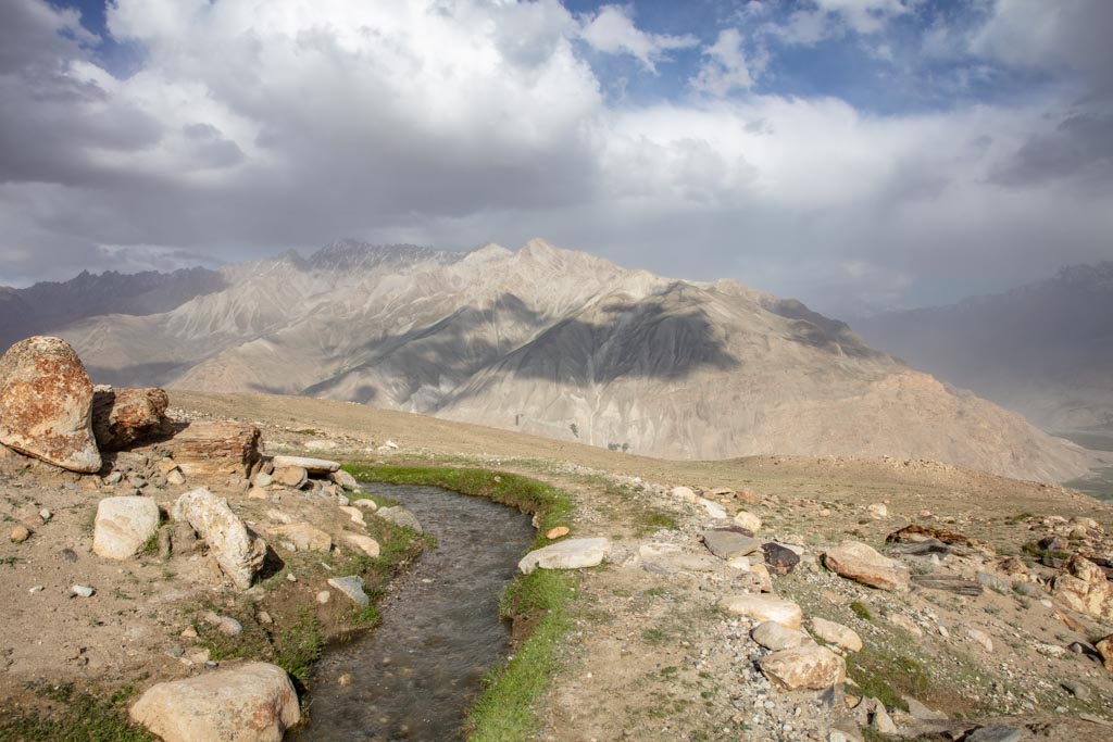
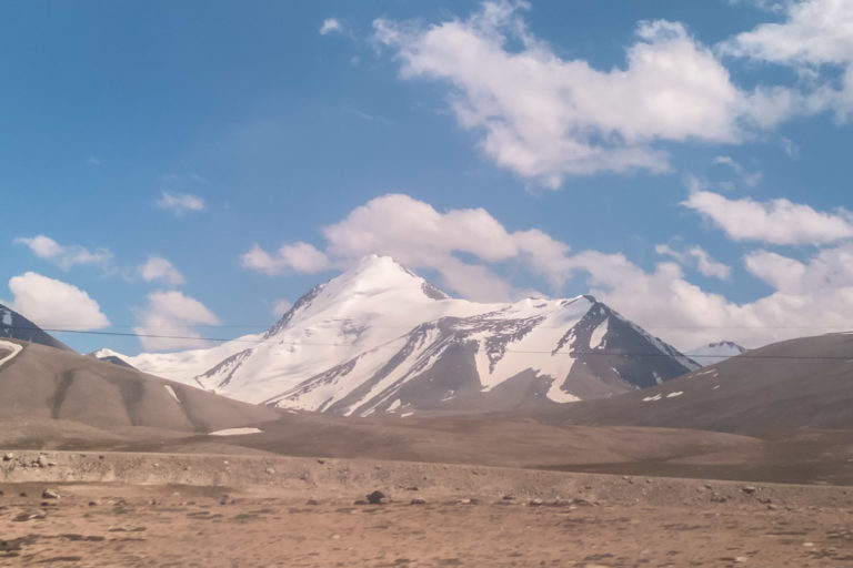
The irrigation canal continues two kilometers into the valley before it ends at a small dam where you should get your first glimpses of the distinct Pik Engles (unless you’re hiking in the pouring rain by this point like I was). From there on, you’ll roughly follow the course of the river.
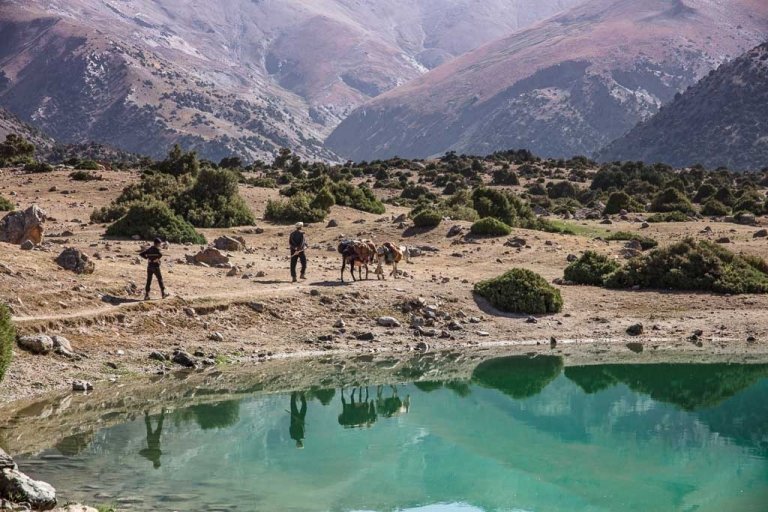
As many locals from Langar and beyond being their livestock to graze at Pik Engles Meadow, the trail is well-beaten, though do expect it to diverge as animals and shepherds may take slightly different routes due to changing river levels throughout the season.
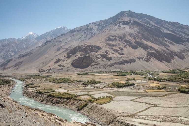
You will always be on the southwest side of the Kishtidjarob River as you continue higher into the valley.
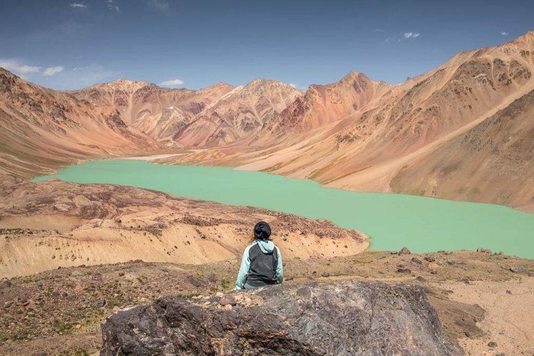
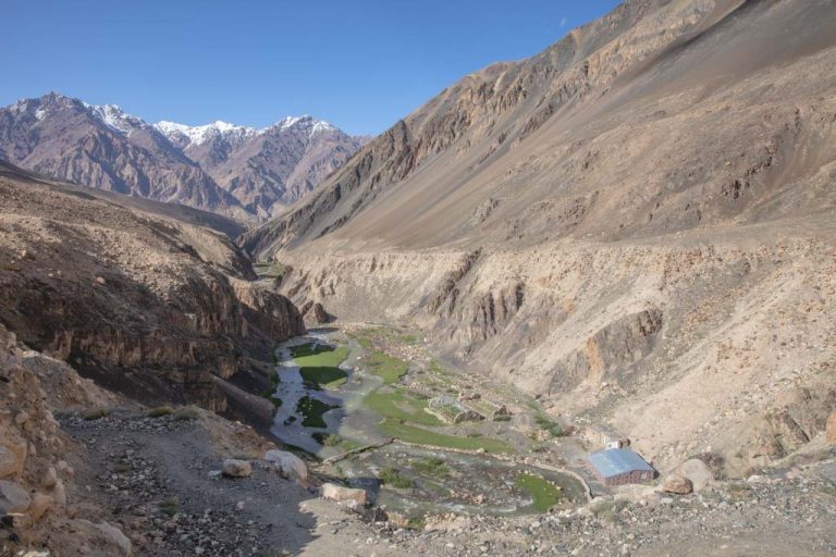
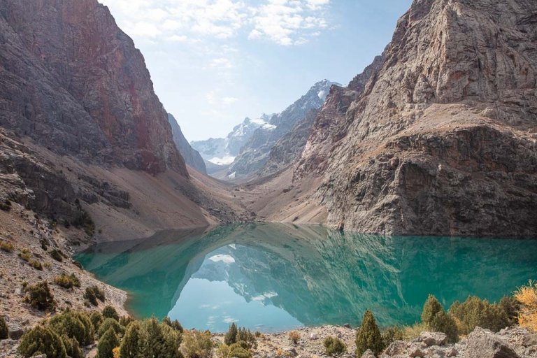
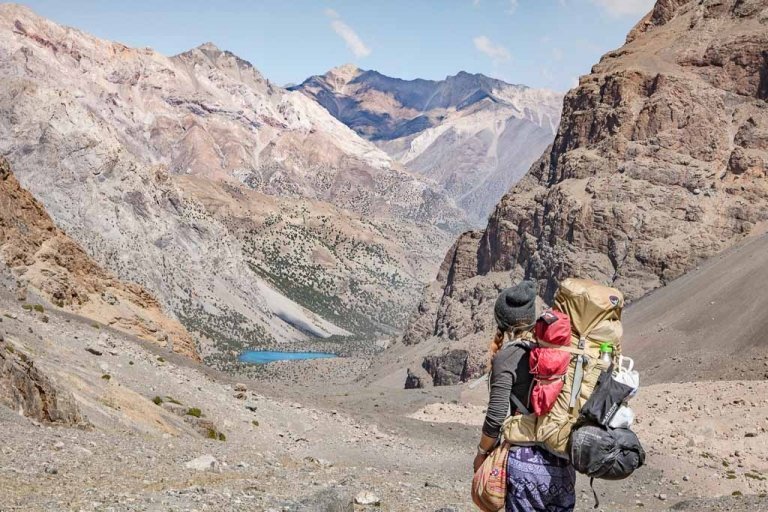
You’ll reach a nice flat grassy field that could make for a nice camping spot, but the path does continue, zigzagging up 150 meters before the valley widens a bit to land you into the beautiful Pik Engles Meadow.
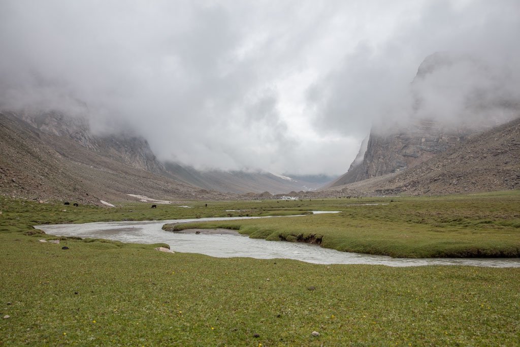
There are a plethora of great camping spots to choose from in the grassy meadows here under Pike Engles, so choose your favorite.
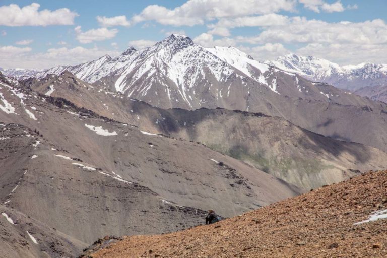
For those planning to spend more time exploring the area around the Pike Engles Meadow, there are a few easy(ish) summits to take on here, including 5,794 meter Churlenisa, 5,837 meter Danilaytisa, and 6,075 meter Moskovskoy Pravda.
Pik Engles Meadow Trek: Day 2
The trek on day two is pretty easy and all downhill. From camp, you’ll follow the same route back, all the way out of the Kishtidjarob River Valley.
Roughly 130 meters after bending the last obvious turn out of Kishtidjarob River Valley, you will want to follow a path that veers from the irrigation canal. It instantly turns to the north for 100 meters before taking a sharp turn straight south.
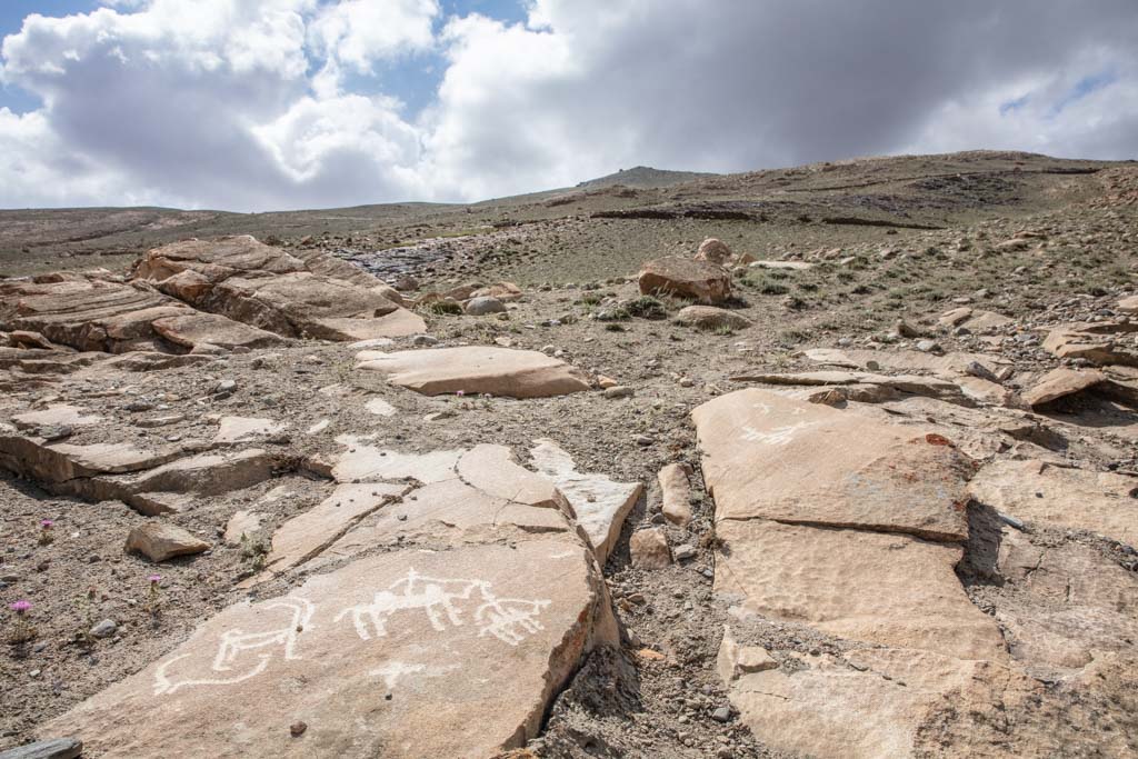
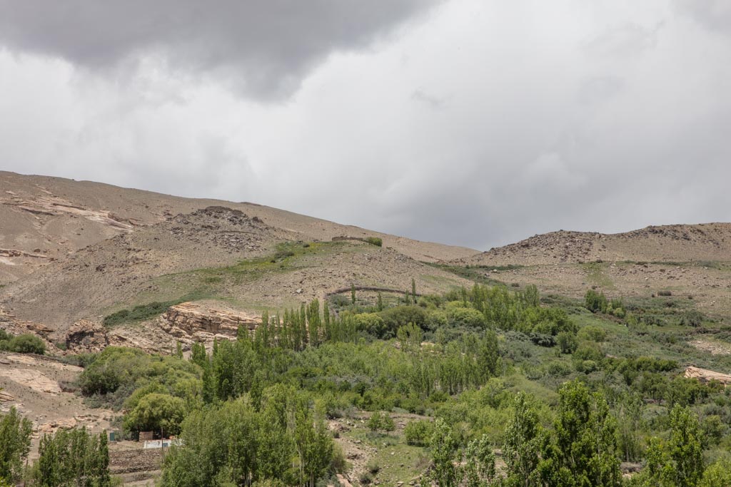
The path is mostly obvious on the way down and about 700 meters after that sharp bend south you’ll begin running into petroglyphs carved into exposed rocks and boulders strewn on either side of the trail.
The trail essentially stays along the countless petroglyphs down to the village of Langar. There are over 6,000 petroglyphs scattered around uphill of Langar that date back to the stone age- though you’ll find plenty of new-age graffiti added on the rocks.
Trek start and end information: Please note that it is entirely possible to start and end the trek from either Zong or Langar to make the Pike Engles Meadow hike an out-and-back, or can be easily reversed, starting in Langar and ending in Zong. Note that the approach from Zong is gentler, while the approach from Langar is steeper.
Note: The GPX file shows a slightly longer distance- this is because I continued to Hisor at the end of the trek after Langar.
Wanna take on the legendary Pamir Highway? Check out this travel guide and this itinerary
Where to Stay
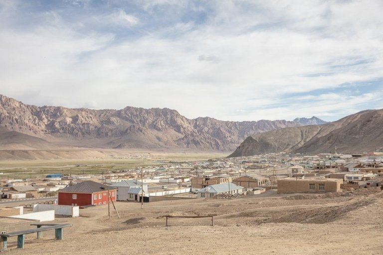
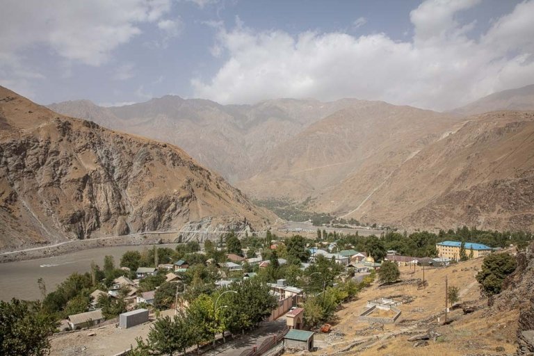
Langar
There are several homestay options in Langar for those that plan to start or end the Pik Engles trek from here. Try Yodgor Homestay (+992501835305), Nigina Homestay (+992938483720), Homestay Mulloniyoz (+992501160683), or Behruz Guesthouse (+992935825732). Expect 200-250 TJS per night, including dinner and breakfast.
Hisor
I opted to stay in Hisor, making the short walk from Langar to Hisor in the end. Davlatkhon’s Homestay (+9929351488119) is the best option in the village, offering rooms including dinner and breakfast for 220 TJS.
The family makes great soups and main dishes, and Davlatkhon can help sort a shared taxi for onwards travel for you- he made some calls and found a shared taxi headed back to Khorog, departing the following morning. The taxi even collected me from the homestay in the morning.
Other Treks in Peak Engles Meadows
Peak Moskovskoy Pravda
What I didn’t know when I did the Pik Engles Meadow trek (not until my return to Tajikistan only a few weeks later) is that from the meadow, you can make a summit up Pik Moskovskoy Pravda just due east.
It’s a 6,075 meter peak, requiring no technical skills (don’t worry, I have plans to return to bag this one).
Summiting Pik Moskovskoy Pravda is possible to complete in a day from Pik Engles Meadow- plan to set up your basecamp in the meadow, spend the night and wake up super early to the summit and come back down to camp on day two, and pack up and trek back to Zong, Langar, or Hisor on day three.
Other nearby peaks to consider summiting before taking on Moskovskoy Pravda in this area are 5,794 meter Churlenisa and 5,837 meter Danilaytisa.
In July 2023, I managed to make the summit up Moskovskoy Pravda. I haven’t had a chance to type up details on doing it but for the time being feel free to email me for further instructions until I get the trail notes up on here!
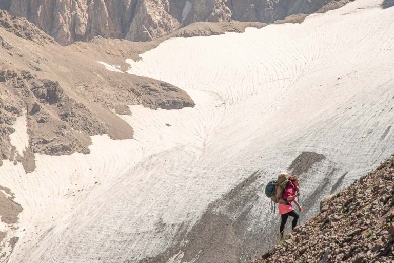
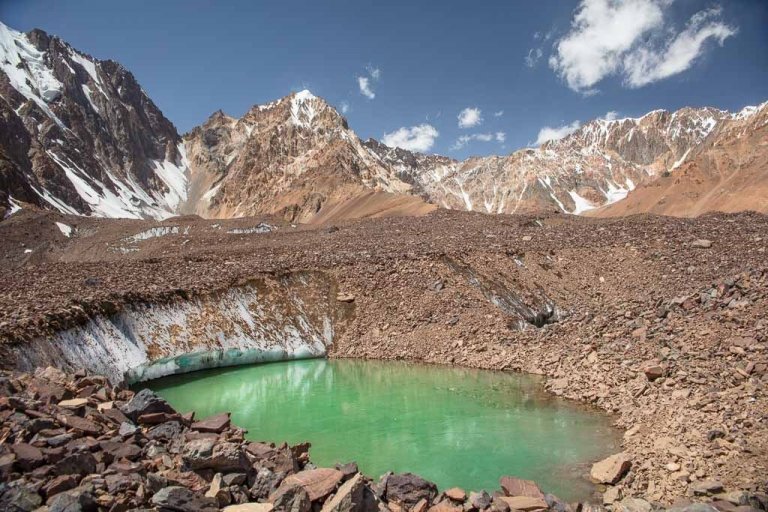
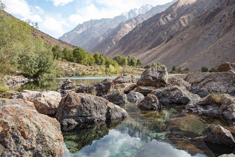
Pik Engles Glacier
If doing the Pik Engles trek later in the summer or the early fall when the valley has had a chance to dry up a bit, it’s usually possible to trek out to the snout of Pik Engles Glacier.
Things to do in Langar
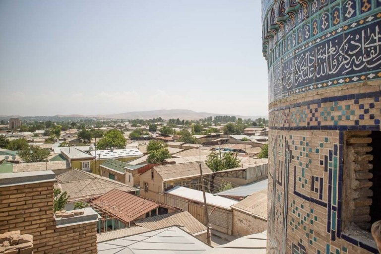
Shah Kambari Aftab Shrine
The name Shah Kambari Aftab translates out to ‘Master of the Sun’ is dedicated to the bringer of Ismailism to Langar, though given the name of the shrine, it’s likely this site predates the arrival of Islam and is an ancient Zoroastrian fire or sun temple.
Langar Museum
The museum is dedicated to the Shah Kambari Aftab Shrine but also general Pamiri and Wakhi life and history.
Langar Petroglyphs
As mentioned in the hiking section, there are about 6,000 petroglyphs scattered on the hillside above Langar Village. The closest cluster of them are marked on Maps.me as well as Gaia GPS but continue along the hiking trail that leads to the Pike Engles Meadows from Langar and you’ll be rewarded with hundreds of petroglyphs found just off the trail.
Things to do in Zong
Abrashim Qala
Abrashim Qala is also known as the Vishim Qala (Vishim Qala translates out to Silk Fortress), the castle sits above the village of Zong and dates back to the middle ages. The castle would have served to protect traders and inhabitants of this section of the Wakhan Valley from marauders.
It’s possible to visit Abrashim Qala for those starting or ending in Zong who don’t mind a roughly 1.5 kilometer detour (each way), though you can just as easily appreciate the fortress from the main Wakhan Valley Road.
Things to do in Hisor
The two main sites in Hisor village are the Sufi Shrine to Oston i Nur Mohammed and the Ruins of Zangibar Fortress.
The Zangibar Fortress is smaller, though similar to nearby Abrashim Qala, served as a defensive fortification from invaders. It is believed to have been built by Kafirs (non-believers, therefore, dating back to pre-Islamic times) and due to the lack of pottery found, is thought to have been inhabited only a short while.
What to Pack for Pik Engles Meadow
- Down jacket
- Fleece
- Long sleeve top
- Trekking pants
- Leggings
- Trekking socks
- Sports bra
- Warm hat
- Sunglasses
- Inreach Explorer+
- Backpack (I personally recommend the Ariel 65 for women)
- Hiking boots (My favorite are the La Sportiva Nucleo High GTX)
- Katadyn water purifier
- Sleeping mat
- 3-season tent
- Hydration Pack
- Sleeping bag
- Campstove and Cooking set
- Propane/butane canister
- Trekking poles
- Headlamp
- Trekking in Tajikistan
- Sunscreen
- Toothbrush
- Biodegradable wipes
- Toilet Paper
- First Aid Kit
- Hand sanitizer
- Camera/lenses and necessary accessories
- Battery Bank
- Solar Panel
- Phone and charging cables
- Bradt Tajikistan Guidebook or Lonely Planet Central Asia
- Lonely Planet Central Asia Phrasebook
Have any questions about the Pik Engles Meadow Hike?
Ask in the comments section below.
More posts from Tajikistan:

Ishkashim Border Crossing Between Tajikistan & Afghanistan
Khujand Travel Guide + 14 Things to Do In Khujand
The Best Restaurants In Dushanbe
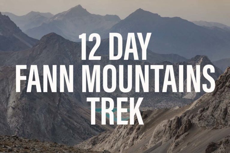
Fann Mountains Trekking Expedition, Tajikistan June 12-23, 2024
The Ultimate Tajikistan Travel Guide

12 Day Pamir Highway Expedition June 25-July 6, 2024
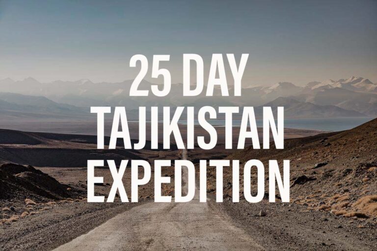
25 Day Tajikistan Expedition June 12-July 6, 2024
Trekking The Haft Kul in Tajikistan’s Fann Mountains
Two Week Tajikistan & Uzbekistan Itinerary
Tajikistan Itinerary For 1-4 Weeks
Must-Try Tajik Food: Best Food in Tajikistan
A Guide To Tajikistan’s Fann Mountains
The 10 Best Hikes In Tajikistan
Panjakent Travel Guide + 6 Things To Do In Panjakent, Tajikistan
17 Things To Do In Tajikistan
A Beginner’s Guide To Central Asia Travel: Discover The Silk Road
Panjakent-Samarkand Border Crossing Between Tajikistan & Uzbekistan
Rasht Valley, Tajikistan
How to Cross the Shirkhan Bandar Border Crossing Between Tajikistan & Afghanistan and get an Afghan Visa on the Border
The Gardan i Kaftar Hike In Tajikistan’s Rasht Valley
A Day Trip to Madiyan Hot Springs, Tajikistan
A Day Trip To The Taboshar Uranium Mines in Istiklol, Tajikistan
Windswept Desolation In Karakul, Tajikistan
Gumbezkul Pass Hike, Tajikistan
Murghab Travel Guide + 4 Things To Do In Murghab, Tajikistan
The Beautiful Bolshoi Allo Lake In Tajikistan’s Fann Mountains
Sarazm Ruins, Tajikistan: The Oldest City in Central Asia
How To Get To Khafrazdara Valley, Tajikistan
Qala i Khumb Travel Guide, Tajikistan
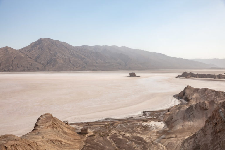
A Giant Salt Flat in Tajikistan? Welcome to Akhkon
Crossing Chimtarga Pass
How To Get To Timur Dara Lake, Tajikistan
A Guide to the Shokhdara Valley, Tajikistan

How To Get To Lake Sarez, Tajikistan
Trekking to Pik Engles Meadow in Tajikistan’s Wakhan Valley
Across Tajikistan In 80 Photos
Climbing Kyzyldong in Tajikistan’s Pamir Mountains
How To Get To Hisor Fort, Tajikistan
Crossing Kyzyl Art Pass Between Tajikistan & Kyrgyzstan
Tajikistan Border Crossings
Khorog Travel Guide + 7 Things To Do In Khorog
Is Tajikistan Safe? The Short Answer: Yes
Solo Female Travel in Tajikistan
Tajikistan Visa Guide: How to Get a Tajik Visa
The Tajik Wakhan Valley Travel Guide
Istaravshan Travel Guide + 9 Things To Do In Istaravshan
Jizeu Trek: Tajikistan’s Best Overnight Hike In The Pamirs
10 Reasons to Visit The Pamirs
The Best Road Trips In The World
Hello,
could you please give us some details on reaching the Peak Moskovsky Pravda?
we plan to hike to the meadow tomorrow, still havent decided from where and how to get there from Khorog.
Thanks 🙂
Hi Alicia, sorry about the late reply! I was out in the Fanns guiding without any internet. Hope you had a successful summit. The short details are to follow the animal tracks up the green grassy hill behind the main camping area
For Pik Engles meadows marked on most maps. Continue upward toward the ridge past a couple shepherd camps. Then essentially follow the ridge to Moskovsky Pravda. When I did it crampons and an ice ax were definitely needed.