A Guide to Tajikistan’s Fann Mountains
Updated January 2026, The Fann Mountains Trekking Guide was originally written in December 2016
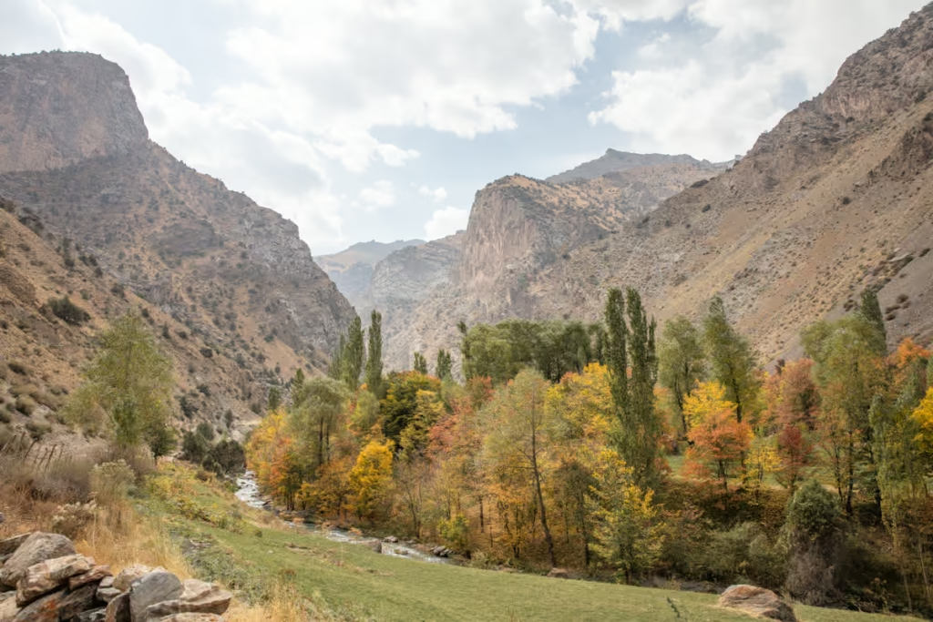
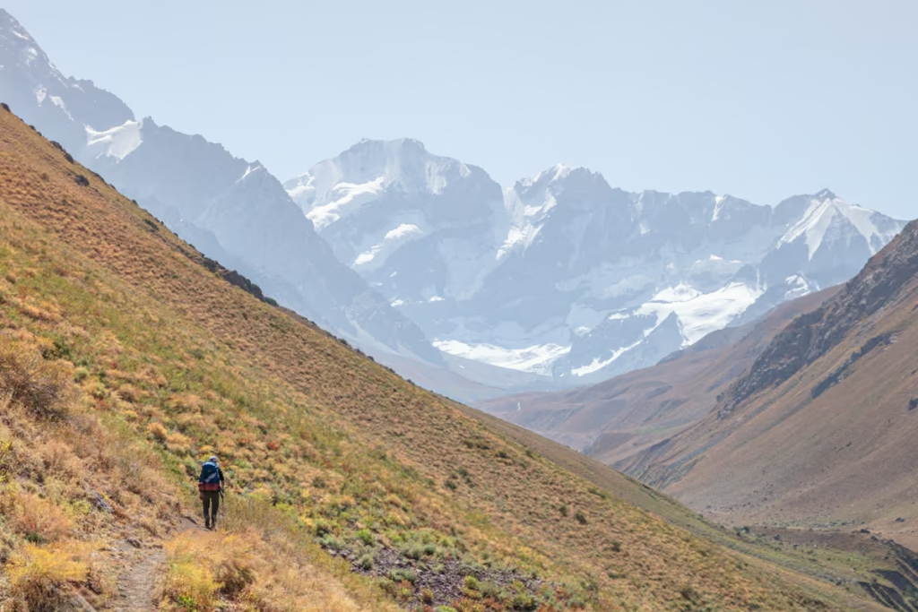
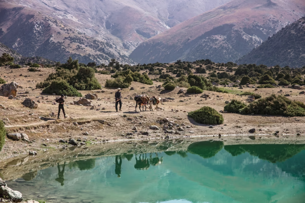
The Fann Mountains may quite possibly be the best trekking destination you’ve probably never heard of. In Tajikistan’s Fann Mountains you’ll find yourself surrounded by sky-scraping jagged mountains, crystal clear lakes of azure, and the warm heart & legendary hospitality of the local people. Although- This is a remote stretch of Earth where you could go days without seeing another soul and that’s as much of its charm as is the stark sceneries.
And this is where this blog comes in to help. When I visited this area for the first time in 2016 there was almost zero information on it. So after my first trip and several updates after a few trips back I finally decided to share the info I gathered over time here.
But don’t fret, you don’t have to be a hardcore mountaineer to enjoy this beautiful area. There are short and long treks around that will give most anyone a great experience in the Fanns. Of course, there are treks that will keep even the experienced trekkers on their toes.
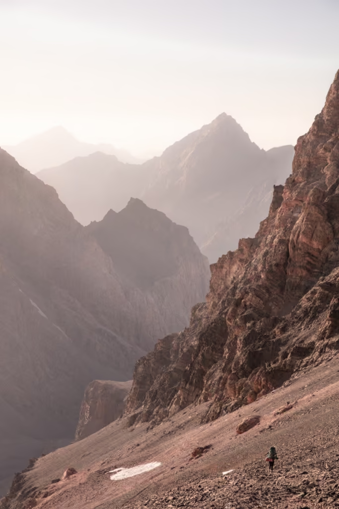
*This is a somewhat remote area of Tajikistan and with any trekking destination, or you know, just life, in general, there are assumed risks. This area is prone, but not limited to earthquakes, extreme weather conditions, landslides, political upheaval, and bone-crushing roads. Much of the trekking in Tajikistan, in general, is wild and remote.
There are little to no facilities and services outside of cities. Be prepared, have enough layers and proper gear, food, and water. The likelihood of being rescued in the event of a life-threatening injury or disaster is slim. You’re going at your own risk and remember that there is never any shame in hiring a guide.
Looking for more trekking ideas in Tajikistan? Check out the 10 best treks in Tajikistan
Need Travel Insurance and Evacuation Services?
Start shopping for travel insurance plans over at IATI Insurance. Readers of the Adventures of Nicole get a 5% discount off your plan.
The Adventures of Nicole partners with Global Rescue to offer the world’s leading medical evacuation and security advisory services. To travel with peace of mind, explore their evacuation coverage.
- Fann Mountains Trekking Routes
- Haft Kul Area
- Haft Kul to the Lakes Area
- The Lakes to Haft Kul Area
- Haft Kul to Iskanderkul
- The Lakes Area to Iskanderkul
- Combining Chimtarga Pass & the Lakes
- How to Get to the Fann Mountains
- Accommodations & Camping in the Fann Mountains
- Tours & Guides for the Fann Mountains
- Packing List for the Fann Mountains
- Practical Info & Safety in the Fann Mountains
Fann Mountains Trekking Routes
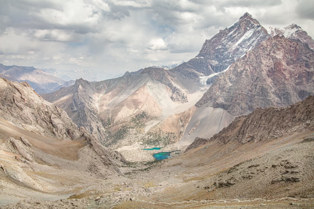
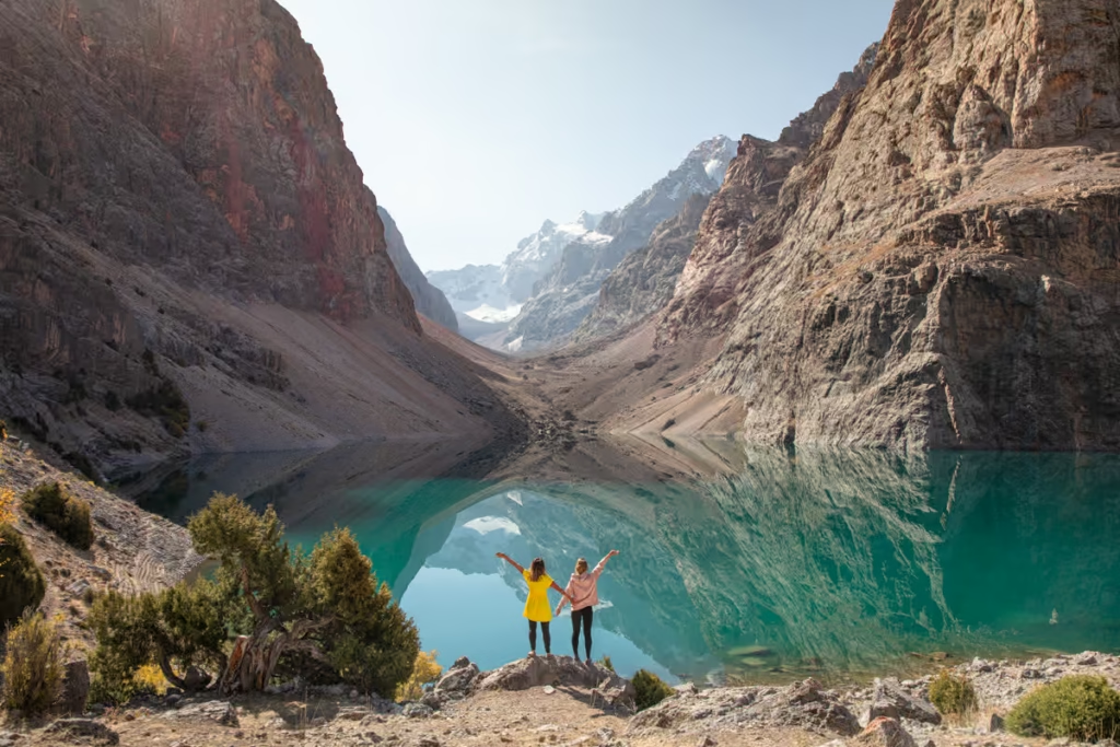
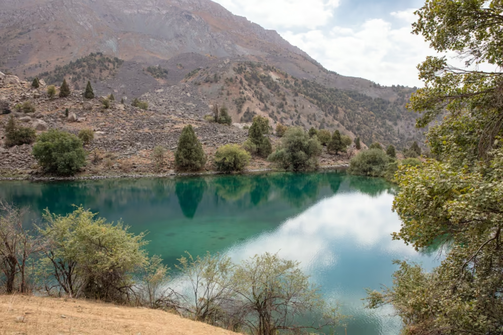
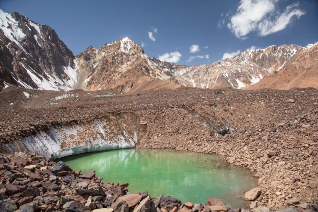
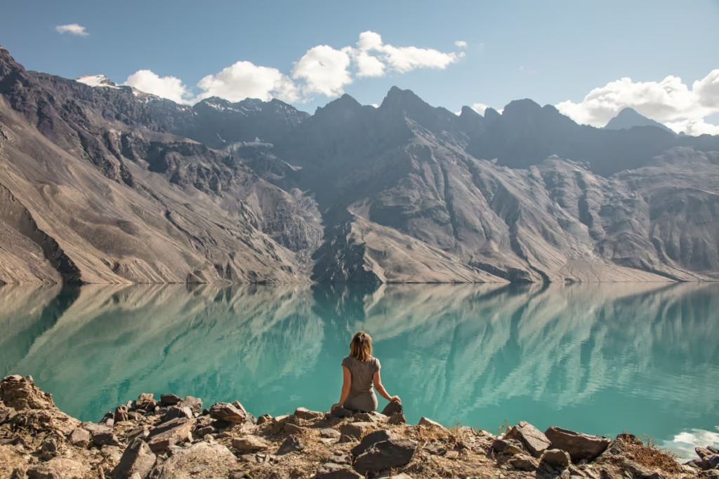
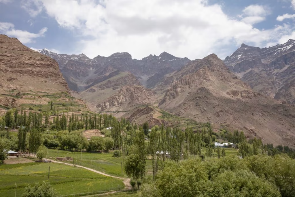
The Kulikalon & Alovaddin Lakes Area
This stunning area will take you through semi-arid mountains, juniper forests and will find you waking up next to Carib-blue lakes. Alovaddin and Kulikalon Lakes are easily a highlight of most Fann Mountains treks. The “Lakes Loop” is one of the most popular treks in the Fanns.
Both the Kulikalon Lakes area, as well as the Alovaddin Lakes area, are only accessible on foot. If you want to see the beauty of the Fanns and are short on time this is your best option. The Lakes area can be visited as a one way through the trek, or combined to form the popular “Lakes Loop”.
*Note that as of 2019 there is a park ranger who will collect a camping fee from you if he runs across you in the Lakes Loop area (Artuch, Kulikalon Bowl, Lake Alovaddin). We were charged 19 TJS per night (don’t expect to get 1 TJS in change if you pay with a 20 TJS note).
The Lakes Loop
Artuch Alplager ➤ Kulikalon Lakes ➤ Alovaddin Pass ➤ Alovaddin Lakes ➤ Lauden Pass ➤ Artuch Alplager
The Lakes Loop is an easy favorite in the Fann Mountains as it dazzles with some of the country’s most beautiful lakes, doesn’t require much backtracking, and is easy to get to and from with public transport.
From Artuch you will trek down to Kulikalon Lake about 5 km. The shoreside of Kulikalon is a great place to camp, other good options to set up camp is near the shores of Bibijonat Lake or Kulisiyekh Lake just a little west in the same meadow. There is a nearby settlement of friendly herders on the far side of Kulikalon, they will likely invite you for a meal, or at least bread and tea if they are around.
The next segment of the trek will take you from Kulikalon over 3,630 meter Lauden Pass. From Lauden Pass, you’ll follow the Pasruddaria River then the Chapdara River to Alovaddin Lakes.
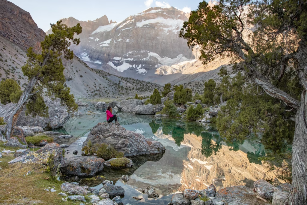
Once over the pass you can set up camp and spend the afternoon relaxing at beautiful Alovaddin Lakes. It is possible to grab a warm meal and a beer at the makeshift restaurant tent at the north end of the main lake.
In the morning head for 3,860 meter Alovaddin Pass back toward Kulikalon. The Pass is a little higher and steeper than Lauden to get over and offers stunning views of both lakes from the top.
Once back to Kulikalon you can make the 5 km trek back to Artuch, or alternatively set up camp next to Dushakha Lakes or Bibijonat Lakes and take a 4th day/3rd night out of the trek. This trek can easily be done in reverse.
For those wanting to tack on an extra day from Alovaddin, you can make a day hike to Mutnyi Lake and back to Alovaddin Lakes.
You will need to camp at Kulikalon (you can set up camp near Bibijonat or Dushakha as well). There are homestays in Artuch and Alovaddin, though I recommend camping at the south shore of Alovaddin for epic sunrise views.
For those looking for an alternative route, start from Zimtut Village, head up over Zurmech Pass (3,260 meter) to arrive at the Chukurak Lakes, and then to Artuch to start the journey to Kulikalon.
Looking for more details on the Lakes Loop Trek? Read The Lakes Loop Trekking Guide
The Lakes One Way
Artuch Alplager ➤ Kulikalon Lakes ➤ Alovaddin Pass or Lauden Pass ➤ Alovaddin Lakes ➤ Vertical Alovaddin
If you want to trek the Lakes Loop, but are short on time and would prefer to trim a day off the itinerary it is possible to do the trek as a one-way through-hike. Reversing this itinerary is no problem.
You will need to camp at Kulikalon (you can set up around Dushakha or Bibijonat Lakes as well). There are homestays available in Artuch and Alovaddin, though I do recommend camping on the south side of Lake Alovaddin. Please note that there is no public transport to/from Vertical Alovaddin.
Kulikalon Lakes From Artuch
Artuch Alplager ➤ Kulikalon Lakes ➤ Artuch Alplager
This short trek will take you about 5km from Artuch Alplager to the Kulikalon bowl where there are the lake systems of Kulikalon, Bibijonat, and Dushakha.
You can set up camp in any of these three areas of the bowl. Camping along Kulikalon Lakes has gorgeous sunrise views. Bibijonat has nice grassy shores to set up on with epic views of Mirali, or camp next to Dushakha at the foot of Mirali Peak.
Local shepherds do pass through the bowl and they even have a settlement on the far shore of Kulikalon, so don’t be surprised if they welcome you with bread, almonds, and chai.
For those really short on time, you can make a day trip here returning to Artuch in the evening.
Alovaddin Lakes From Vertical Alovaddin Camp
Vertical Alovaddin ➤ Alovaddin Lakes ➤ Vertical Alovaddin
This is a short and sweet trek to the lake from Vertical Alovaddin, the old Russian climbing camp. From the camp, the trail makes a gentle ascent past small lakes and finally up to the main Alovaddin Lake.
In 2017 a couple of pop-up chaikhanas have opened up on the north shore of the lake for those wanting to grab a warm meal and a beer.
The best place to set up camp in on the southern shore of the lake- and set your alarm early to catch the sunrise. You can easily visit Lake Alovaddin as a day trip if you’re not keen on spending the night.
Lakes Loop Via Chukurak Lakes
Artuch Alplager ➤ Kulikalon Lakes ➤ Lauden Pass ➤ Alovaddin Lakes ➤ Alovaddin Pass ➤ Kulikalon Lakes ➤ Govkhona (Chukurak) Pass ➤ Chukurak Lakes ➤ Artuch
This is a fun alternative to the standard Lakes Loop Circuit. You essentially take the same route as the traditional hike (from Artuch to Kulikalon to Alovaddin and back to Kulikalon), but after Kulikalon you’ll ascend up 3,180 meter Govkhona (also called Chukurak Pass).
Upon descent, you’ll arrive at the beautiful Chukurak Lakes, a great place to set up camp for a night before making the brief trek back to Artuch Alplager. Alternatively, you can end in Zimtut by trekking over Guitan Pass. This trek can easily be done in reverse.
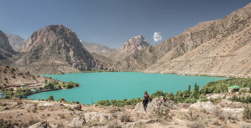
Haft Kul Area
The Haft Kul is set in a narrow, craggy mountain valley. The old legend says an old man went missing in the valley. His seven daughters came to search for him but were unable to find him and began to cry along the narrow valley.
The valley filled with tears and drown them. Each of the seven lakes represents one of the man’s daughters.
In reality, it’s a narrow, earthquake-prone valley with the Shing River running through it. Researchers believe that earthquakes over the years created rockslides that dammed off the Shing River resulting in the Haft Kul.
Haft Kul means seven lakes in Tajik. The lakes stretch roughly 15km from lake one down to lake seven.
Their names from north to south are Mijgon, Soya, Gusbor, Nofin, Khurdak, Marguzor, and Hazorchazma. Each lake has a unique and different color to it.
The Haft Kul offers a variety of trekking options from day trips from Panjakent to hike between the glimmering lakes to multi-day treks. There are a few homestays along the valley where you could do short treks lake to lake staying at homestays. Perched just above Marguzor Lake (the 6th lake) sits Kiogli village to the east and Soimarguzor Village just above the lake on the west shore.
If you’re really short on time or not wanting to trek there is a road connecting 6 of 7 the lakes making a day trip to the lake possible.
For more detailed information on the Haft Kul area, read my Haft Kul Trekking Guide
The Haft Kul
Mijgon (Lake #1) ➤ Soya ➤ Gusbor ➤ Nofin ➤ Khurdak ➤ Marguzor ➤ Hazorchazma (Lake #7) ➤ Homestay ➤ Mijgon
Welcome to the Haft Kul, also called the Seven Pearls of Shing and Marguzor Lakes. This area is easily reached from Panjakent. 6 of the 7 lakes are reachable by road, so you can trek the dirt path or drive it. The 7th lake- Hazorchazma is about 30 minutes on foot beyond Marguzor (#6).
Most will take two days to explore the valley, but others may opt to spend several days slowly making their way from lake to lake. This area is not ideal for camping, but if you’re determined the shores of Hazorchazma are grassy making it the only place worth setting up camp.
There is a turbaza at the north end of Marguzor, Namjmidden Homestay near Nofin (I personally recommend staying there), as well as homestays in the village of Padrud.
For those short on time, it’s possible to visit on a day trip from Panjakent.
Mogiyon Village To Haft Kul
Mogiyon ➤ Rogich ➤ Komichura Pass ➤ Soimarguzor Village ➤ Marguzor Lake (#6) ➤ Hazorchazma Lake (#7) ➤ Nofin ➤ Padrud Village
This is so unknown it’s almost a secret. This route is rarely visited by foreigners and it’s hard to understand why not after having completed it in 2017.
From Panjakent grab a shared taxi in the morning bound for Mogiyon and brace yourself- after the road splits from the Haft Kul road it gets windy and narrow with steep drops on either side into an unforgiving valley. Once in Mogiyon, you’ll follow a shepherd’s trail that follows the Subashi River through narrow canyons and across rickety bridges.
Eventually, you’ll arrive at the village of Rogich where you can sleep at a homestay or set up camp just outside the village (though don’t be surprised if friendly locals invite you in).
The next morning make your way up 3,050 meter Komichura Pass following shepherd trails that will lead you down to Soimarguzor Village with gorgeous views of Marguzor Lake. Once down to Marguzor you can make the short detour to Hazorchasma or continue to Marguzor, Najmidden Homestay, or Padrud for the night.
You can do this trek without camping equipment if you want to stay at homestays both nights. It is advisable to contact ZTDA prior to your trek set up homestays. This trek can easily be done in reverse.
Haft Kul to the Lakes Area
The Haft Kul and the Lakes Area are two of the Fann Mountain’s most gorgeous destinations and this trek combines the tow areas. These trekking options are great for those that are just arriving at higher altitudes as the Haft Kul does sit lower in altitude than the lakes making acclimatization easier.
Haft Kul to the Lakes
Marguzor Lake (#6) ➤ Kiogli Village ➤ Tavasang Pass ➤ Sarymat & Archamaidan River Confluence ➤ Zimtut Village ➤ Guitan Pass ➤ Chukurak Lakes ➤ Kulikalon ➤ Alovaddin or Lauden Pass ➤Alovaddin Lakes ➤ Vertical Alovaddin
This trek combines the beauty of two of the best and easiest to access places in the Fann Mountains to visit. Start from Marguzor Lake in the Haft Kul towards the village of Kiogli before making it up and over 3,300 meter Tavasang Pass. At the bottom of the pass near the shore of the Sarymat River, there is a great spot to set up camp for the night.
The next two days are pretty mellow, but long following the Sarymat beyond its confluence with the Archamaidan River and finally into Zimtut Village where you can camp nearby or sleep in a homestay for the night.
The next day you’ll continue up and over 2,600 meter Guitan Pass and descend down to Chukurak Lakes to set up camp for the night.
The following morning you’ll head up and over 3,180 Govkhona Pass into the Kulikalon Bowl where you’ll camp for the night.
Your final day will take you up and over either Alovaddin or Lauden Pass to end at Alovaddin Lake. This trek can be done in reverse however it is recommended to go from Haft Kul to the Lakes if you haven’t yet adjusted to the altitudes in Tajikistan.
As an alternative, you can head east from the Archamaidan River along a shepherd trail about 2 kilometers north of Gazza Village. From here you’ll go over 3,260 Zurmech Pass to arrive at Chukurak Lakes.
Highlights of the Fann Mountains From Haft Kul to the Lakes
Marguzor Lake (#6) ➤ Kiogli Village ➤ Tavasang Pass ➤ Sarymat & Archamaidan River Confluence ➤ Zimtut Village ➤ Guitan Pass ➤ Chukurak Lakes ➤ Kulikalon ➤ Alovaddin or Lauden Pass ➤Alovaddin Lakes ➤ Mutnyi Lake ➤ Foot Of Chimtarga Pass ➤ Chimtarga Pass ➤ Bolshoi Allo ➤ Maloye Allo ➤ Zimtut Village
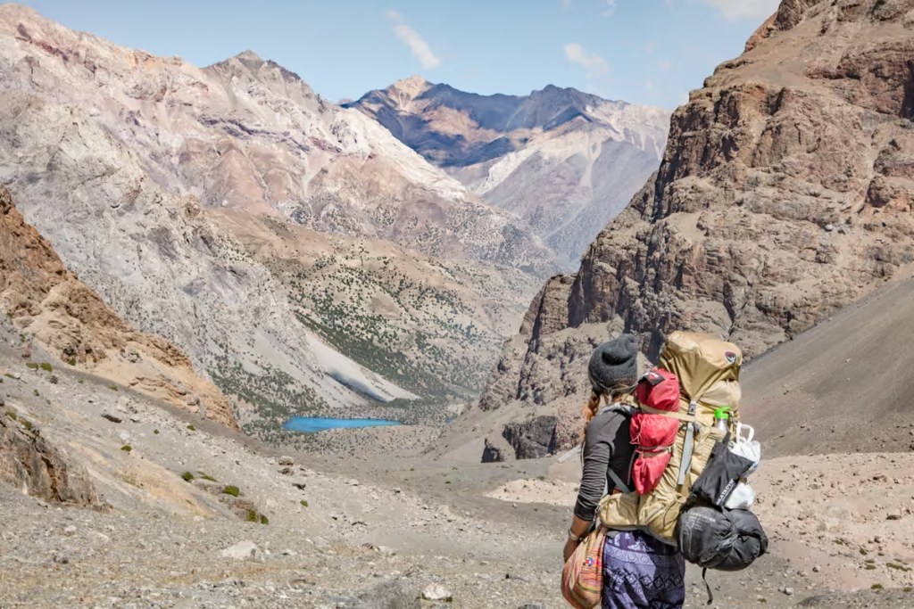
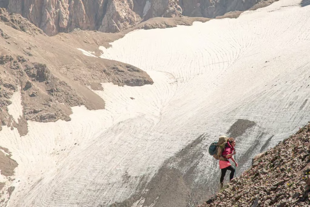
This is a big trek that will take you from the Haft Kul to Zimtut and Chukurak Lakes and onto Kulikalon and Alovaddin Lakes. The trek continues to pass the murky Mutnyi Lake before taking on the massive 4,740 meter Chimtarga Pass. Take a much-needed rest day exploring the area around Bolshoi Allo Lake before you descend down the Zindon Valley to meet the Archamaidan River once again and turn back north to end the trek at Zimtut.
You will definitely need camping gear on this trip and make sure you bring plenty of food with you. Due to how high Chimtarga Pass is it would be wise to take a rest day at Alovaddin the day before your trek to Mutnyi and make the following day a short one camping below Chimtarga Pass.
In 2016 I took on Chimtarga Pass (and backward from most at that- which I don’t recommend). In 2019, I returned and went over Chimtarga Pass in the usual direction (Mutnyi to Bolshoi Allo and it went much better).
Another tidbit worth being aware of– pack animals cannot go over Chimtarga Pass, so you’ll need to plan to carry your own gear over it.
The Lakes to Haft Kul Area
Combining the two famous Fann Mountains alpine lake areas from the previous section, however thanks to steep scree conditions on the Bolshoi Allo side of Chimtarga Pass it is recommended to take on these treks in this direction.
Kulikalon to Haft Kul Via Chimtarga Pass
Artuch Alplager ➤ Kulikalon Lakes ➤ Alovaddin or Laudden Pass ➤ Alovaddin Lakes ➤ Mutnyi Lake ➤ Foot Of Chimtarga Pass ➤ Chimtarga Pass ➤ Bolshoi Allo ➤ Maloye Allo ➤Sarymat & Archamaidan River Confluence ➤ Tavasang Pass ➤ Kiogli Village ➤ Marguzor (Lake #6)
Much like the treks covered in the previous section, this one will take you from Artuch Alplager to the Haft Kul via Chimtarga Pass. It is best to only attempt this trek if you’ve already adjusted well to higher altitudes in Tajikistan. It is smart to take at least 4 days making it to camp at the foot of Chimtarga Pass to help prevent altitude sickness getting over the pass.
I don’t recommend doing this trek in reverse due to the steep scree conditions on the Bolshoi Allo side of Chimtarga Pass. I unwittingly did the trek this way in 2016 and it was a challenge, to say the least. After returning in 2019 and doing it in the opposite direction I can attest to it being much easier in the direction laid out in this section.
Read more about beautiful Bolshoi Allo here
Alovaddin to Haft Kul Via Chimtarga Pass
Vertical Alovaddin ➤ Alovaddin Lakes ➤ Mutnyi Lake ➤ Foot Of Chimtarga Pass ➤ Chimtarga Pass ➤ Bolshoi Allo ➤ Maloye Allo ➤ Sarymat & Archamaidan Confluence ➤ Tavasang Pass ➤ Kiogli Village ➤ Marguzor (Lake #6)
This is the same trek as from Kulikalon, just a day less trekking. I do recommend spending at least an extra day at Alovaddin or Mutnyi if you’re not yet acclimatized to the altitudes.
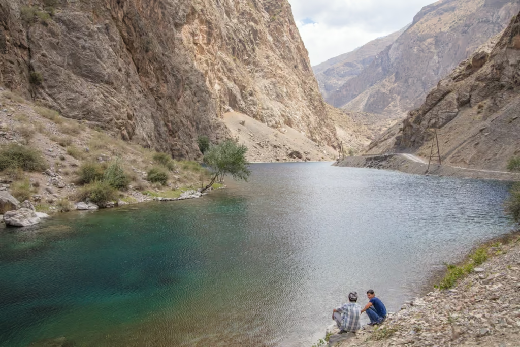
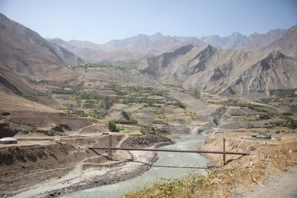
Haft Kul to Iskanderkul
Iskanderkul is the most well known of the Fann Mountains lakes. The massive lake sits in the southeast corner of the Fanns. These are more cultural treks that pass through high summer pastures and little mountain villages where you’re guaranteed to experience Tajik mountain hospitality.
Read the Iskanderkul & Sarytag Travel Guide to plan your time at the end (or beginning) of your Haft Kul-Iskanderkul trek
West-East Traverse From Haft Kul Via Dukdon Pass
Marguzor (Lake #6) ➤ Kiogli Village ➤ Tavasang Pass ➤ Munora Pass Or Sarymat/Archamaidan Confluence ➤ Foot Of Dukdon Pass ➤ Dukdon Pass ➤ Sarytag/Iskanderkul
This is a somewhat long, and in some areas challenging trek that connects the Haft Kul to Sarytag/Iskanderkul.
From the village of Kiogli mentioned above in the Haft Kul trek, continue up Tavasang Pass and then proceed down the pass and cross the Abusafedsol River. After crossing the river you have two options: Either take 3,520 meter Munora Pass slightly toward the northeast and eventually link up to the Dukdon Pass that will lead you to Iskanderkul.
Alternatively, veer to the northeast and trek along the Sarymat River to its confluence with the Archamaidan and follow the Archmaidan back to the southeast to finally link up with 3,810 meter Dukdon Pass.
Once down Dukdon Pass follow the Akhbashir (which turns into) Karakul (which eventually turns into the) Sarytag River and on down to Sarytag Village and Iskanfderkul.
This trek can be done in reverse. Plan to camp outside of the Haft Kul and Sarytag, however, you may be invited in by shepherds along the journey.
West-East Traverse From Haft Kul Via Sarymat Pass
Marguzor (Lake #6) ➤ Kiogli Village ➤ Tavasang Pass ➤ Foot Of Sarymat Pass ➤ Sarymat Pass ➤ Sarytag/Iskanderkul
This trek starts out the same as the previously covered trek. After a night of camping at the Sarymat River banks, you’ll continue east-southeast and eventually tackle the aggressively steep 4,160 meter Sarymat Pass.
After descending out of the Sarymat plan to split the remainder of the trek into two days before you arrive at Sarytag Village and Iskanderkul.
The Lakes Area to Iskanderkul
These North-South Traverse treks combine the beauty of the Lakes Area and Iskanderkul.
North-South Traverse: Artuch to Iskanderkul Via Kaznok Pass
Artuch Alplager ➤ Kulikalon Lakes ➤ Alovaddin or Lauden Pass ➤ Alovaddin Lakes ➤ Mutnyi Lake ➤ Kaznok Pass ➤ Sarytag/Iskanderkul
This trek will start out as many others in this post going from Artuch to Kulikalon, Alovaddin onto Mutnyi.
From Mutinyi you’ll ascend up into 4,040 meter Kaznok Pass and descend down into Sarytag Village. Some reports claim that crampons are necessary to cross the Kaznok. From my experience, I found that it was possible without, though at least a set of cleats is useful.
Take care heading up the Kaznok as there are other trails that lead up to passes that you cannot get down without proper climbing gear, so do pay attention to your GPS.
This trek can be shortened by starting from Vertical Alovaddin rather than Artuch, saving you 13-20 kilometers and shaving a day off your travel time.
North-South Traverse: Artuch to Iskanderkul Via Chimtarga & Dukdon Passes
Artuch Alplager ➤ Kulikalon lakes ➤ Alovaddin or Lauden Pass ➤ Alovaddin Lakes ➤ Mutnyi Lake ➤ Chimtarga Pass ➤ Bolshoi Allo ➤ Maloye Allo ➤ Sarymat/Archamaidan River Confluence ➤ Dukdon Pass ➤ Sarytag/Iskanderkul
Making a backward ‘s’, this trek takes a turn once to Mutnyi Lake. This trek is a stunner, but it’s a long one. I completed this exact through-hike in fall 2019.
Rather than continuing due south to cross Kaznok Pass, you’ll instead head west to cross Chimtarga Pass and down to Bolshoi Allo. From here continue down the Zindon Valley until meeting up with the Archmaidan River and following it to the southeast to cross Dukdon Pass and continue on to Sarytag and Iskanderkul.
North-South Traverse: Alovaddin to Iskanderkul Via Guitan & Dukdon Passes
Vertical Alovaddin ➤ Alovaddin Lakes➤ Alovaddin or Lauden Pass ➤ Kulikalon Lakes ➤ Chukurak Lakes ➤Guitan Pass ➤ Zimtut ➤ Sarymat/Archamaidan River Confluence ➤ Dukdon Pass ➤ Sarytag/Iskanderkul
This trek connects beauty and culture departing from Alovaddin Lake to Kulikalon and continuing over Govkhona Pass to Chukurak Lakes nestled perfectly between mountains before taking on Guitan Pass to Zimtut Village.
From Zimtut meander along the Archamaidan River for a mellow stretch of the trek before heading up into Dukdon Pass, a place where you’ll definitely experience the culture of the area. Once up and past the Dukdon it’s a straightforward descent down to Iskanderkul and the village of Sarytag.
Combining Chimtarga Pass & the Lakes
Pair challenge with beauty. Chimtarga Pass is rugged and challenging but damn, those views from the top are worth it. The Lakes Loop sweetens the deal and getting to visit Bolshoi Allo is the cherry on top (or the side since Chimtarga Pass is the top, but now we’re getting too literal).
Chimtarga-Lakes Circuit
Artuch Alplager ➤ Kulikalon Lakes ➤ Alovaddin or Lauden Pass ➤ Alovaddin Lakes ➤ Mutnyi Lake ➤ Chimtarga Pass ➤Bolshoi Allo ➤ Maloye Allo ➤ Zimtut ➤ Guitan Pass ➤ Chukurak Lakes ➤ Artuch Alplager
This trek combines the lakes loop with Chimtarga Pass and Bolshoi Allo Lake. Alternatively, you can opt to end the trek in Zimtut rather than looping back to Artuch.
Up for a challenge? Read about crossing Chimtarga Pass
How to Get to the Fann Mountains
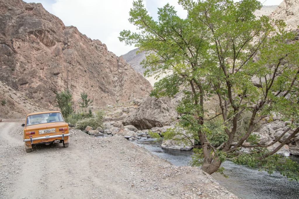
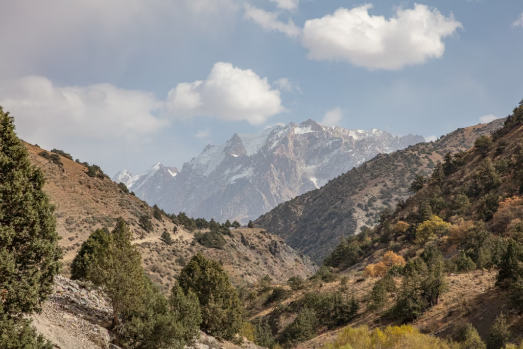
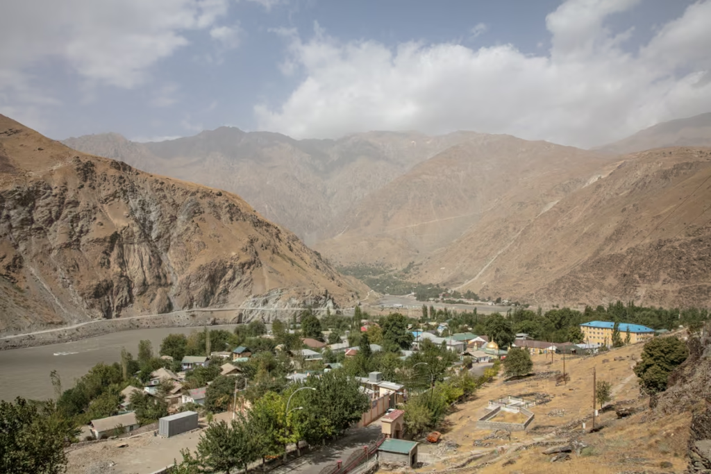
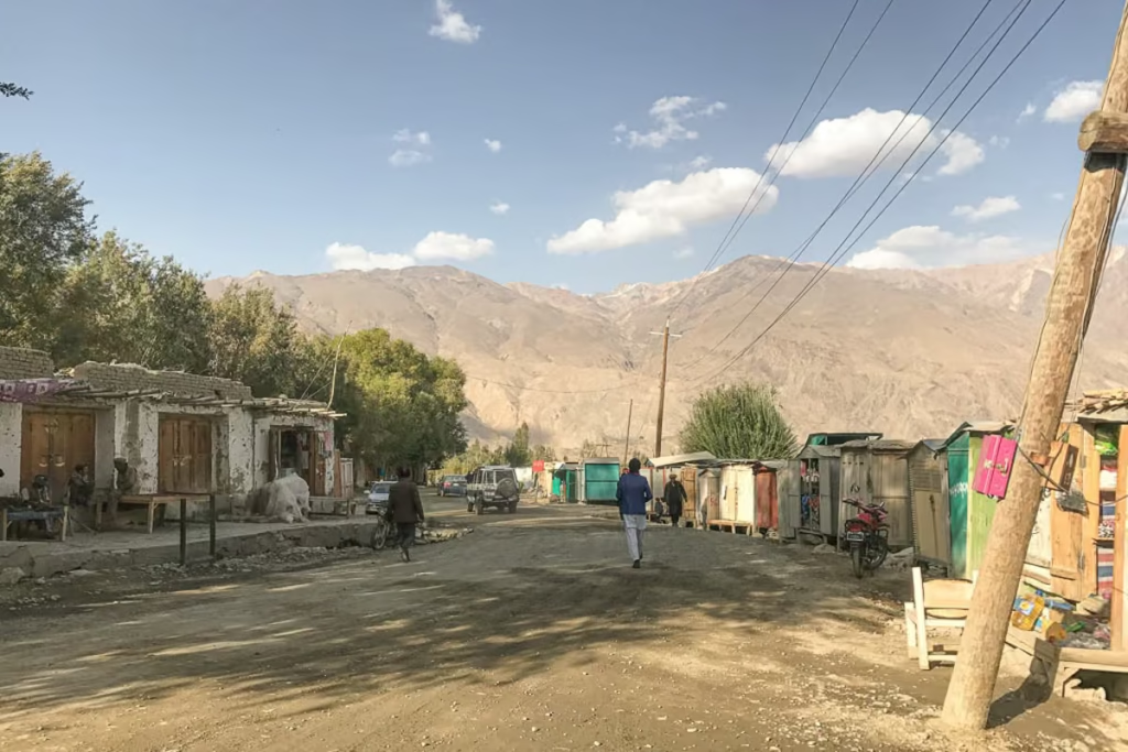
The Fann Mountains are part of the Western Pamir-Alay Mountain System, located in Tajikistan’s Sughd Province. The Fanns are bound by the Zeravshan range to the North, the Gissar range to the South, The Haft-Kul (Seven Lakes) to the West of the Archamaidon River, and the Fann Darya River to the East. This whole swath of land is situated in the northwest of Tajikistan. Cities & towns near and around the Fanns include Panjakent, Ayni, Shing, Sarvoda, and Sarytag.
Panjakent is the main jumping-off point into the Fann Mountains and is connected to Artuch Alplager, the Haft Kul, and Mogiyon by shared taxis. Most travelers will arrive here from Dushanbe, Khujand, or Samarkand in Uzbekistan.
Want to visit both Uzbekistan & Tajikistan? Check out my two week Uzbekistan + Tajikistan itinerary
If coming from Dushanbe you will have the great thrill of driving through the 5 km long famed Anzob tunnel. If arriving from Khujand or other cities in the Tajik Fergana Valley be ready for a winding cliff-side road with amazing views.
Another popular option is to combine the Fann Mountains with a trip to Uzbekistan’s Silk Road cities of Samarkand & Bukhara. In fact, the city of Penjikent sits only 73 kilometers from Samarkand. With the re-opening of the Panjakent border in 2018, you can combine the two places with ease.
The town of Sarvoda (sometimes marked as Zeravshan- 1 on maps) is typically where those traveling by shared transport to Vertical Alovaddin Base Camp and to Sarytag will need to go. This is an estimated price list of transportation.
Contact ZTDA for the most up-to-date information on these costs.
Please note that Artuch, the Haft Kul, Sarytag, Zimtut, and Mogiyon Village are the only places serviced by (typically) shared taxis or minibusses on most days. Vertical Alovaddin is not and you should arrange a car beforehand.
Shared Taxis to the Fann Mountains
Gasoline prices in Tajikistan can be a little bit of a rollrollercoasterercoaster. Here are prices for shared taxis and marshrutka as of summer 2025.
- Dushanbe-Panjakent: 170 TJS
- Khujand-Panjakent: 170 TJS
- Dushanbe-Sarvoda: 70 TJS
- Panjakent-Artuch: 85 TJS
- Sarvoda-Iskanderkul 70 TJS
- Sarvoda-Alovaddin 70 TJS
- Samarkand-Panjakent 60,000 UZS + 15 TJS (you must take a shared taxi from Samarkand to the border and then take another shared taxi from the border to Panjakent)
Marshrutka/Minibus to the Fann Mountains
- Dushanbe-Panjakent: 90 TJS
- Khujand-Panjakent: 120 TJS
- Panjakent-Haft Kul: 35 TJS
- Panjakent-Artuch: 70 TJS
Private Car Hire for the Fann Mountains
Private car hire can be done in a couple of different ways. The cheapest will be to head to a shared taxi stand and find a driver and buy all the seats. If it’s a smaller car the price will be 4x the normal price of a single seat, whereas larger vehicles like a Landcruiser will be about 6x the price of a single seat.
More expensive will be to book a car and driver through a tour agency, costing you about $0.70-0.90 USD per kilometer. This option will almost certainly yield a better quality vehicle than most of the shared taxis. For reference, I’ve listed some common routes and their distances below.
- Dushanbe-Panjakent: 230 km
- Dushanbe-Sarytag: 138 km
- Dushanbe-Alovaddin: 138 km
- Dushanbe-Nofin (Haft Kul): 266 km
- Panjakent-Artuch: 67 km
- Panjakent-Haft Kul: 52 km
- Panjakent-Alovaddin: 150 km
- Sarvoda-Alovaddin: 29 km
- Sarvoda-Iskanderkul 39 km
- Khujand-Panjakent: 258 km
Accommodations & Camping in the Fann Mountains
Plan to camp if trekking in the Fann Mountains, especially outside the Haft Kul area.
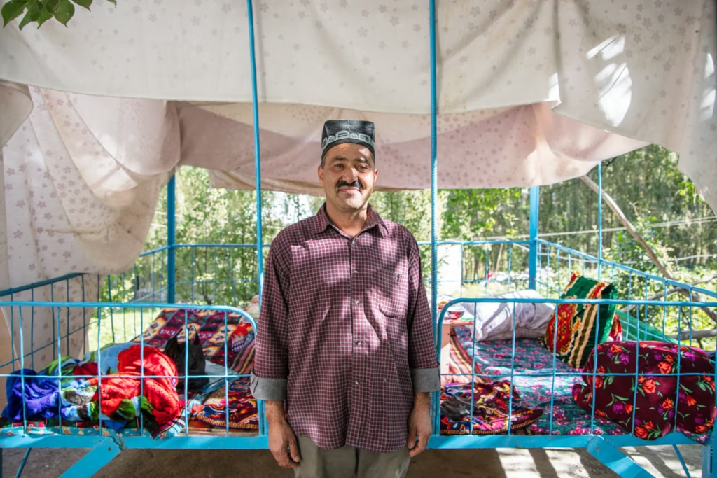
In general, most accommodation in the Fann Mountains area will be in basic homestays. Community-Based Tourism (CBT) is fairly common throughout Tajikistan and greater Central Asia.
In Panjakent there are a handful of hotels and guesthouses in addition to homestays. You can expect to pay between $10-20USD (90-180 TJS) per person per night at most homestays and guesthouses, including dinner and breakfast. Contact ZTDA to arrange a homestay if you are planning ahead.
Many families that live in the area will likely offer to take you in and subsequently show you legendary Tajik hospitality. Typically they will refuse payment, but do try to hide some Somoni in the home or try giving to the eldest child.
Homestays in the Fann Mountains region I recommend:
- Haft Kul: Najmidden Homestay (near Nofin Lake, ran by the friendly Jumaboy and family)
- Haft Kul: Rogich Homestay (for those doing the Mogiyon to Haft Kul trek)
- Sarytag: Dilovar’s Homestay (In the heart of Sarytag, Dilovar speaks excellent English)
- Iskanderkul: Shezok Guesthouse (right on the lakeshore)
- Yakkakhona: Hazratsho Homestay (nearby to Artuch, Hazratsho speaks English and can help arrange cars and pack animals for trekking)
Accommodations in cities and towns I recommend from personal experience:
- Dushanbe: Hello Hostel Super clean with a friendly and helpful staff. Tucked away in a quiet neighborhood in Dushanbe. Green House Hostel is another popular option nearby.
- Khujand: Qalai Khujand Hostel Qalai Khujand Hostel sits inside the walls of the Khujand Citadel, staff is very helpful. Armon Apartment Hotel also comes recommended by other travelers.
- Panjakent: Hotel Umariyon Clean and located smack near the middle of Panjakent. The staff speaks Tajik and Russian only but are still helpful and friendly nonetheless. Another great option is Salom Hostel, with a friendly and helpful owner named Safar.
- Samarkand (Uzbekistan): Highly recommended accommodations in Samarkand are Amir Hostel, Samarkand Travel Inn, and Orient Star Hotel.
Tours & Guides for the Fann Mountains
It is possible to arrange guides in the area and even join tours. Contact ZTDA for information on guides and guided treks.
Several tour operators can arrange organized tours and treks in the Fann Mountains, as well as in the Zaravshan, Yagnob Valleys, and more!
- Safar Expeditions My own company that specializes in off the beaten path travel, particularily Tajikistan and the greater Central Asia Region and the Middle East.
- Paramount Journey Offers some of the best itineraries around Tajikistan and their staff are extremely knowledgeable.
- Pamir Highway Adventure
- Pamir Guides
- Pamir Silk Tours
- You can also contact ZTDA to arrange guides and tours.
- Shop for tours in Tajikistan as well as the greater Central Asia region at Indy Guide.
Packing List for the Fann Mountains
Clothing
- Warm outer shell jacket x1
- Down jacket x1
- Fleece x1
- Long sleeve base layer top x2
- Short sleeve shirts x2
- Trekking pants x1
- Leggings x2
- Trekking socks x2
- Warm socks x1
- Sports bra x2
- Mittons x1
- Warm hat x1
- Sunglasses x1
- Microfiber towel x1
Recommended Gear
- Inreach Explorer
- Backpack (I personally recommend the Osprey Ariel 65 and an attaching daypack)
- Hiking boots (My favorite are the La Sportiva Trango Tech GTX)
- Waterproof sandals
- Katadyn water purifier
- Fann Mountains Map
- Sleeping mat
- 3-season tent
- Hydration Pack
- Sleeping bag cold rated to -5ºC/20ºF
- Campstove and Cooking set
- Silicone squeeze tubes (for cooking with sauces, olive oil, etc.)
- Propane/butane canister (available for purchase at Greenhouse Hostel in Dushanbe)
- Trekking poles
- Headlamp
- Trekking in Tajikistan by Jan Bakker (Written by a friend and includes the Fann Mountains, Yagnob Valley, and Pamir)
Toiletries
- Sunscreen
- Biodegradable shampoo bar
- Biodegradable soap
- Toothbrush
- Biodegradable wipes
- Toilet Paper
- First Aid Kit
- Hand sanitizer
Electronics
- Camera/lenses and necessary accessories
- Battery Bank
- Solar Panel
- Phone and charging cables
Maps
- Fann Mountains Map by EWP (can be ordered direct from EWP as well)
- Southern Tajikistan Map by Gecko Maps
Guide Books
- Trekking in Tajikistan by Jan Bakker & Christine Oriol. You’ll find detailed descriptions of these hikes as well as those in the Pamirs in this book.
- Tajikistan and the High Pamirs by Robert Middleton & Hue Thomas. This is a huge book, but it has so much good info on Tajikistan from history, great-game stories, travel information, and more.
- Bradt Tajikistan by Sophie Ibbotson & Max Lovell-Hoare. The most comprehensive guide to Tajikistan in print.
- Central Asia by Lonely Planet. Though I will say, their newest redesign is almost functionally useless and serves little more than a ‘X reasons to visit Tajikistan’. blog post.
- The Central Asia Phrasebook by Lonely Planet I found this to be a handy item for Tajik, Russian and Kyrgyz phrases, not so much for the Wakhi phrase section.
Food
- Dehydrated meals (you’ll need to stock up before leaving home)
- Trail mix
- Jerky
- Dried fruit and nuts (easily purchased at a bazaar)
- Peanut butter
- Spice packets
- Olive oil for cooking
- Hot sauce (bring from home to jazz up bland food)
- Instant mashed potatoes (so unhealthy, but I love them after a long trekking day)
- Fresh veggies, noodles, bread, rice, and more can be purchased at a bazaar prior to setting out for your trek)
Practical Info & Safety in the Fann Mountains
Practical Info & Other Things Worth Noting
- The best time for trekking is late June through mid-September when the weather is clearest, high passes the least snowy, and temperatures the most pleasant.
- Tajik and Russian are both widely spoken in the Fann Mountains as well as the rest of Tajikistan. Learn a few phrases (bonus points for Tajik).
- Special gear and equipment are not necessary for most of the popular treks in the Fann Mountains. For those wanting to summit some of these high altitude peaks, mountaineering and climbing gear will be necessary.
- Make sure that you do have your passport with you (and a paper copy of your visa if you have the e-visa!). There is a checkpoint near the village of Shing before the start of the Haft Kul and documents will be checked. Note that this is the only checkpoint like this in the Fann Mountains area.
- As of 2019, there is a park ranger that will charge you 19 TJS per night for camping if he comes across you. He usually is only in the Lakes Loop Area (Artuch, Kulikalon Bowl, and Lake Alovaddin). Since I hadn’t run across him in prior years I did ask to see his documents to make sure he was legit and he presented his ID cards.
- Solo female travelers may run into overly-friendly male locals, guides, etc. Usually more of an annoyance than anything else, but worth being aware of. A firm ‘no’ usually will halt the behavior.
- You can arrange porters from ZTDA, or hire them in Yakkakhona, Artuch, Alovaddin, Zimtut, Sarytag, Kiogli, and Mogiyon. Most porters will expect $20-25 USD per day.
- If you are unsure about your skill level, hire an experienced guide.
- The Fann Mountains are pretty remote in some areas. Take proper precautions.
- You cannot fly in propane/butane tanks for cooking. You can pick one up in Dushanbe at Green House Hostel, sometimes you can get one in Khujand although it’s not always possible. If arriving from Kyrgyzstan it’s best to purchase one before leaving Osh.
- Most Tajiks living in this part of the country follow Sunni Islam, so dress in the Fann Mountains can be a little more conservative than the rest of Tajikistan. Typically women will wear long sleeves and full-length loose-fitting trousers or skirts. Men typically wear t-shirts or long sleeve button-downs with trousers.
- Wine and cognac are locally made just outside Panjakent, definitely worth a try especially after a long successful trek.
- Locally handcrafted beadwork can be purchased in the Haft Kul from homestays.
Pass, Peak & Lake Elevations in the Fann Mountains
- Guitan Pass 2,600 meters
- Komichura Pass 3,050 meters
- Govkhona Pass 3,180 meters
- Zurmech Pass 3,260 meters
- Tavasang Pass 3,300 meters
- Munora Pass 3,520 meters
- Laudden Pass 3,630 meters
- Dukdon Pass 3,810 meters
- Alovaddin Pass 3,860 meters
- Kaznok Pass 4,040 meters
- Sarymat Pass 4,160 meters
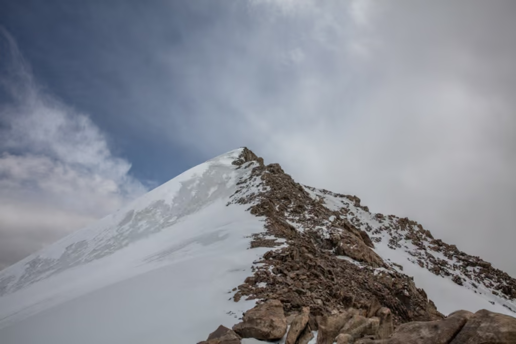
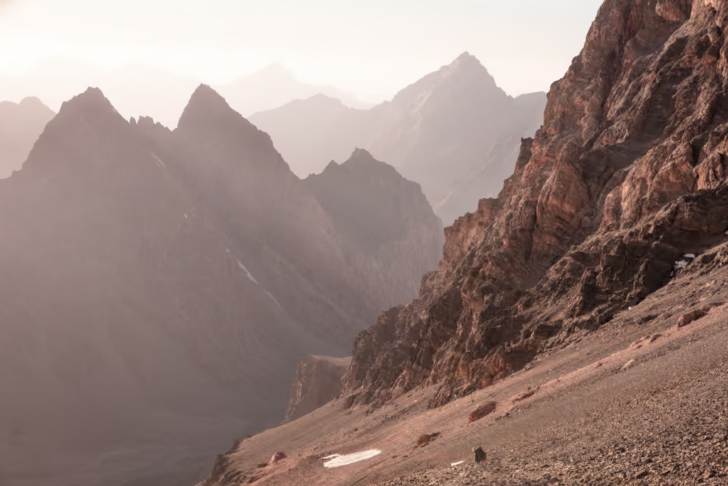
- Chimtarga Pass 4,740 meters
- Kulikalon Lake 2,850 meters
- Alovaddin Lake 2,800 meters
- Mutnyi Lake 3,510 meters
- Bolshoi Allo 3,180 meters
- Iskanderkul 2,200 meters
- Gora Chimtarga 5,489 meters
- Gora Energia 5,120 meters
- Gora Mirali 5,120 meters
- Pik Moskva 5,046 meters
- Gora Chapdara 5,050 meters
Safety in the Fanns
- The Fann Mountains, as well as the vast majority of Tajikistan, is prone to earthquakes. Being caught in a landslide in the mountains with your route being cut off is a possibility.
- Temperatures can range drastically from day to night even in summer. Temperatures can dip below freezing at altitudes over 3,000 meters in the dead of summer.
- There are snow leopards, Marco Polo sheep, bears, and wolves living in Tajikistan’s mountains. Although you’d be highly unlikely to cross any of them, they are something to be aware of.
- Take time to acclimatize to the altitudes here in the Fanns. Altitude sickness can be dangerous and even deadly. Read up on acclimatization here.
Have any Questions About Trekking in the Fann Mountains?
Ask your Fann Mountains questions in the comments below!
Posts from Tajikistan
A Guide to Rasht Valley, Tajikistan
Soviet Architecture in Khorog
10 Essentials to Pack for Central Asia
The Gardan i Kaftar Hike in Tajikistan’s Rasht Valley
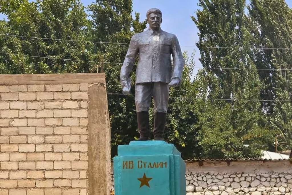
Stalin Statue in Asht, Tajikistan
Crossing Dukdon Pass in Tajikistan’s Fann Mountains
South Aral Peak Hike, Tajikistan
Shaimak Travel Guide Tajikistan
A Day Trip to Taboshar Uranium Mines in Istiklol, Tajikistan
How to Get to Timur Dara Lake, Tajikistan
How to Visit Childukhtaron, Tajikistan
Bolshoi Allo Lake, Tajikistan
Climbing Kyzyldong, Tajikistan
A Guide to the World Nomad Games

Registering with Tajikistan OVIR in Khorog
Karakul Travel Guide, Tajikistan
Gumbezkul Pass Hike, Tajikistan
Madiyan Hot Springs Tajikistan
Dushanbe Day Trips
Central Asia Travel Tips
Tajikistan SIM & eSIM Guide
Vegetarian in Central Asia
How to Get to Khafrazdara Valley, Tajikistan
Eastern Pamir Travel Guide
Trekking to Pik Engles Meadow
Murghab Travel Guide
Tajikistan-Afghanistan Border Crossing at Shirkhan Bandar
Qala i khumb Travel Guide
Akhkon Salt Flat in Asht, Tajikistan
Is Tajikistan Safe?
Sarazm Ruins: Tajikistan’s Oldest City
How to Get to Lake Sarez
Tajikistan Border Crossings

Hike the Lakes Loop in Tajikistan’s Fann Mountains
Shokhdara Valley, Tajikistan
Tajikistan Visa Guide
Crossing Chimtarga Pass
Afghan Bazaar in Khorog, Tajikistan
Tajik Wakhan Valley Travel Guide
How to Get a GBAO Permit
12 Day Fann Mountains Trekking Expedition, Tajikistan
12 Day Pamir Highway Expedition
Iskanderkul & Sarytag Travel Guide
Kyzyl Art Border Crossing

Jizeu Trek in Tajikistan’s Pamir
10 Reasons to Visit the Pamirs

Tajikistan In Photos
Tajikistan Itinerary for 1-4 Weeks
Solo Female Travel in Central Asia